 |
 |
 |
 |
|
 |
 |
 |
 |
|
 |
 |
 |
 |
|
 |
 |
 |
 |
|
 |
 |
 |
 |
|
 |
 |
 |
 |
|
 |
 |
 |
 |
|
 |
 |
 |
 |
|
 |
 |
 |
 |
|
 |
 |
 |
 |
|
 |
 |
 |
 |
|
 |
 |
 |
 |
|
 |
 |
 |
||
Walling, Albert G. 1884. History of Southern Oregon: Comprising Jackson, Josephine, Douglas, Curry and Coos Counties, Compiled from the Most Authentic Sources. House of A. G. Walling, Portland, Oregon: 545 pp. Maps.
![]()
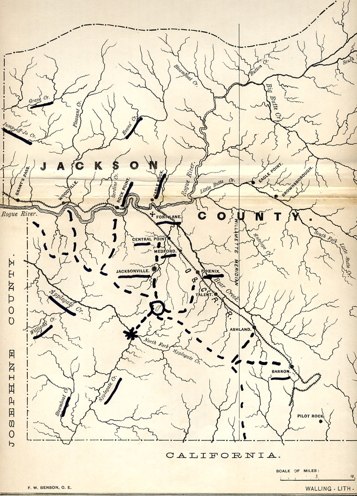
Historic Cultural Landscape Patterns of Southwest Oregon
Select Illustrations
from Albert G. Walling's 1884 Book:
History of Southern Oregon: Comprising Jackson, Josephine, Douglas, Curry and Coos Counties, Compiled from the Most Authentic Sources.
Published by House of A. G. Walling, Portland, Oregon: 545 pp. Maps.
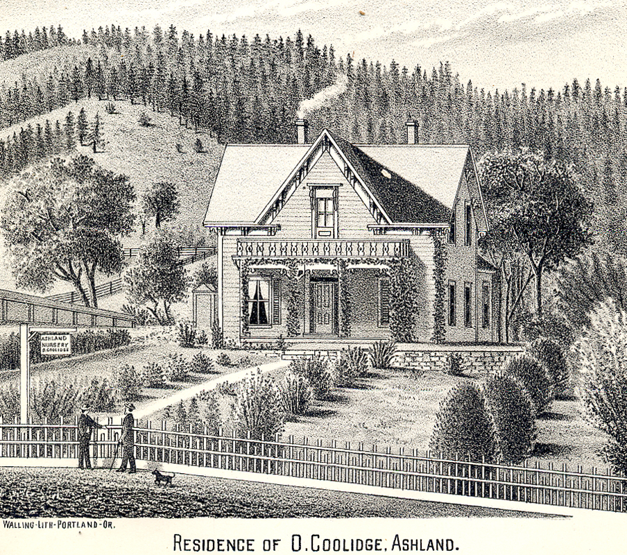
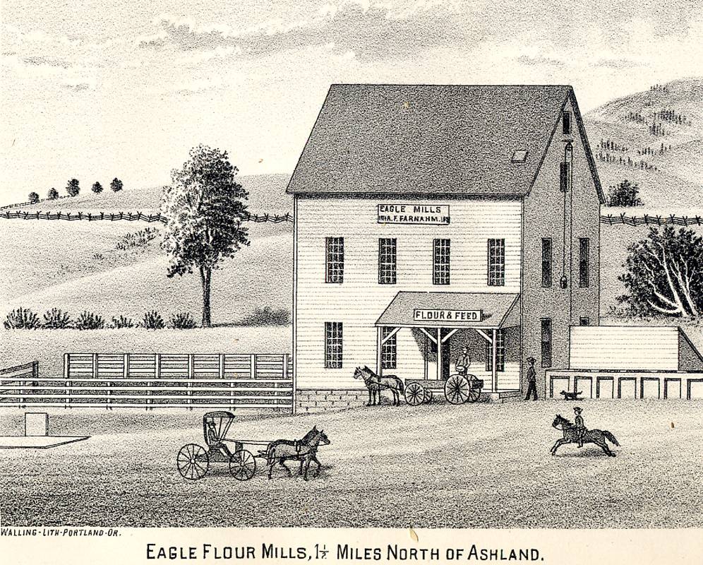
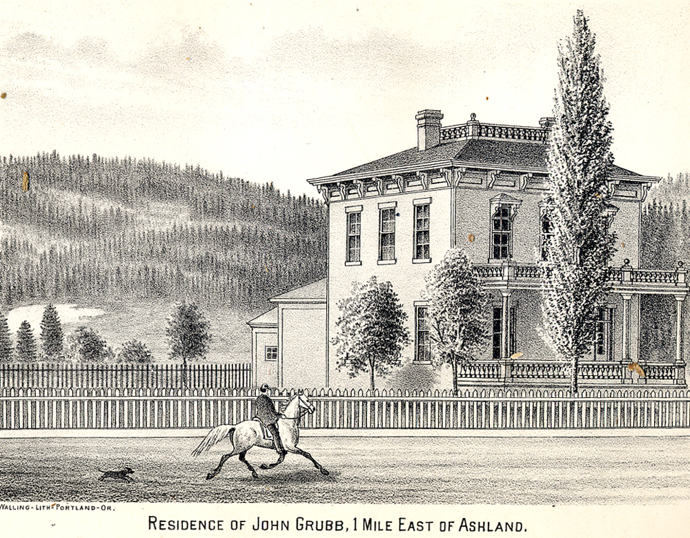
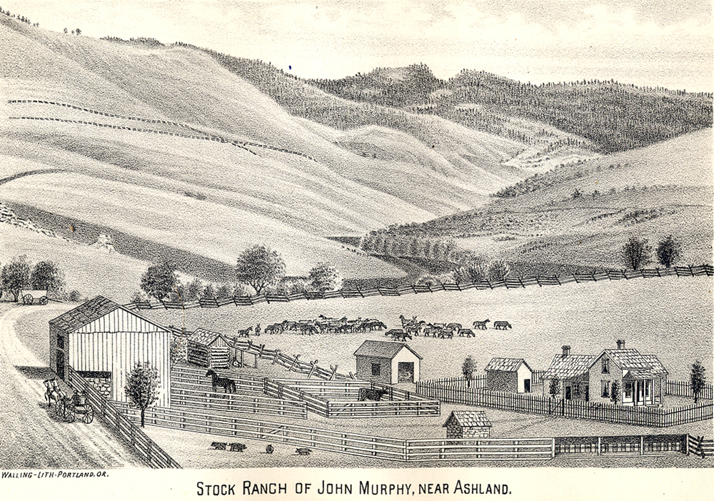
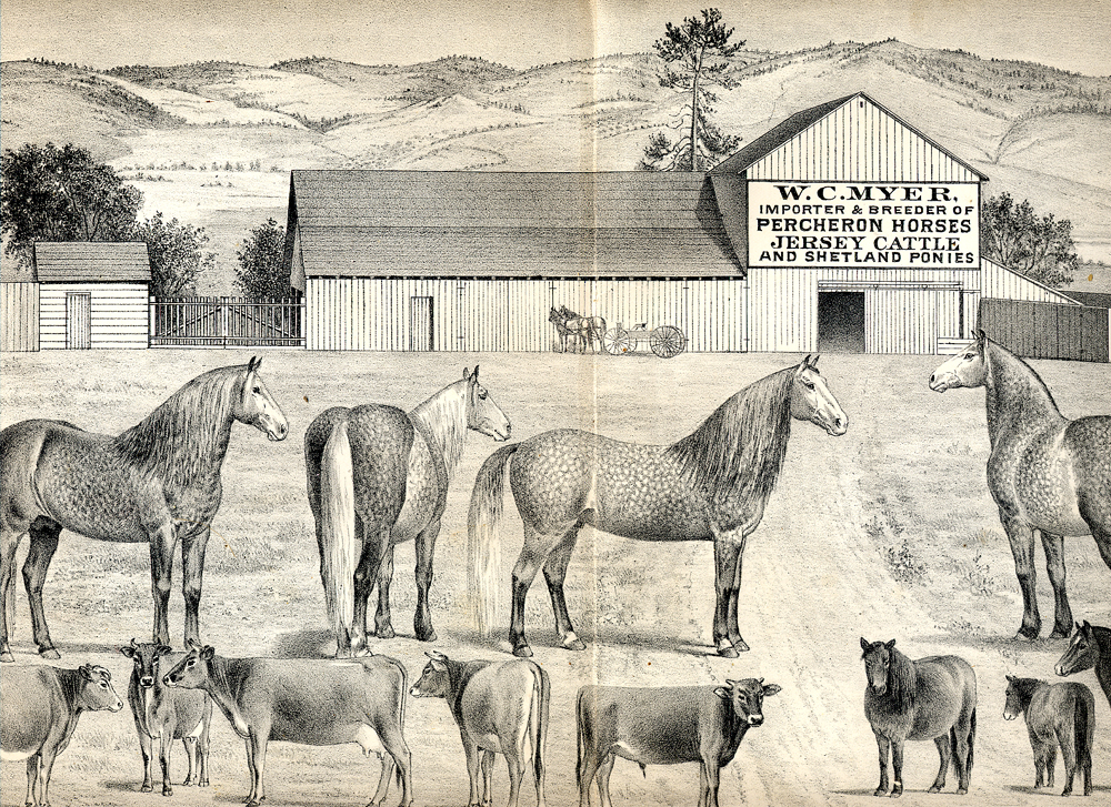
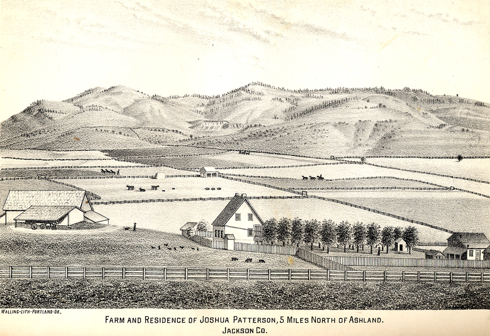
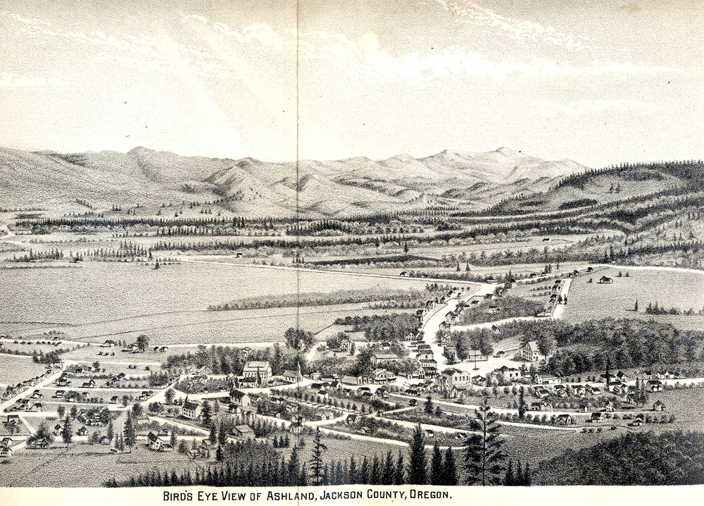
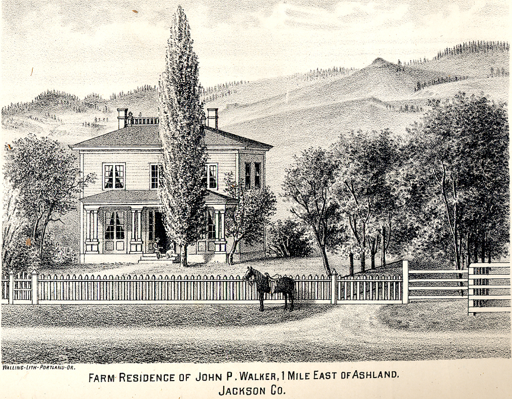
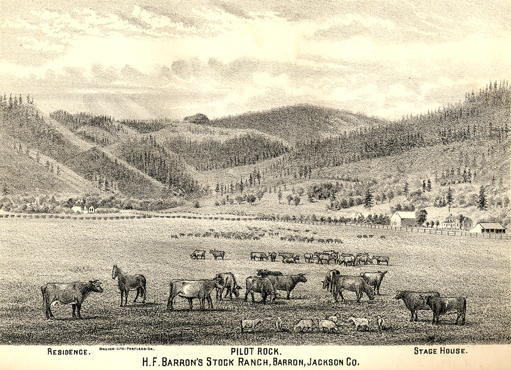
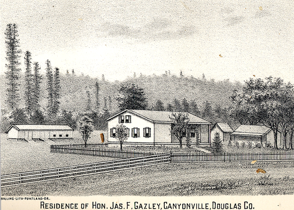
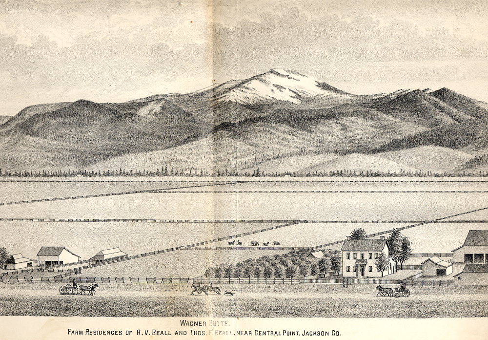
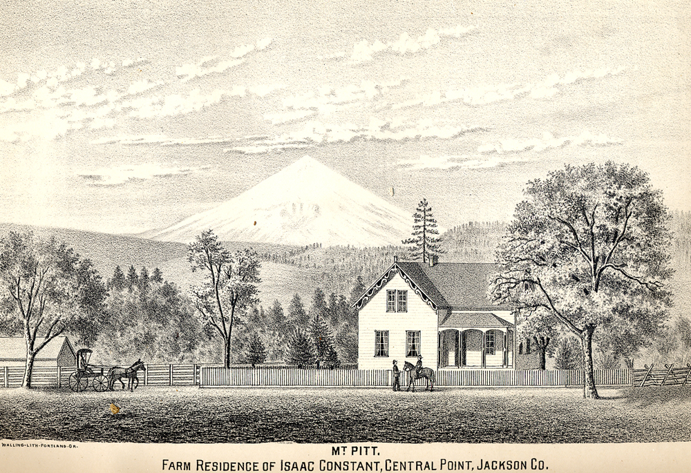
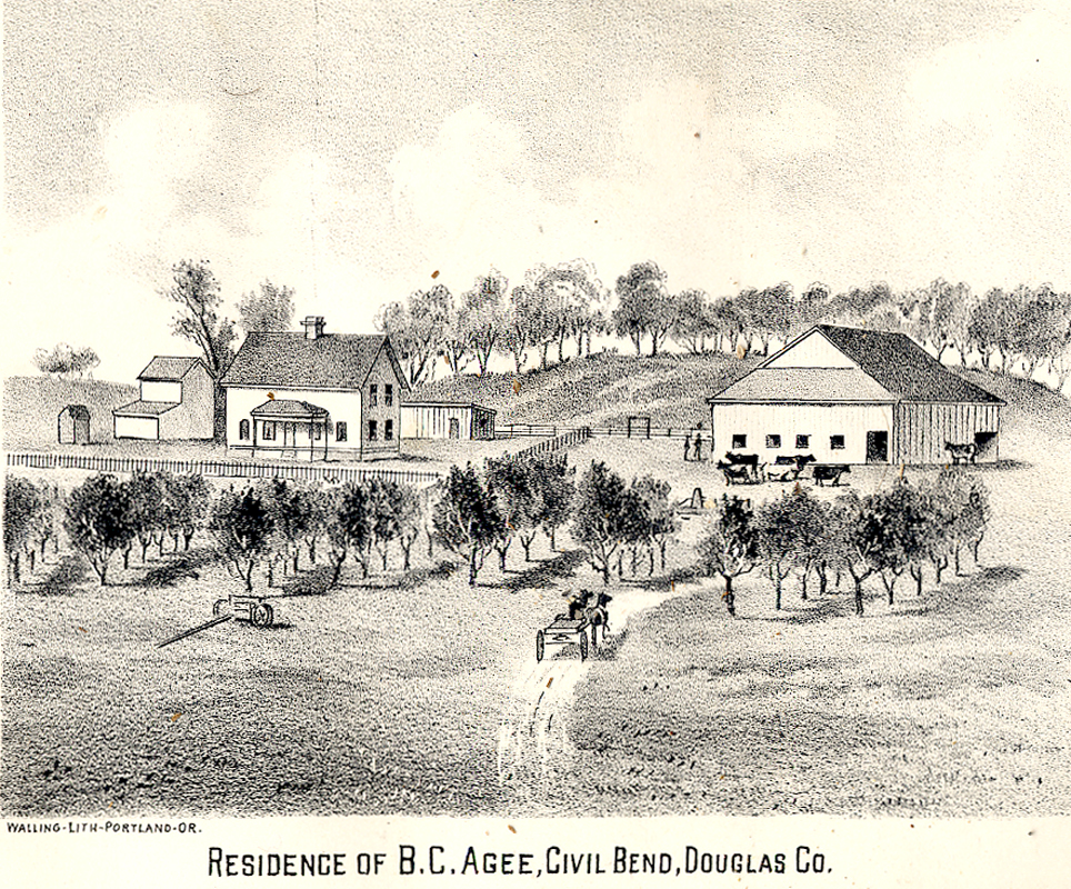
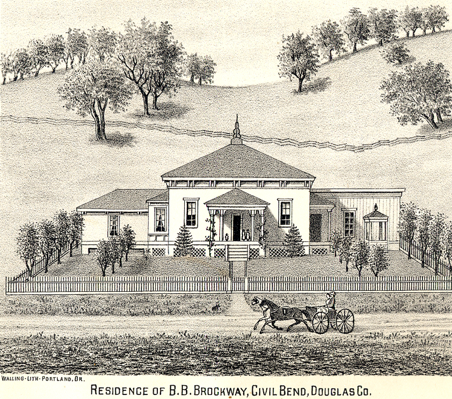
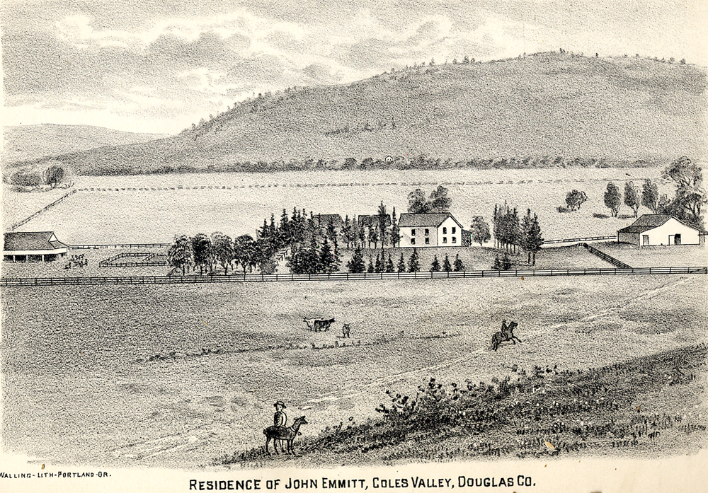
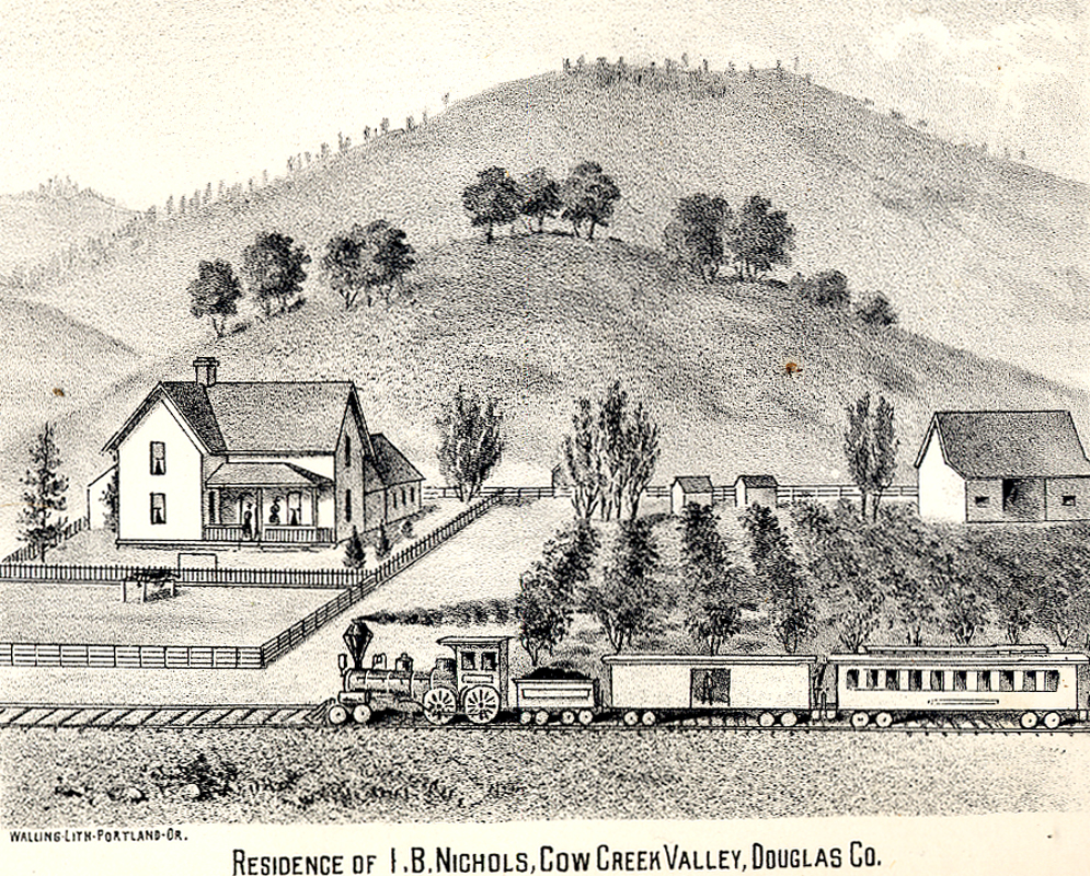
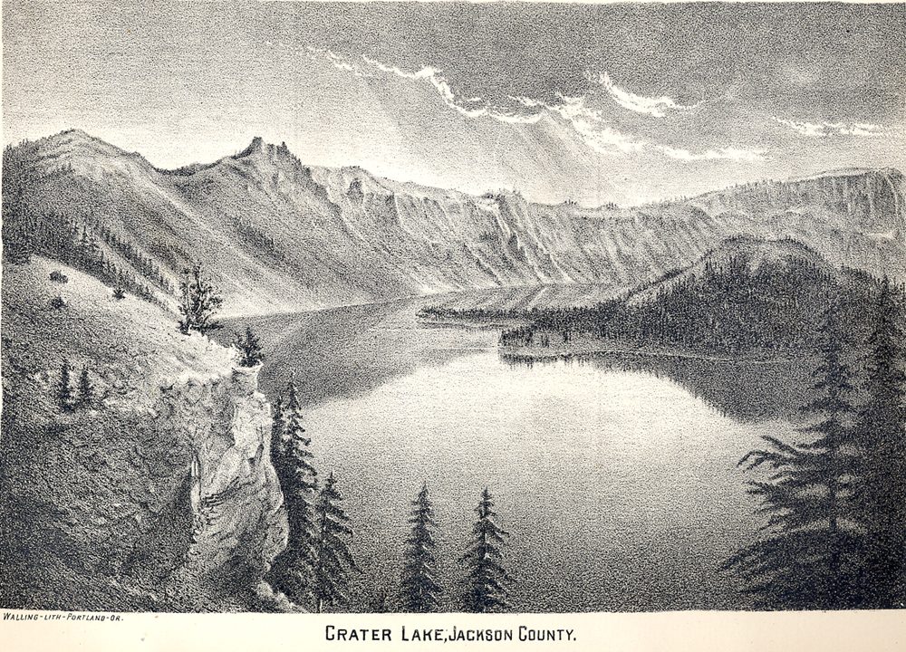
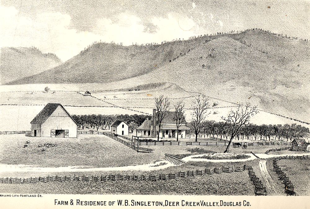
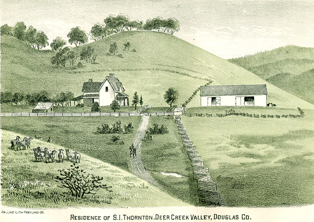
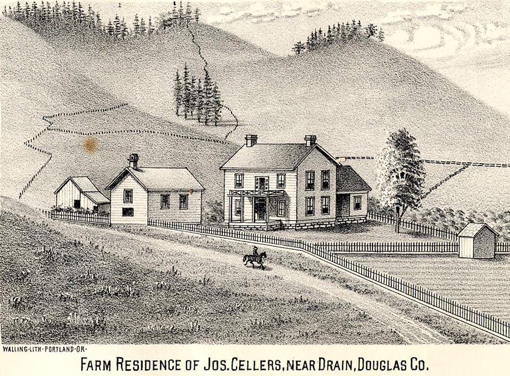
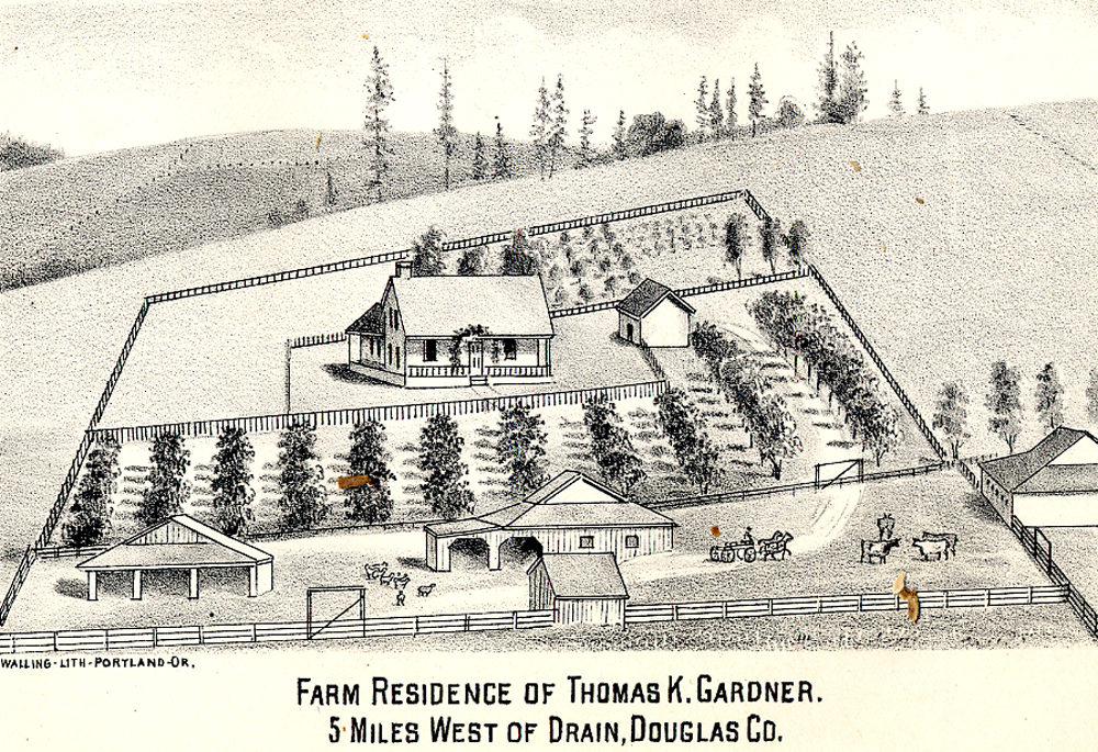
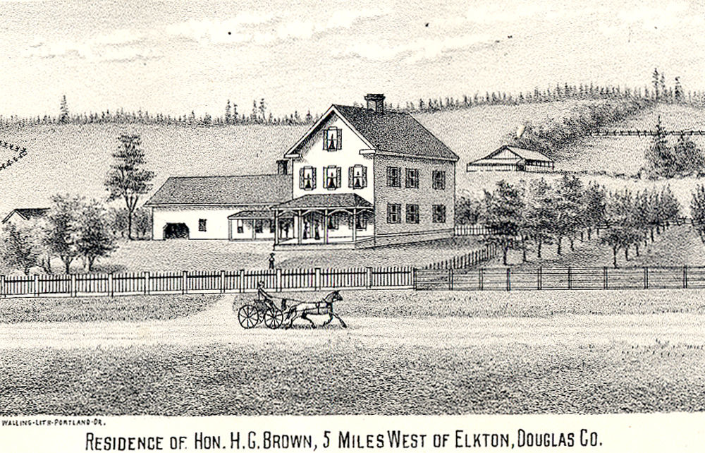
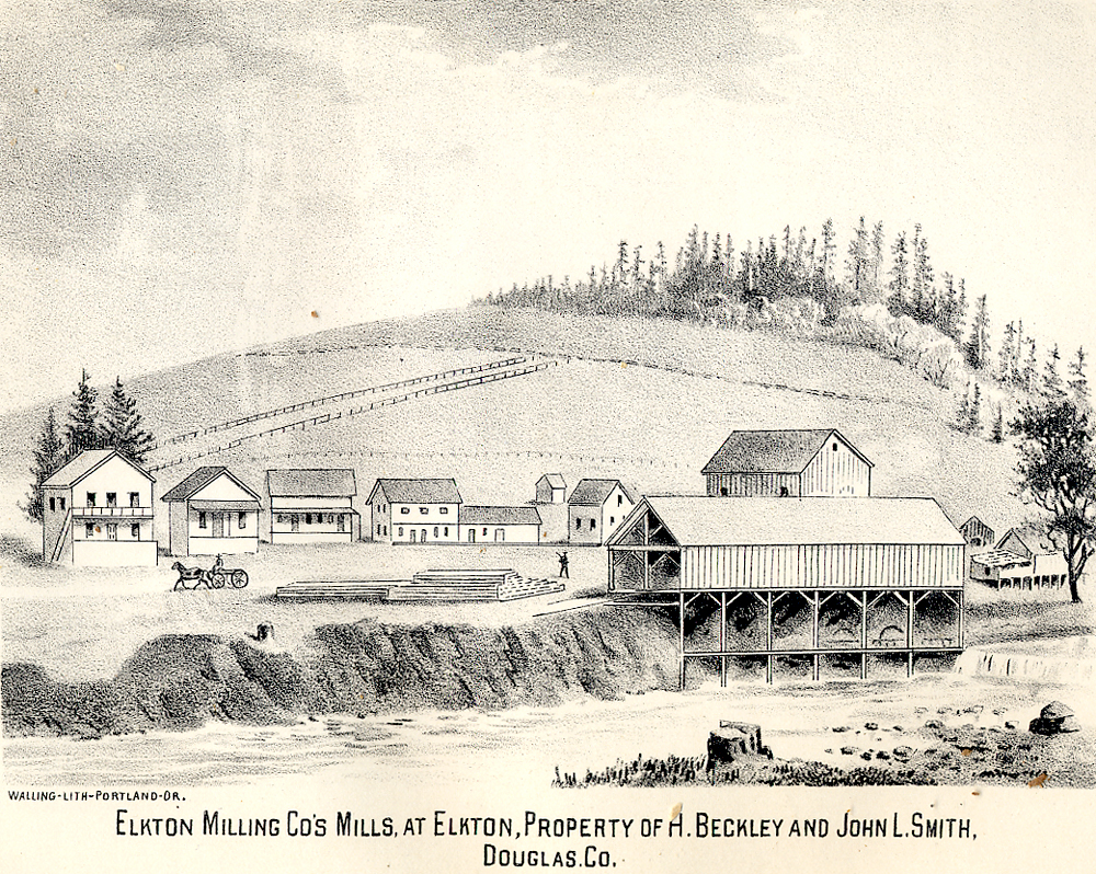
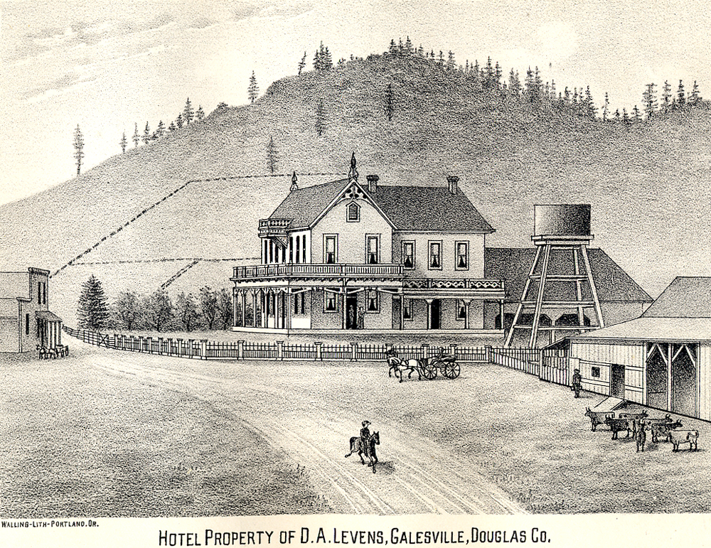
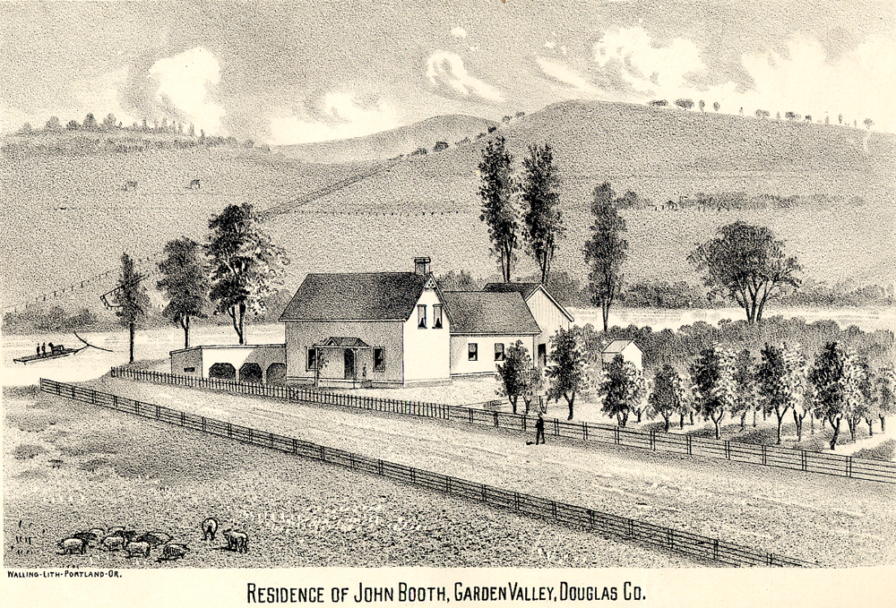
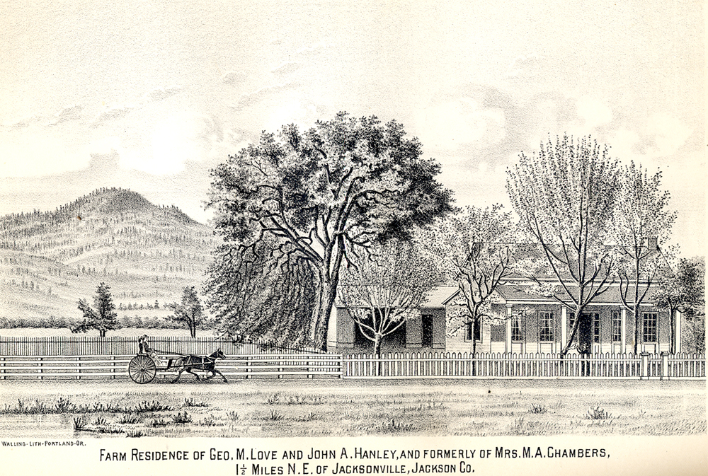
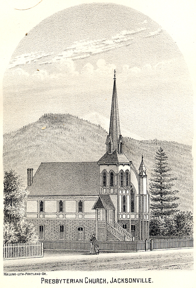
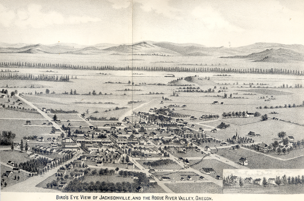
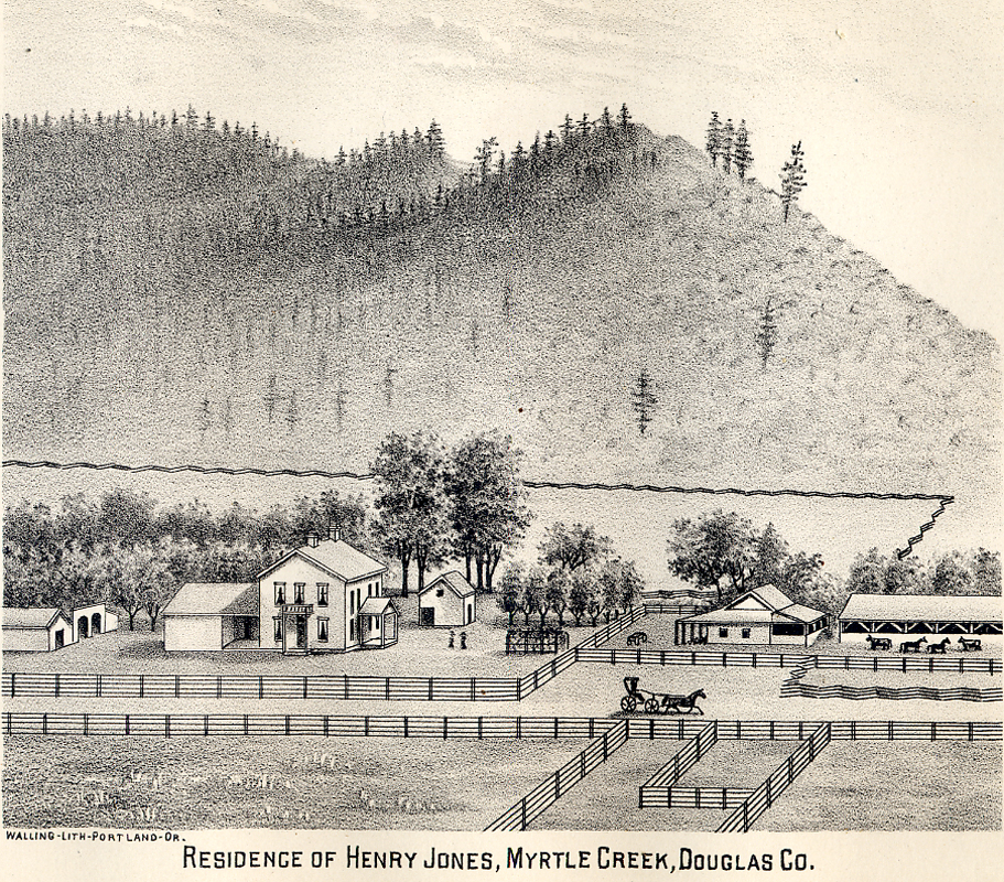
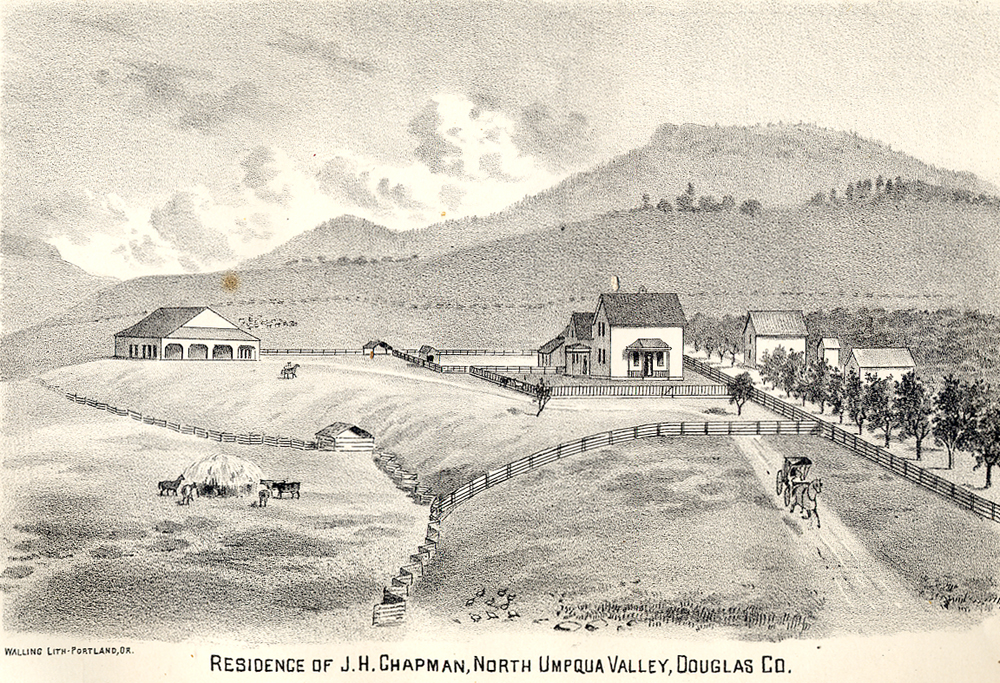
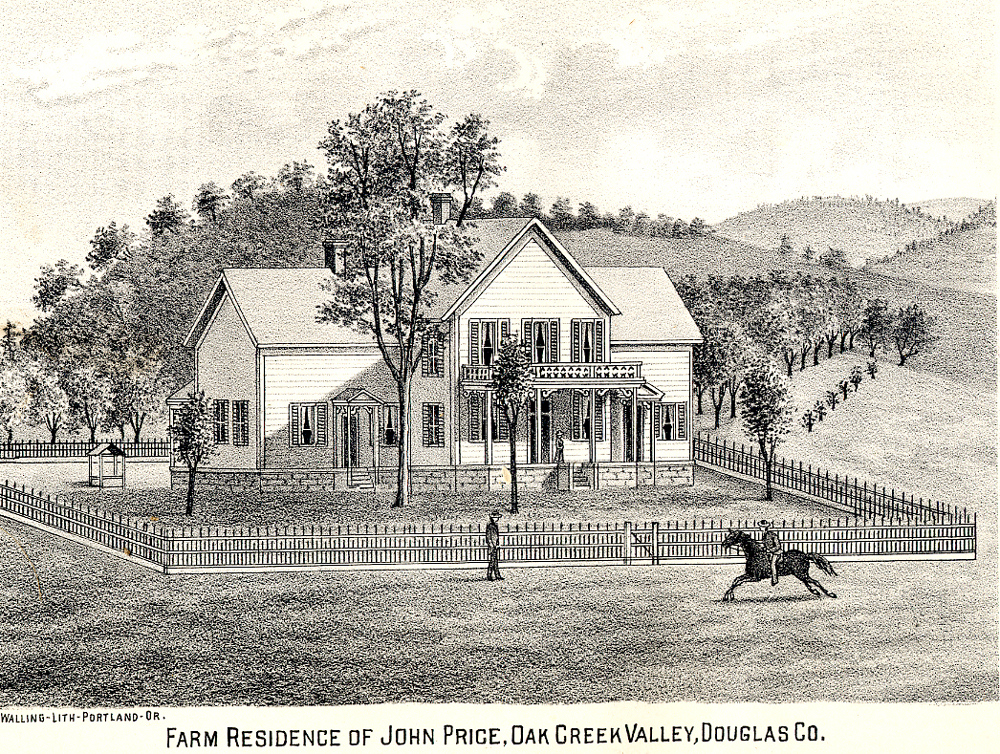
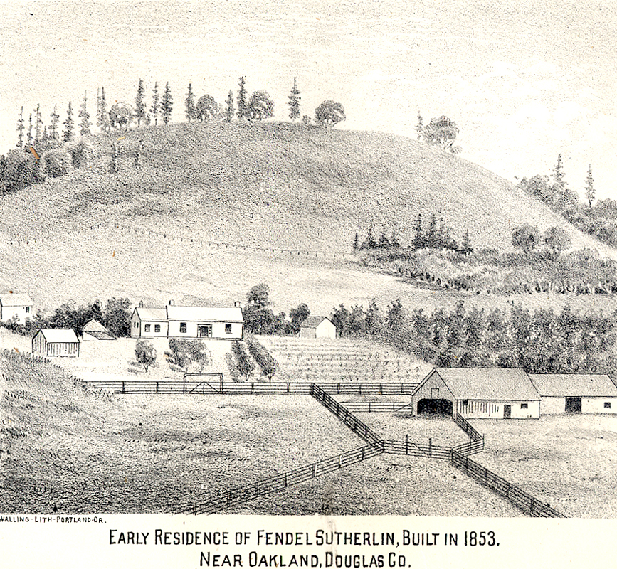
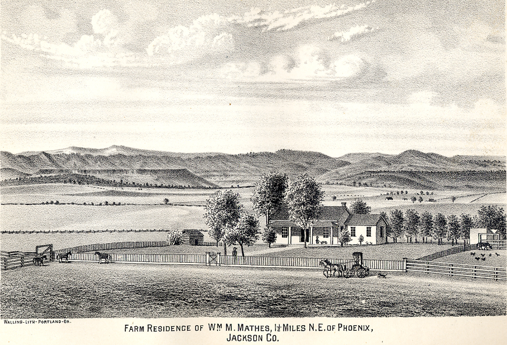
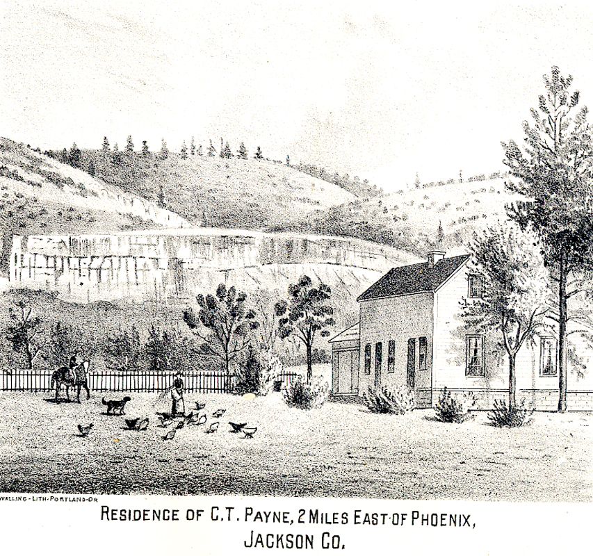
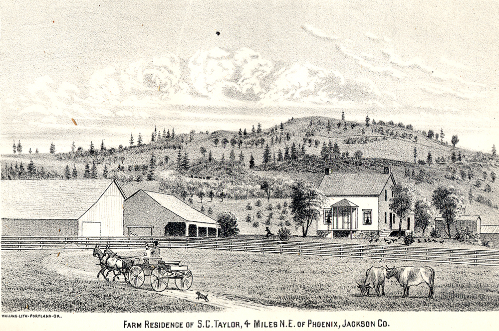
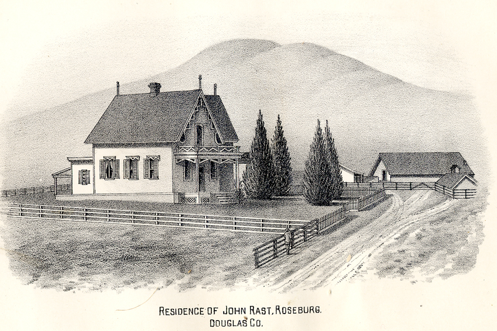
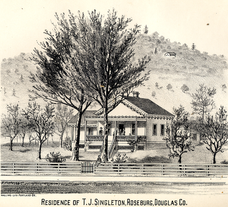
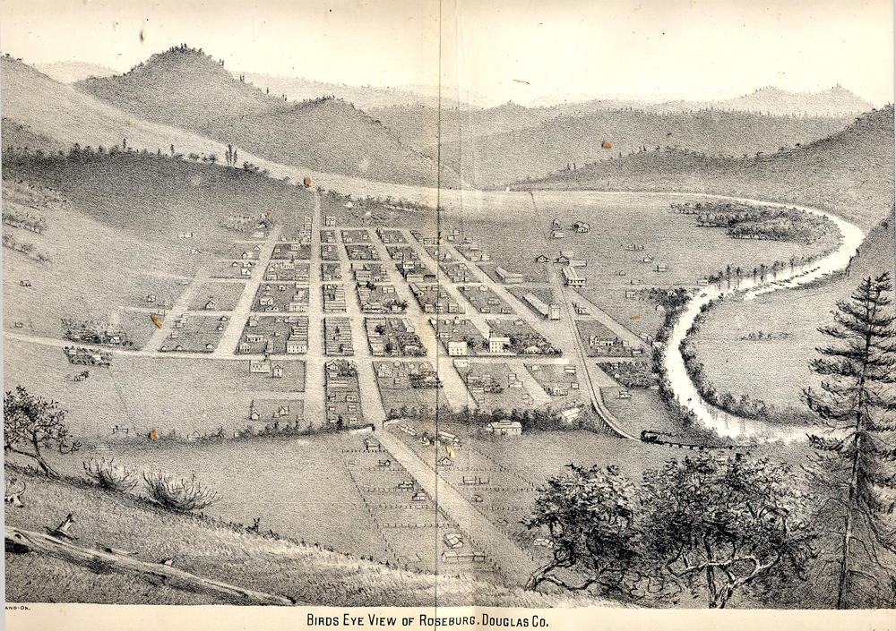
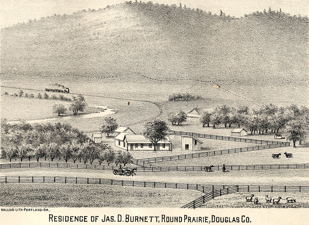
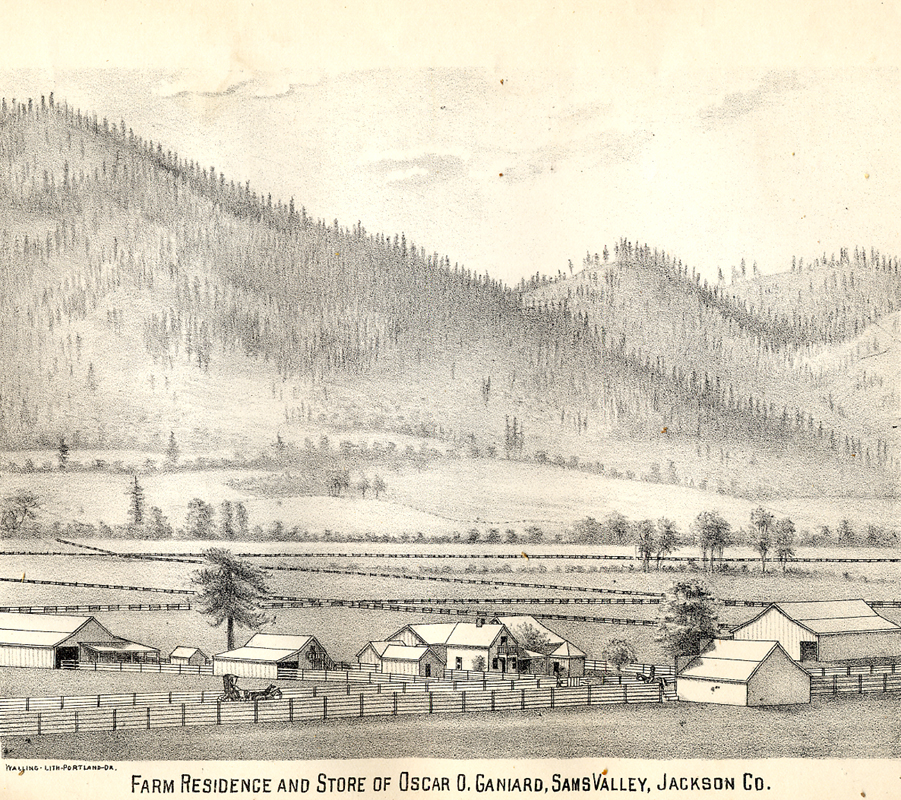
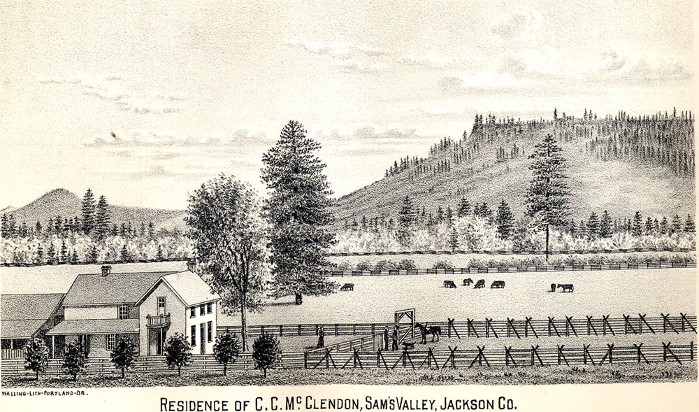
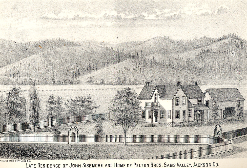
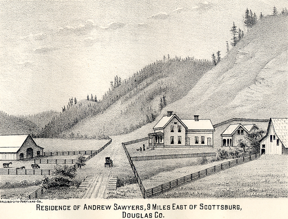
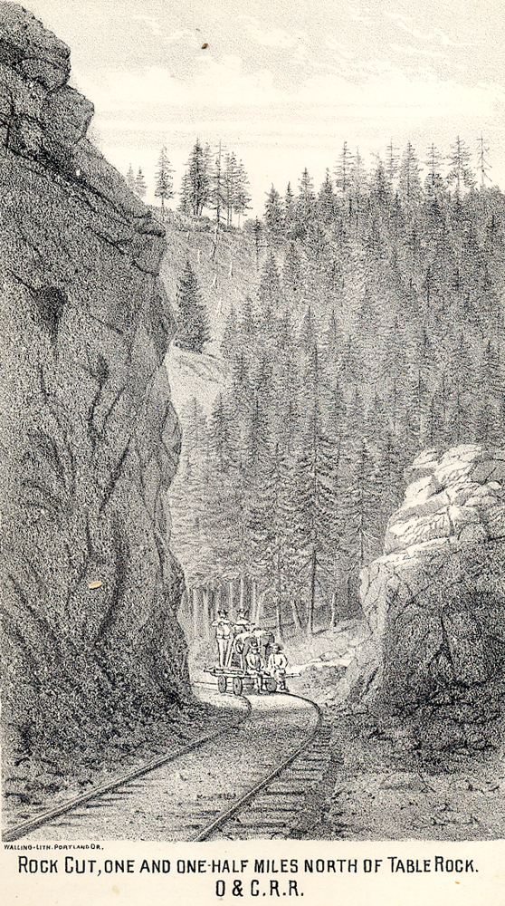
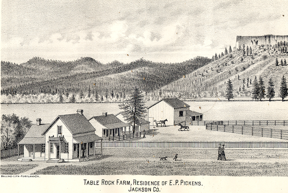
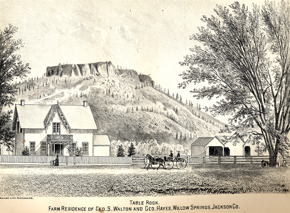
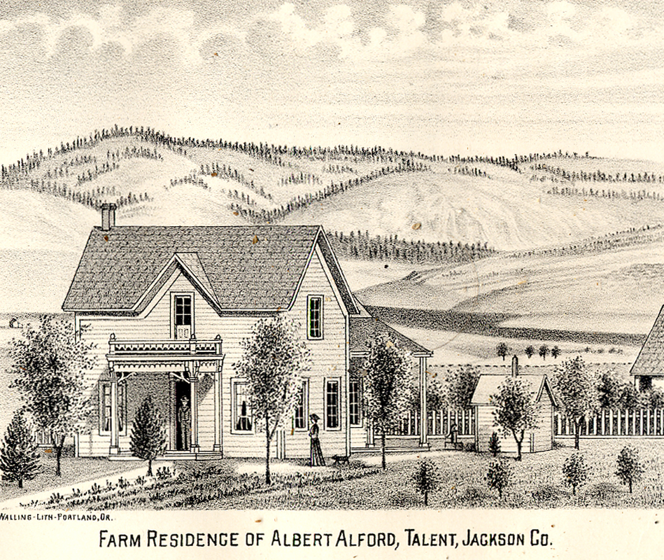
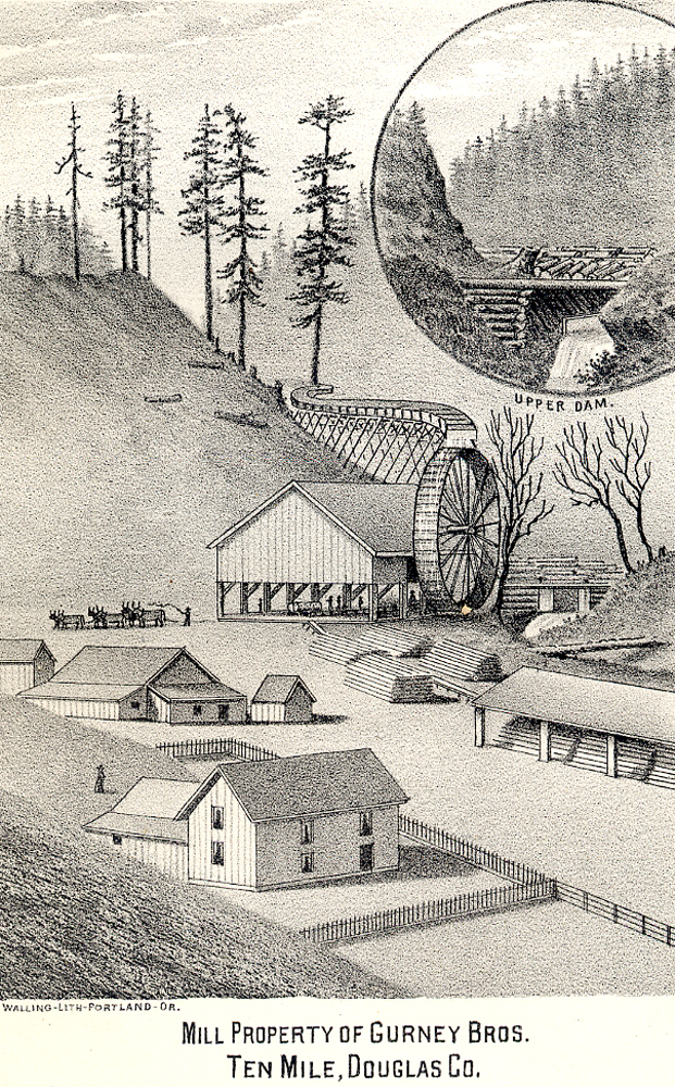
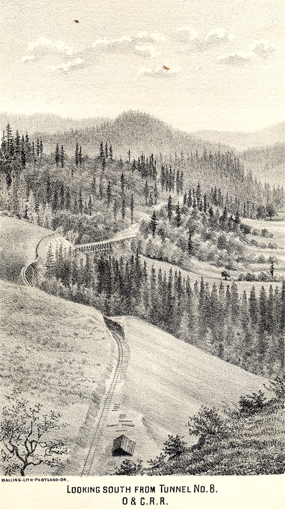
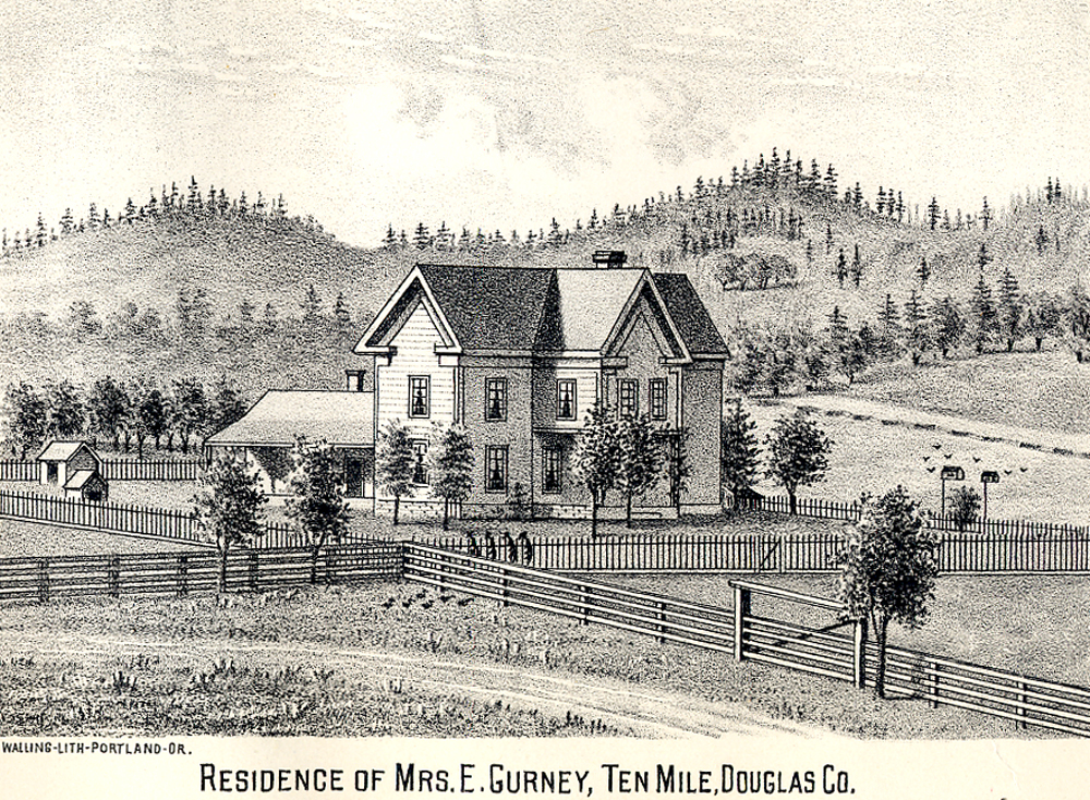
The following drawings of southwest Oregon were selected because they show a great amount of landscape-scale detail. The near-photographic quality of Walling's illustrations have generally proven to be very accurate in both scale and details; as shown in depictions of buildings and other foreground structures, as well as most background landforms and native vegetation patterns of forests, groves, trees, woodlands, grasslands, and shrubs.
Selections are indexed geographically, according to early historical townsites or creek subbasins. They are not reproduced to original print scale, but have been uniformly enlarged to 8-inch by 10-inch dimensions for study, reproduction, and display purposes.
The region shown by these drawings focus on the areas of central Douglas County, western Jackson County, and eastern Josephine County that were the primary scene of gold mine prospecting, Rogue River Indian Wars, and white occupation and settlement in southwest Oregon between 1848 and 1856. Subsequent landscape patterns on the land, recorded nearly 30 years later, retain clear indications of these events, as well as strong and persistent evidence of local Athapaskan, Takelma, Hokan, and Kalapuyan management methods and results from earlier times.
|
|
|
|
|
|
|
|
|
|
|
|
|
|
|
|
|
|
|
|
|
|
|
|
|
|
|
|
|
|
|
|
|
|
|
|
|
|
|
|
|
|
|
|
|
|
|
|
|
|
|
|
|
|
|
|
|
|
|
|
|
|
|
||
Walling, Albert G. 1884. History of Southern Oregon: Comprising Jackson, Josephine, Douglas, Curry and Coos Counties, Compiled from the Most Authentic Sources. House of A. G. Walling, Portland, Oregon: 545 pp. Maps.
![]()
© 2007 Oregon Websites and Watersheds Project, Inc. & NW Maps Co.