2018 SWOCC Elliott State Forest Draft Recreation Plan

MAPS

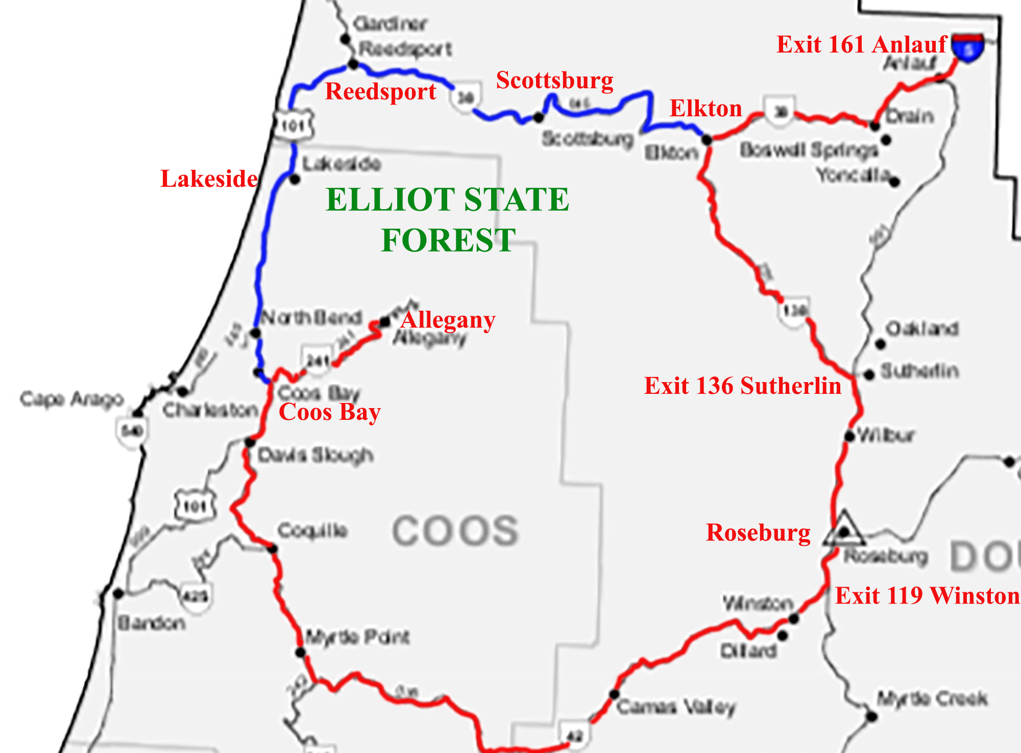
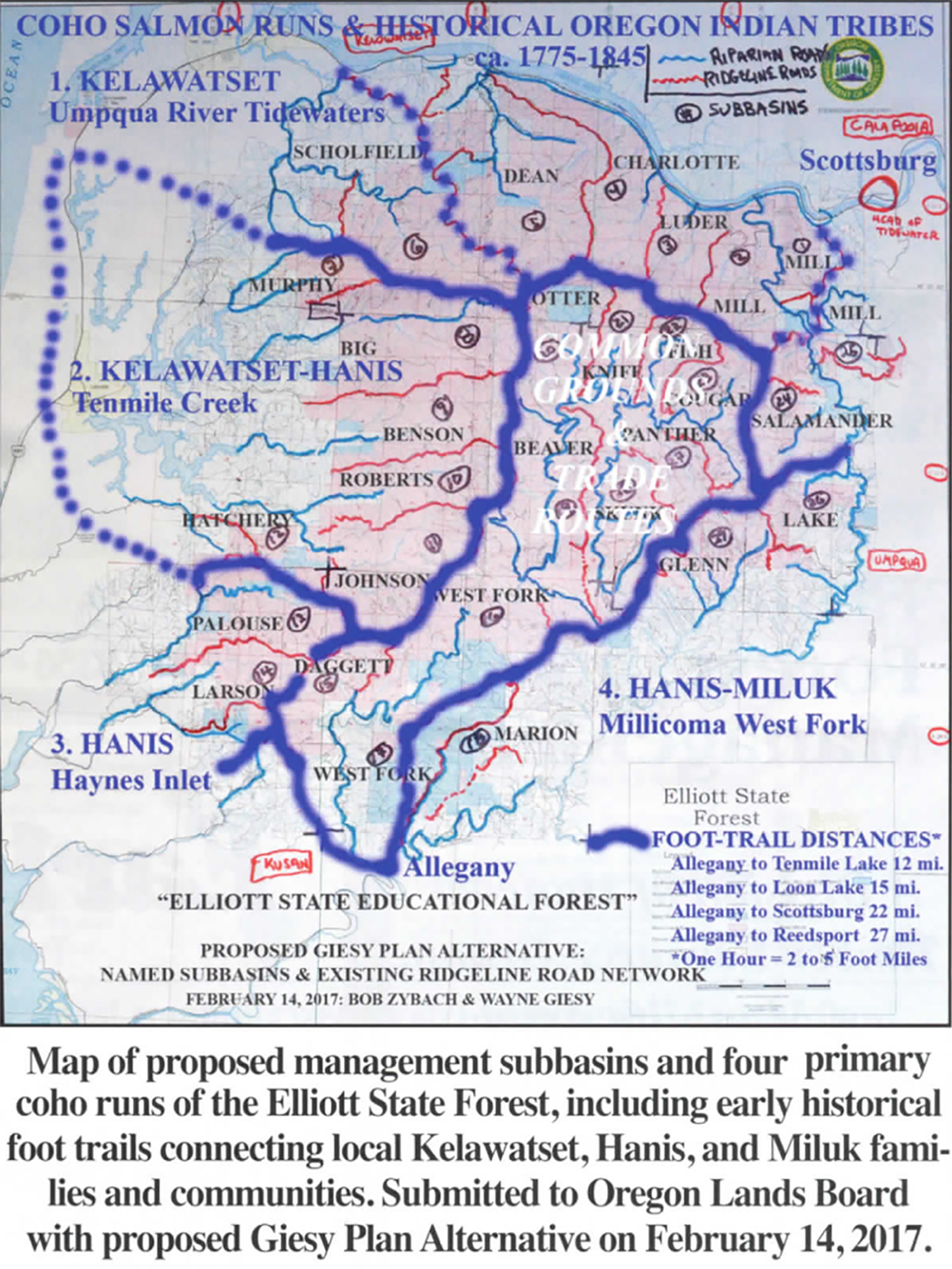
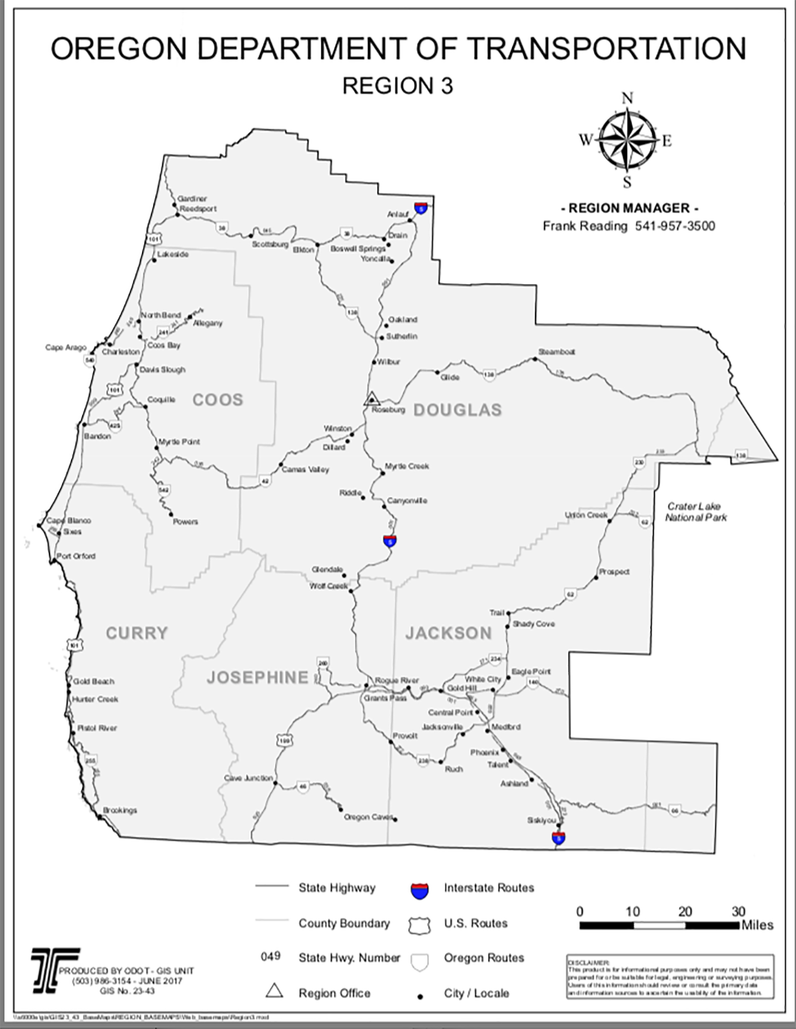
Map 1.1. Elliott Forest Access Map (Oregon Department of Transportation 2017 base map).

Citation: Amy Kronsberg, Tara Boyd, Maggie Boone, Cole Smith, Daniel Patton, Carter Carr, Matthew Hofenbridl, Maxwell Richcreek, Matthew Smith, Abigail Richards, Cody Harkins, and Scott Guthrie 2018. 2018 Draft Elliot State Forest Recreation Plan. Oregon Websites & Watersheds Project, Inc., Philomath, Oregon: 65 pp. [PDF: 7 MB].

Elliott State Forest Base Maps

Jerry Phillips' Historical Maps

Location of Elliott State Forest in Oregon 1.1. Local Access Routes to Elliott State Forest 1.2. Primary Travel Routes in Elliott State Forest 2.1. Elliott State Forest Recreation Area Campgrounds 4.1. Historical ca. 1930 Elliott State Forest Map
5.1. Scenic Locations on Elliott State Forest 6.1. Historic Trails of the Elliott State Forest 7.1. "HCP Fish and Timber Watersheds" of the Elliott State Forest 8.1. Native Fish Runs of the Elliott State Forest 9.1. Endangered Birds vs. Recreation on the Elliott State Forest
       
10.1. ODFW Tioga Hunting Unit (#24)        


© 2017, 2018 Oregon Websites & Watersheds Project, Inc. & NW Maps Co.