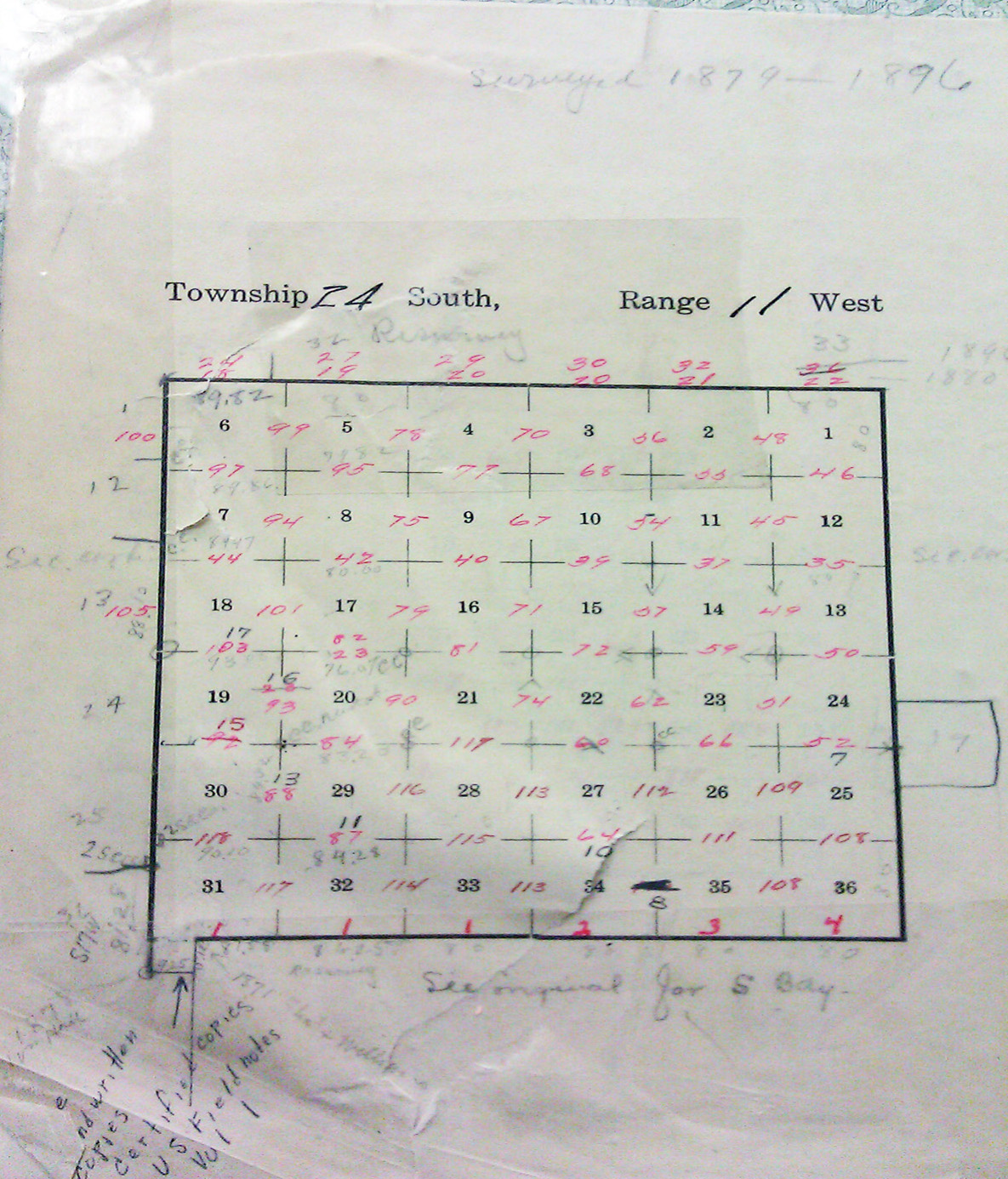
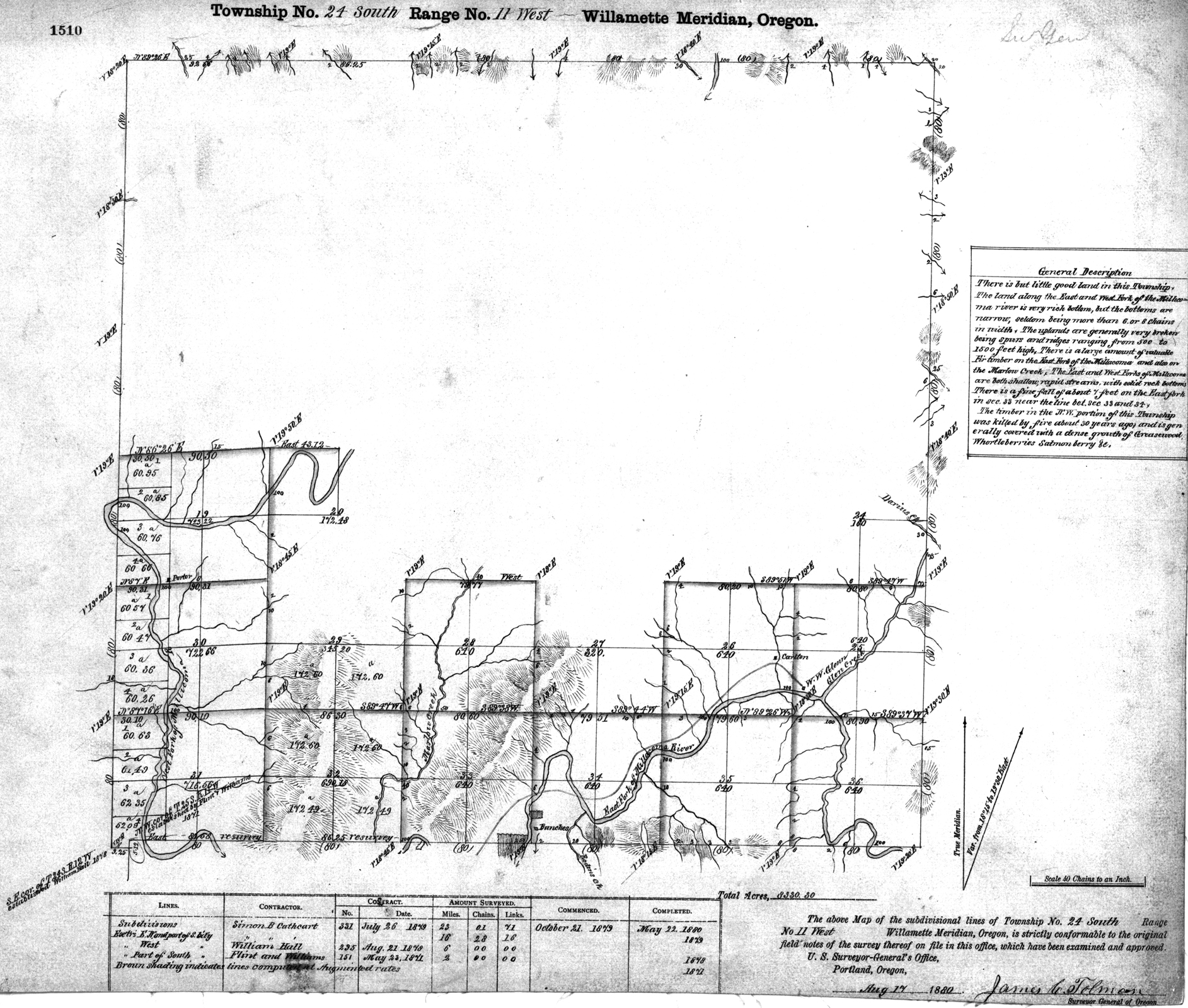
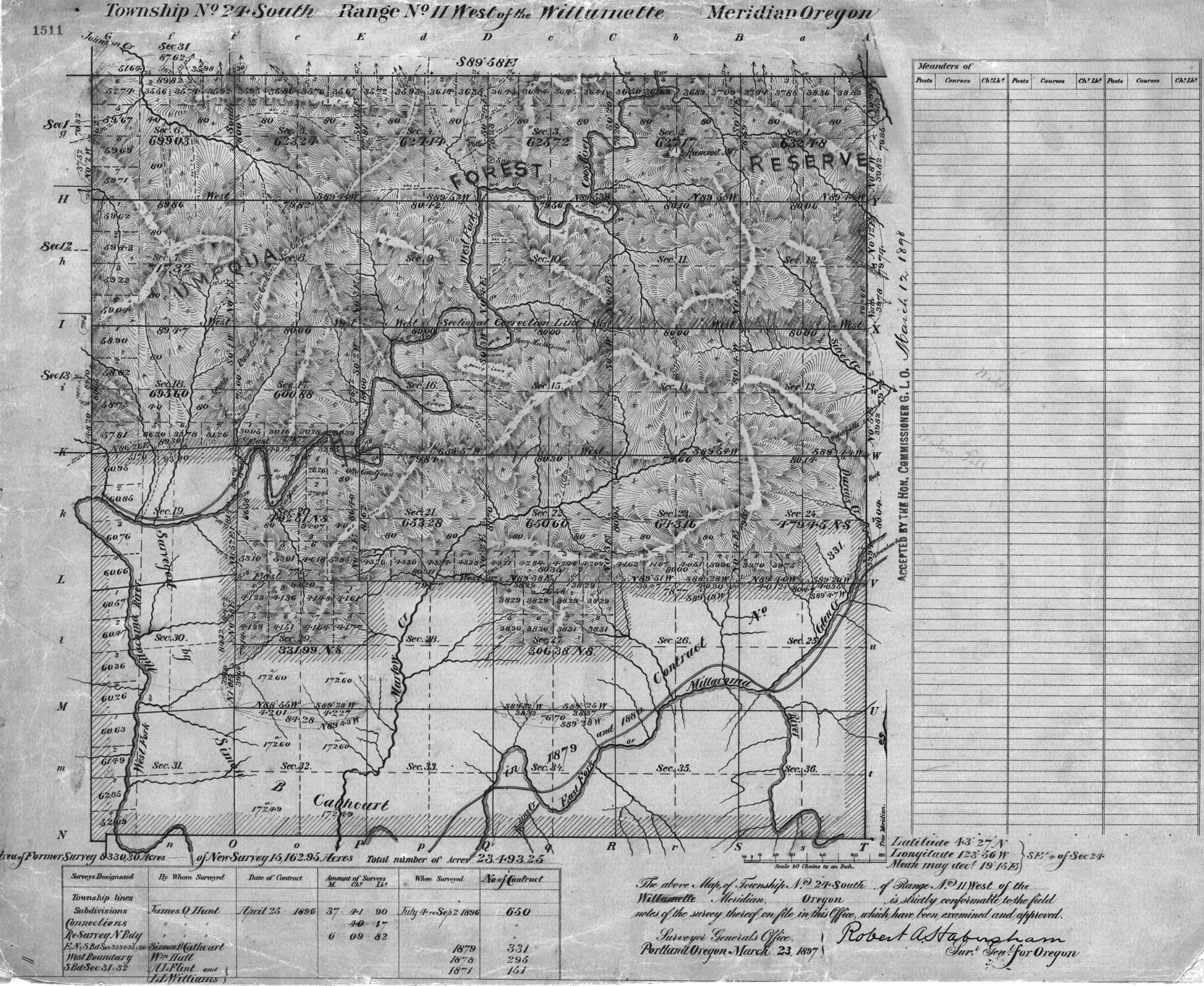
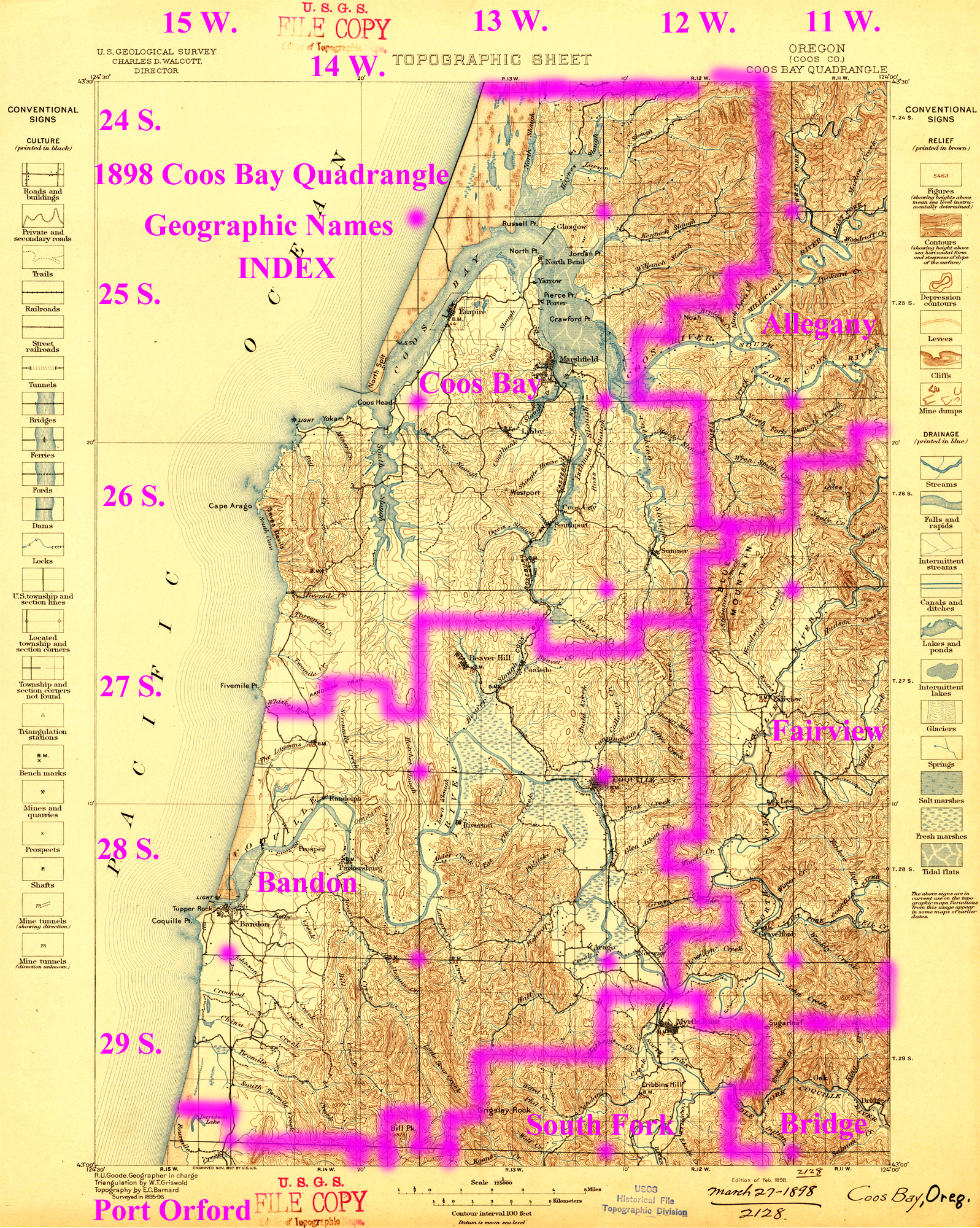
Tsp. 24 S., Rng. 11 W.
General Land Office Survey Index
 |
 |
 |
 |
 |
1880 GLO |
1897 GLO |
1898 Annotated USGS Coos Bay |
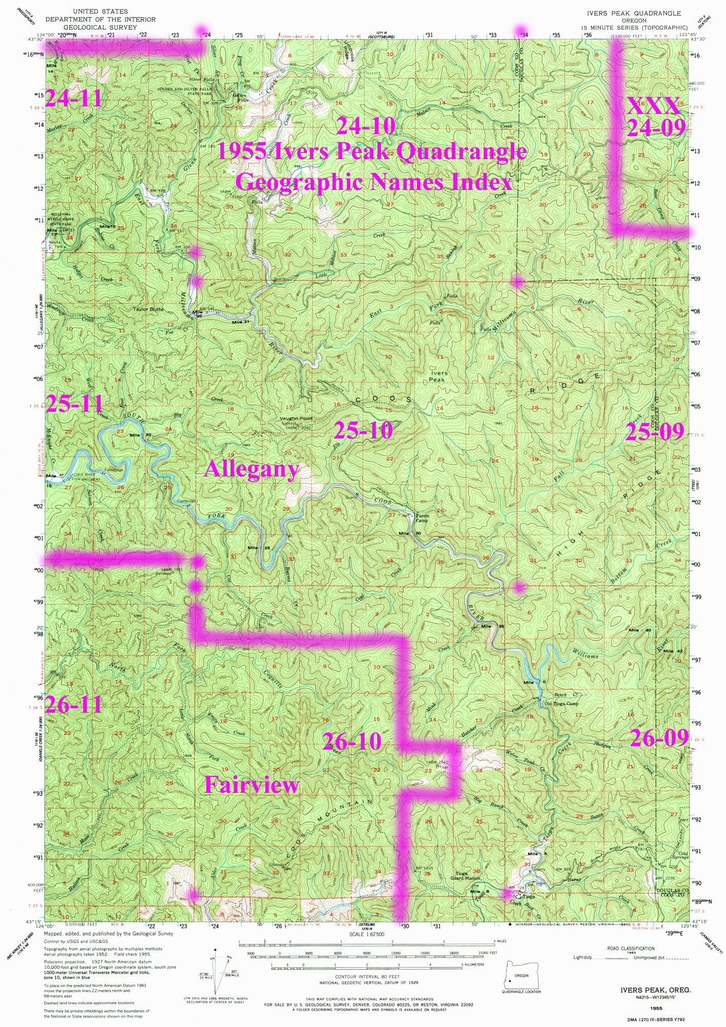
1955 Annotated USGS Ivers Peak |
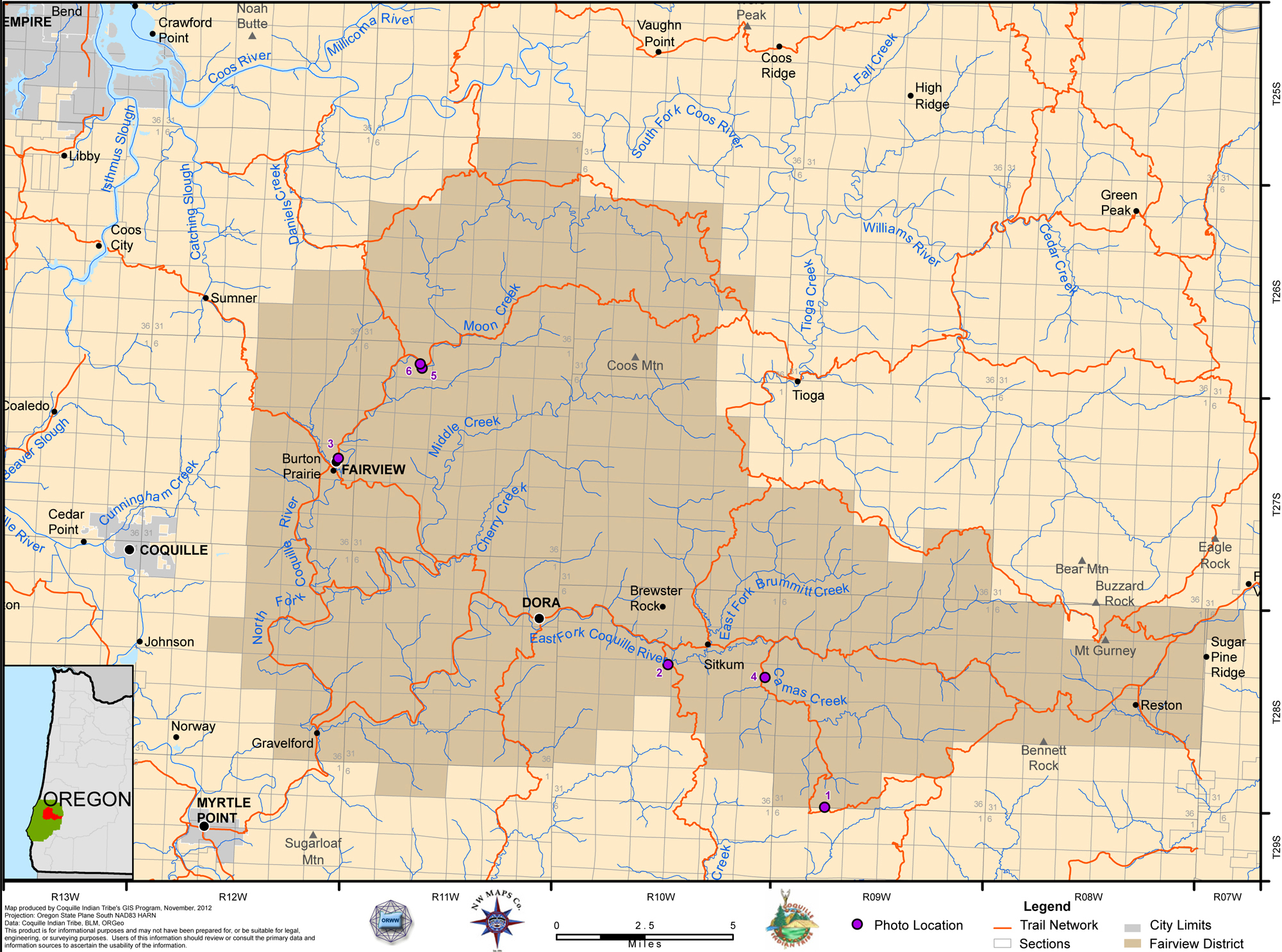
2012 Fairview District |
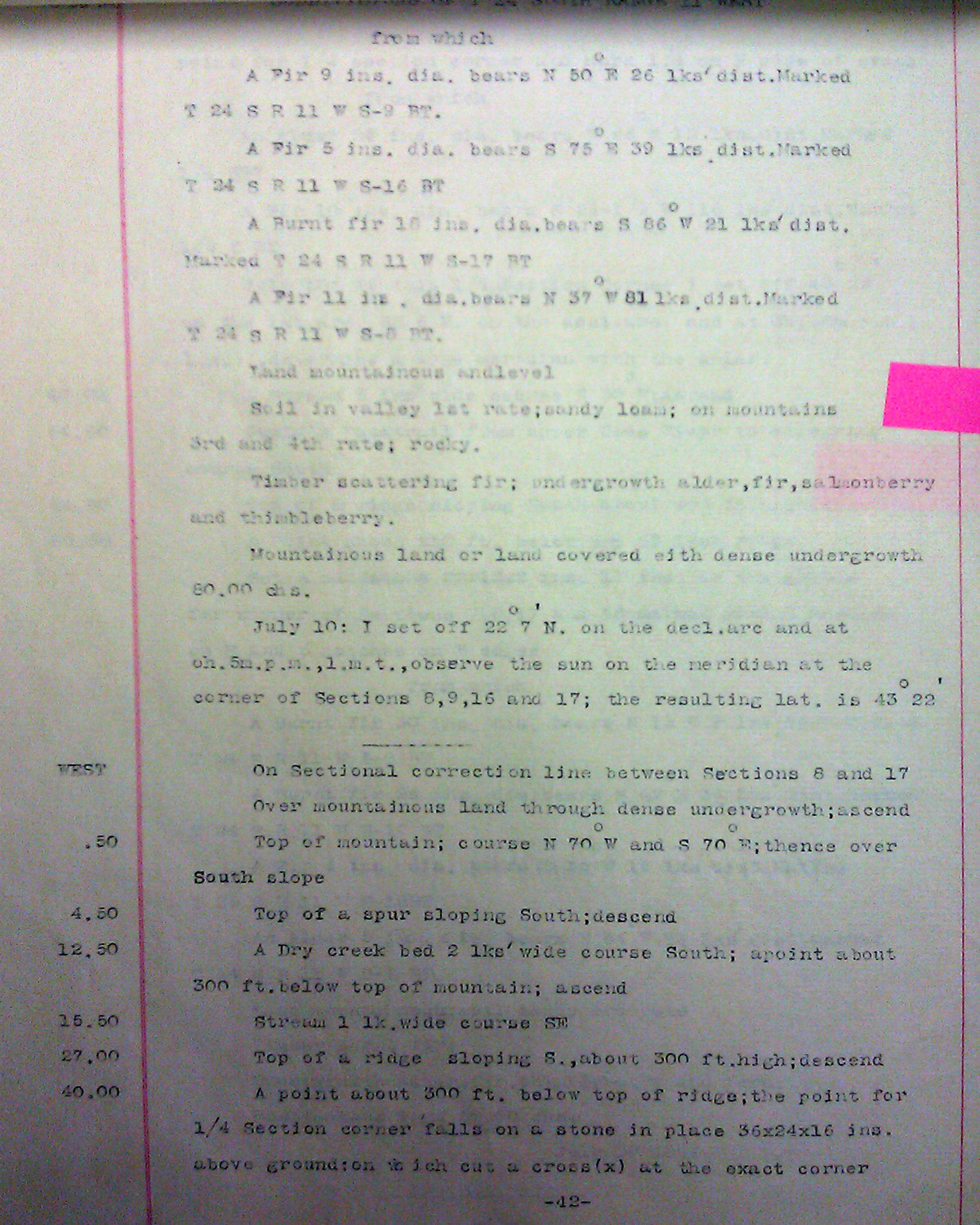
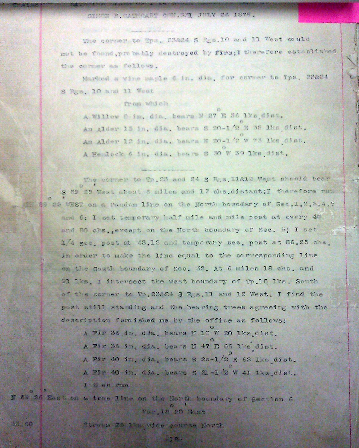
This township is entirely within the boundaries of the 2011-2012 Coquelle Trails Project. It includes Taylor Butte, Bear Camp Creek, and the Millicoma River in the Fairview Historical District. This survey was completed in 1880, 1896, and mapped in 1880 and 1897. (Flint & Williams 1871; Hall 1878; Cathcart 1879; Hunt 1896).
![]()