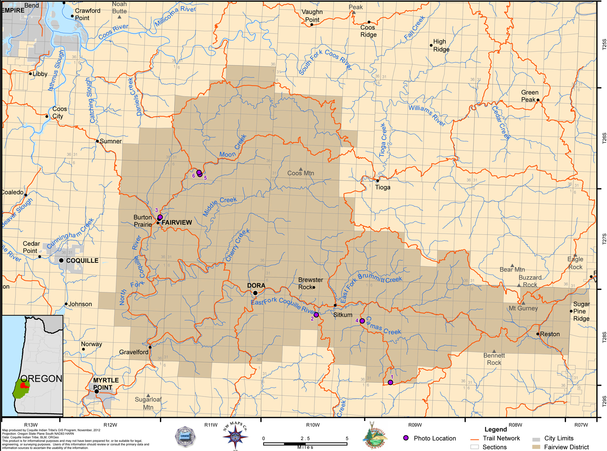
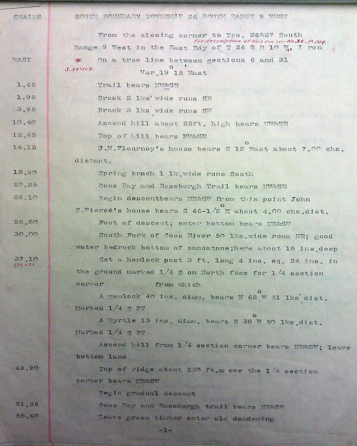
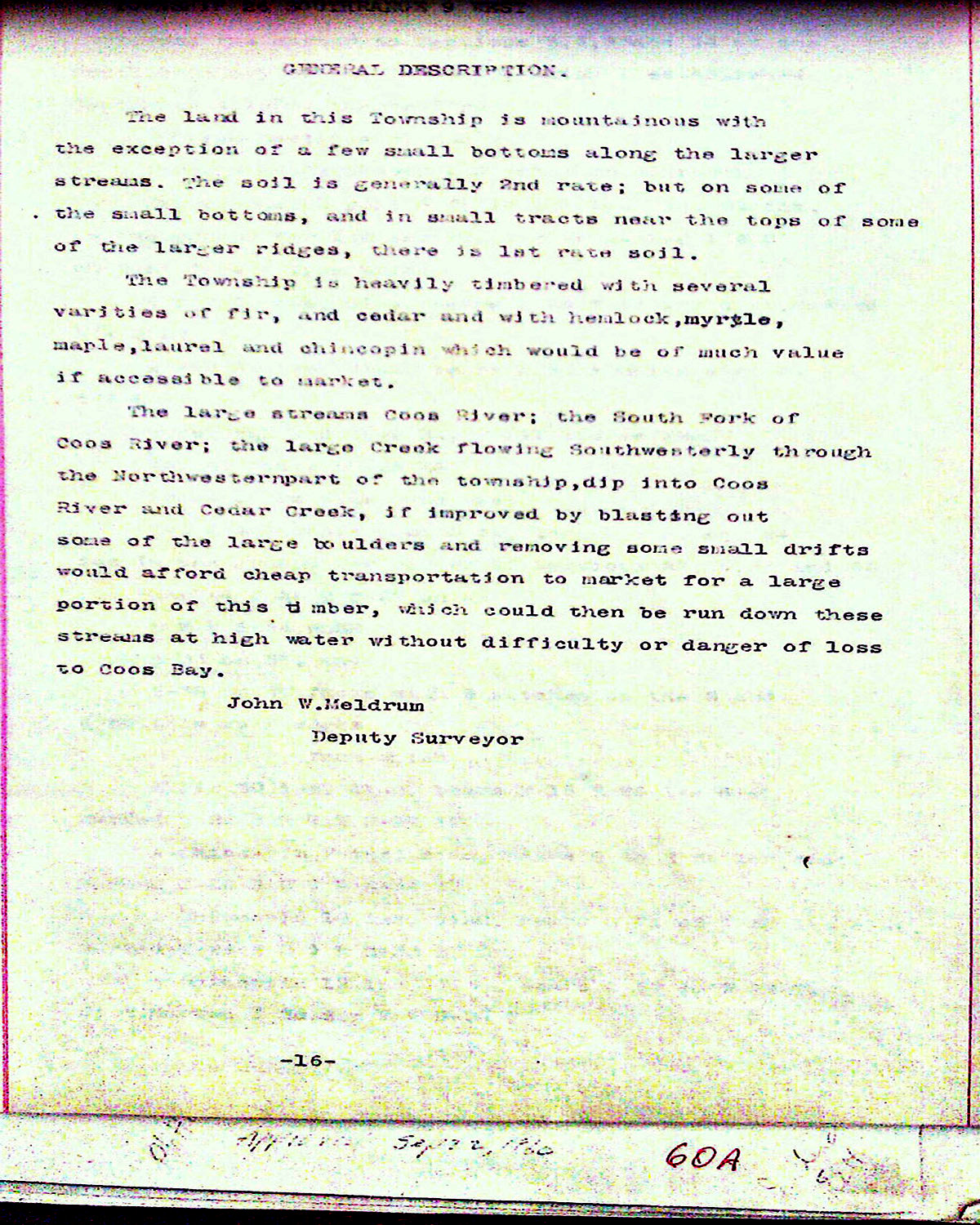
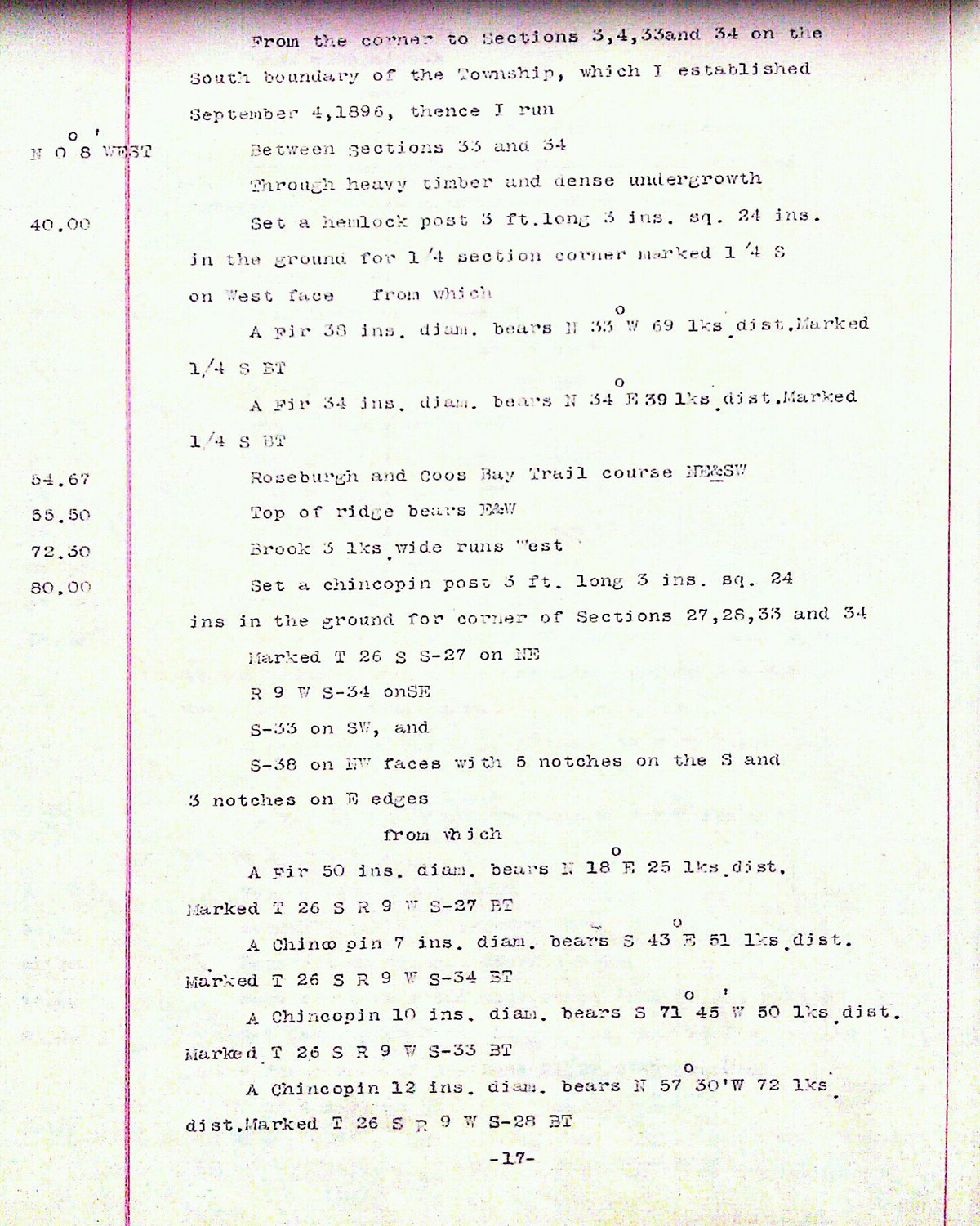
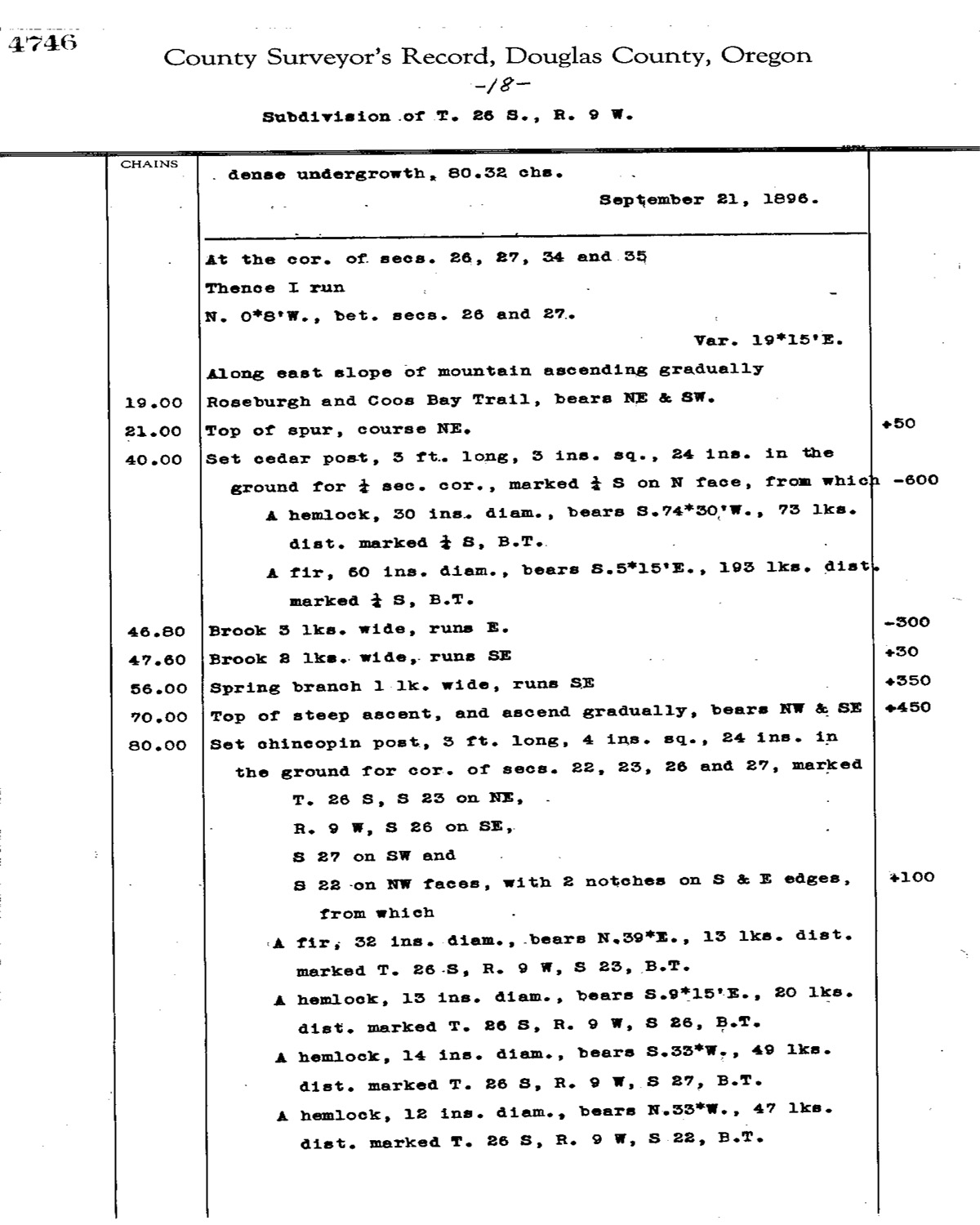
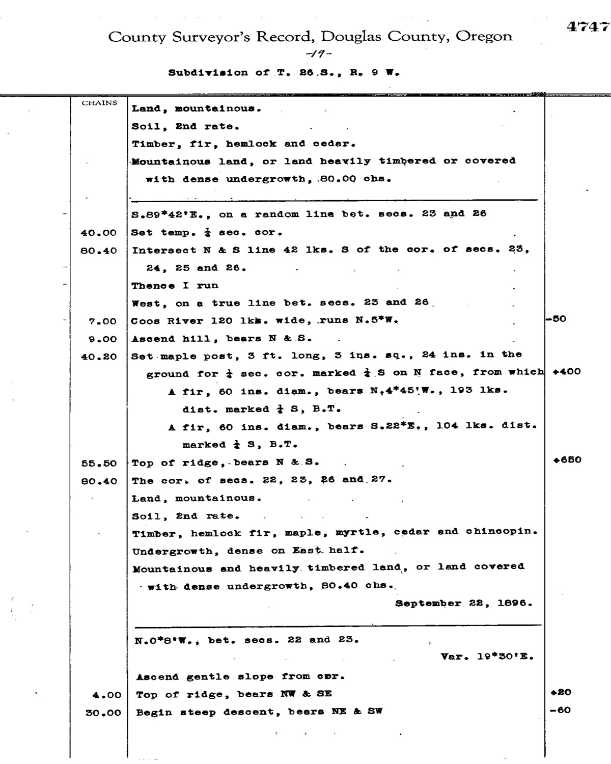
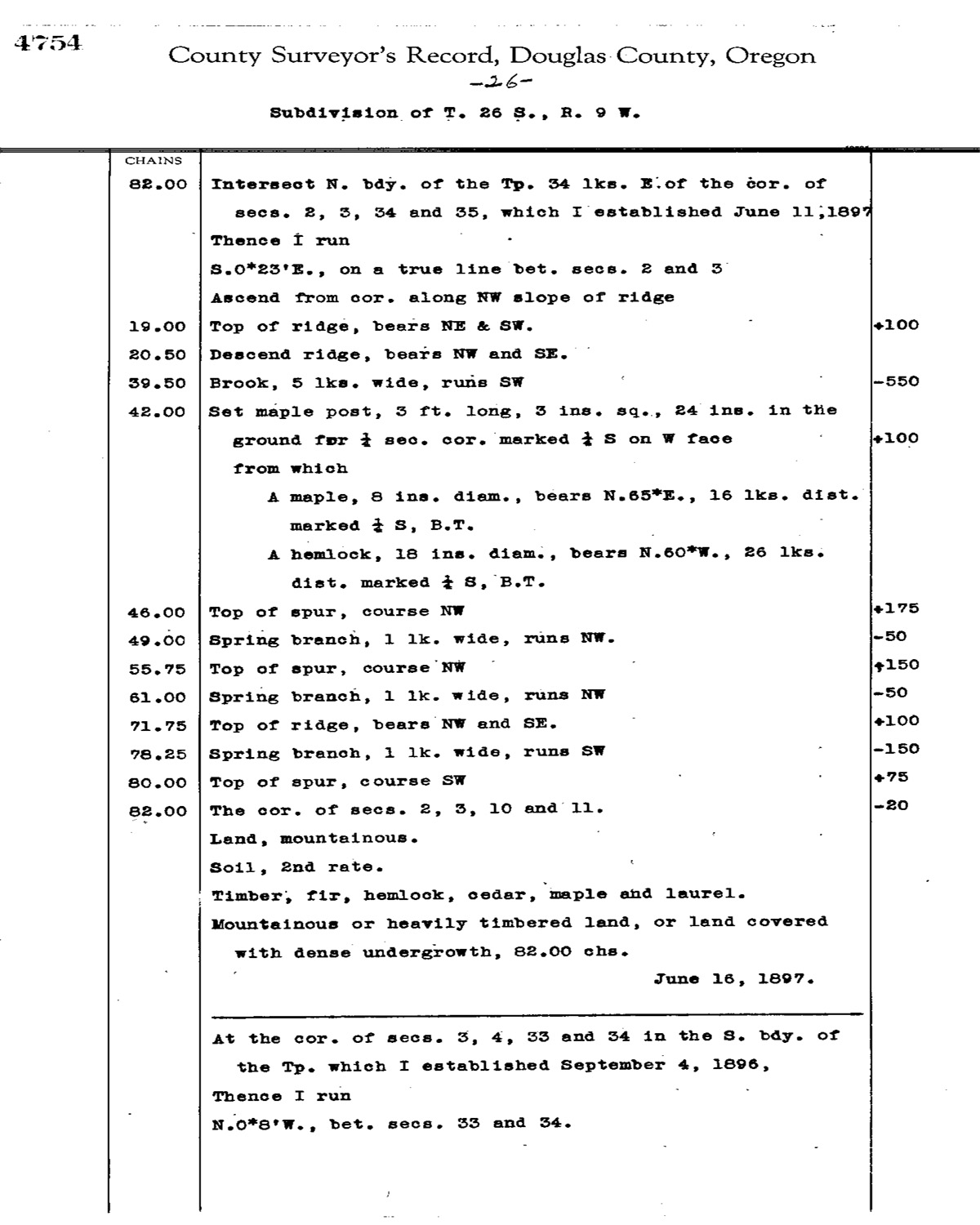
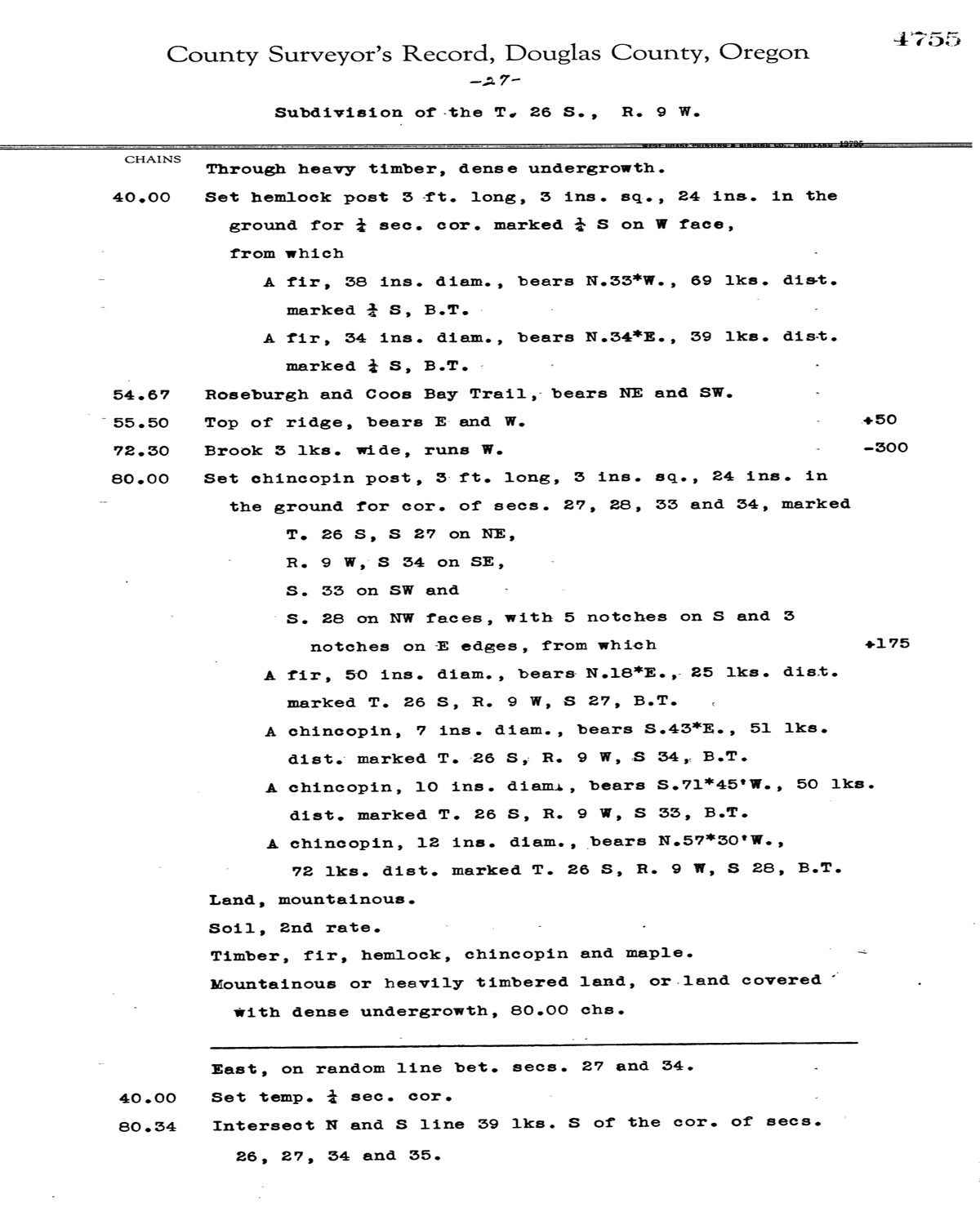
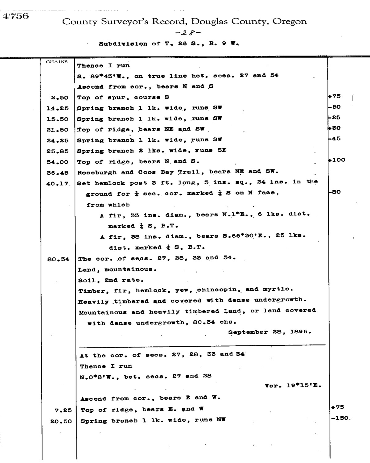
Tsp. 26 S., Rng. 09 W.
THIS INDEX MAP DOES NOT CONFORM TO ALL THE PAGE NUMBERS IN THE TABLE.
General Land Office Survey Index
 |
 |
 |
 |
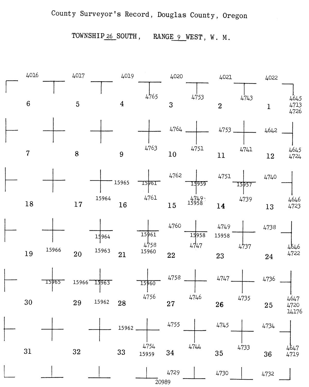
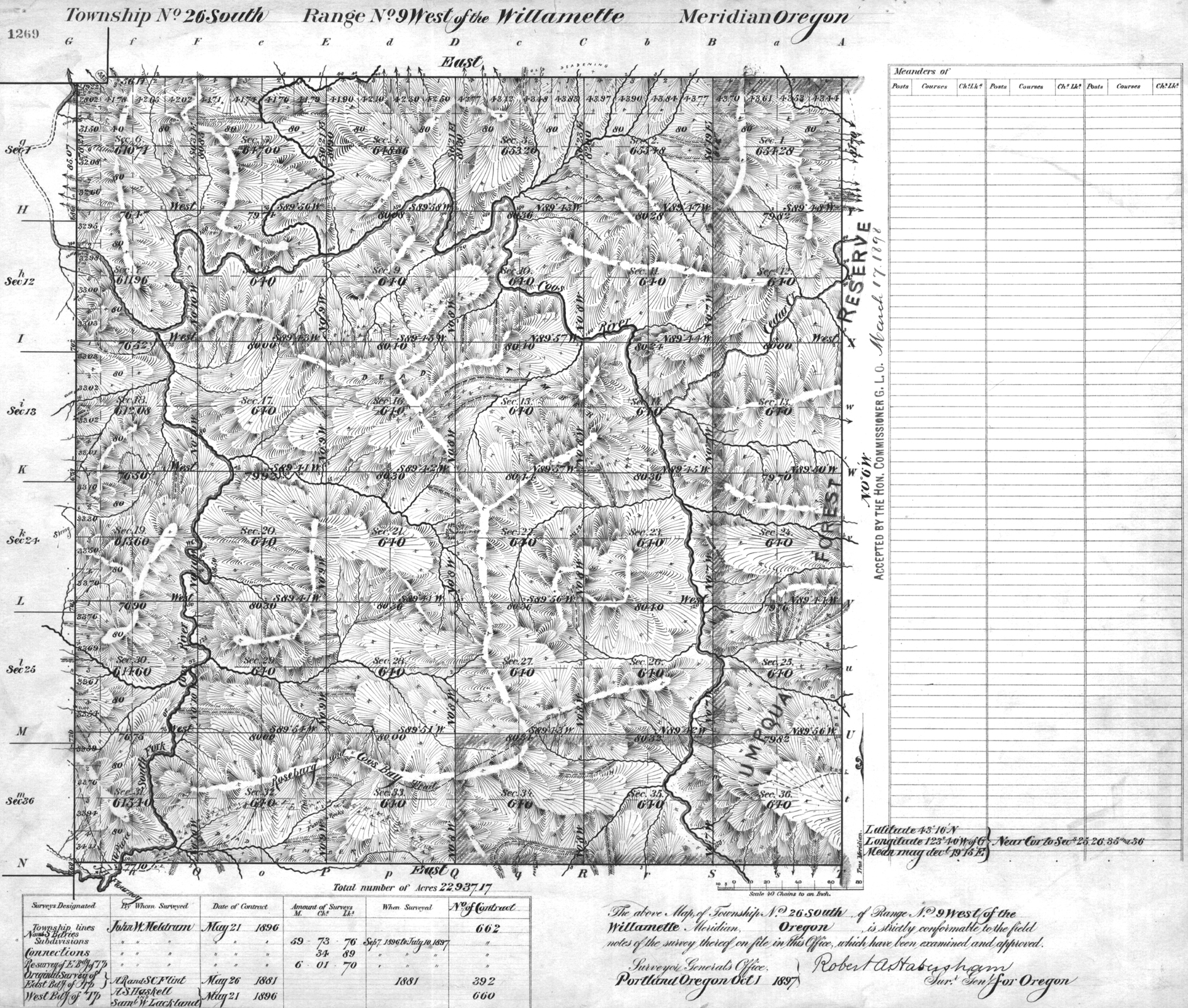
1897 GLO |
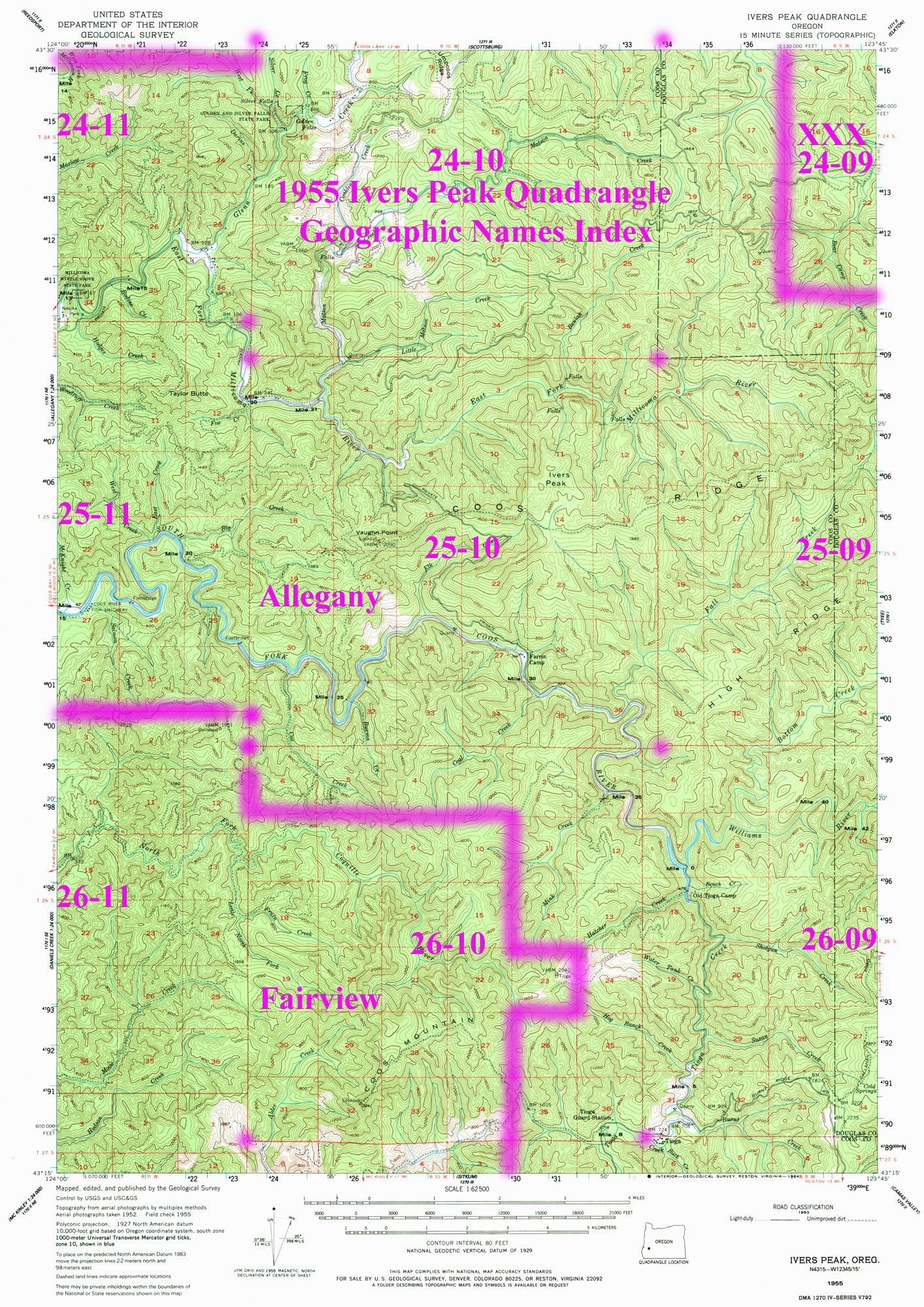
1955 Annotated USGS Ivers Peak |
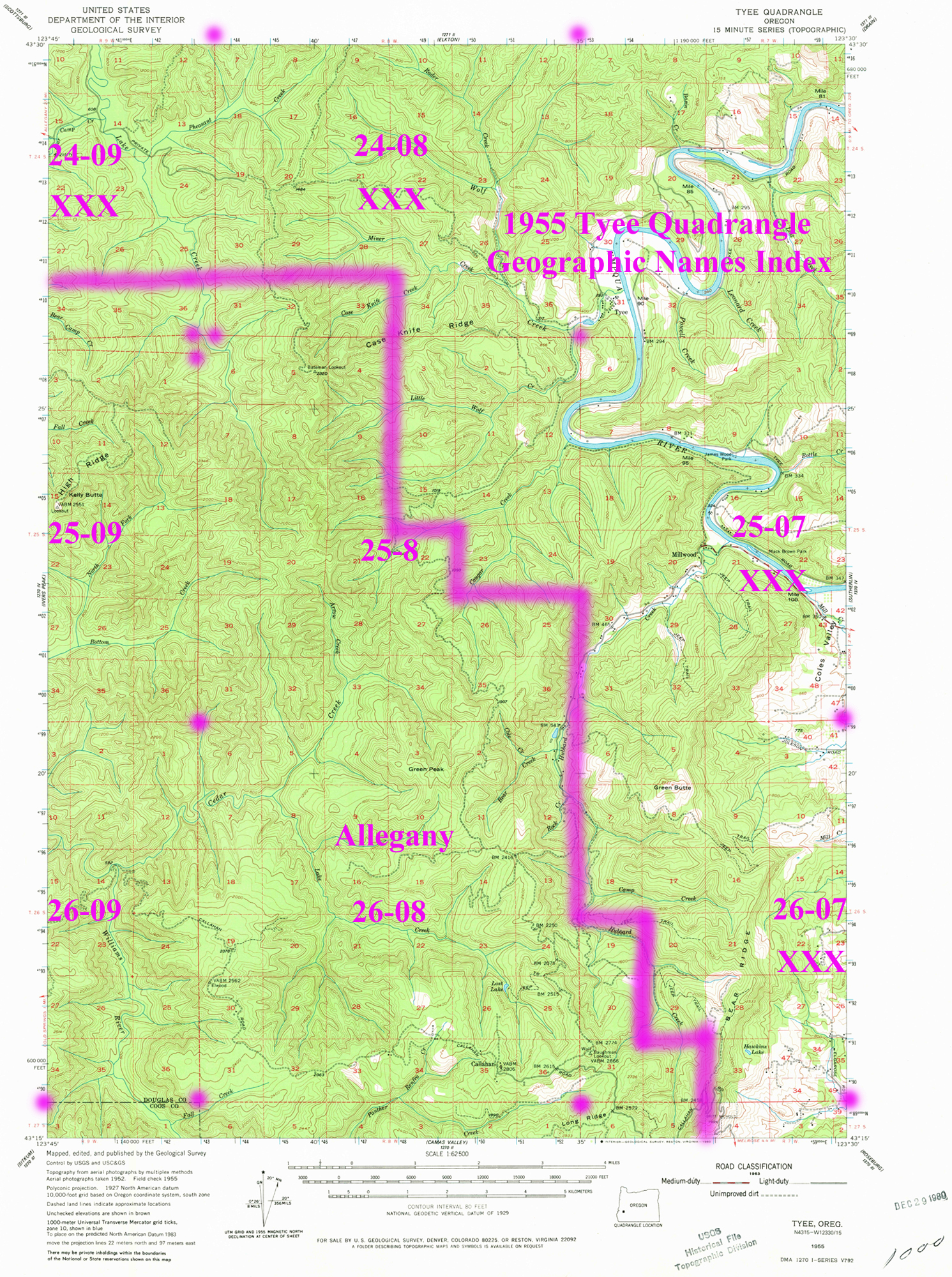
1955 Annotated USGS Tyee |
2012 Fairview District |
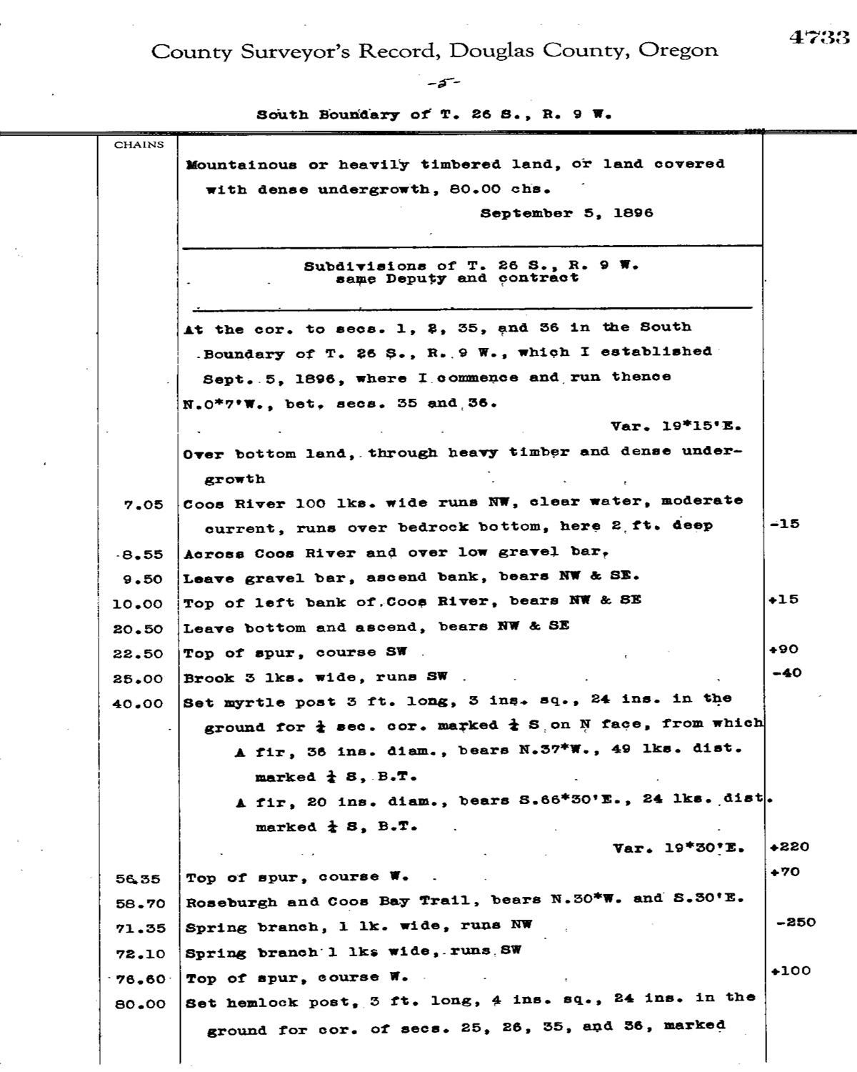
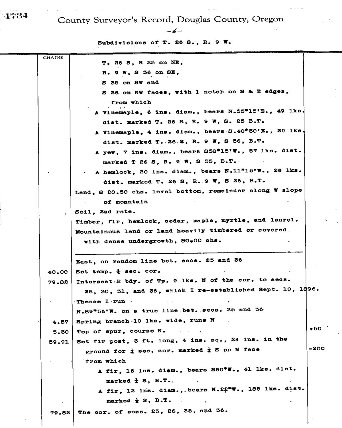
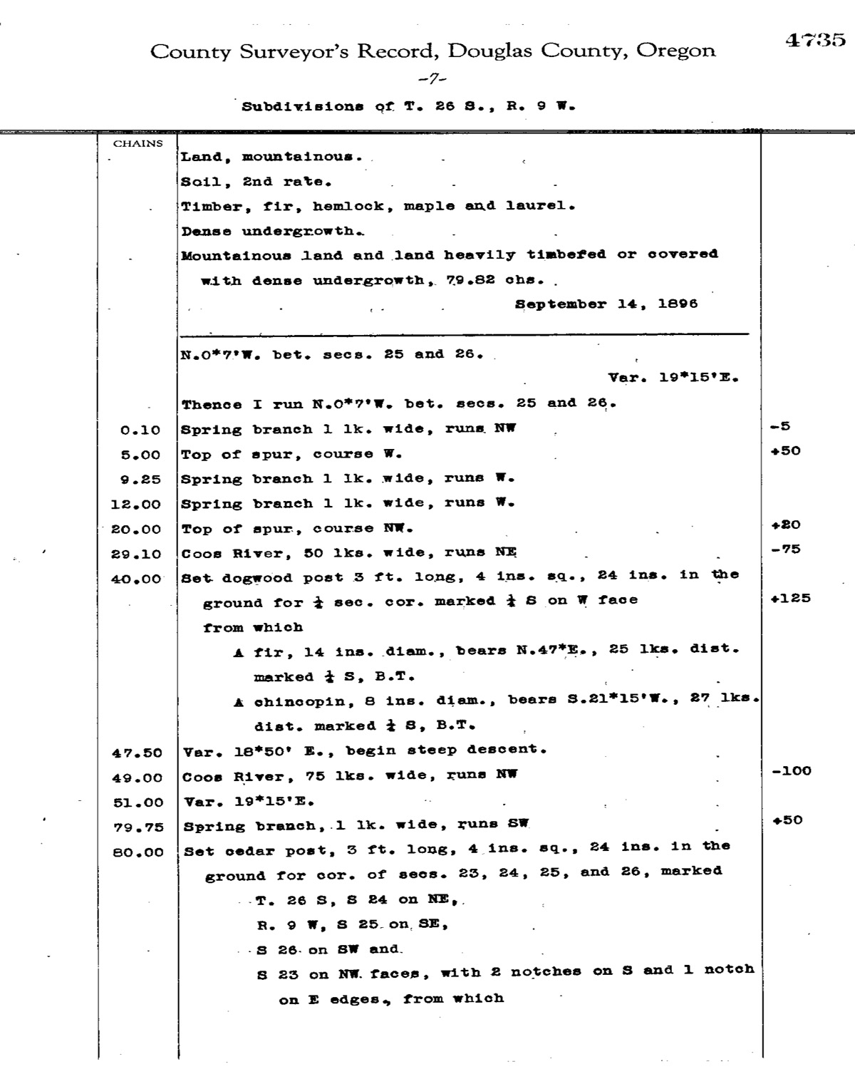
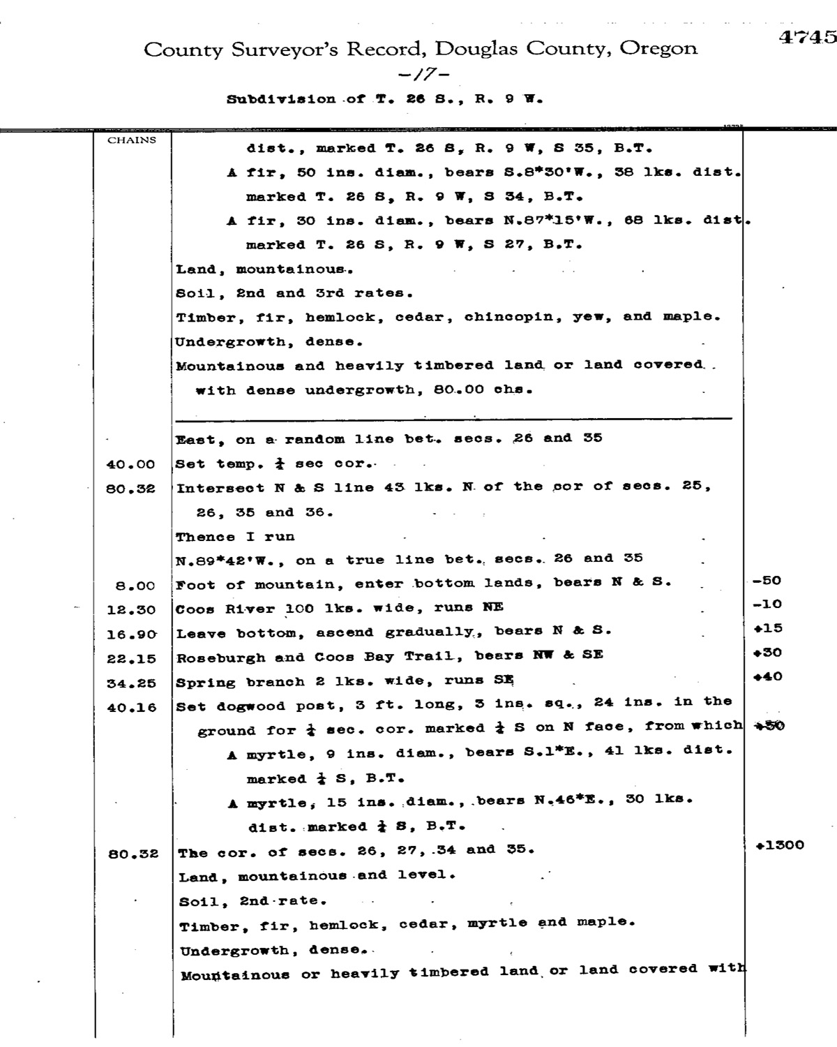
This township is entirely within the boundaries of the 2011-2012 Coquelle Trails Project. It includes Ivers Peak, Cedar Creek, and the Coos and Williams Rivers in the Fairview Historical District. This survey was completed in 1881, and 1897 and mapped in 1897 (Flint & Flint 1881; Lackland & Haskell 1896; Meldrum 1896).
![]()