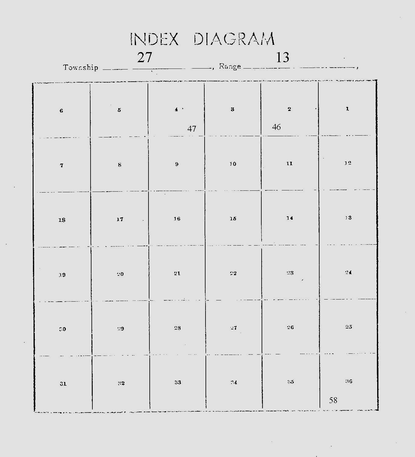
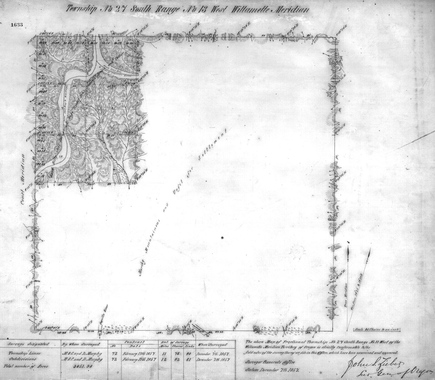
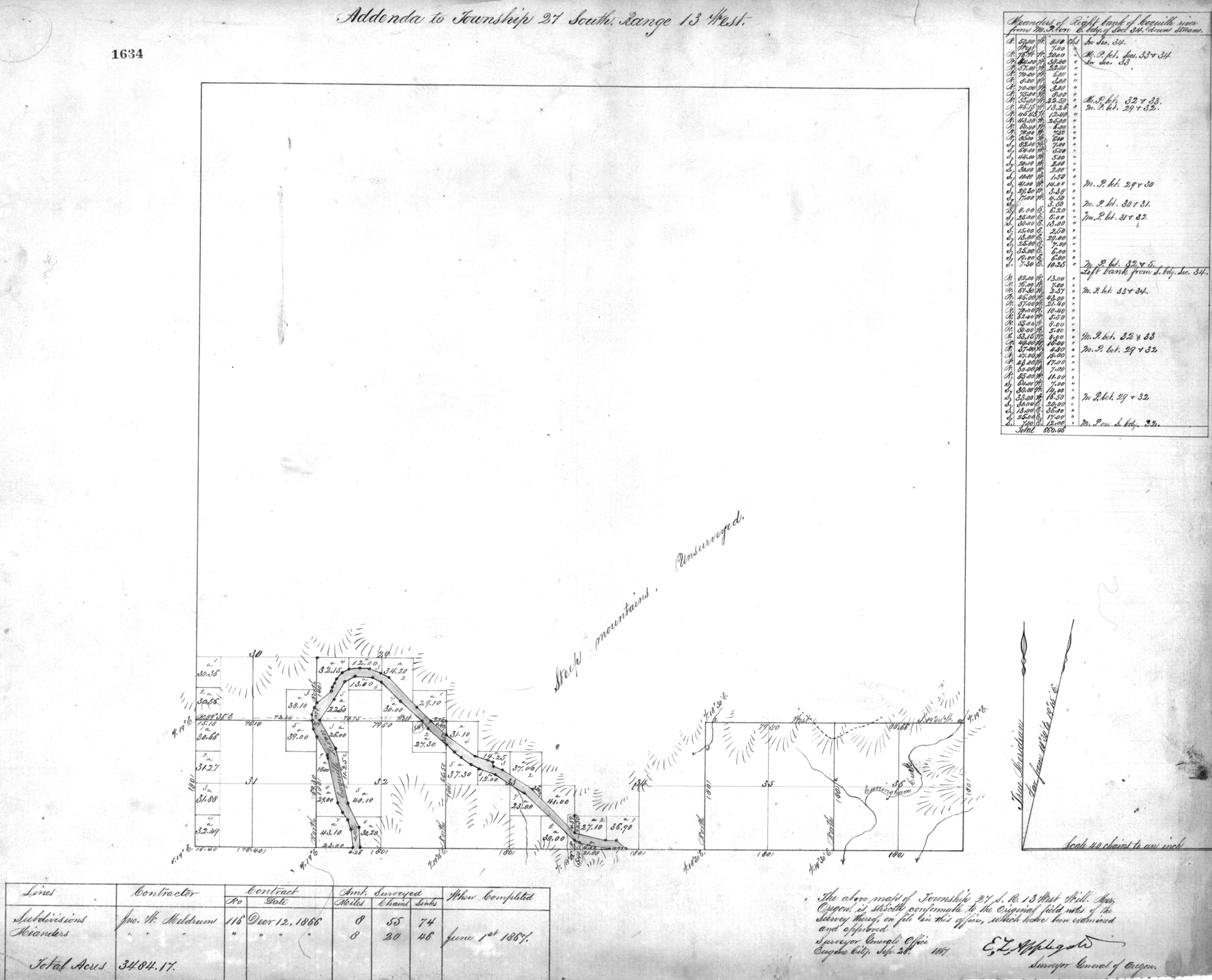
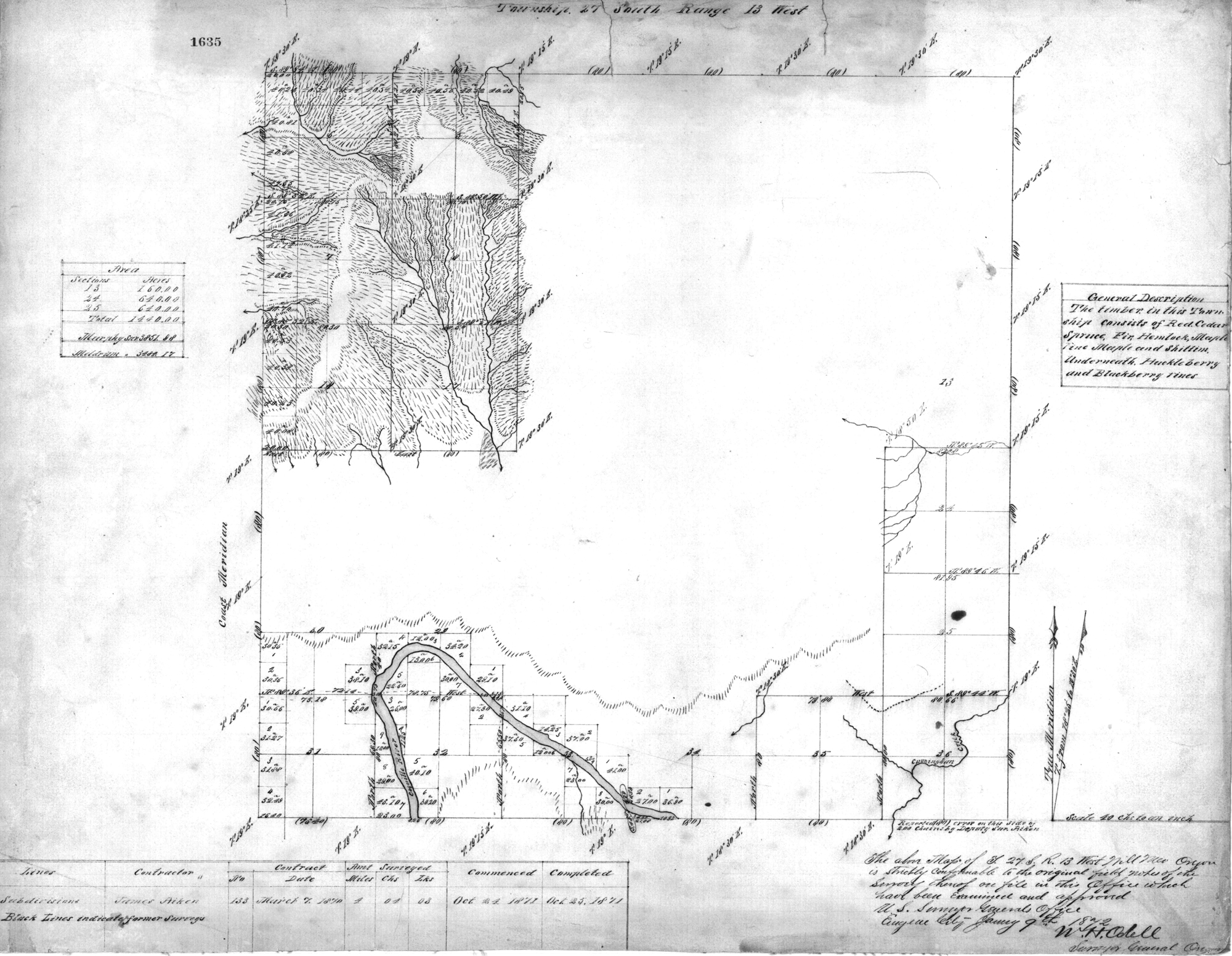
Tsp. 27 S., Rng. 13 W.
General Land Office Survey Index
 |
 |
 |
 |
 |
 |
 |
1857 GLO |
1867 GLO |
1872a GLO |
1872b GLO |
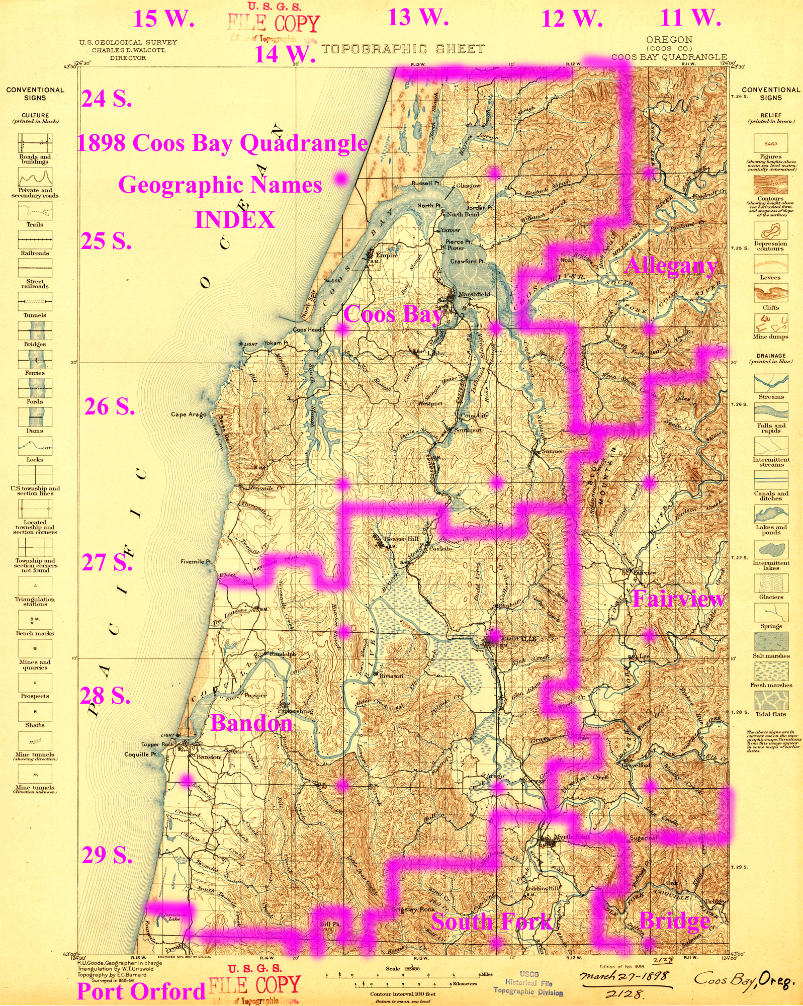
1898 Annotated USGS Coos Bay |
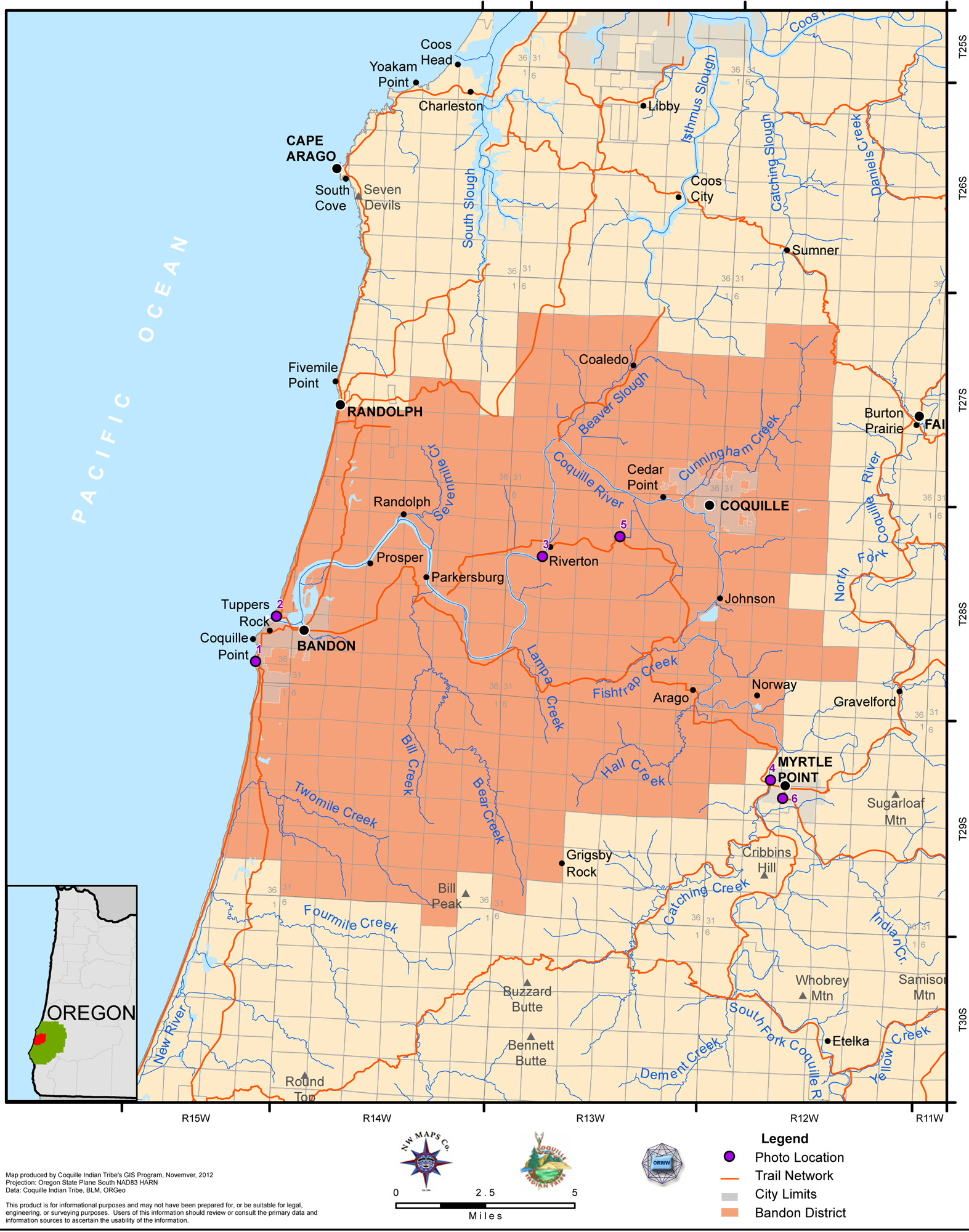
2012 Bandon District |
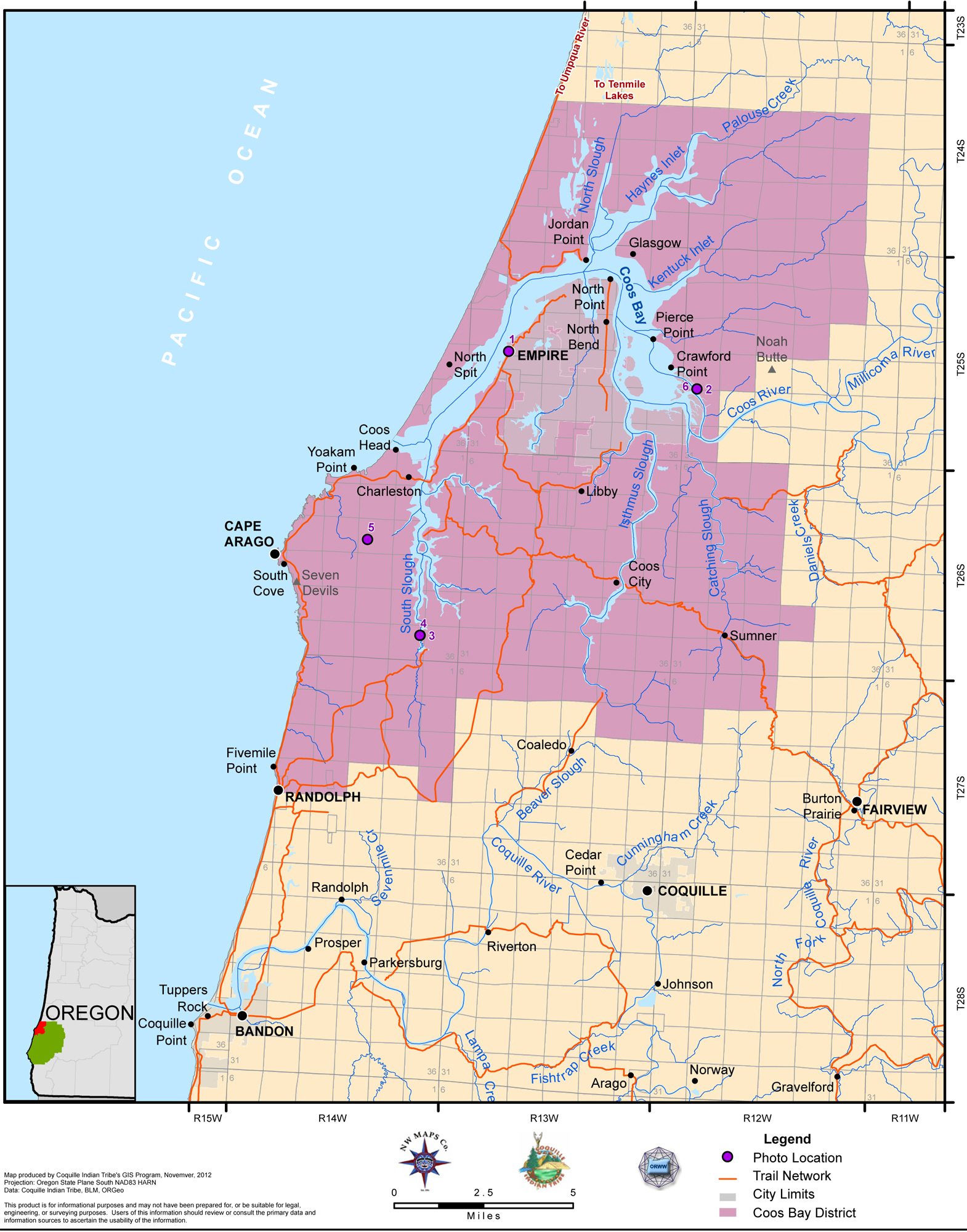
2012 Coos BayDistrict |
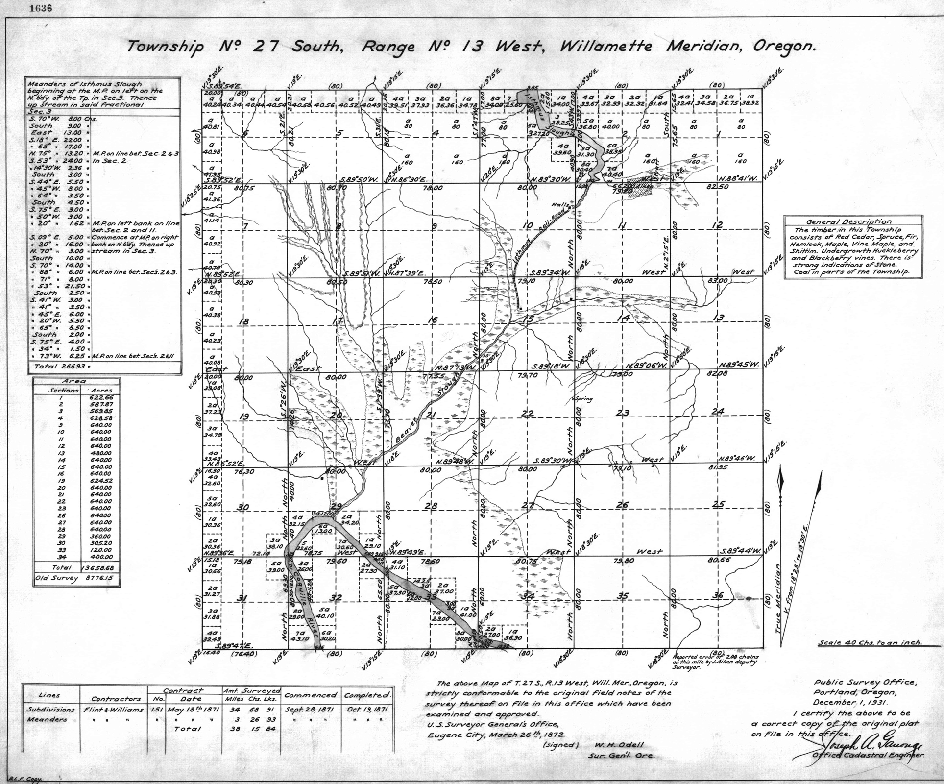
This township is entirely within the boundaries of the 2011-2012 Coquelle Trails Project. It includes Budd Mountain, Beaver Creek, and Coquille River in the Bandon and Coos Bay Historical Districts. This survey was completed in 1857, 1867, and 1871 and mapped in 1857, 1867, 1872, and 1931 (Murphy & Murphy 1857; Meldrum 1866; Aiken 1870; Flint & Williams 1871)