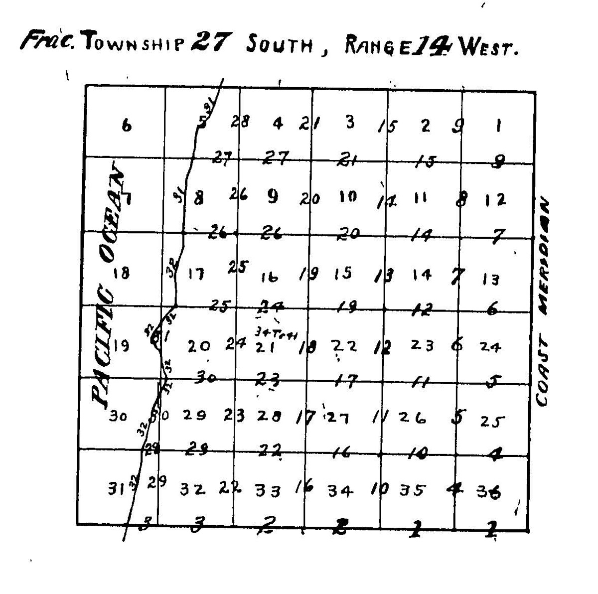
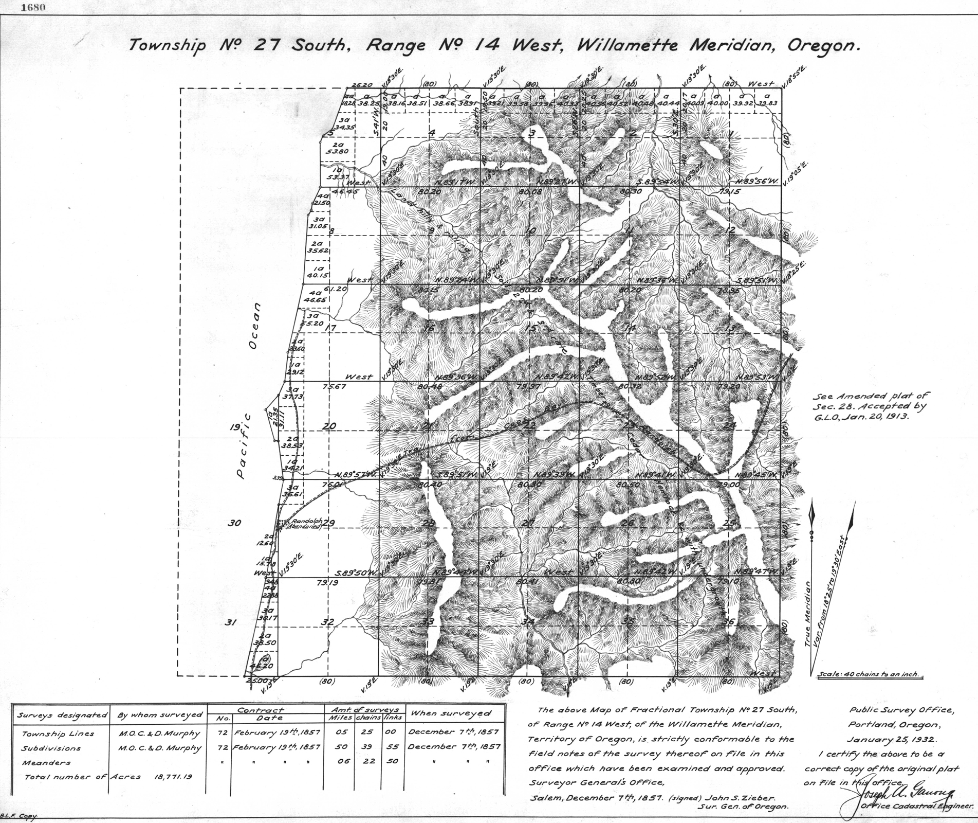
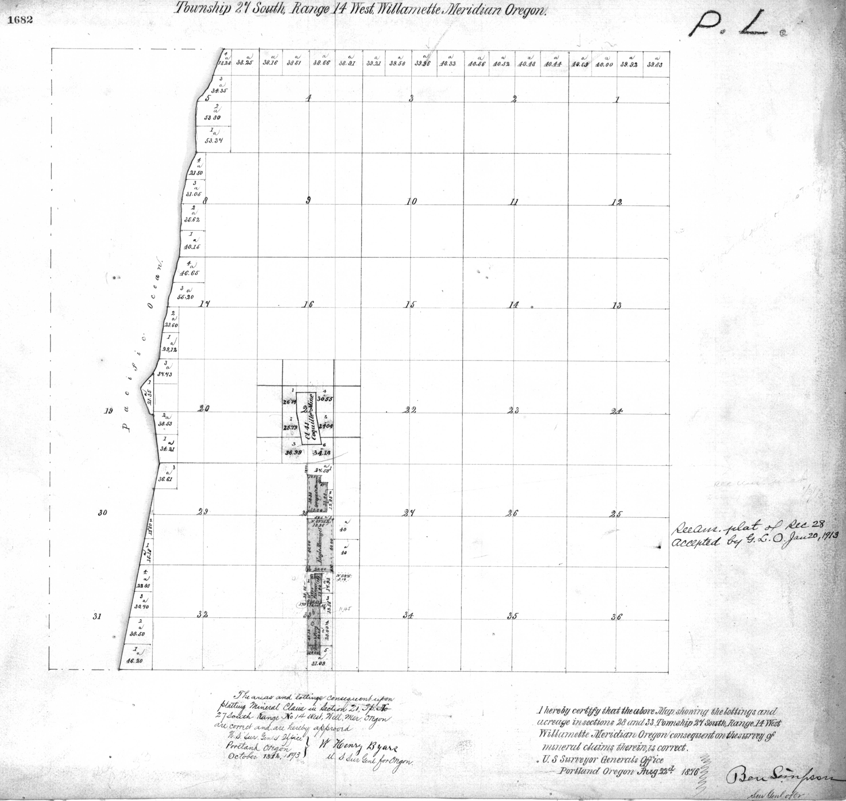
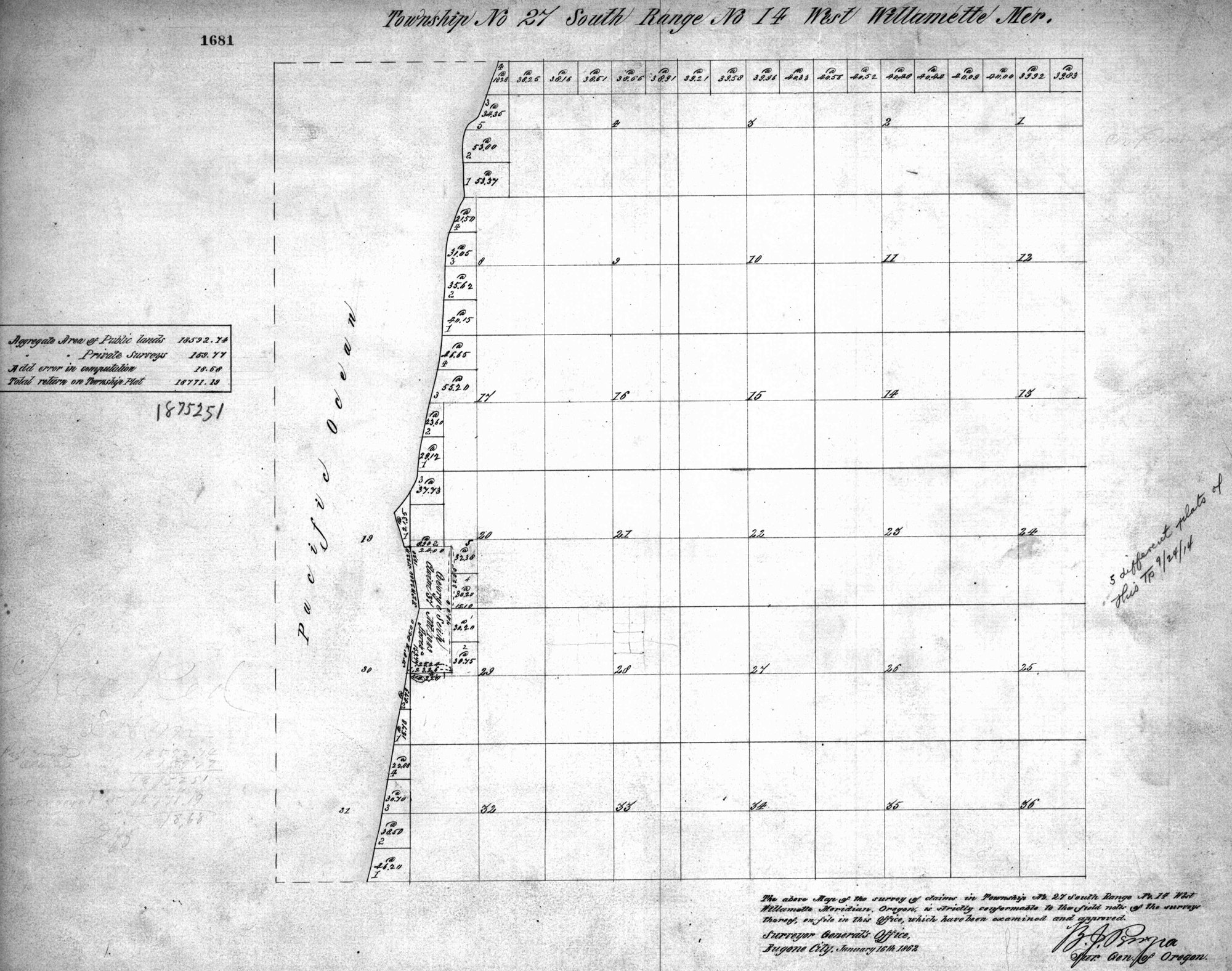
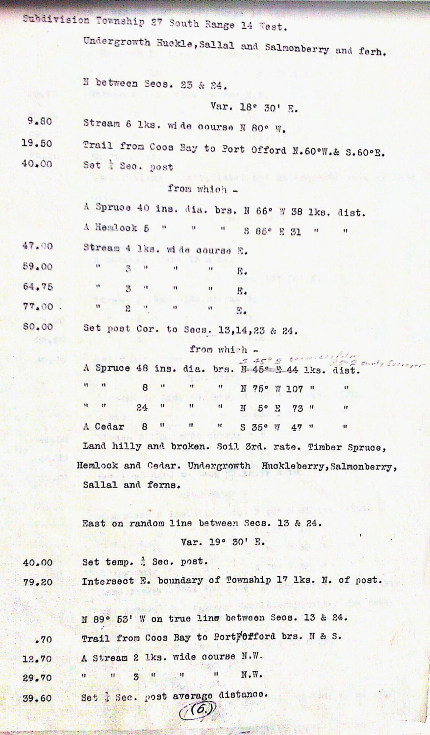
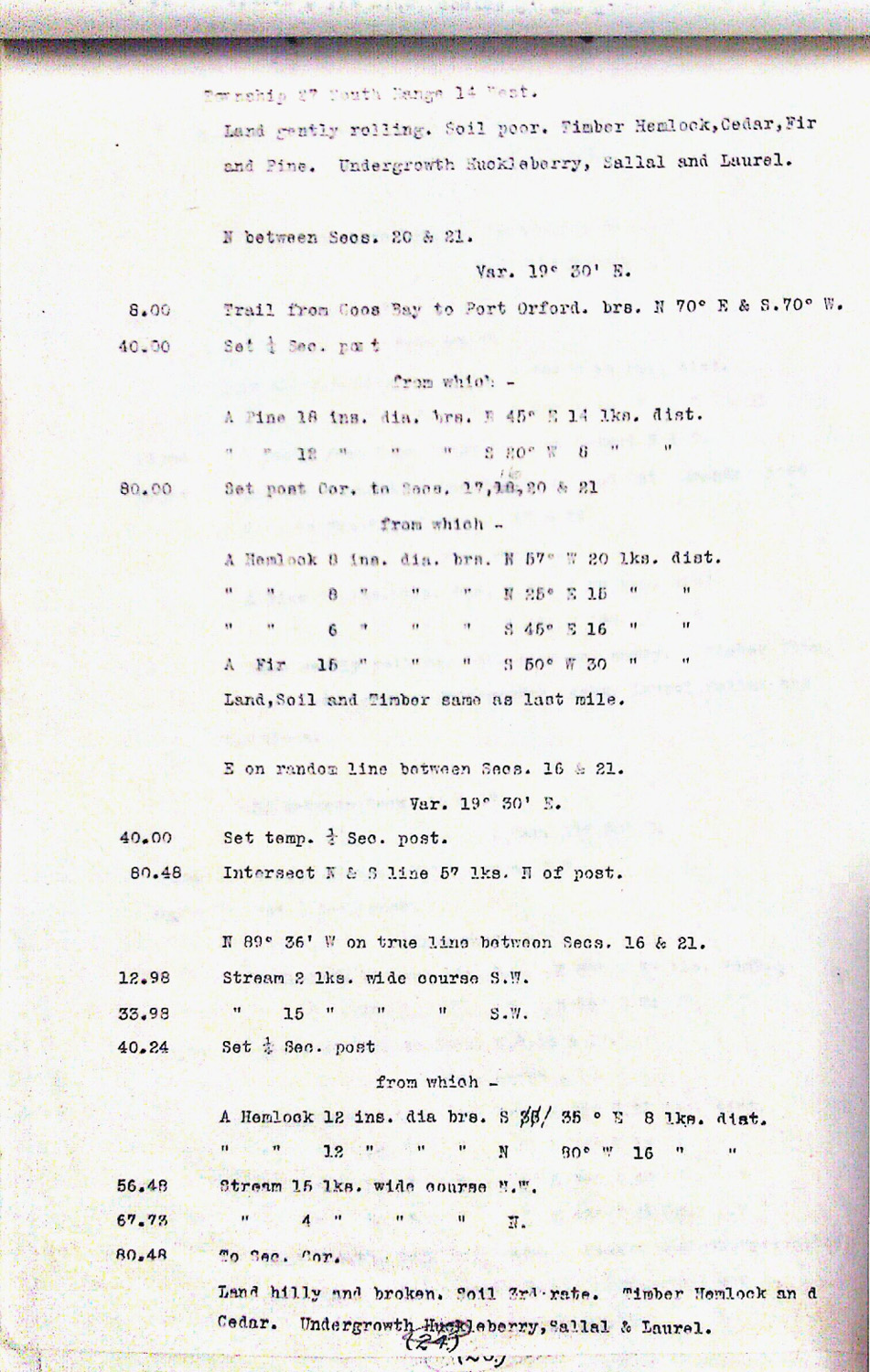
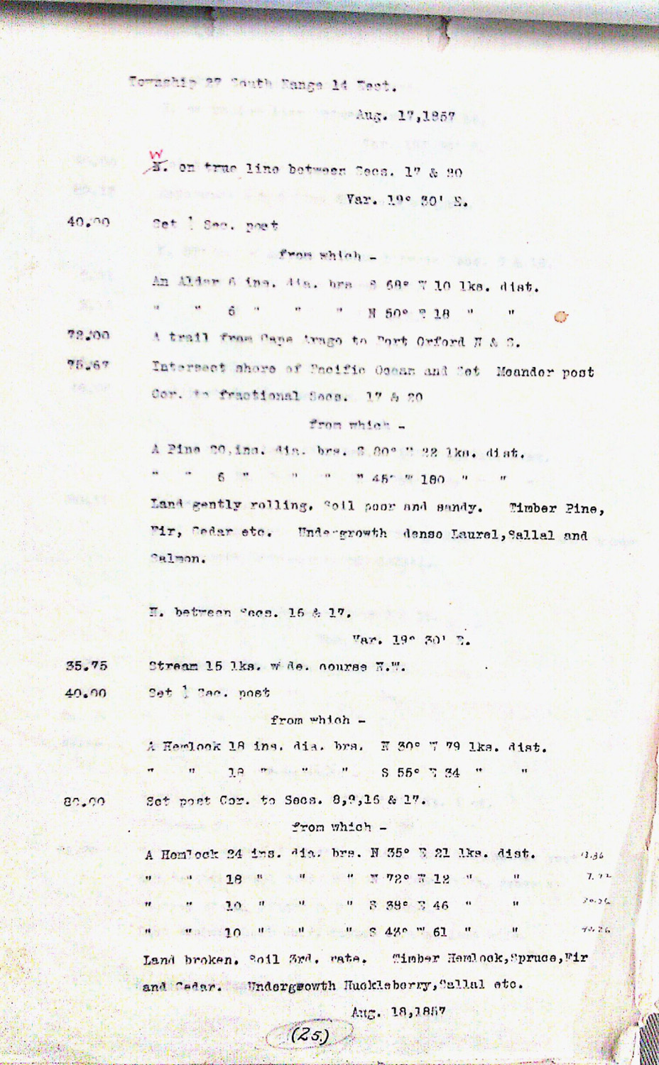
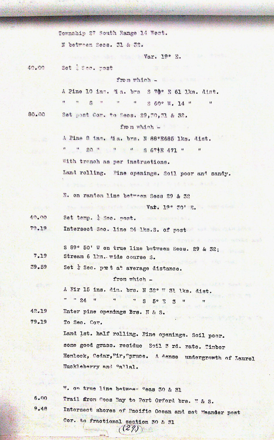
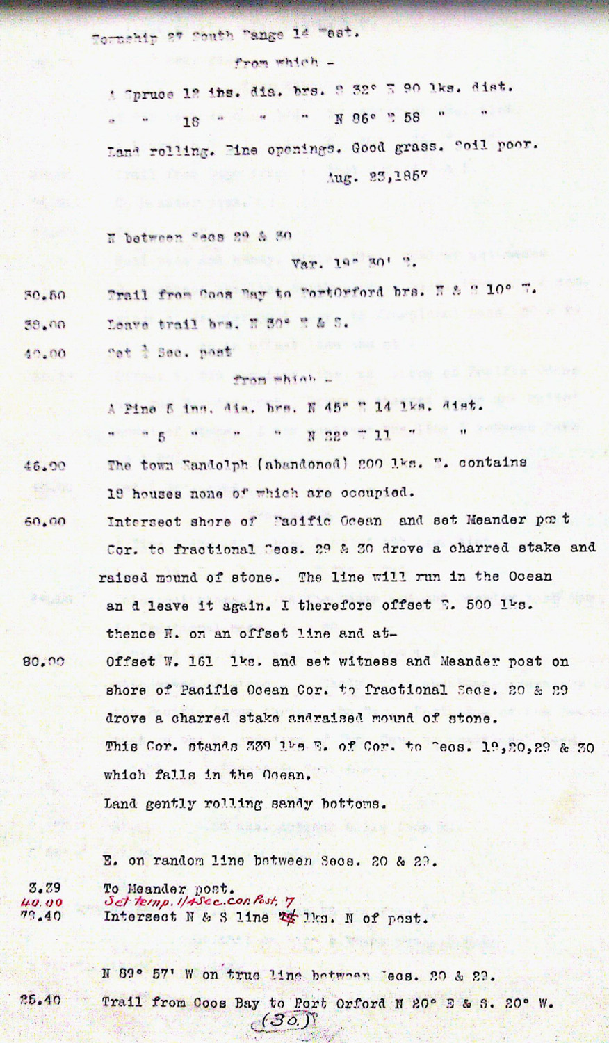
Tsp. 27 S., Rng. 14 W.
General Land Office Survey Index
 |
 |
 |
 |
 |
 |
1857 GLO |
1876 Mine Claims |
1862 DLC |
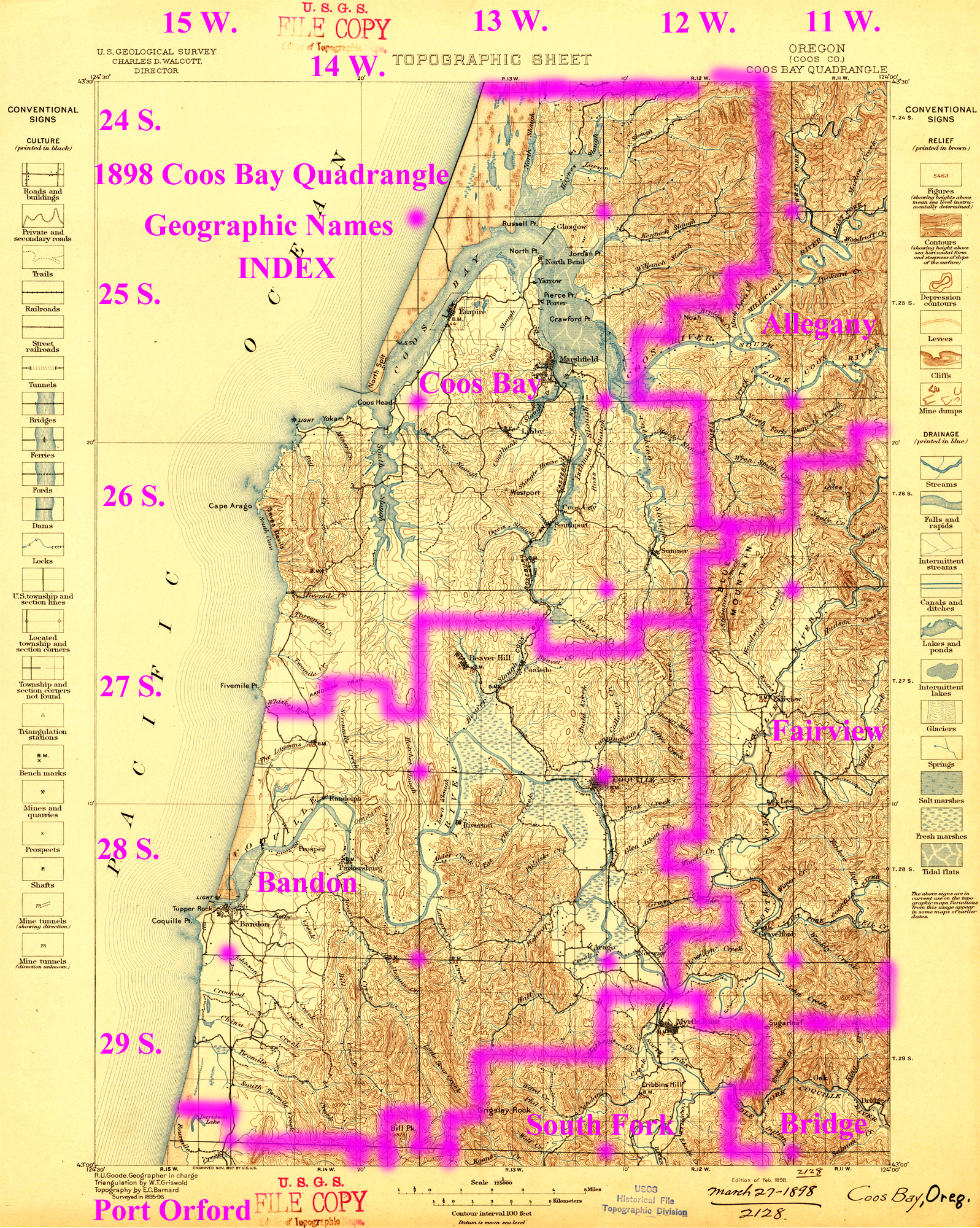
1898 Annotated USGS Coos Bay |
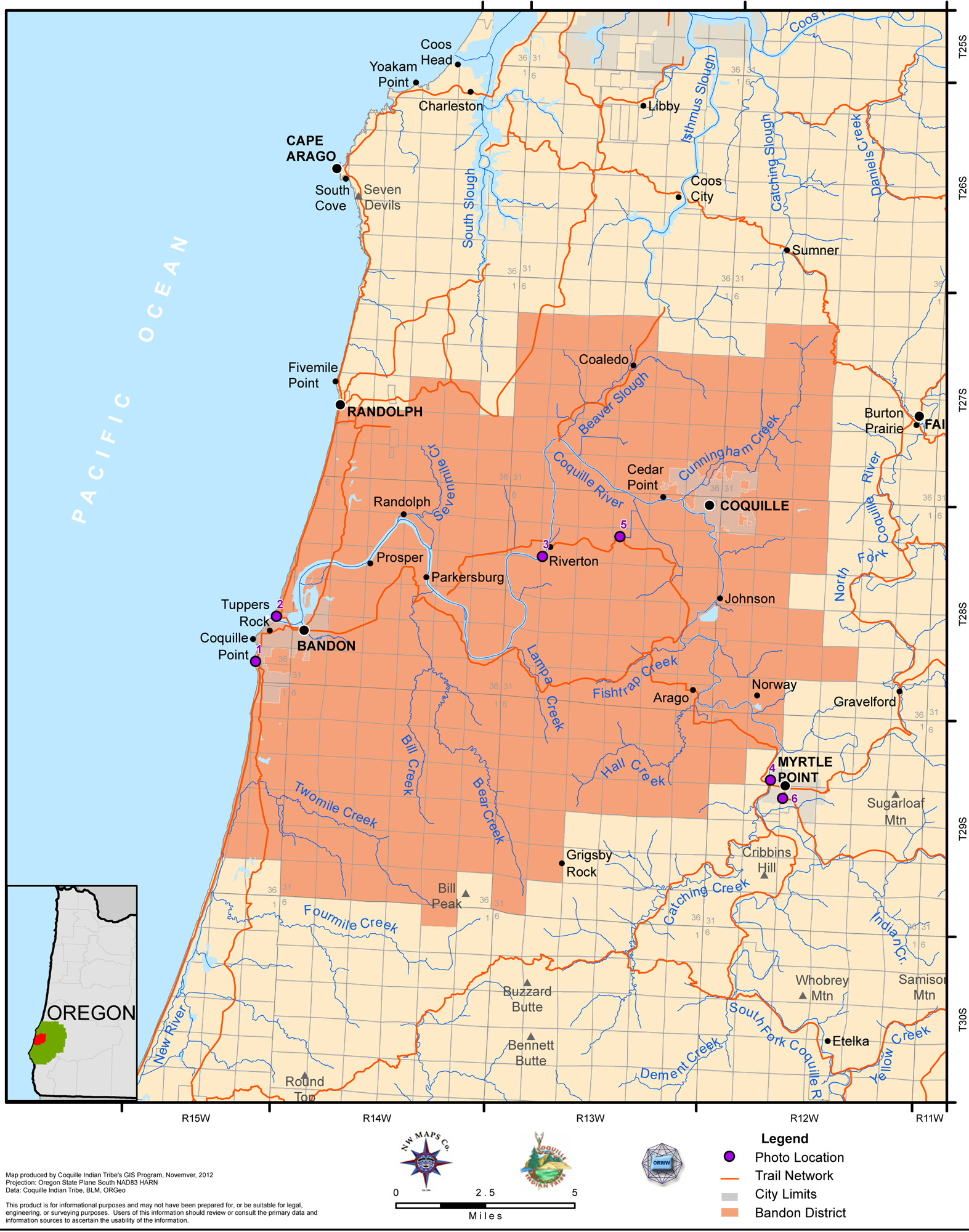
2012 Bandon District |
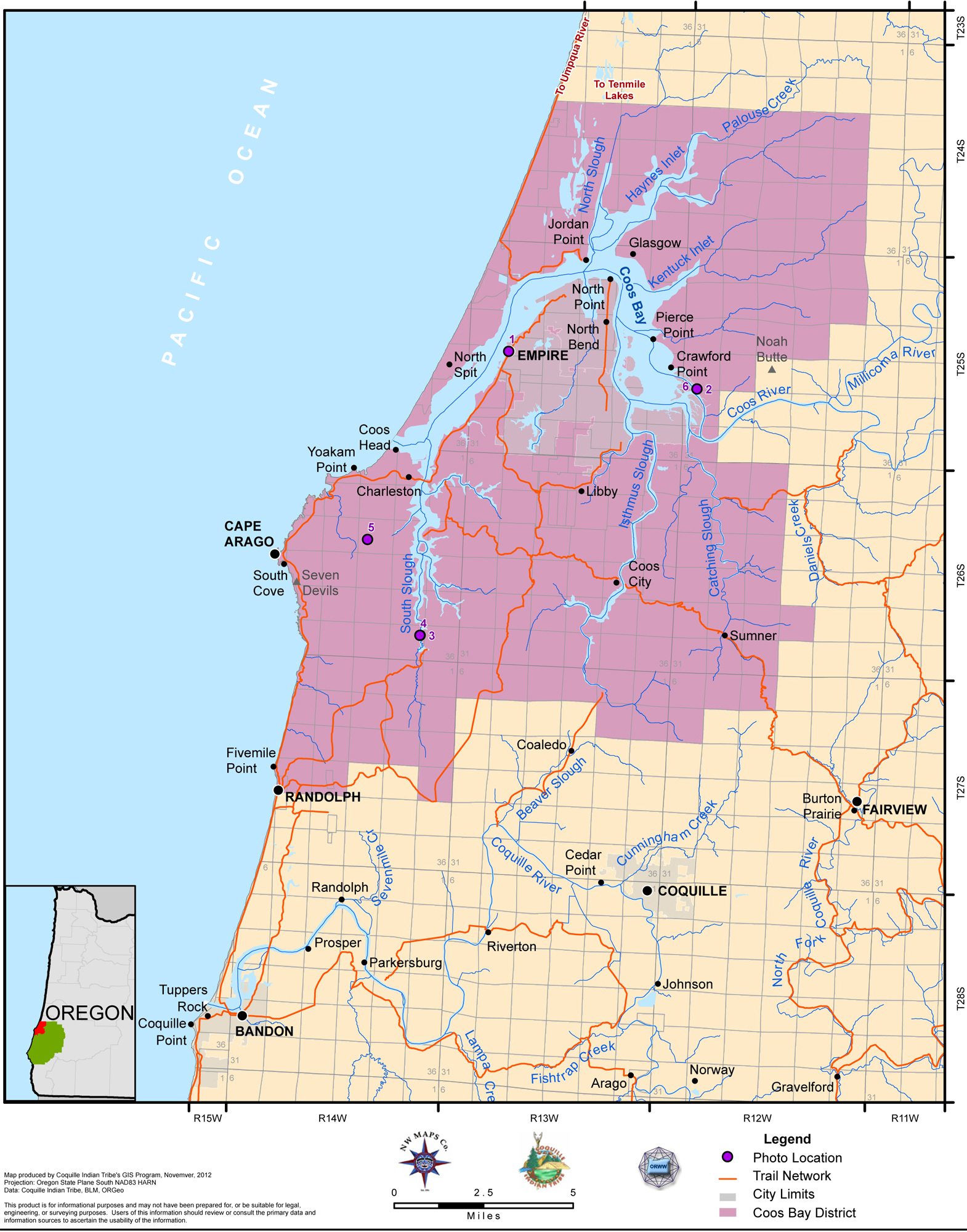
2012 Coos Bay District |
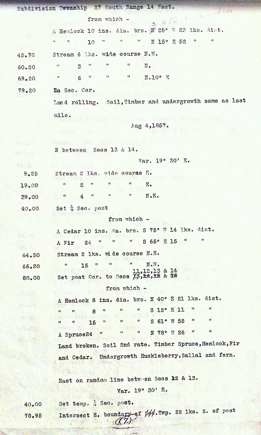
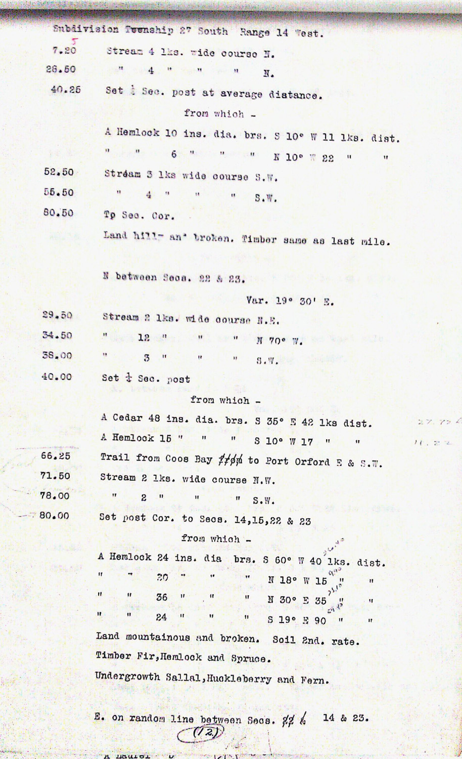
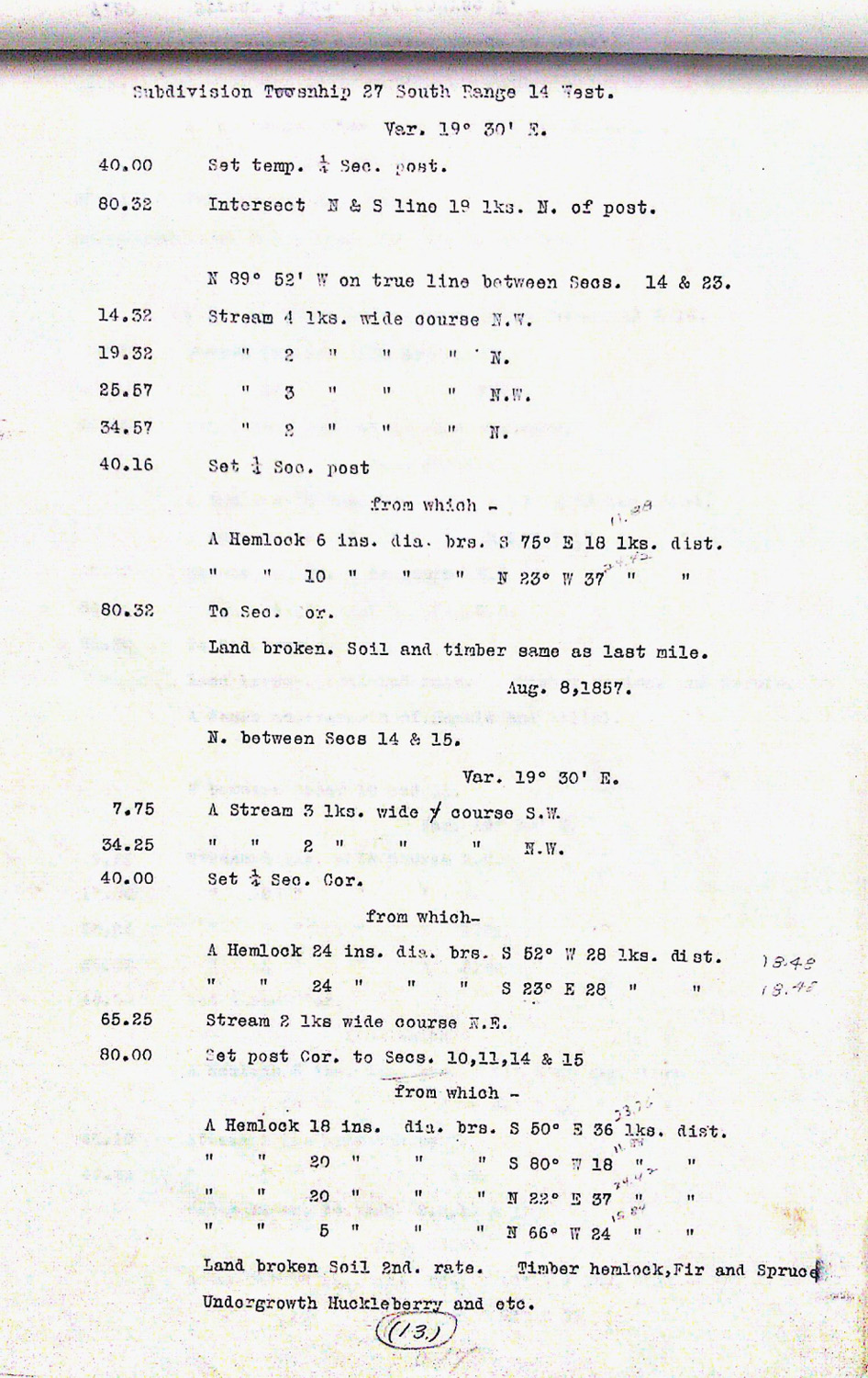
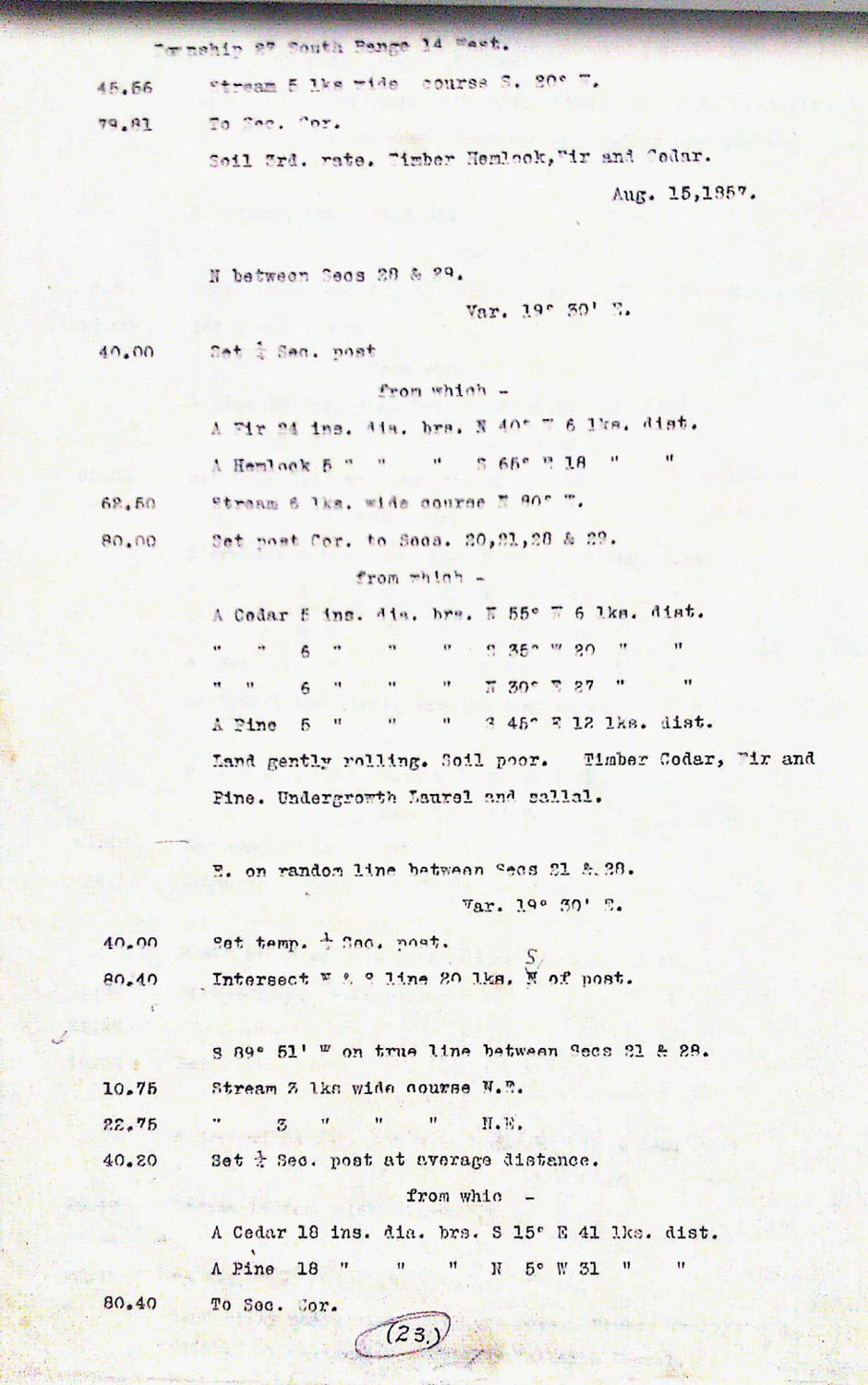
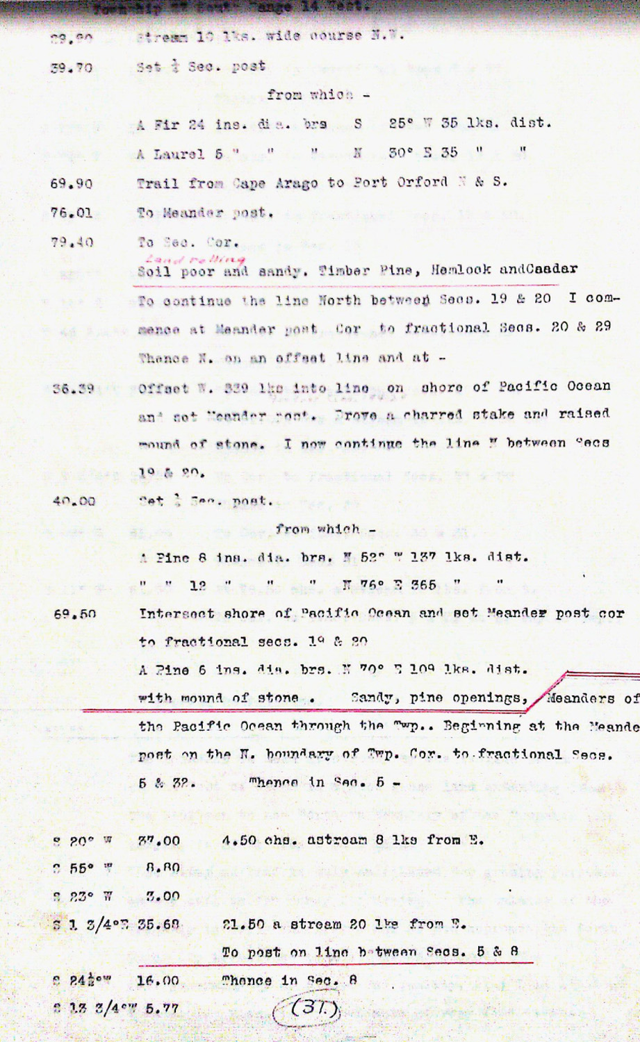
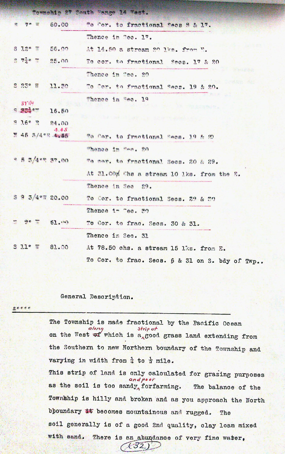
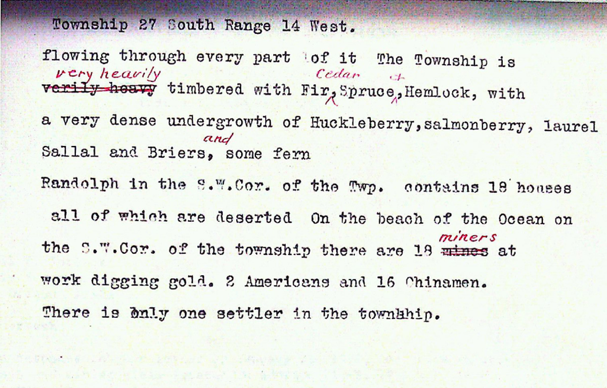
This township is entirely within the boundaries of the 2011-2012 Coquelle Trails Project. It includes Beaver Hill, Sevenmile Creek, and Coquille River in the Bandon and Coos Bay Historical Districts. This survey was completed in 1857, 1876 and 1862 and mapped in 1857, 1862, 1876, 1893, 1913, 1914 and1932 (Murphy & Murphy 1857). A Donation Land Claim was filed by George Seith.
![]()