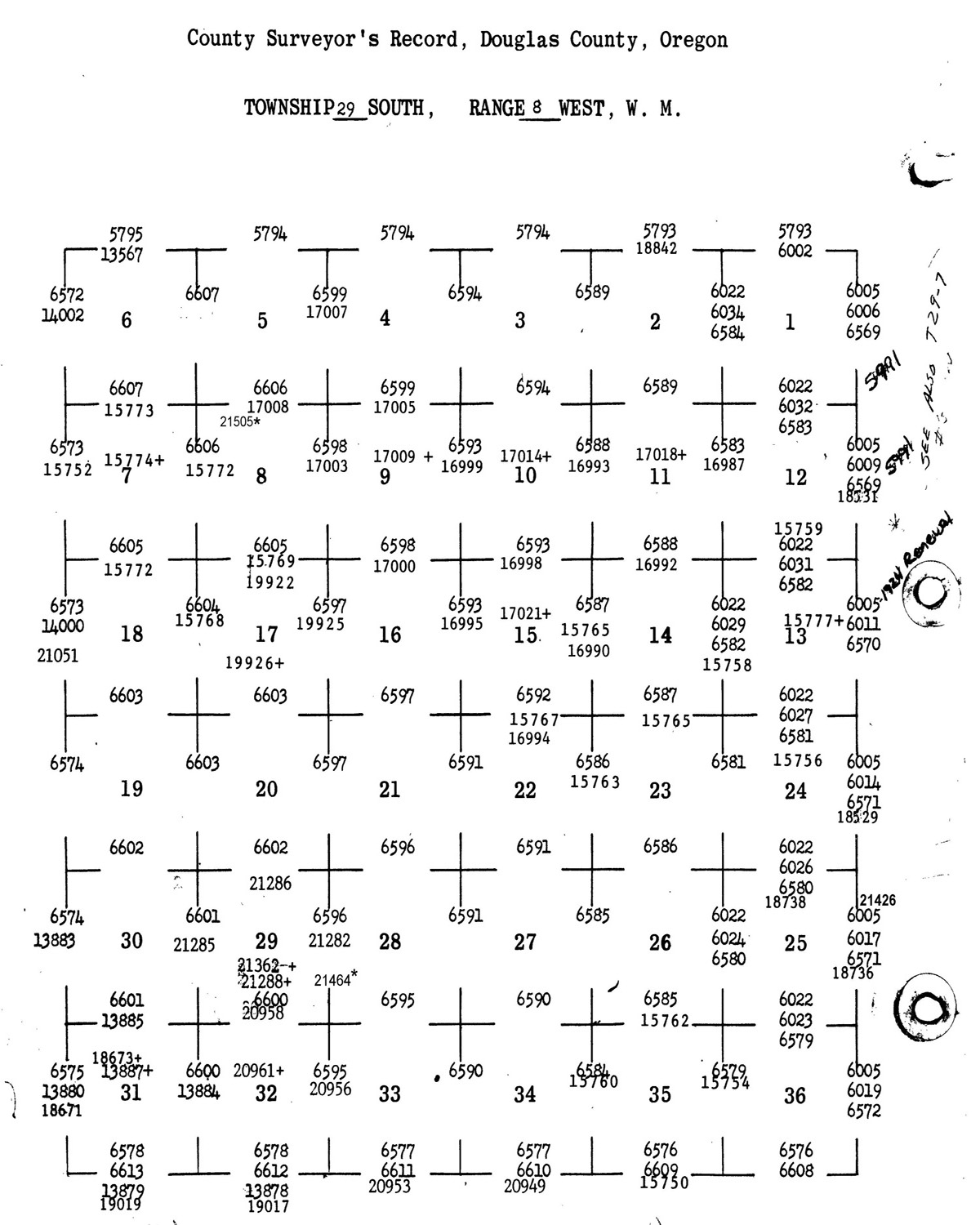
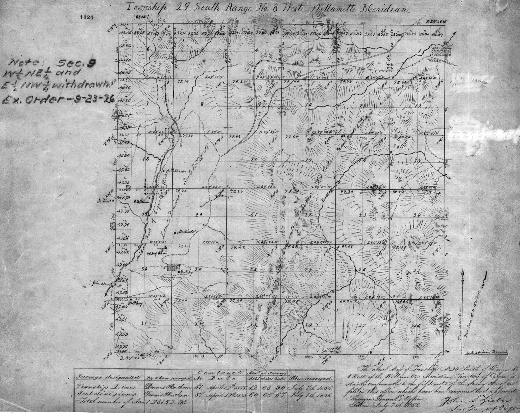
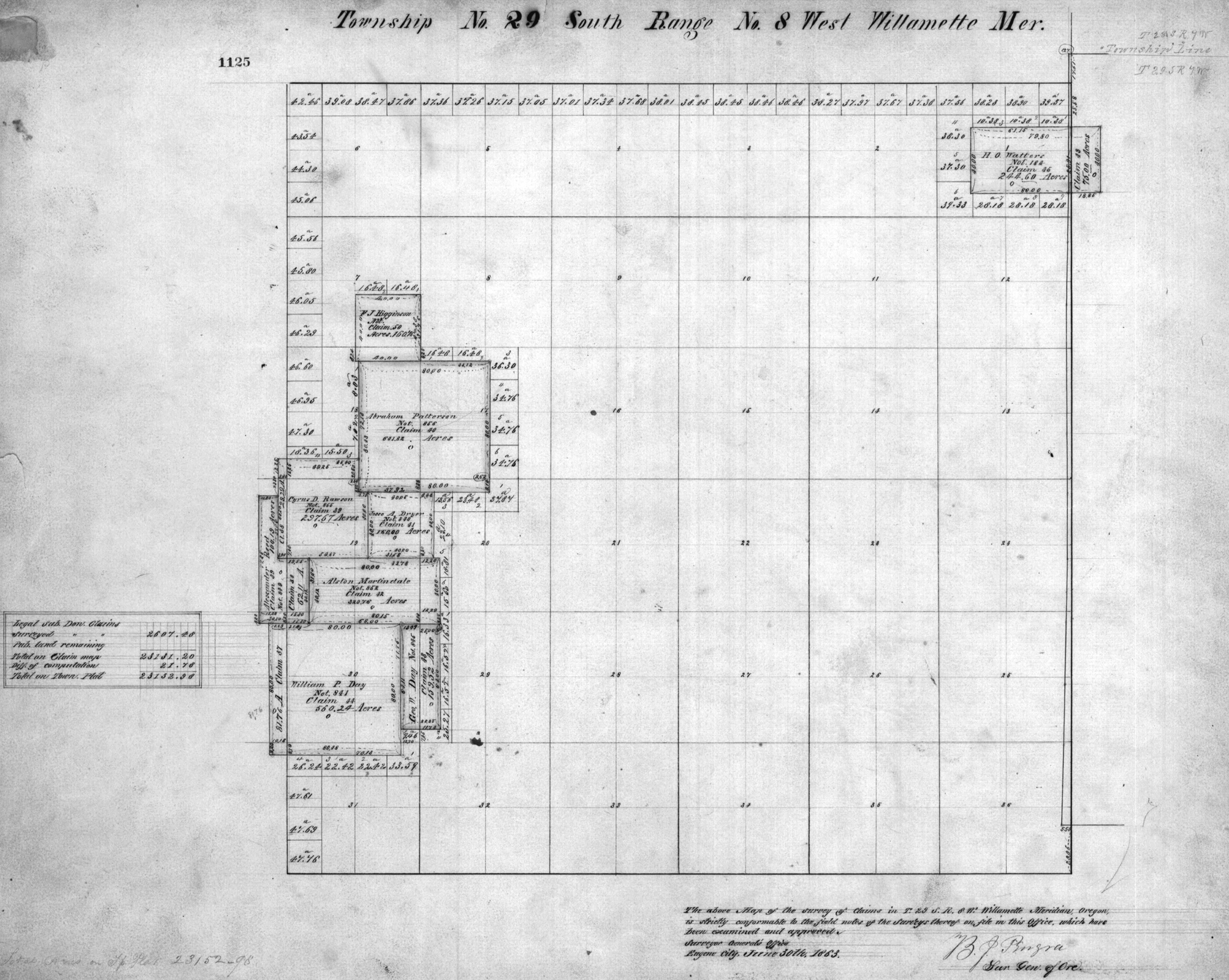
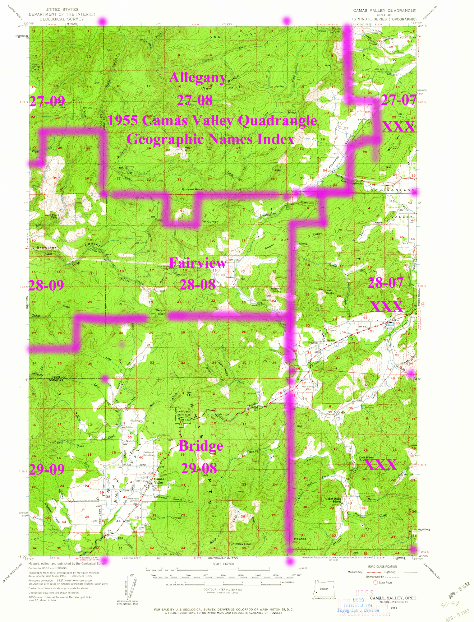
Tsp. 29 S., Rng. 08 W.
General Land Office Survey Index
 |
 |
 |
 |
 |
1856 GLO |
1926 GLO |
1863 DLC |
1955 Annotated USGS Camas Valley |
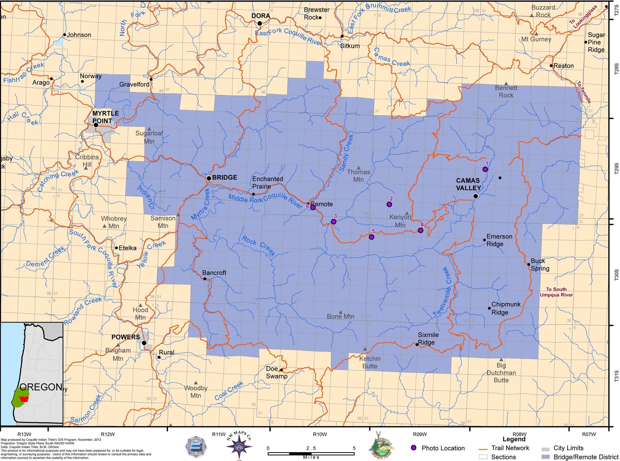
2012 Bridge-Remote District |
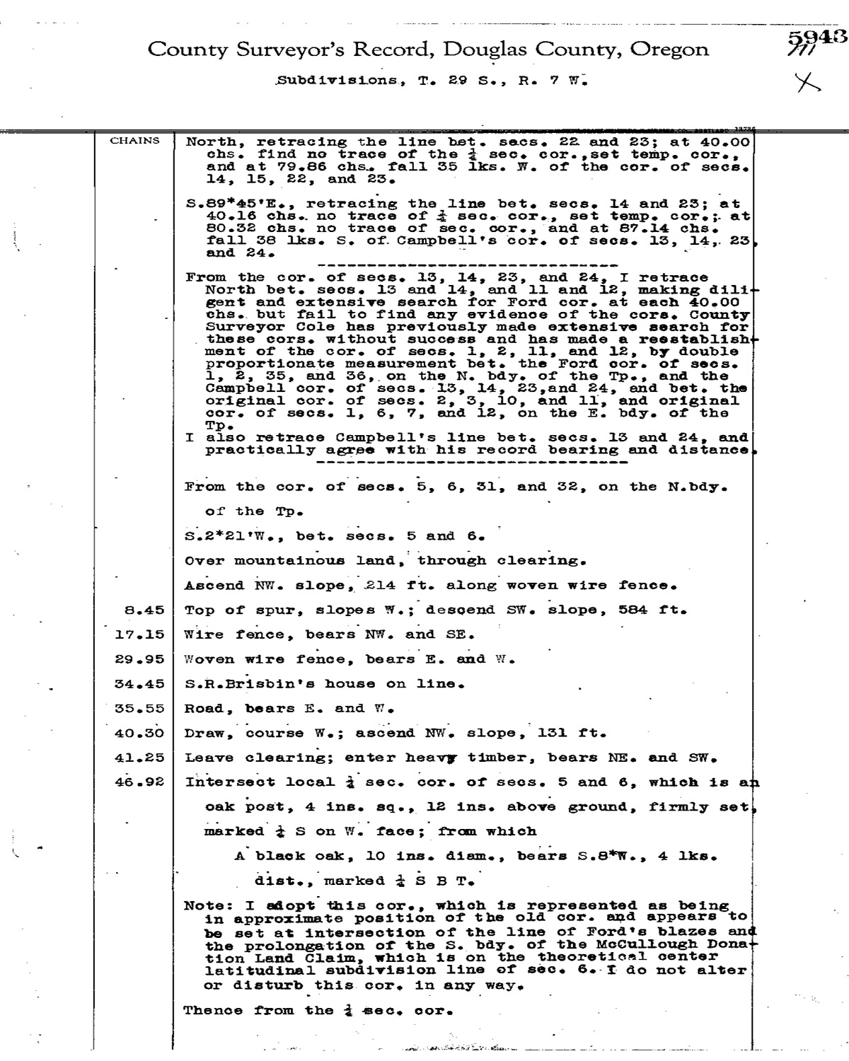
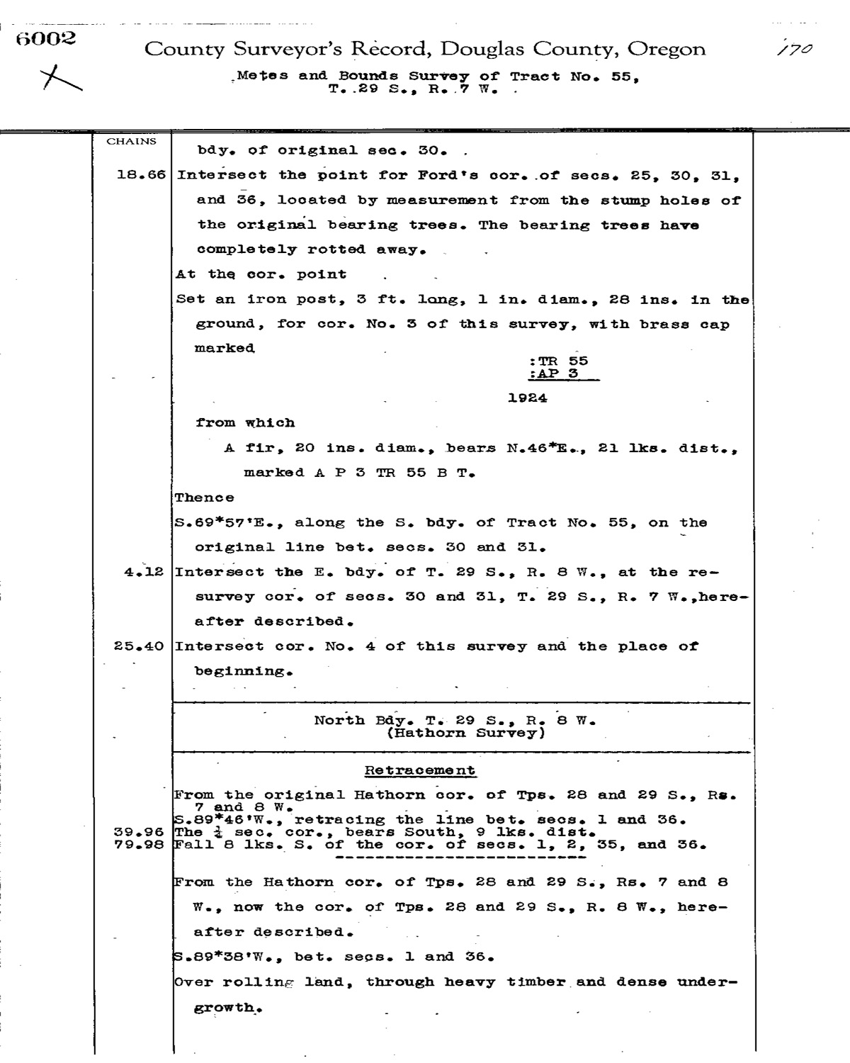
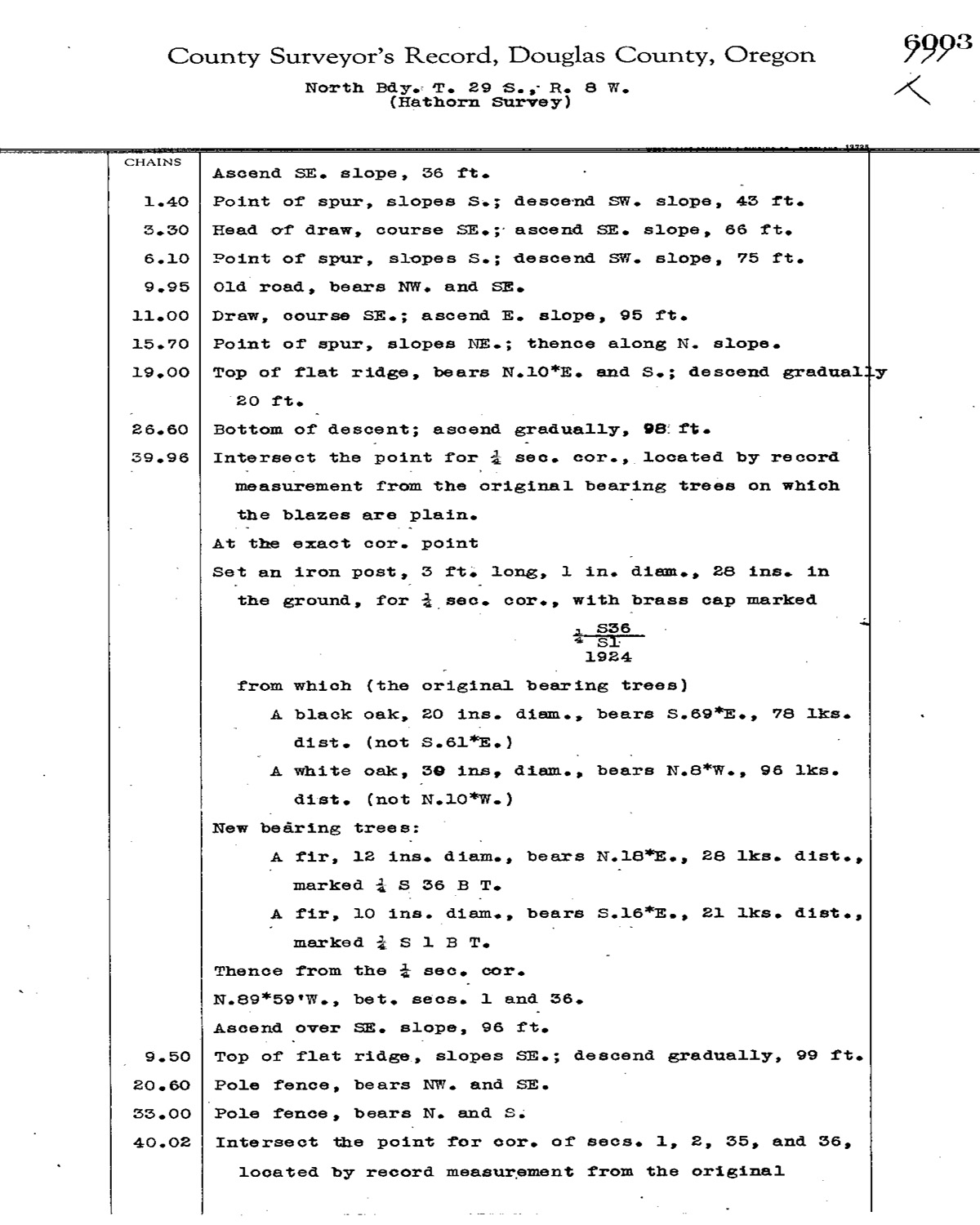
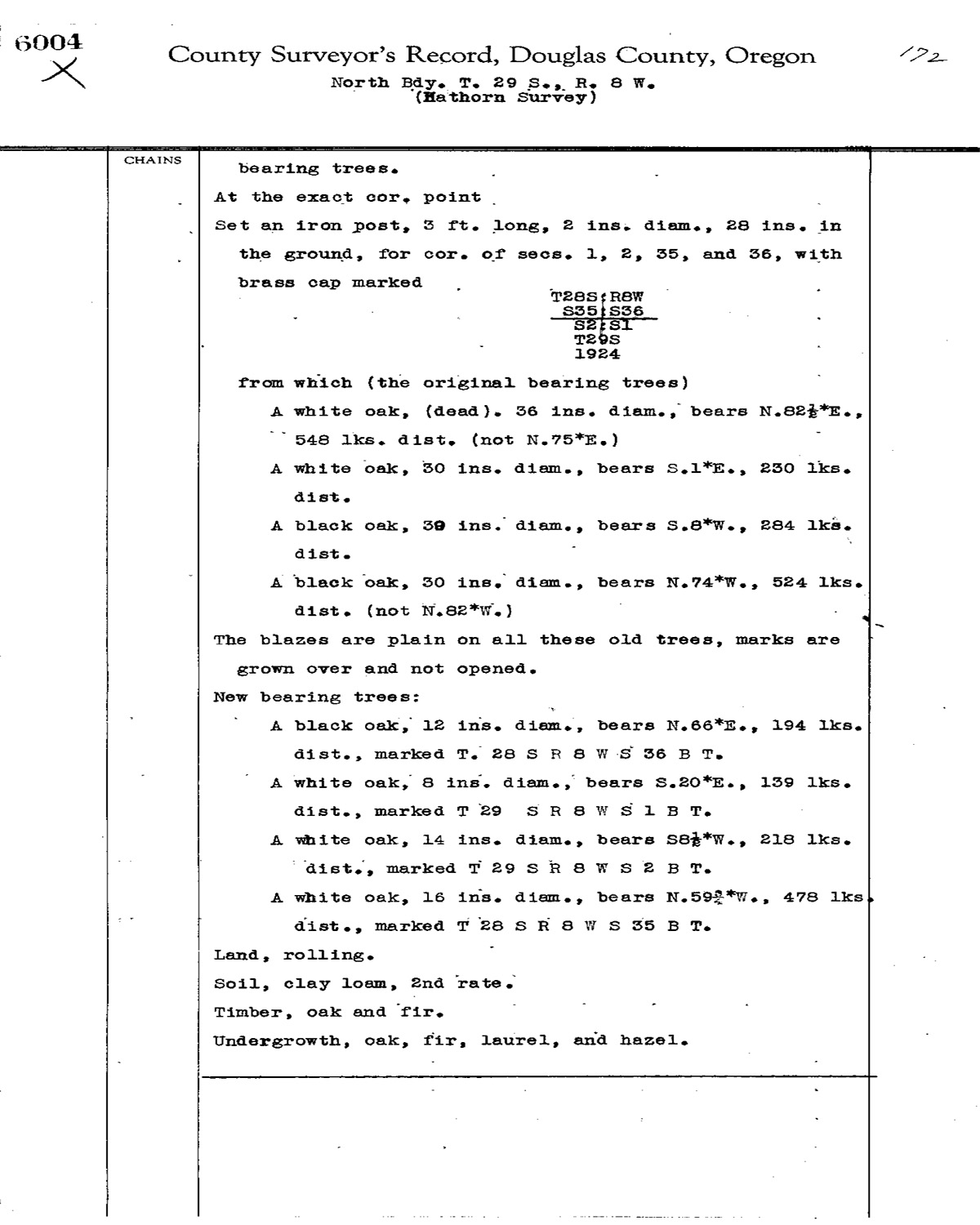
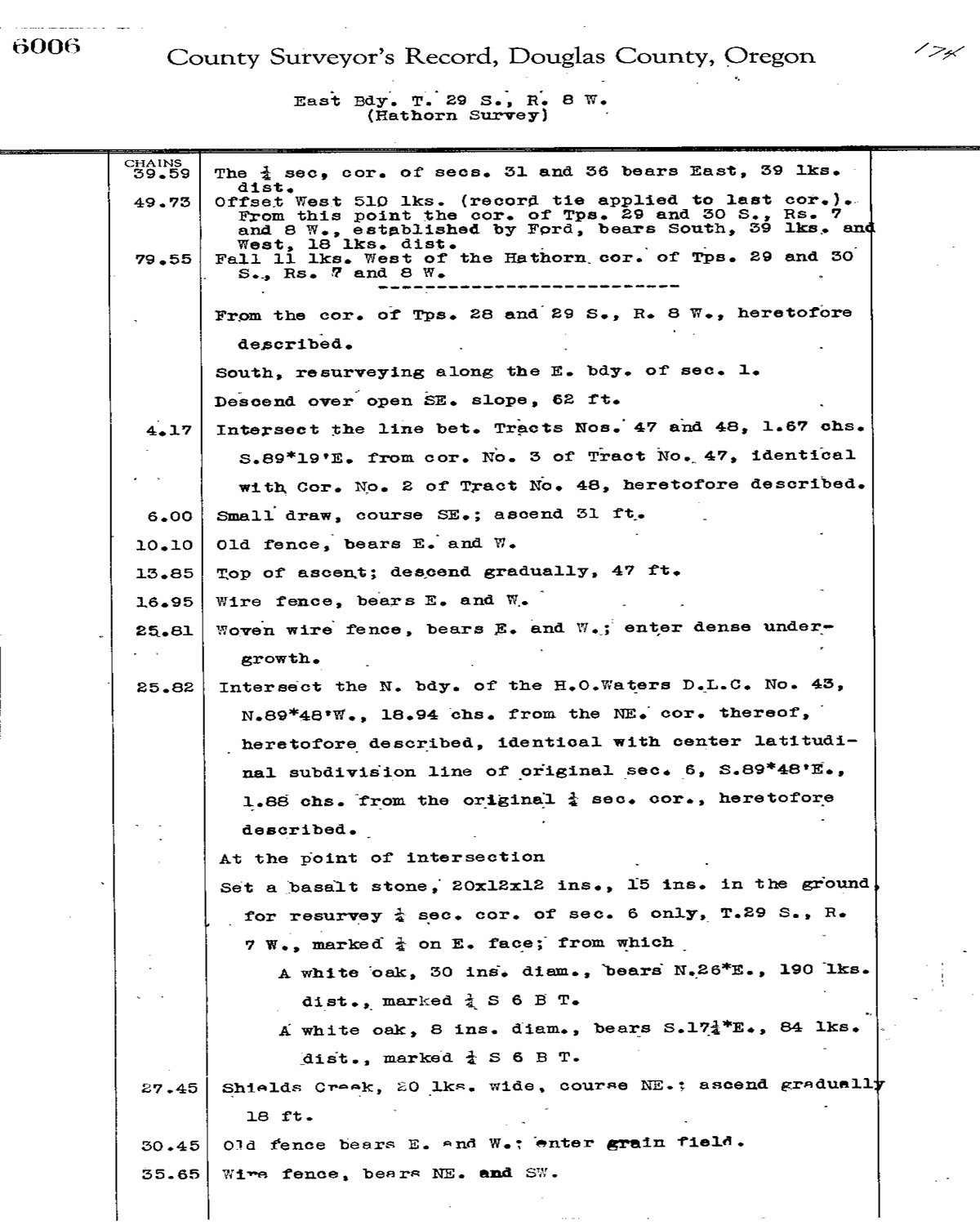
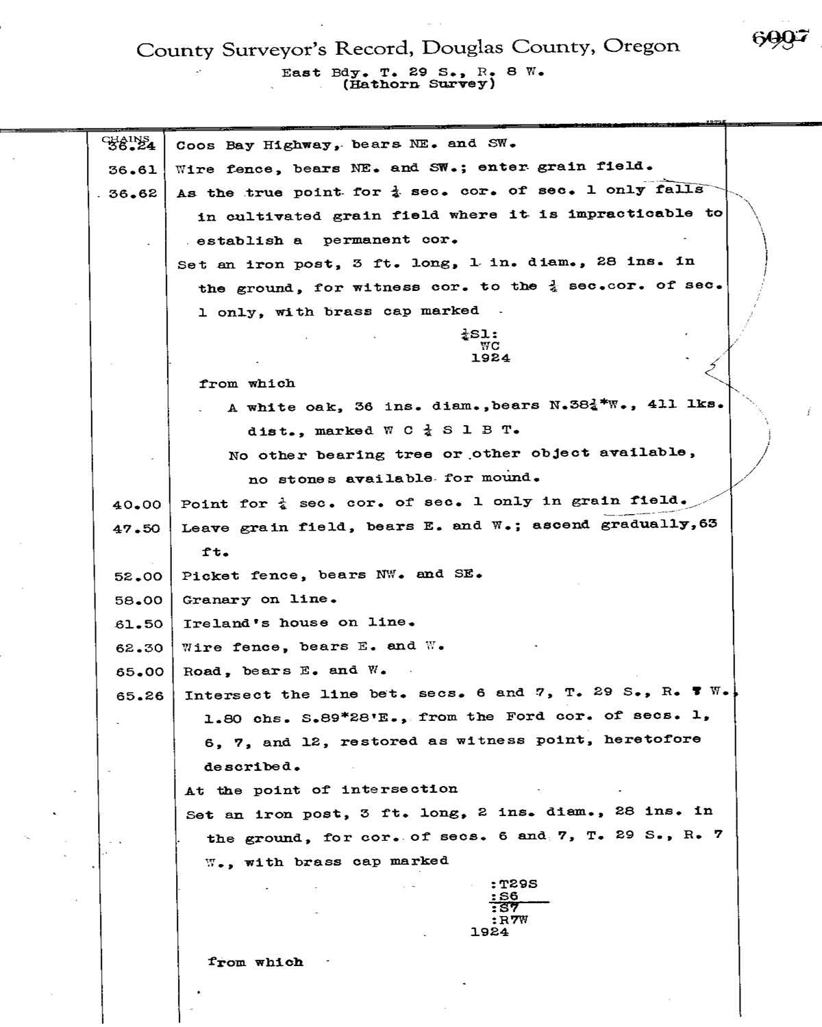
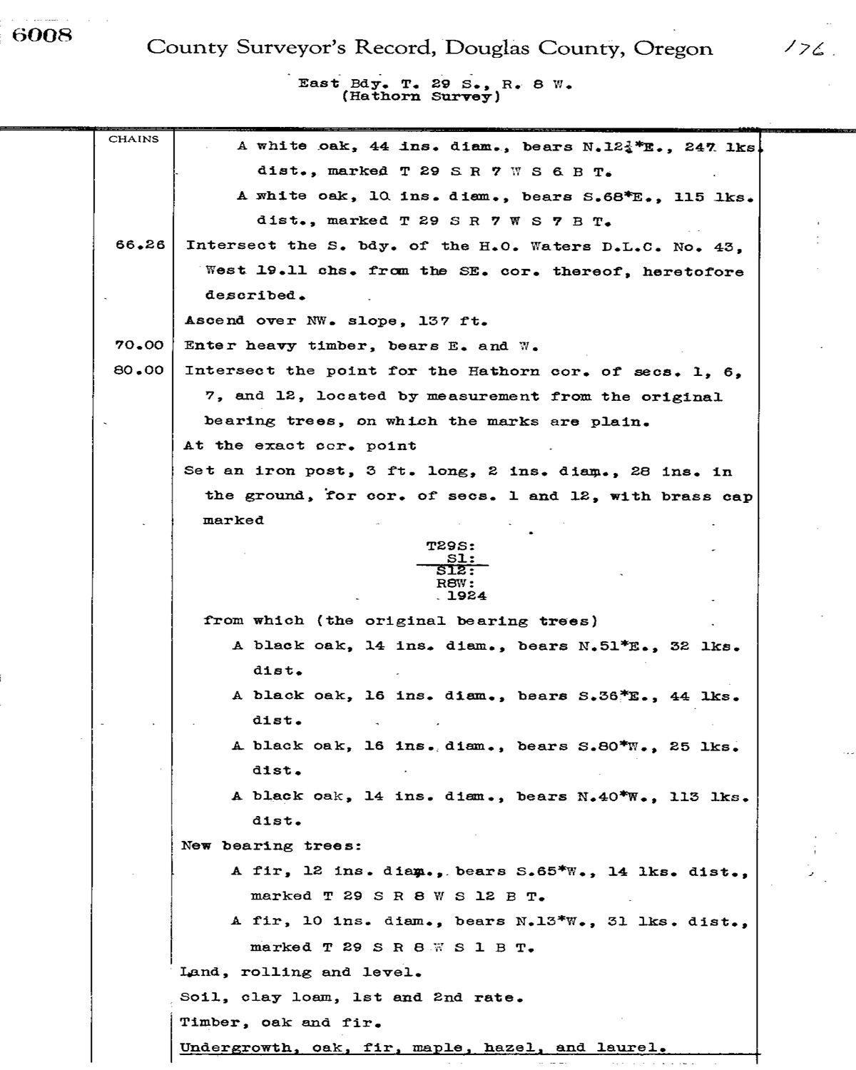
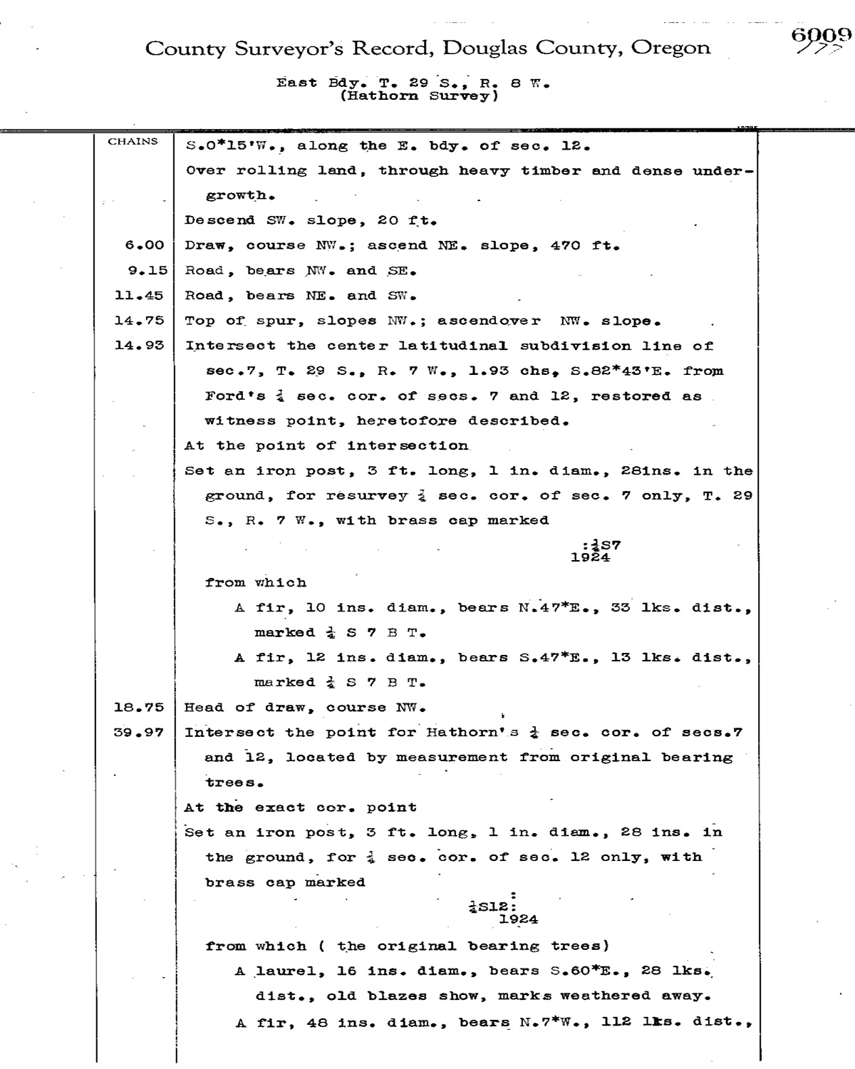
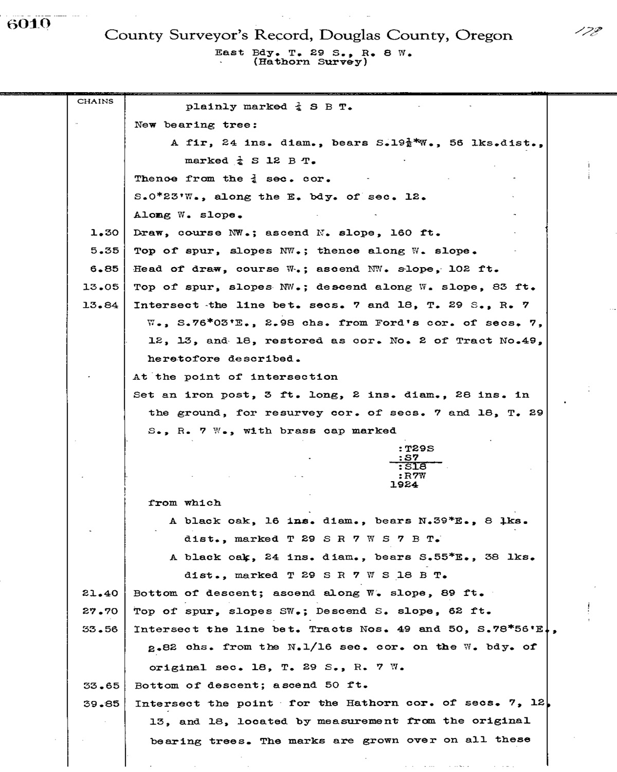
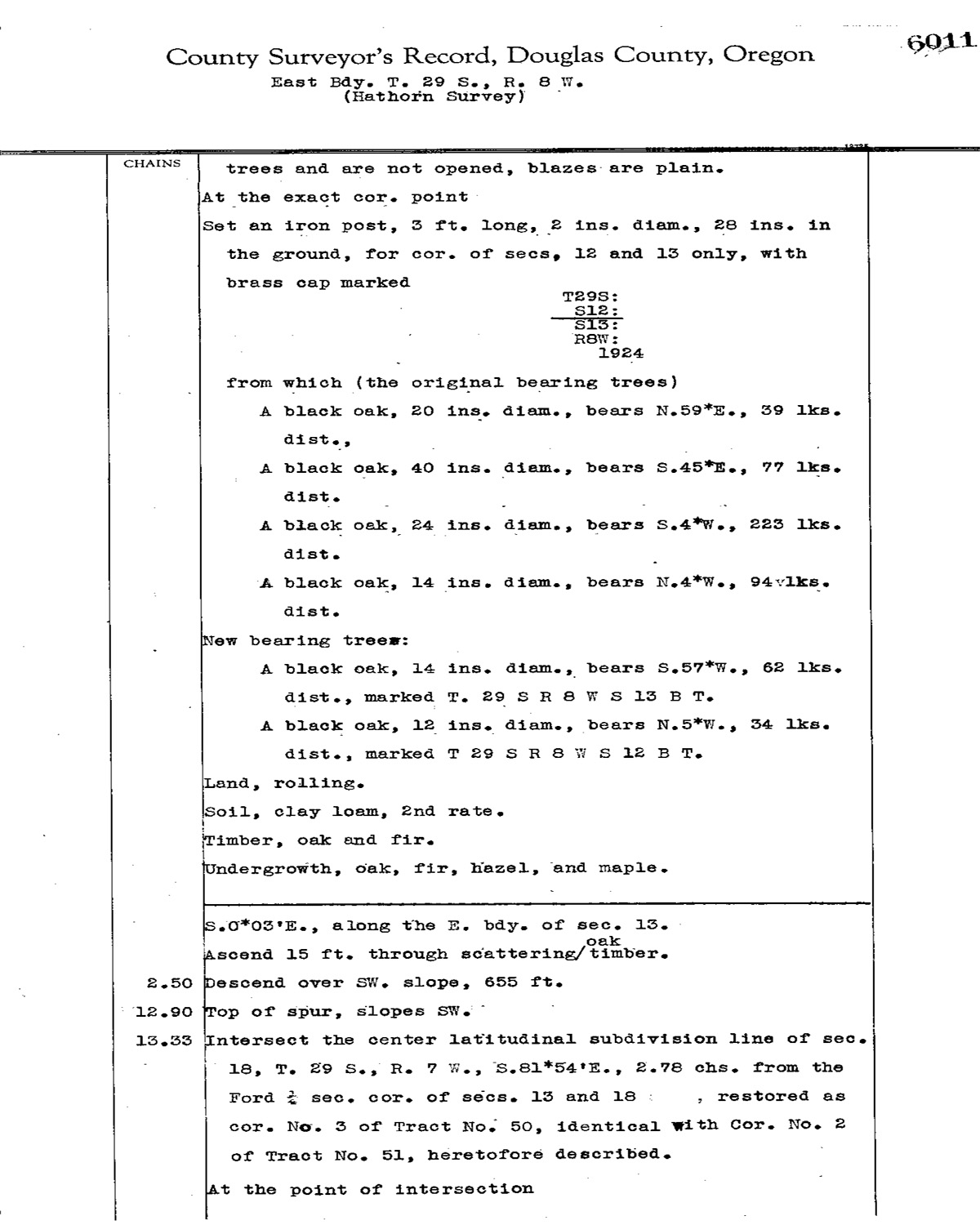
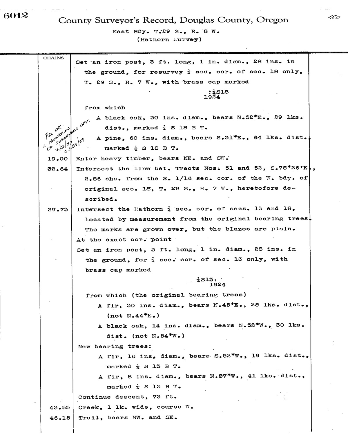
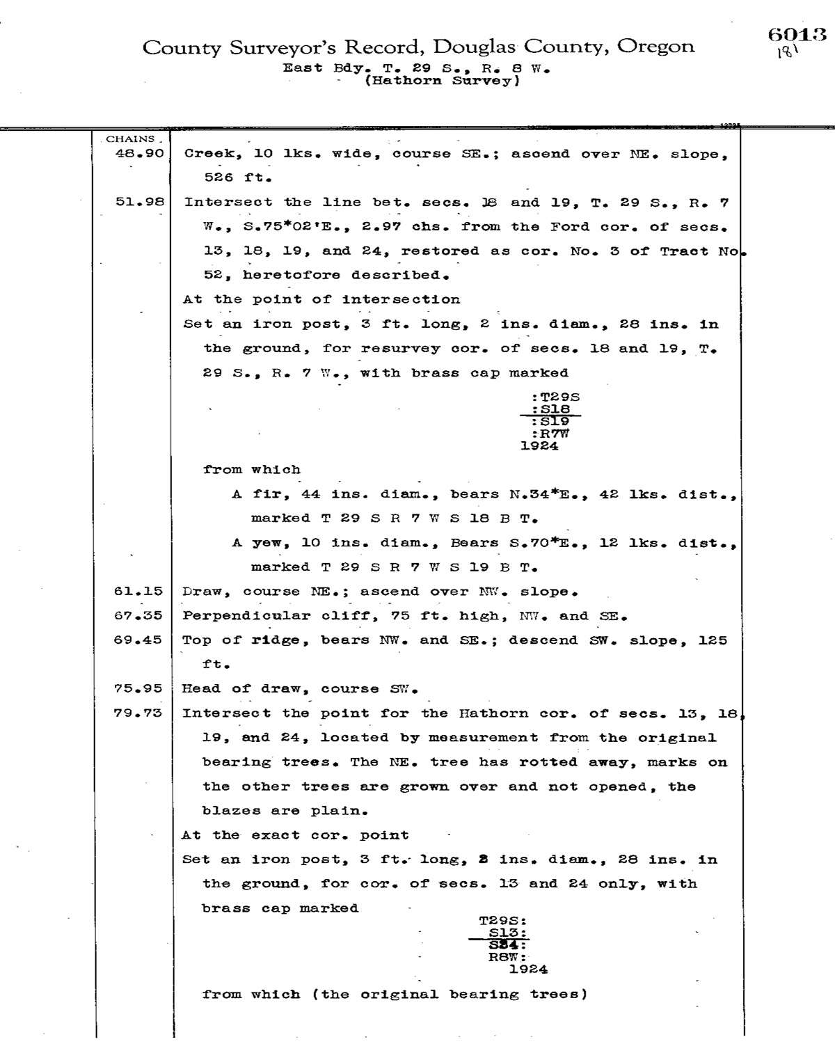
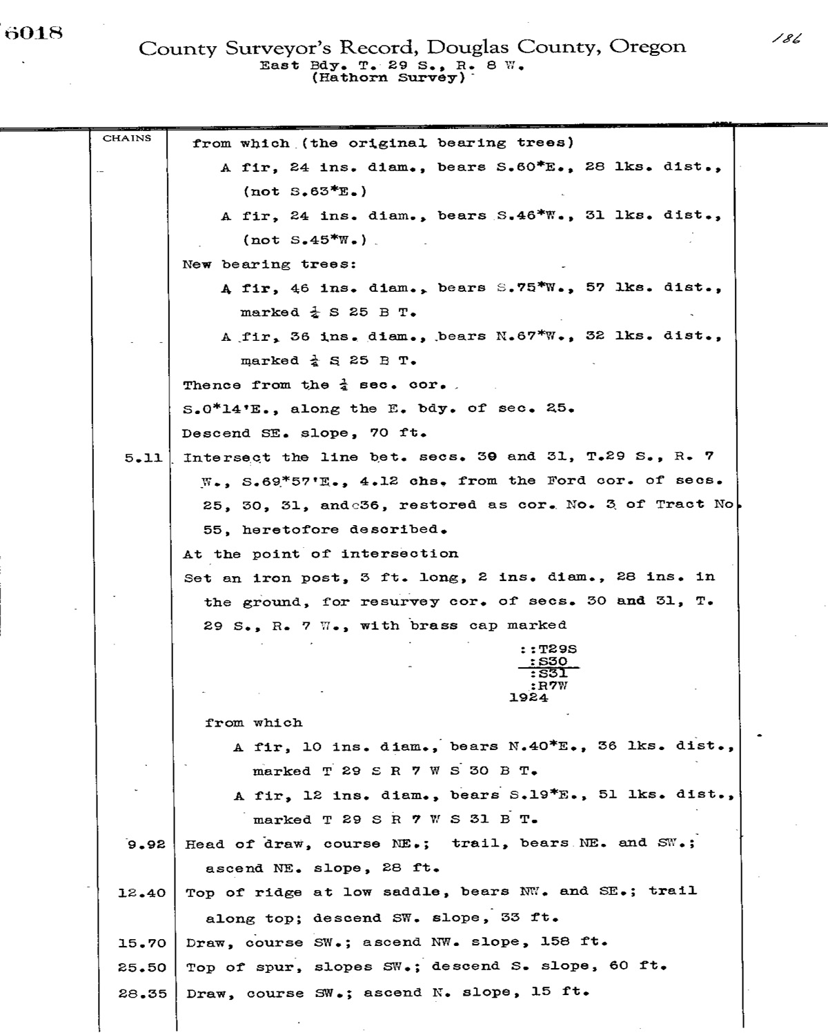
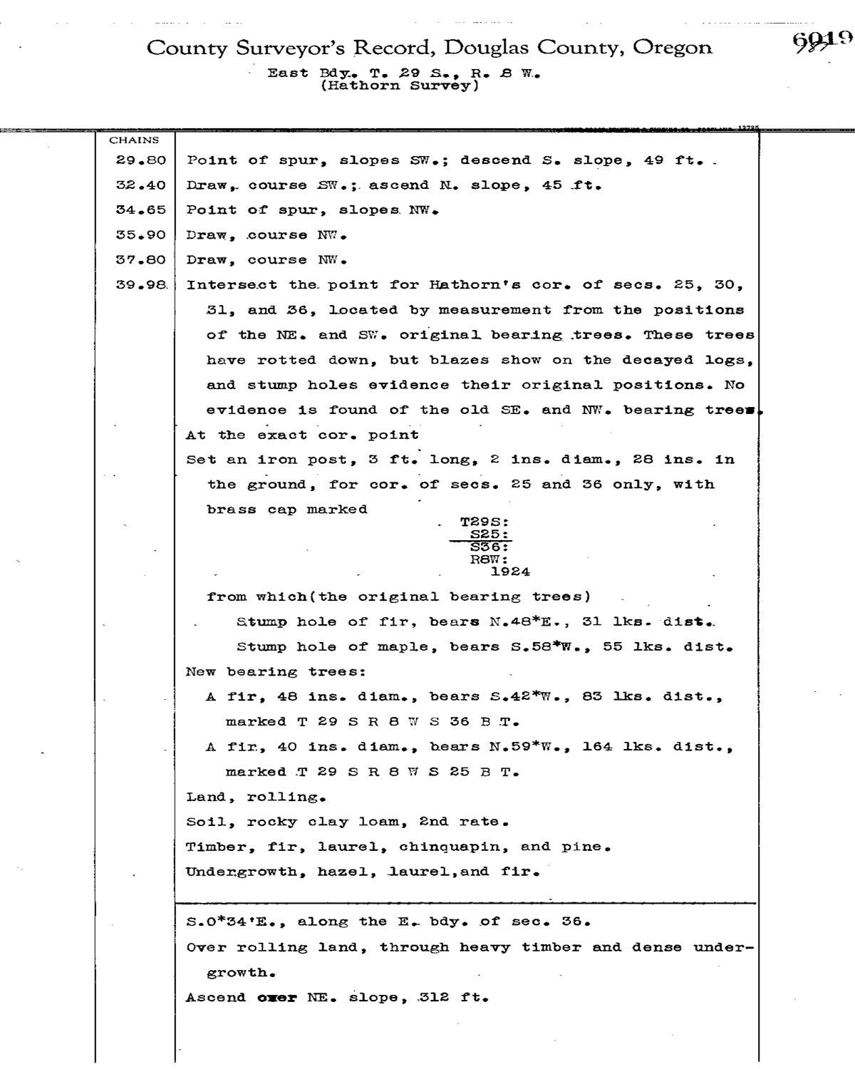
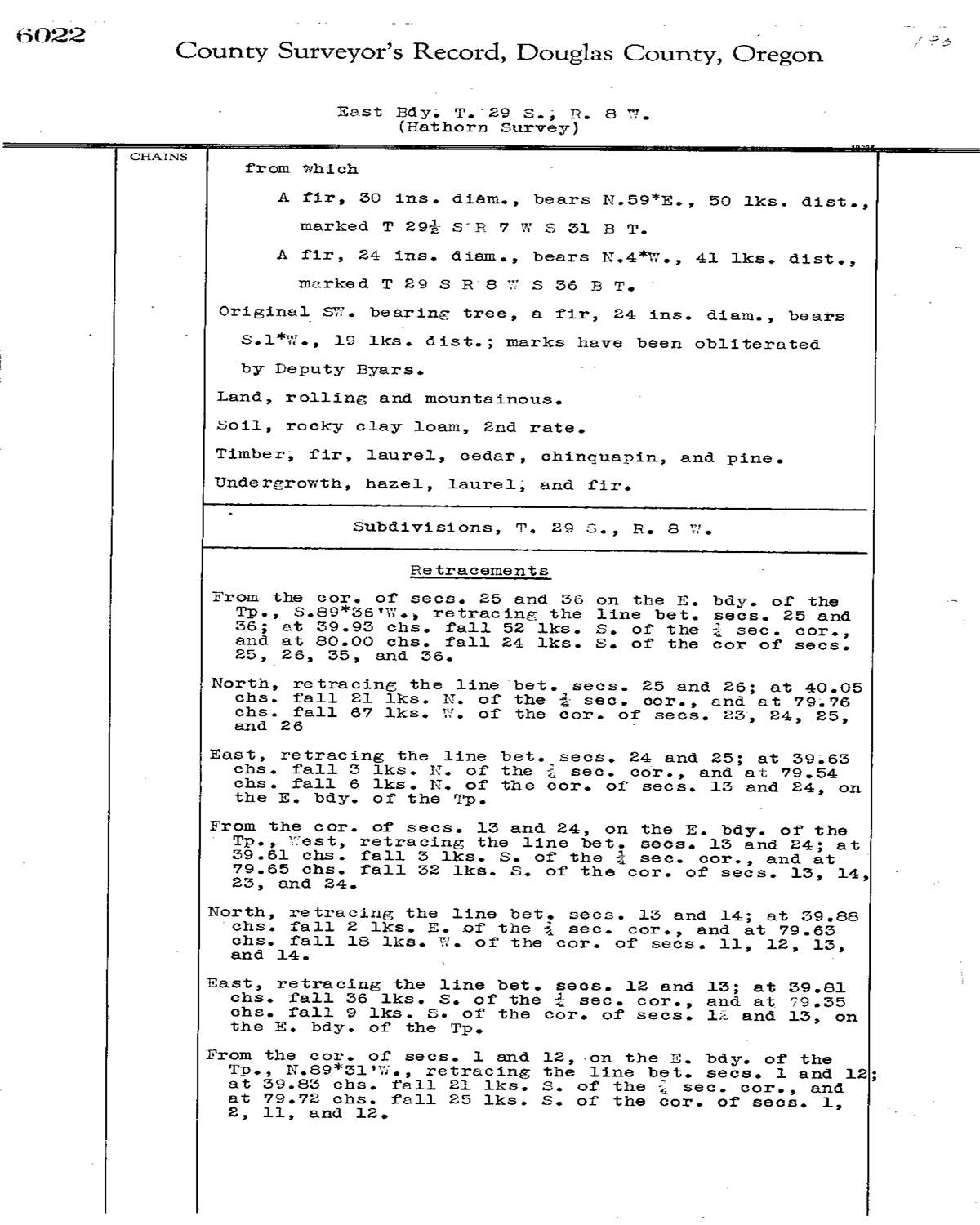
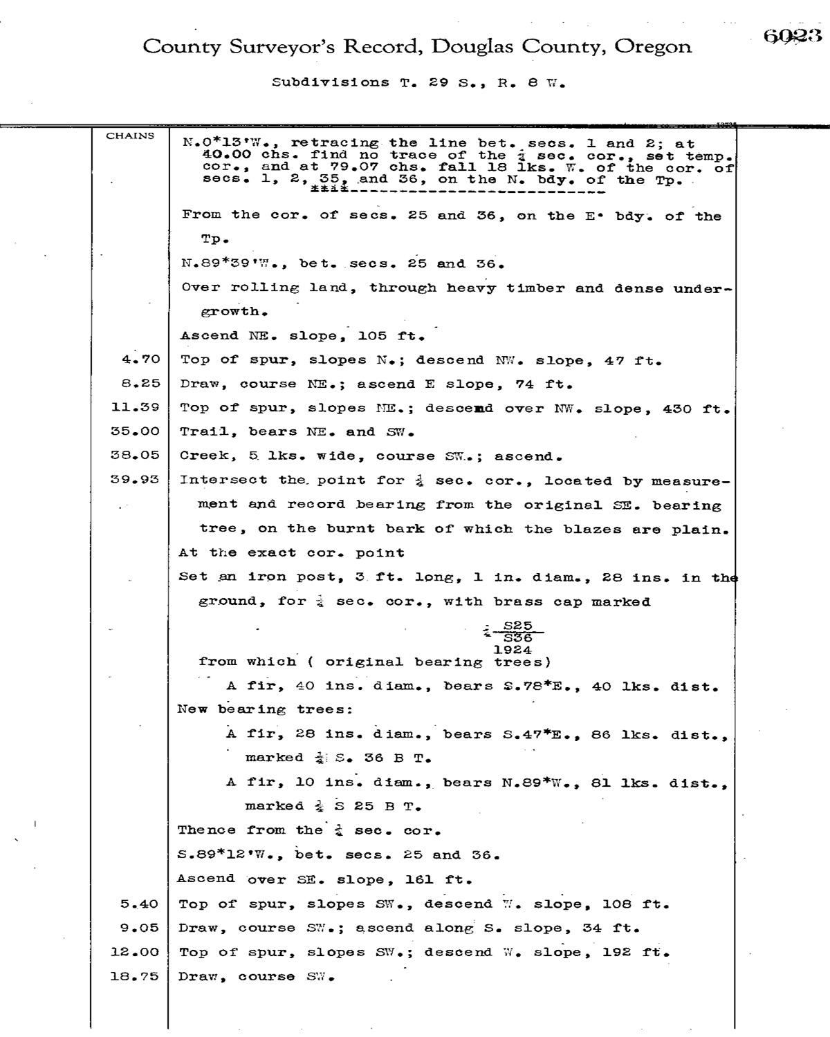
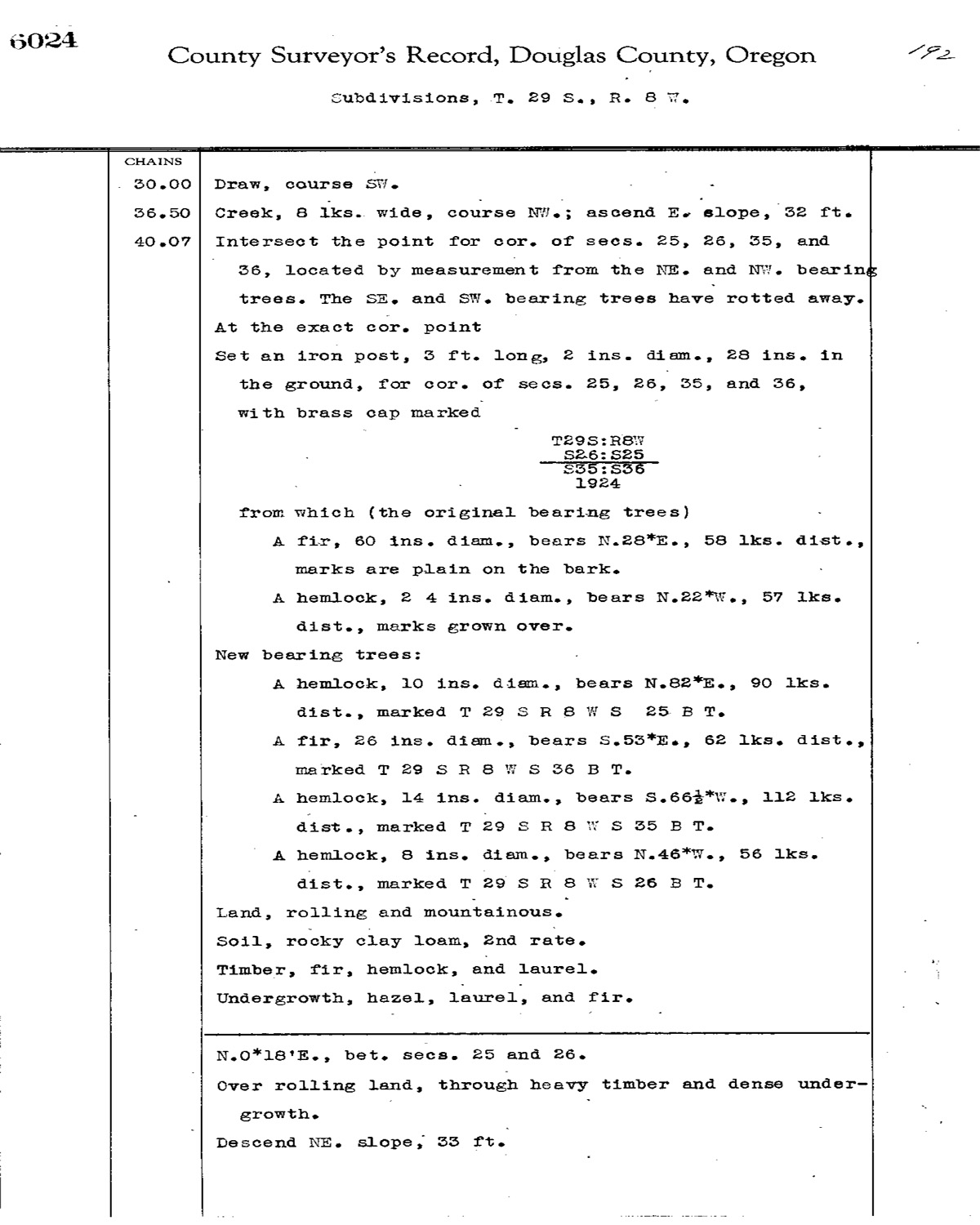
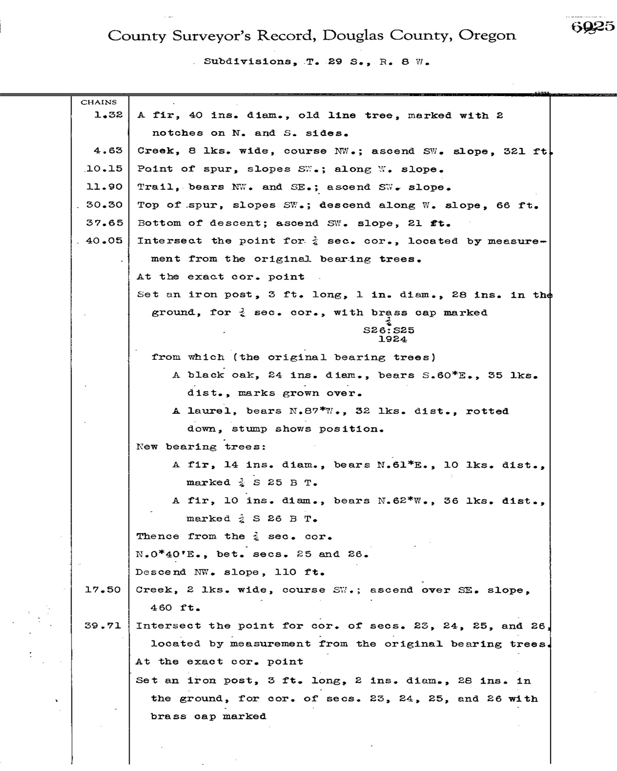
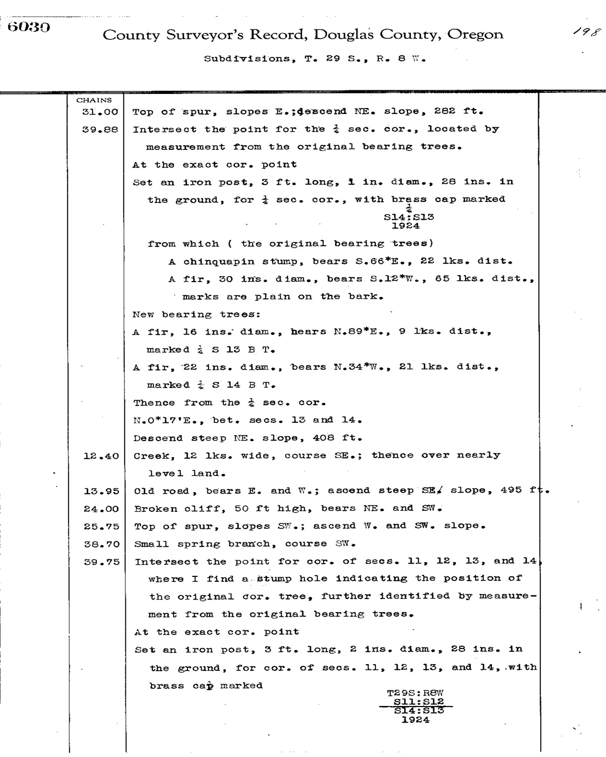
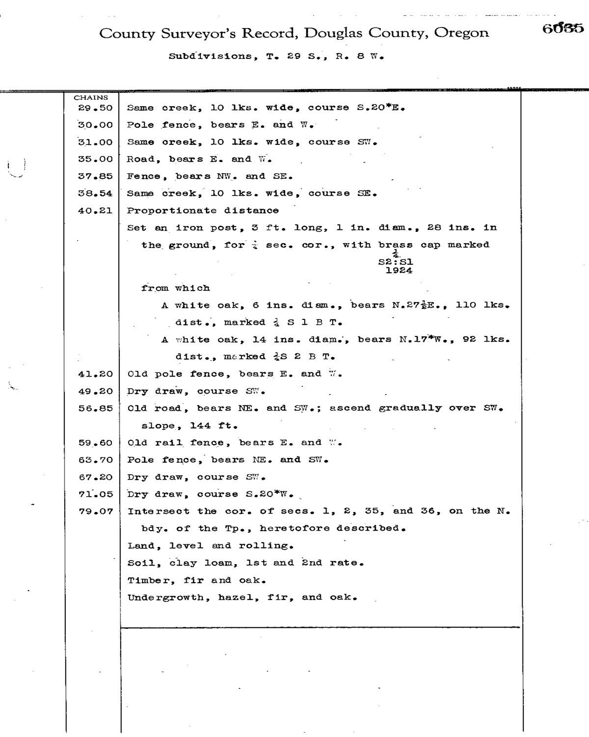
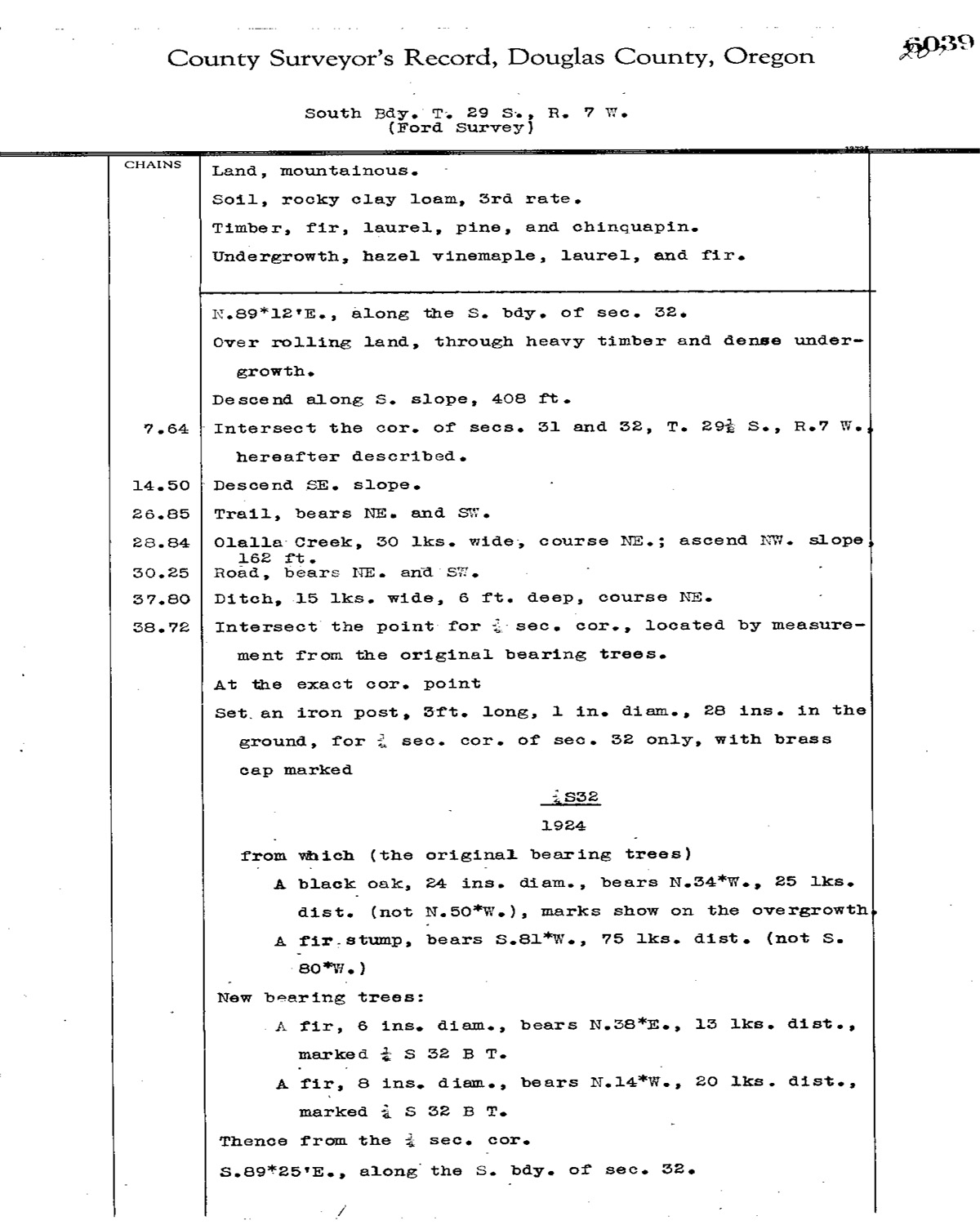
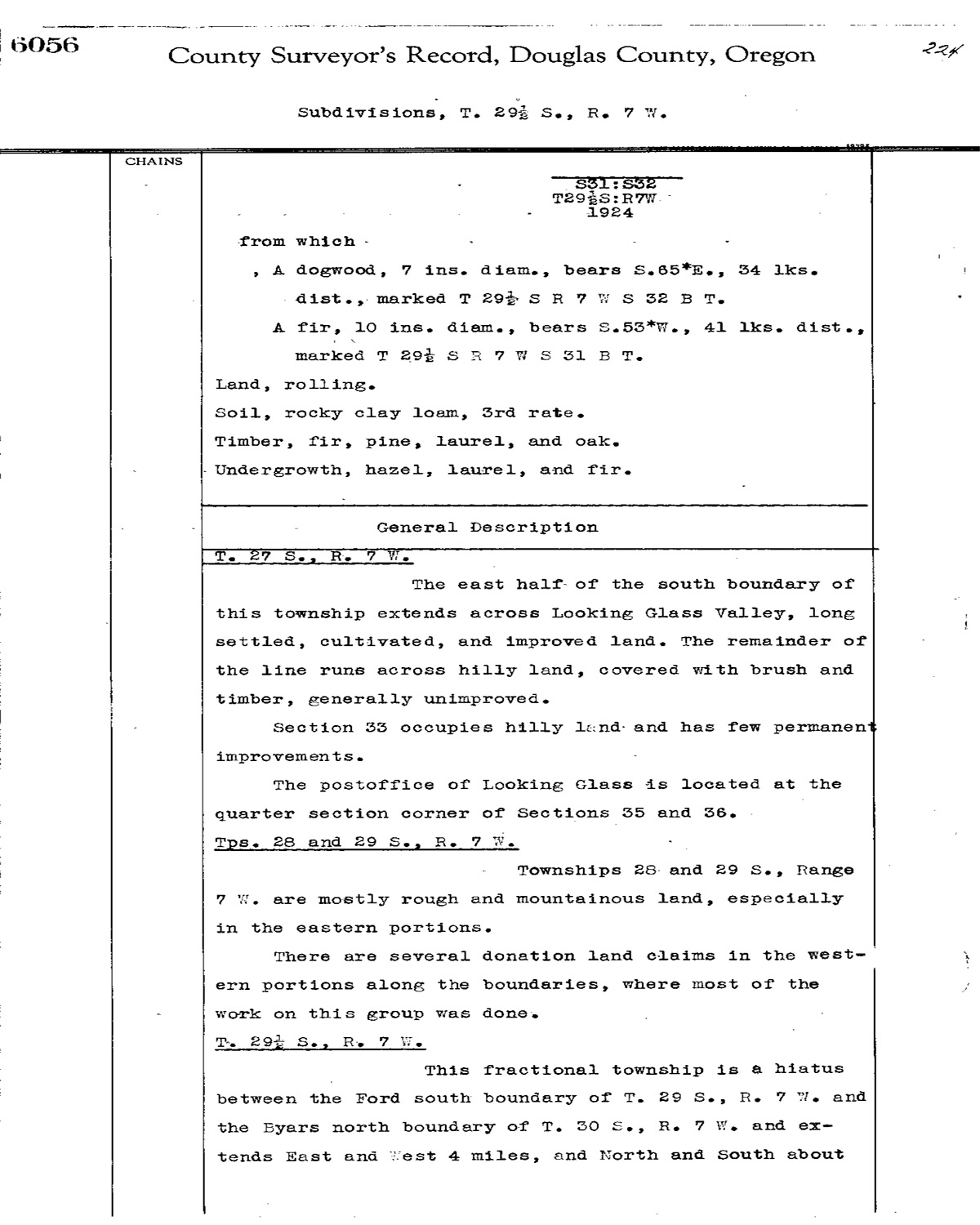
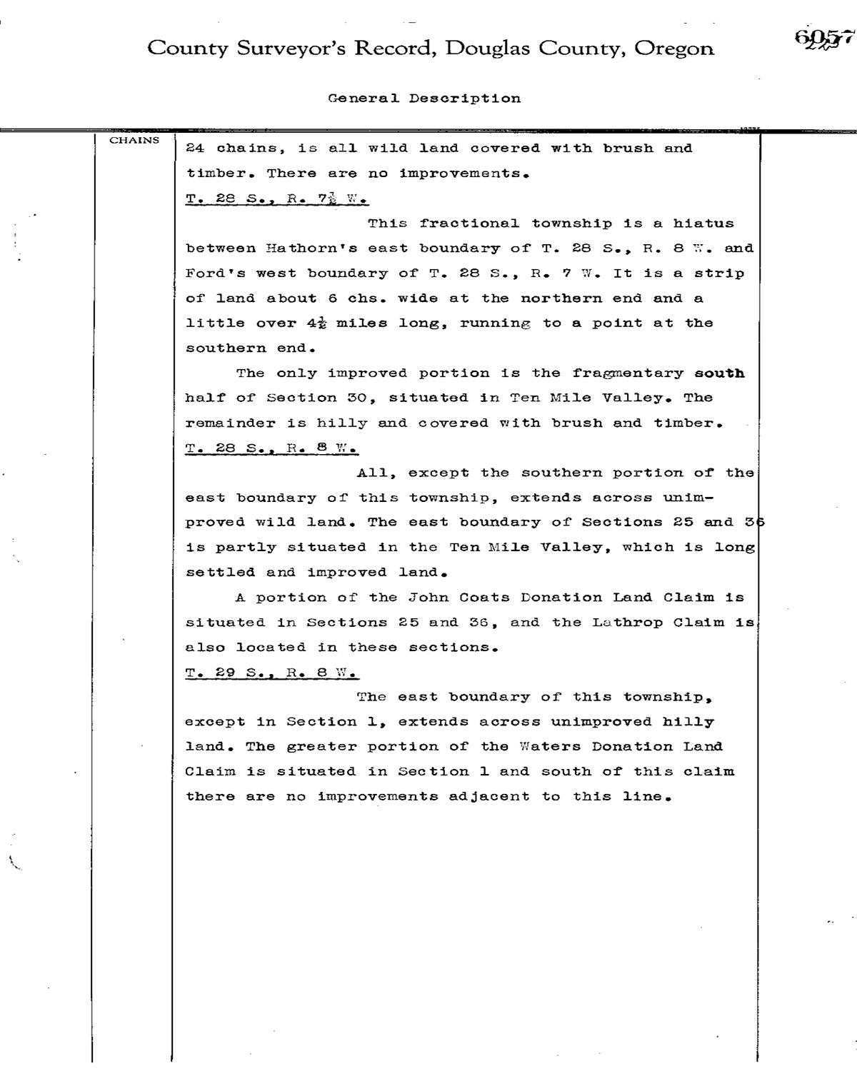
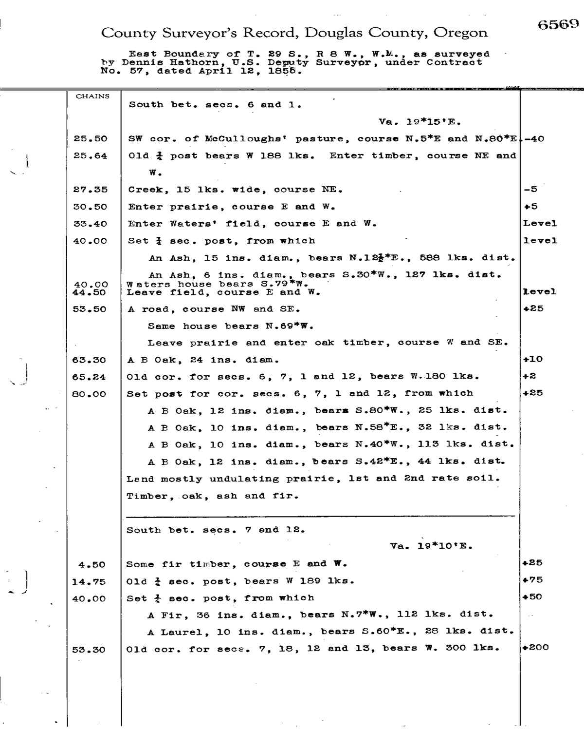
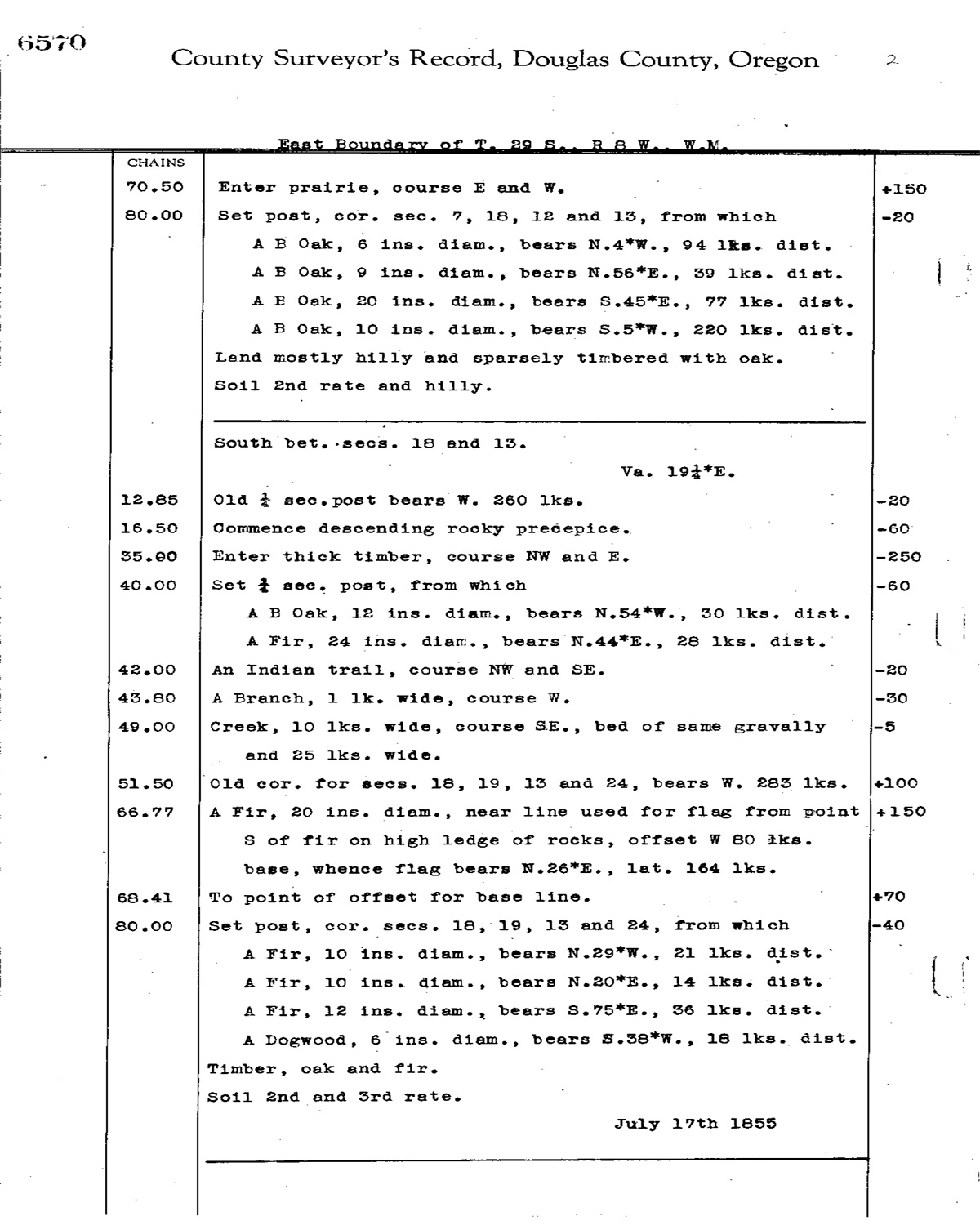
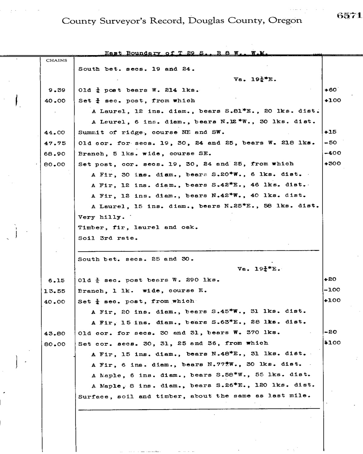
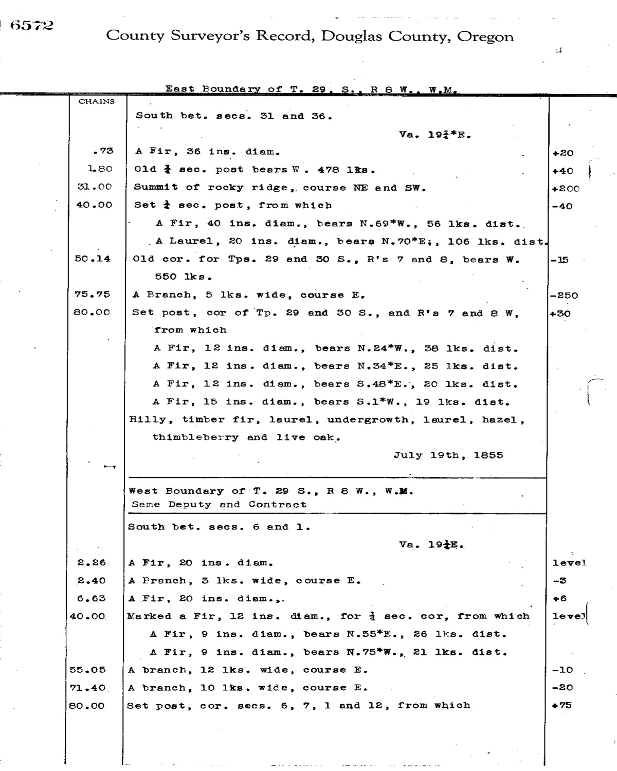
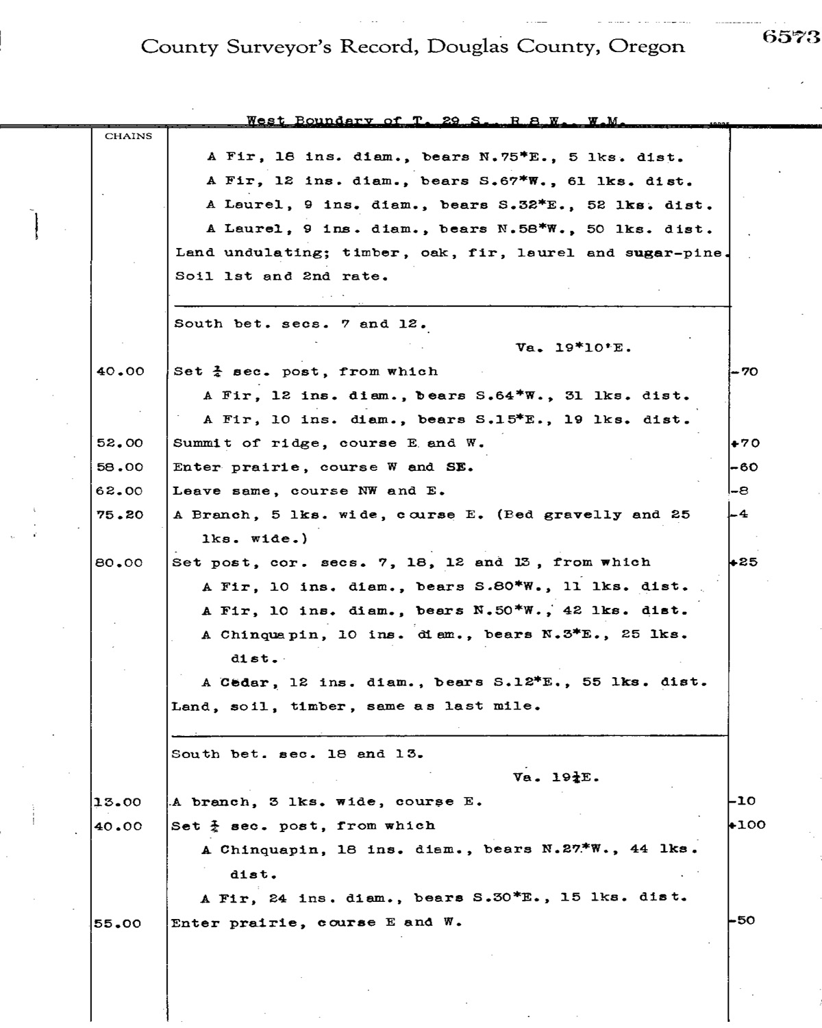
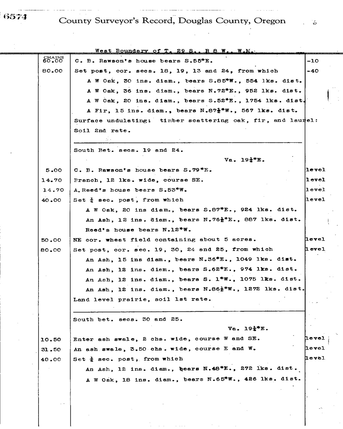
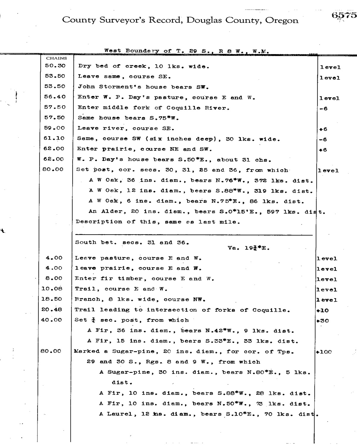
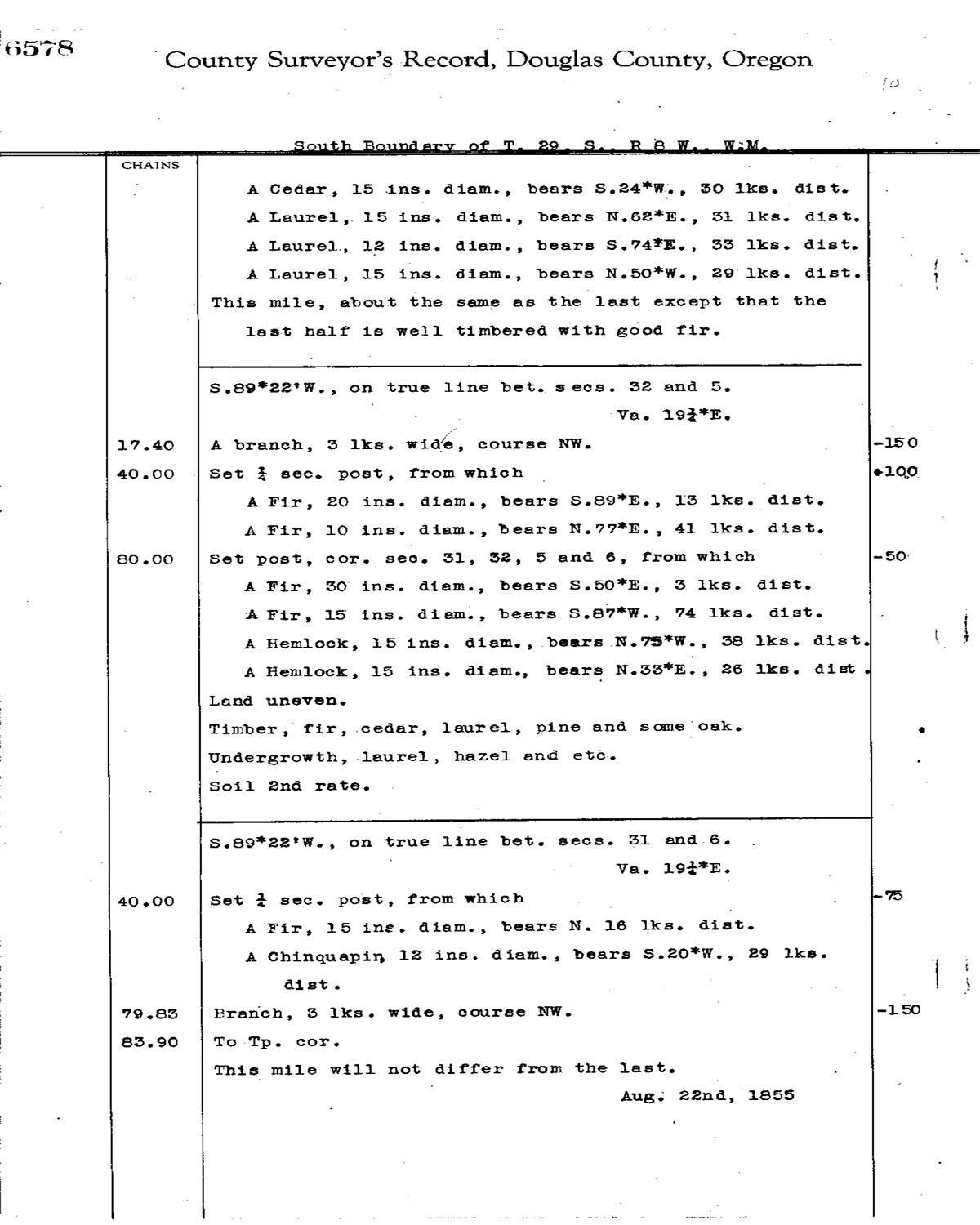
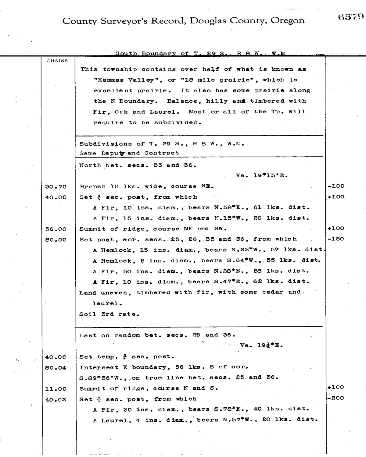
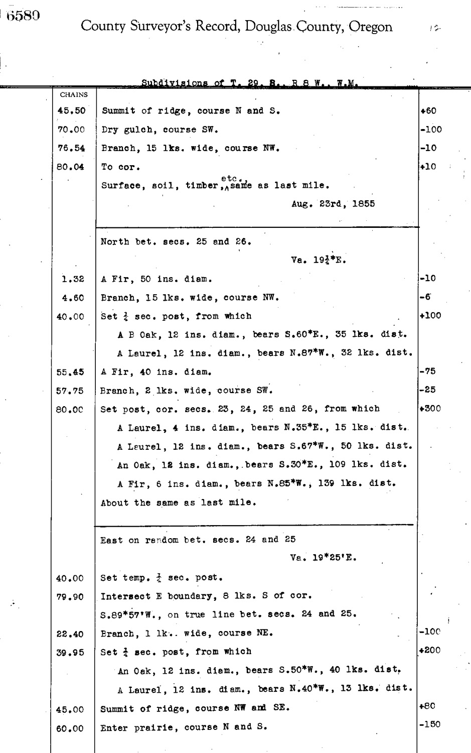
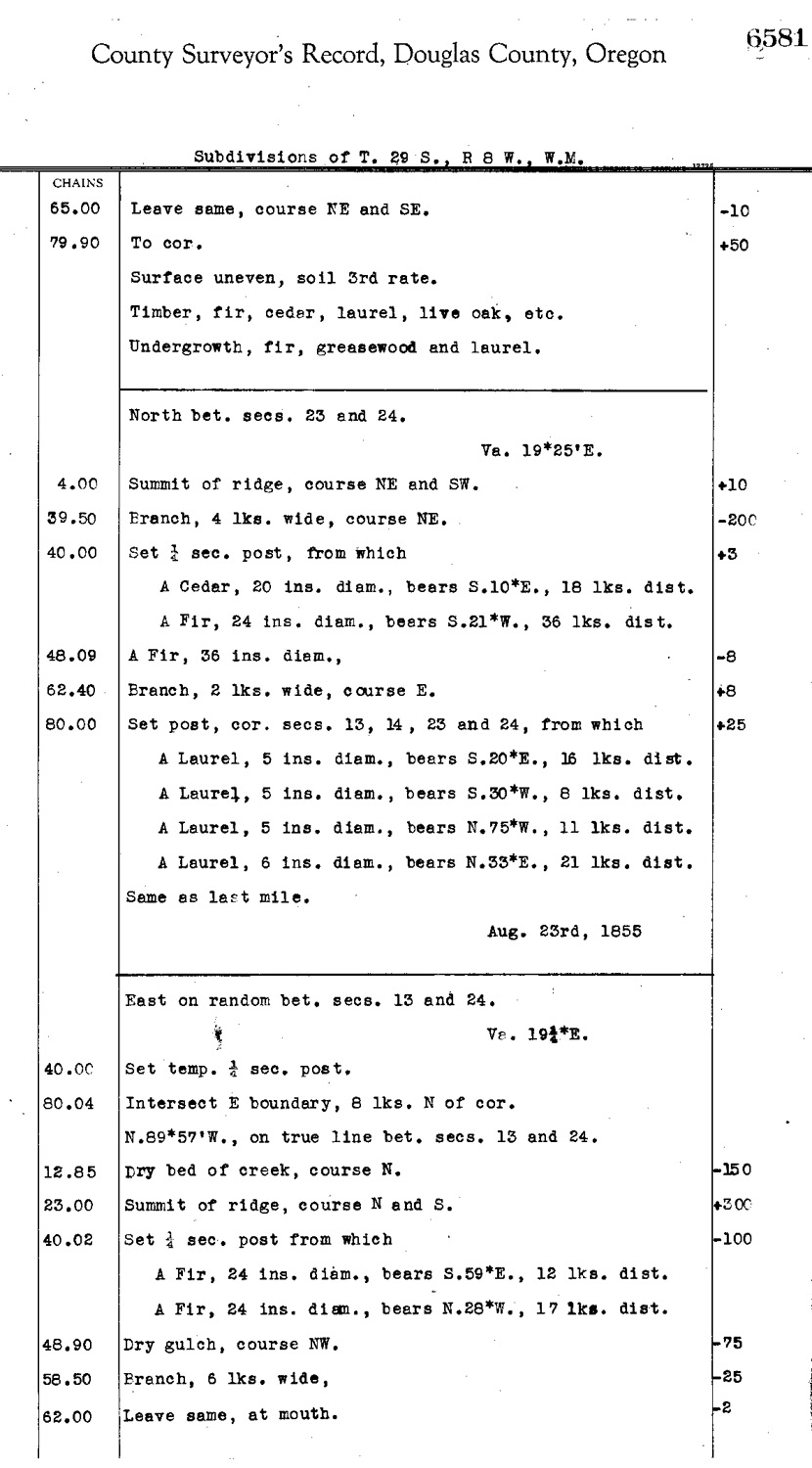
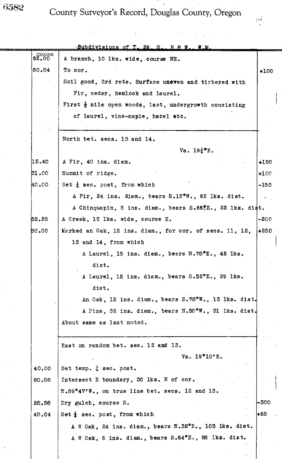
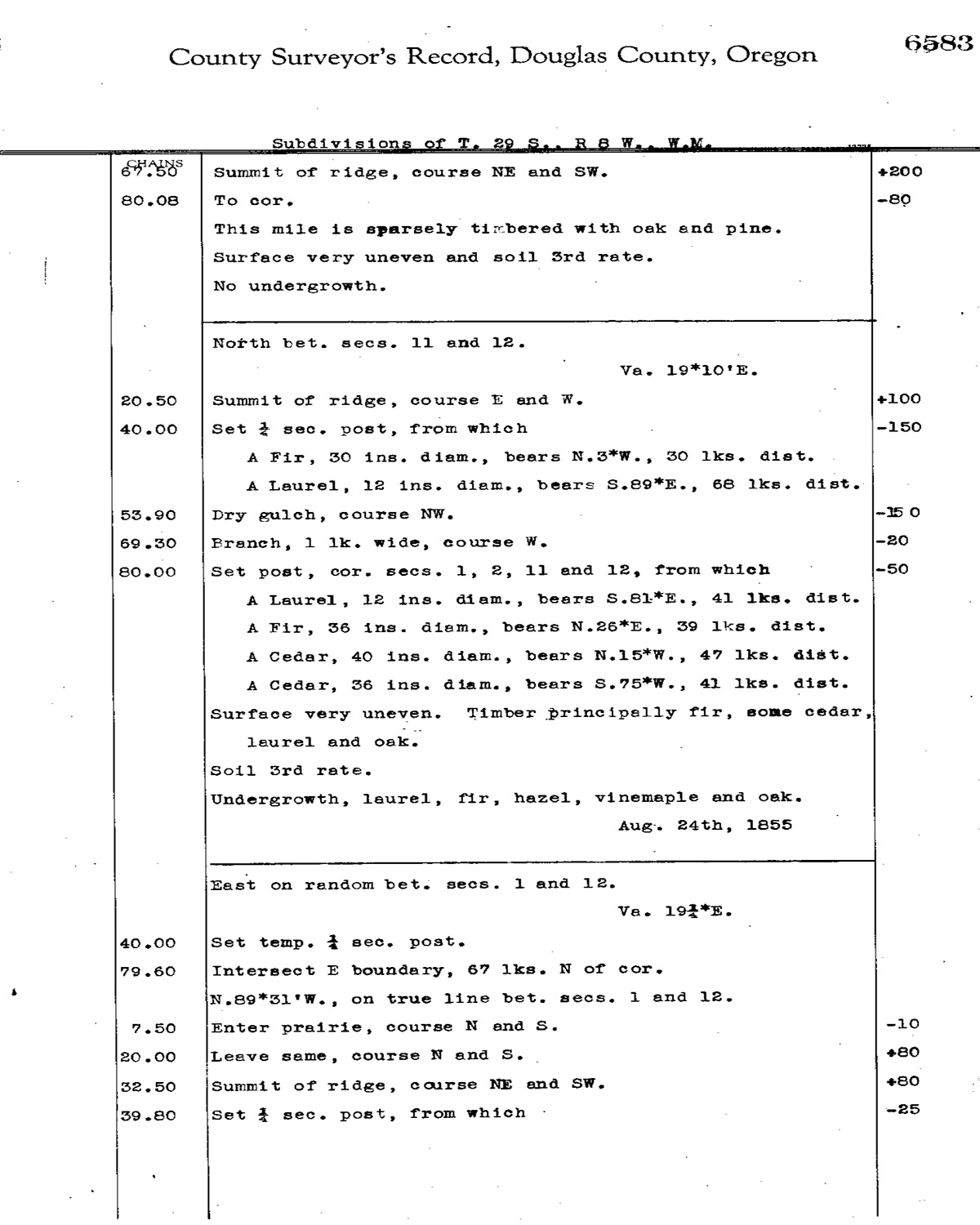
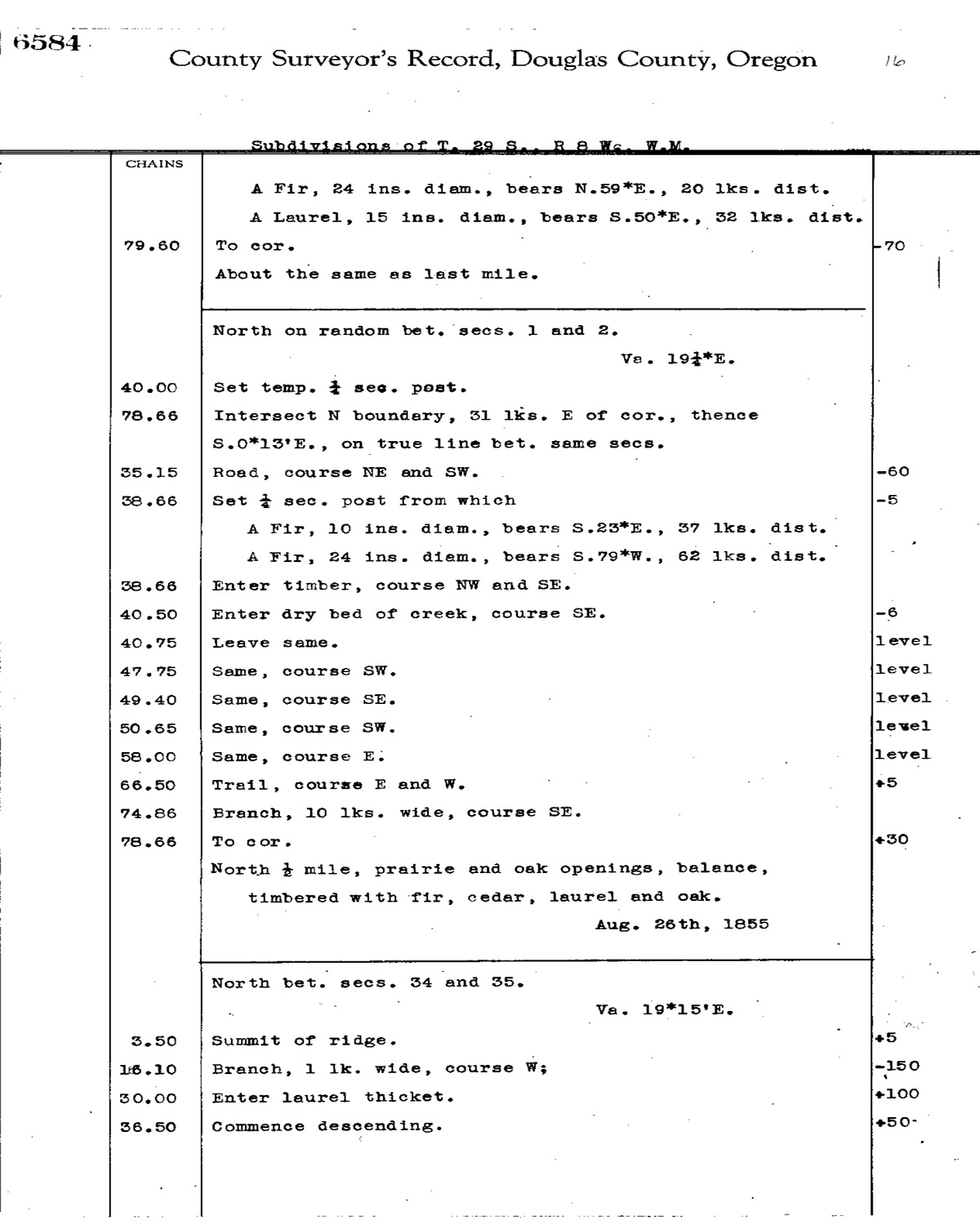
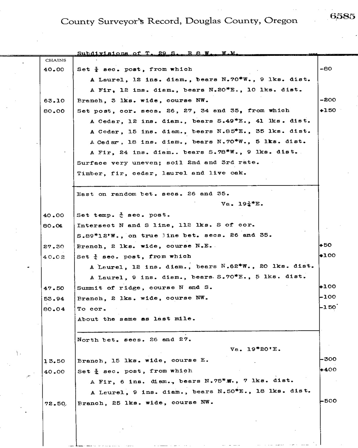
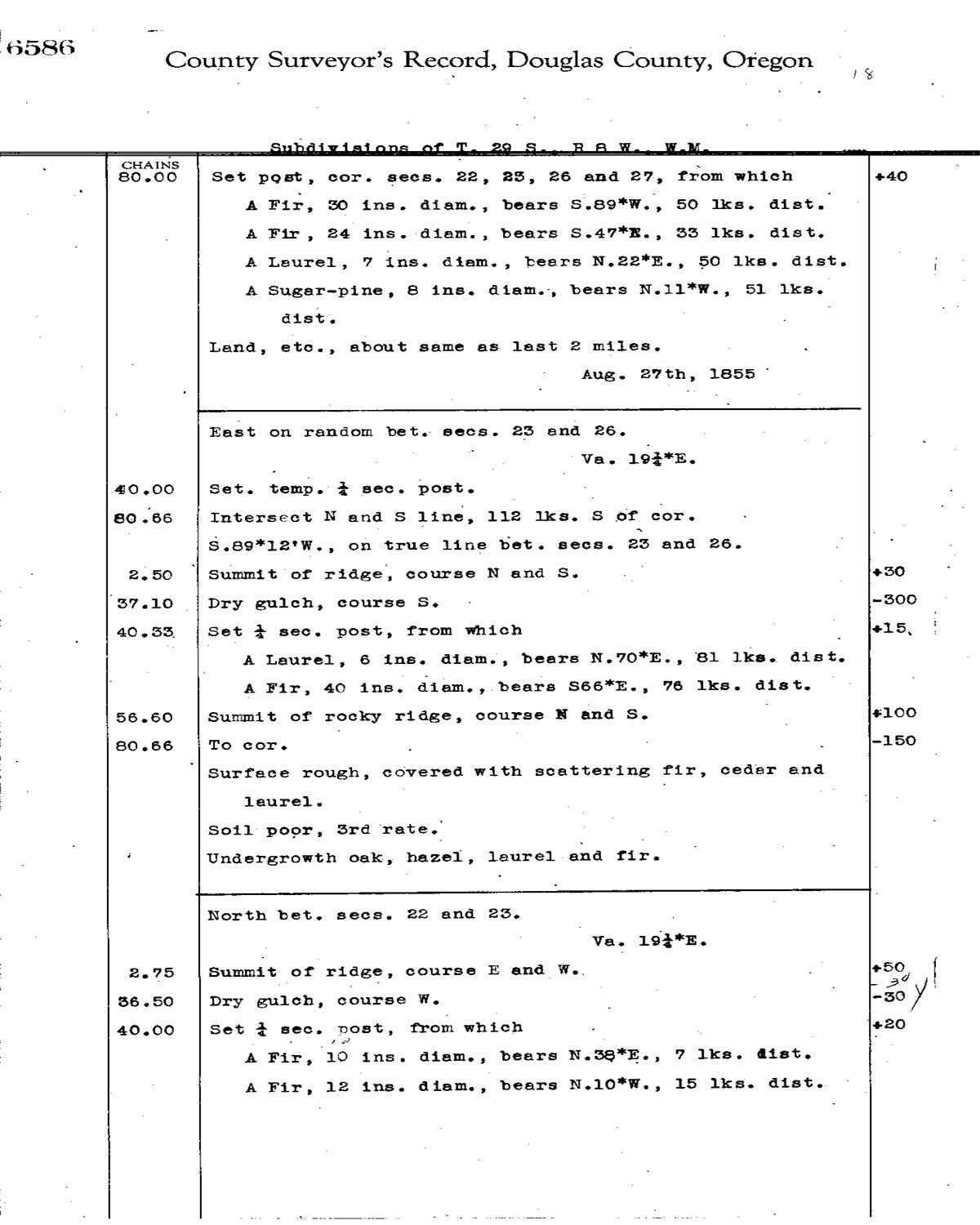
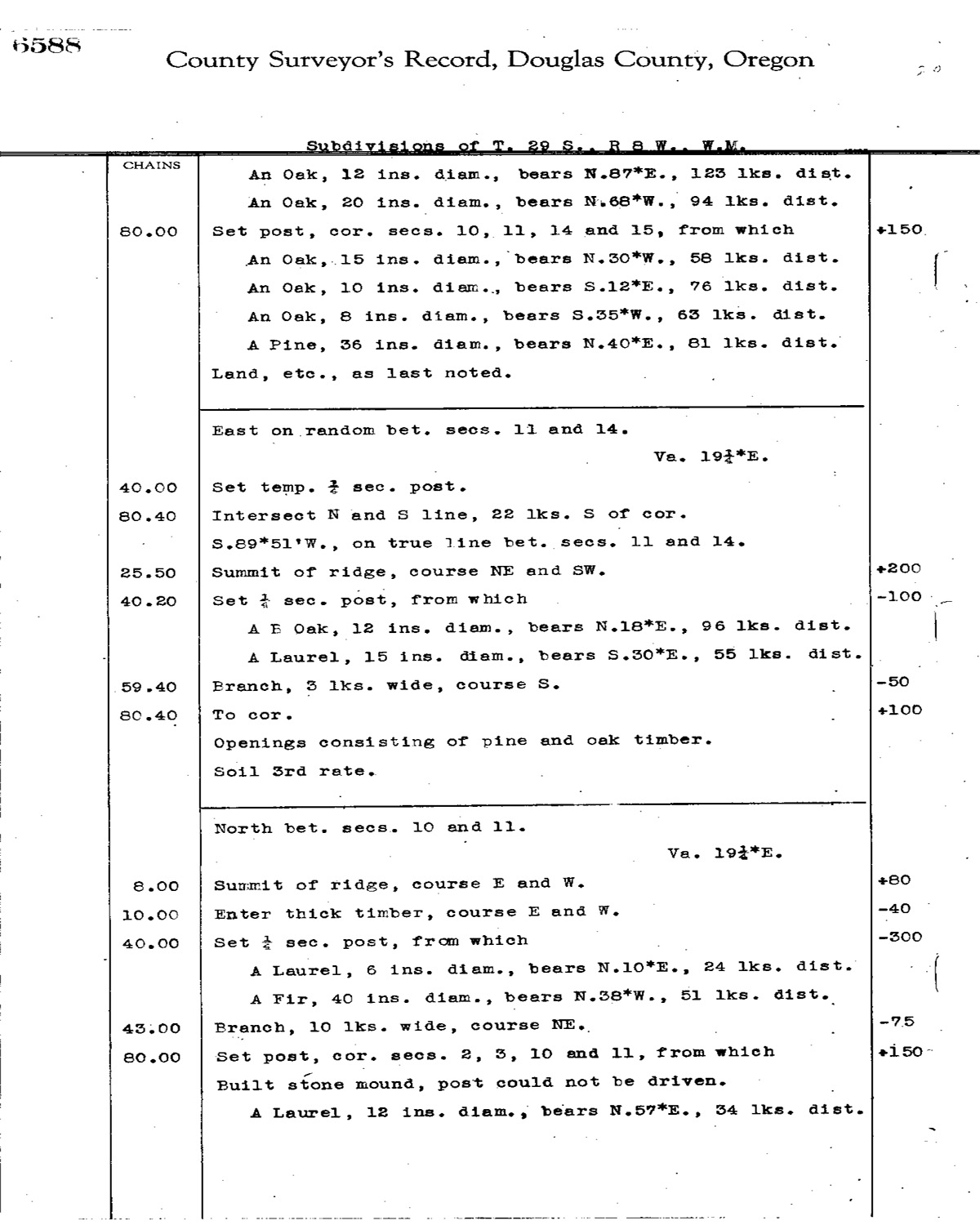
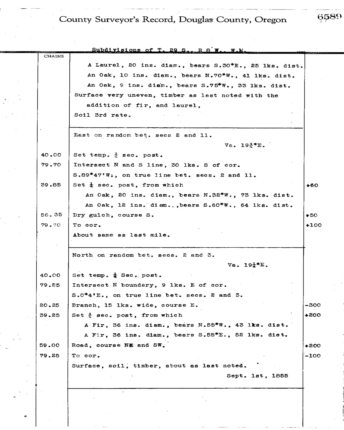
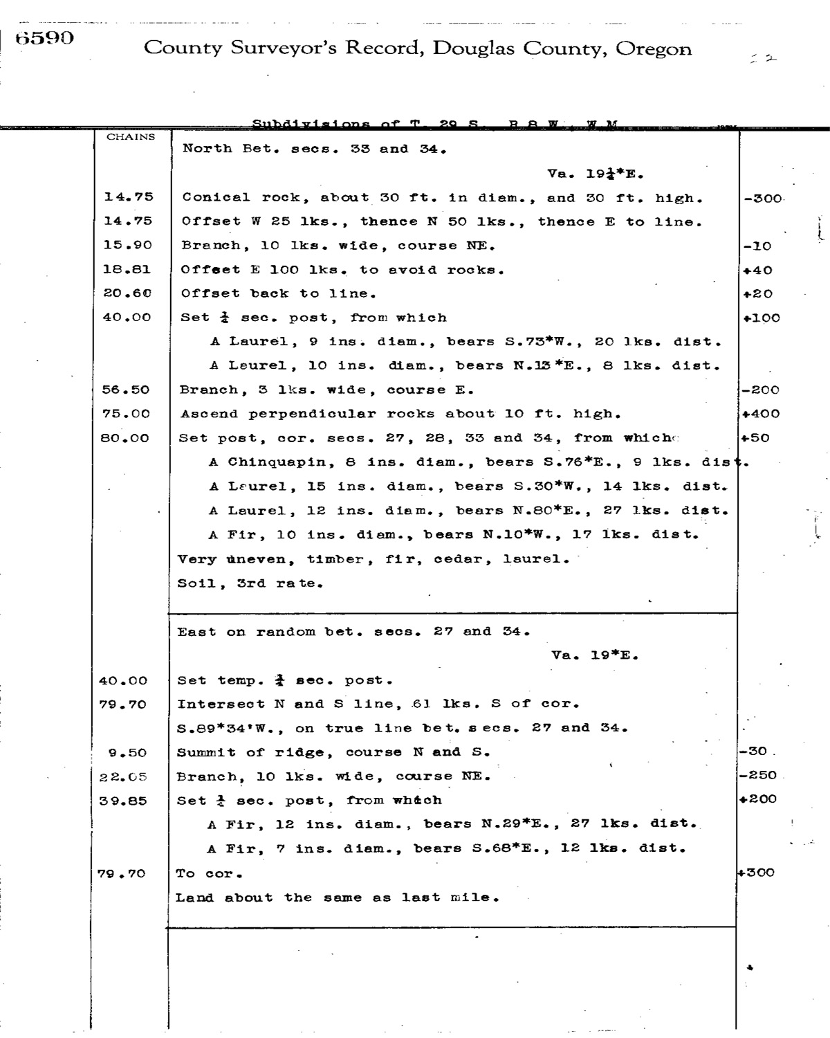
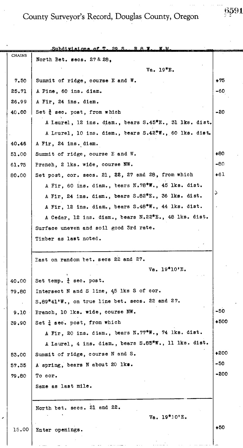
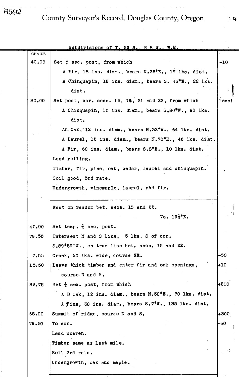
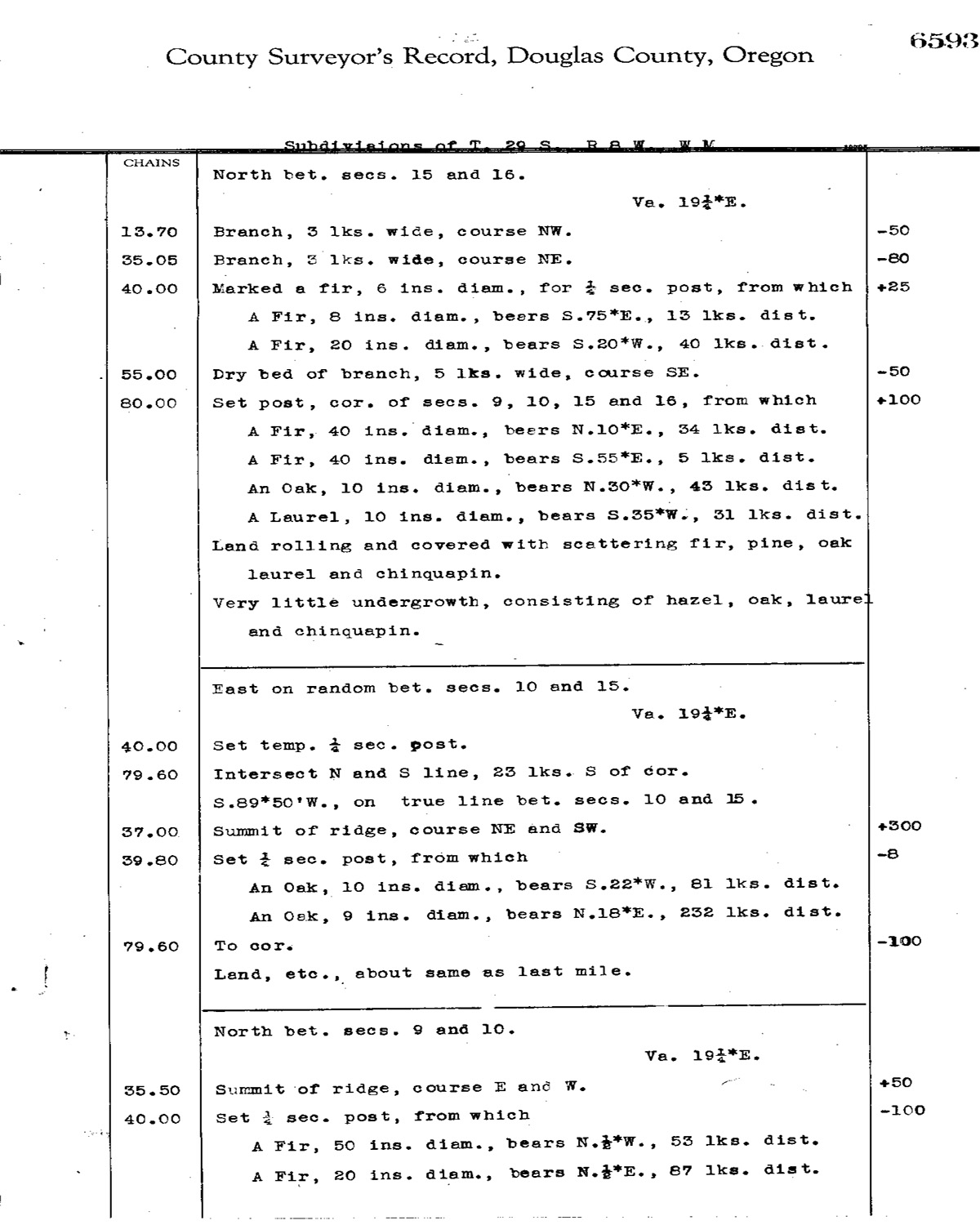
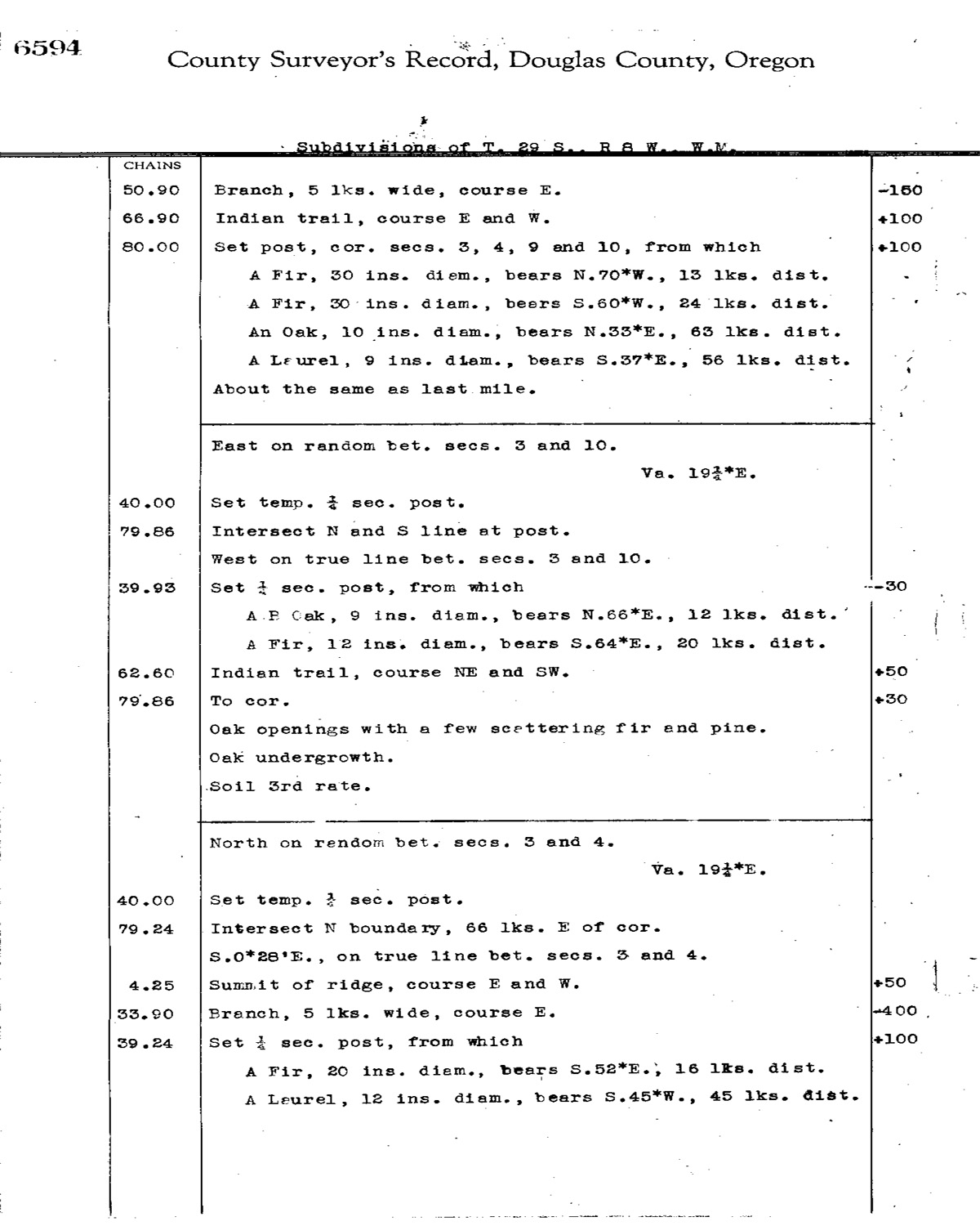
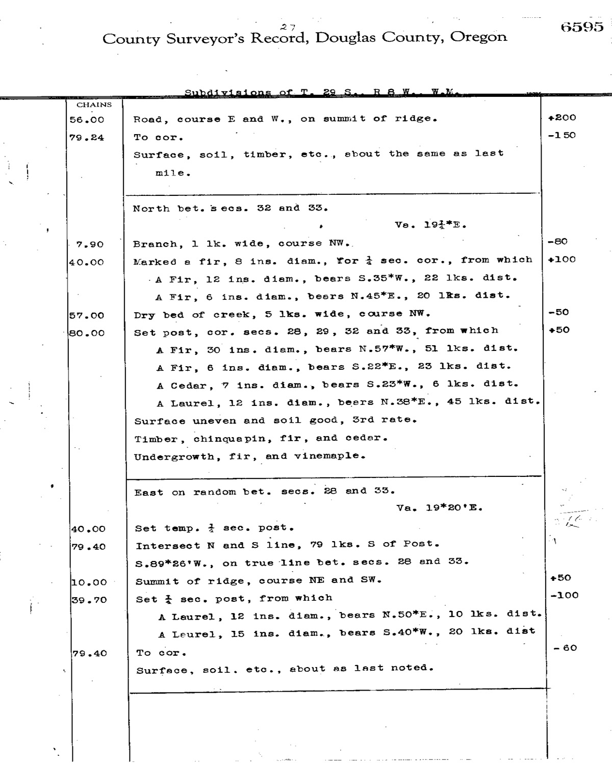
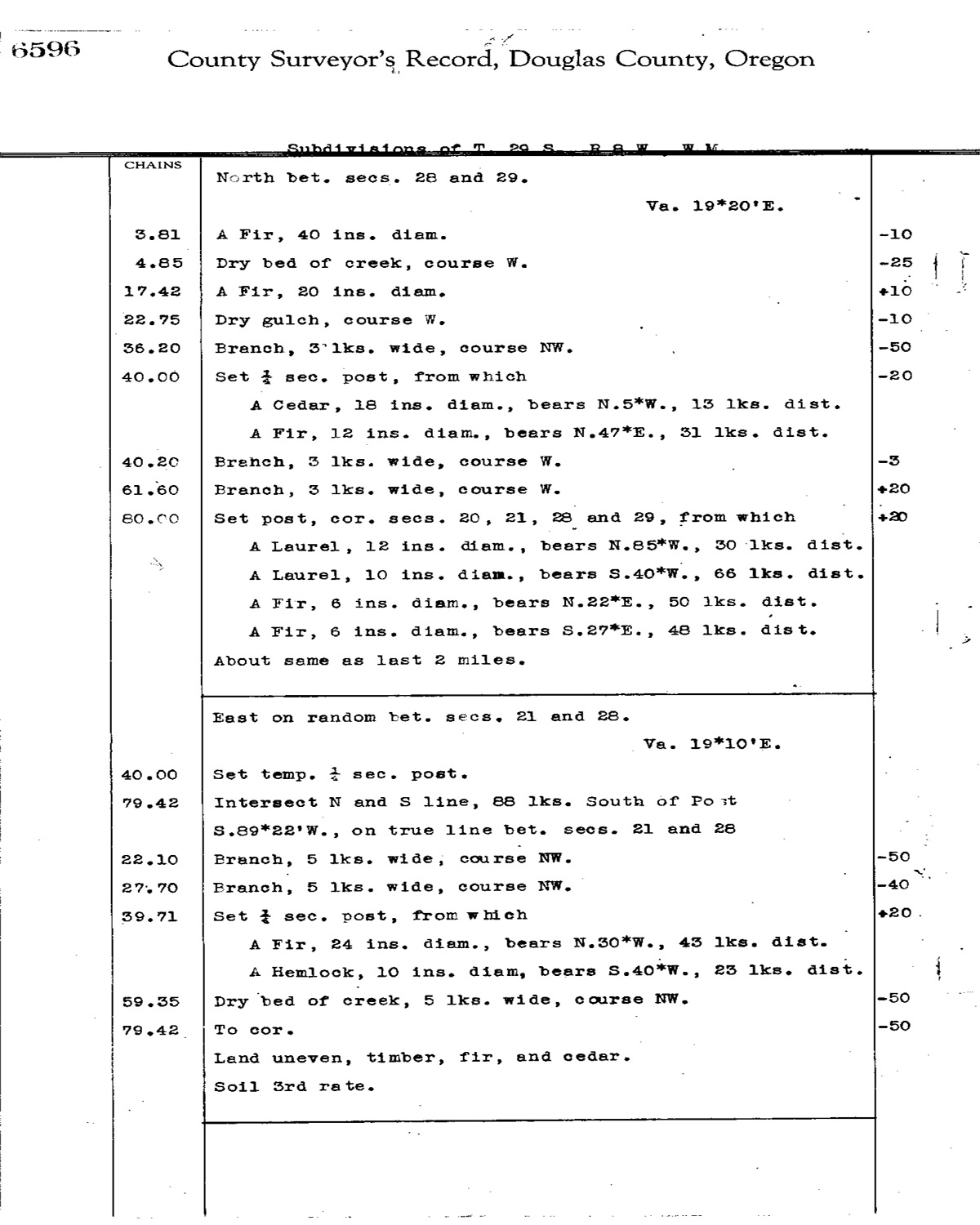
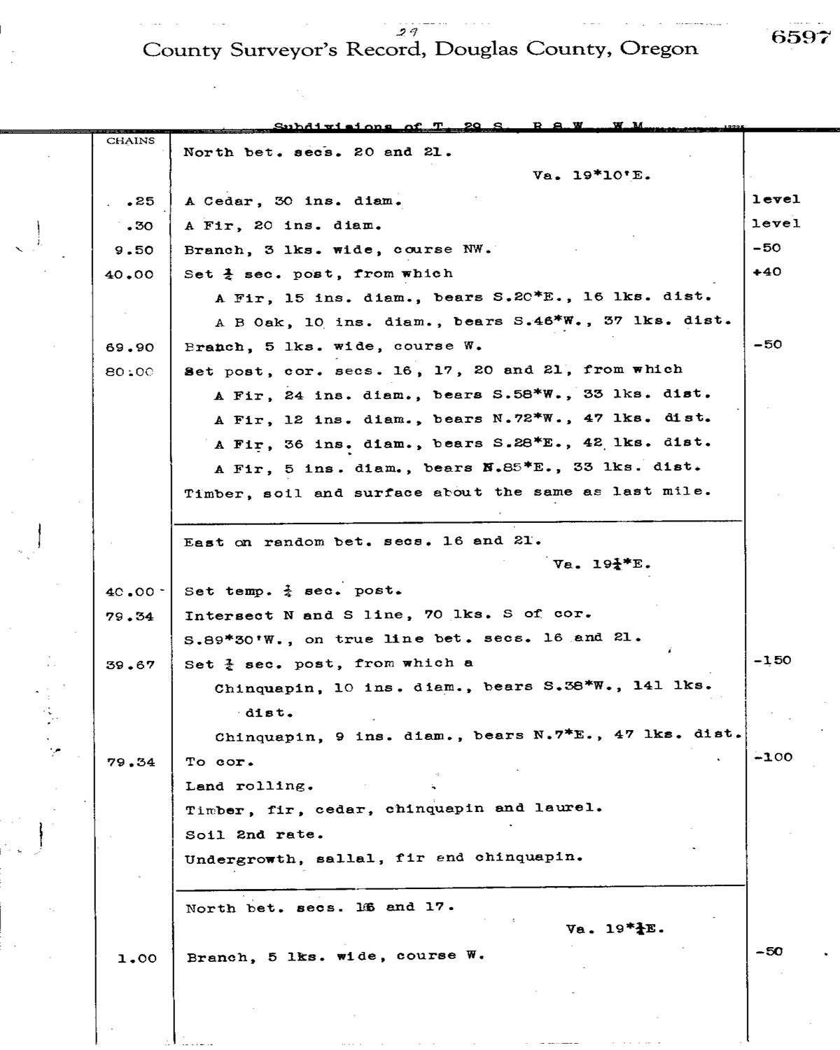
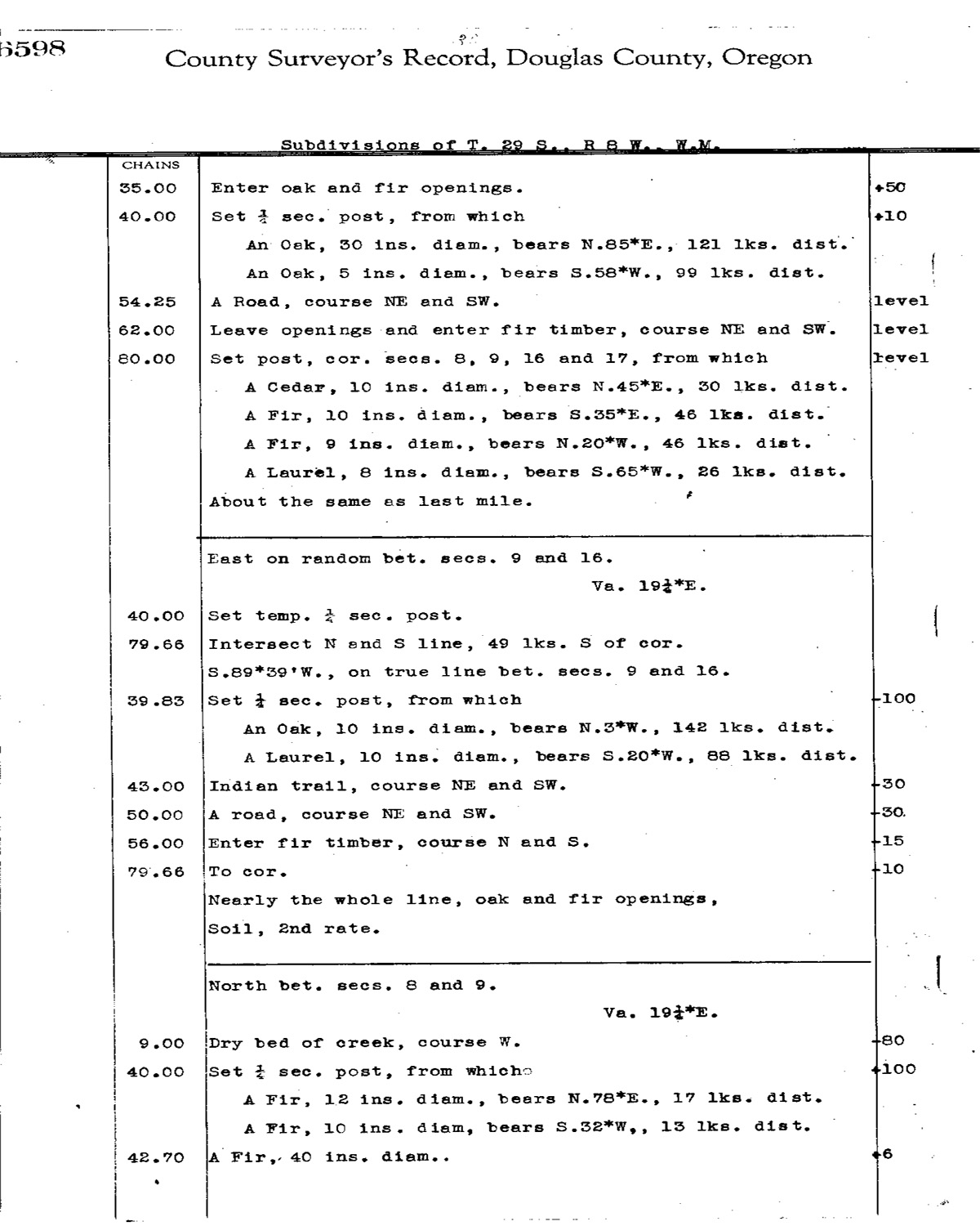
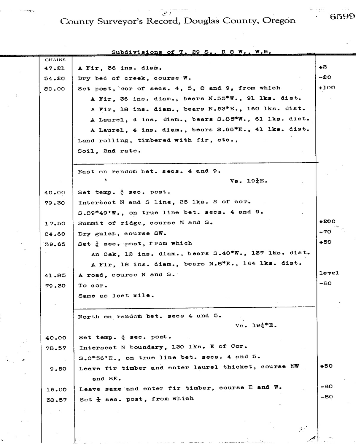
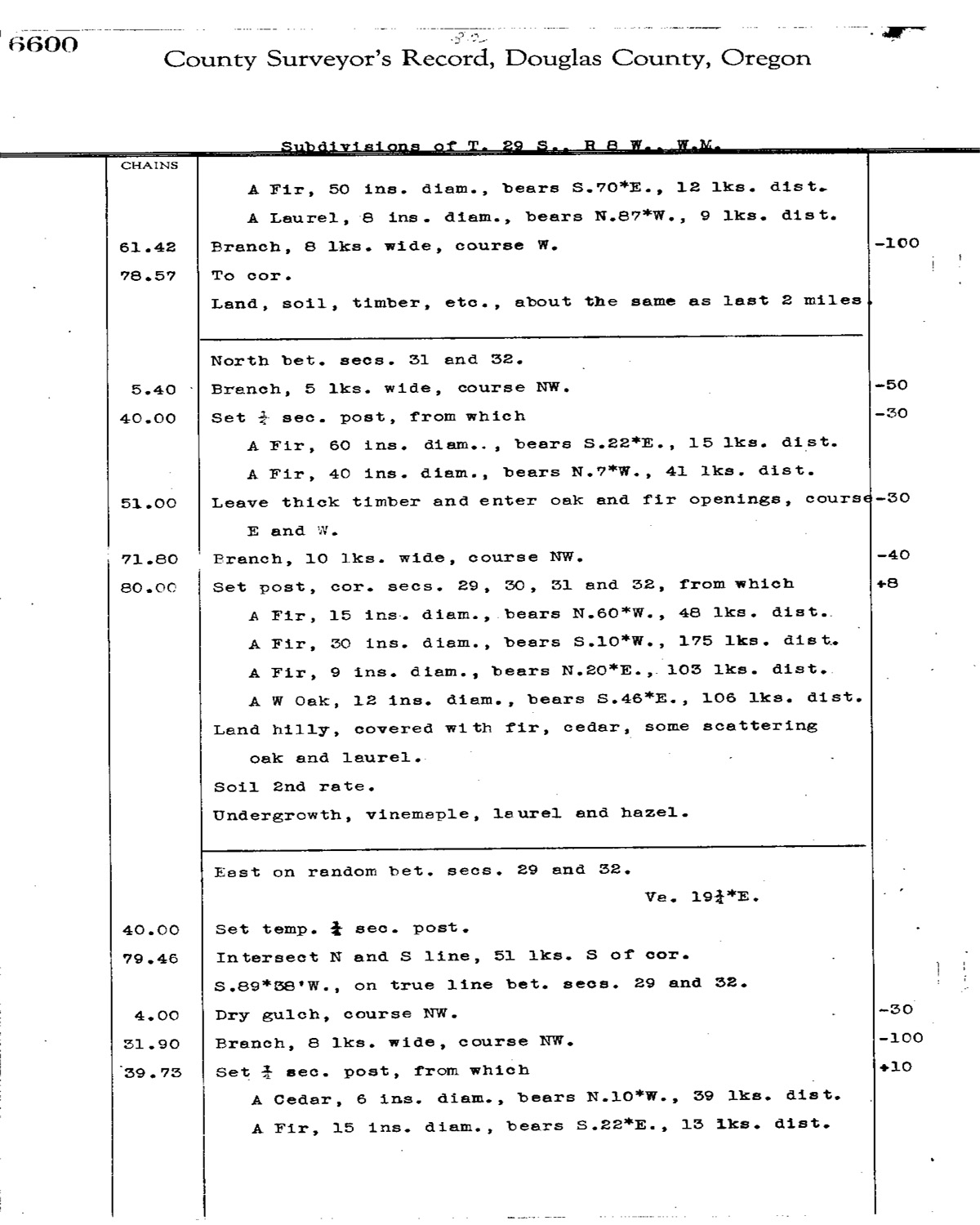
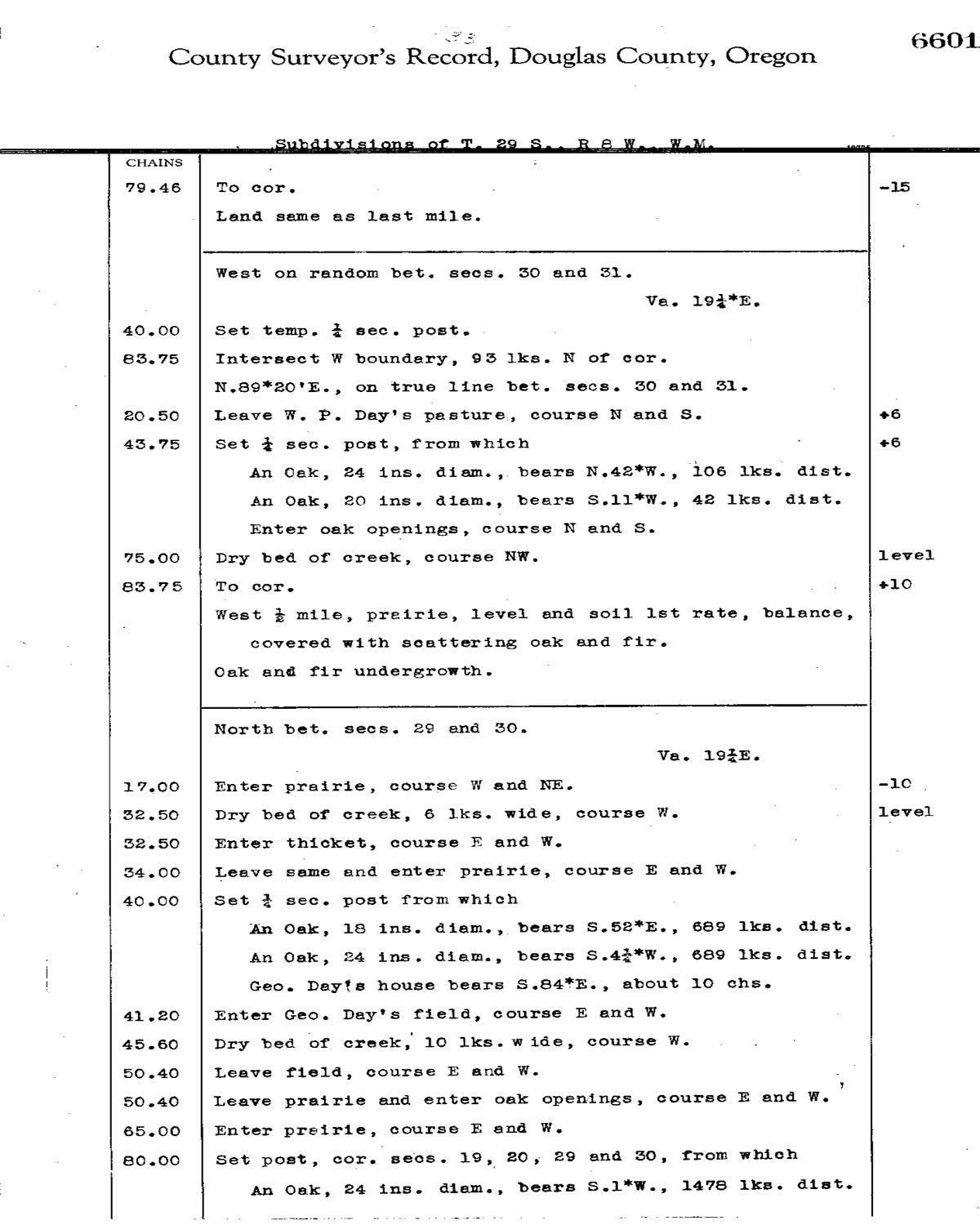
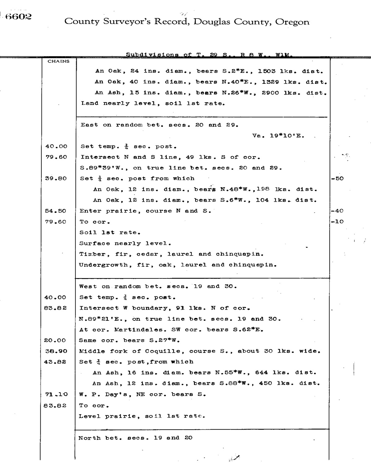
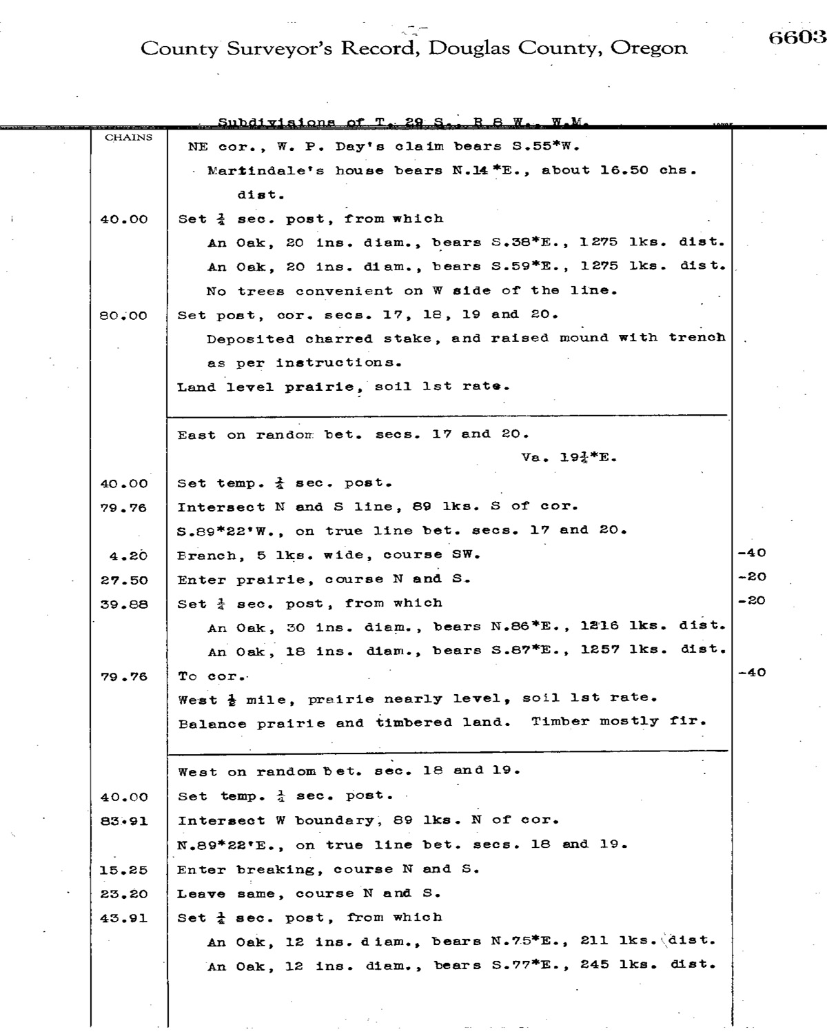
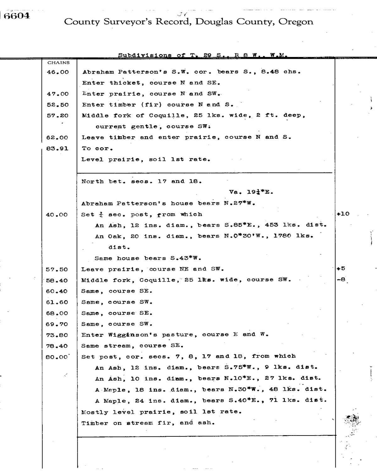
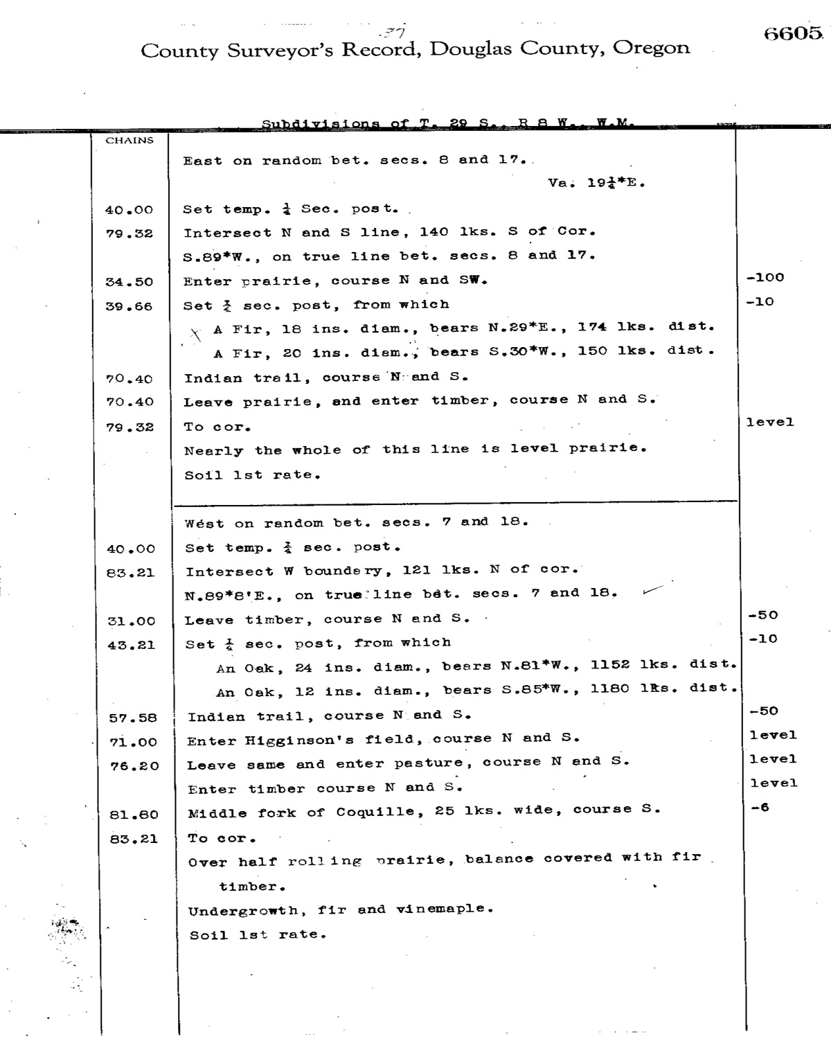
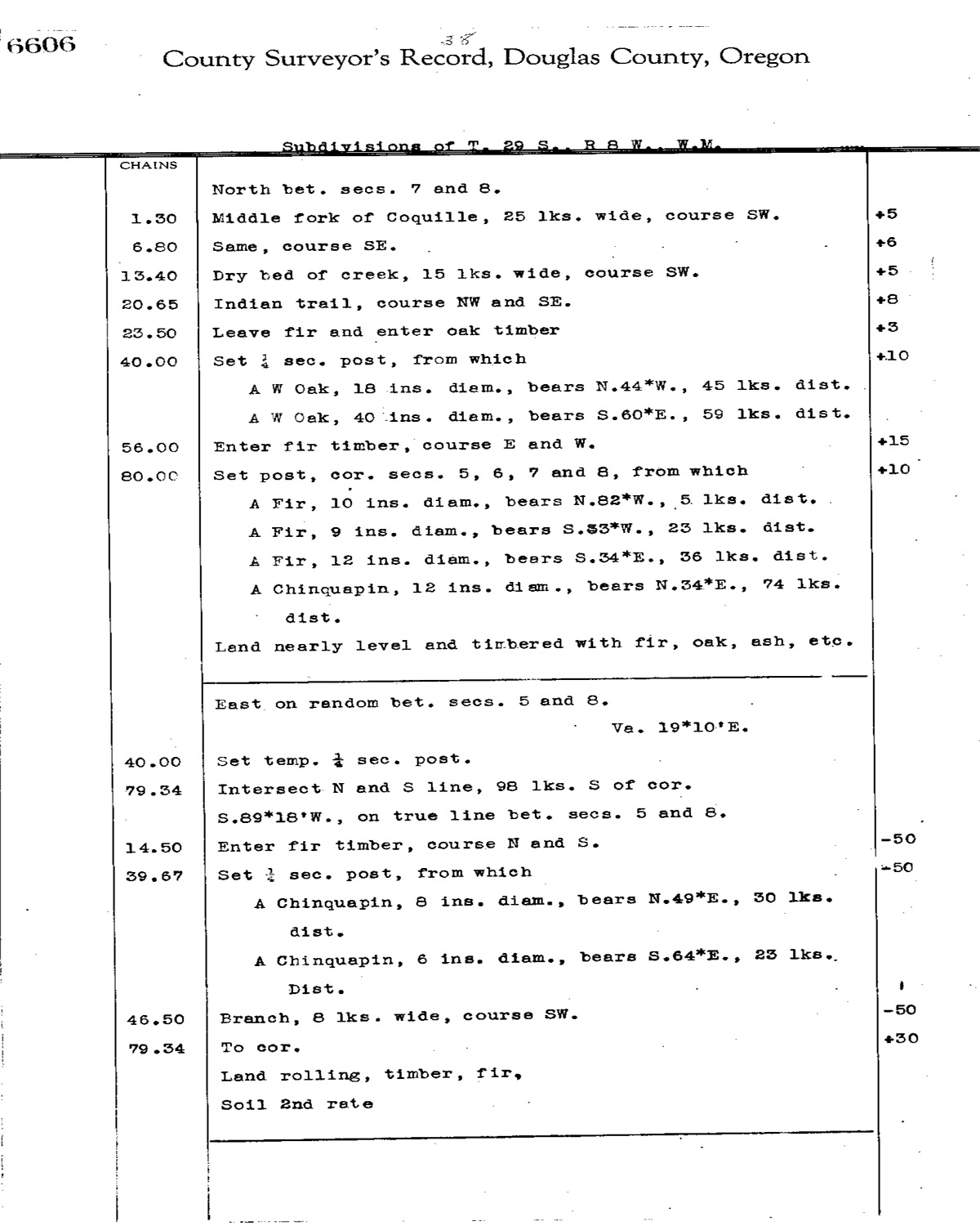
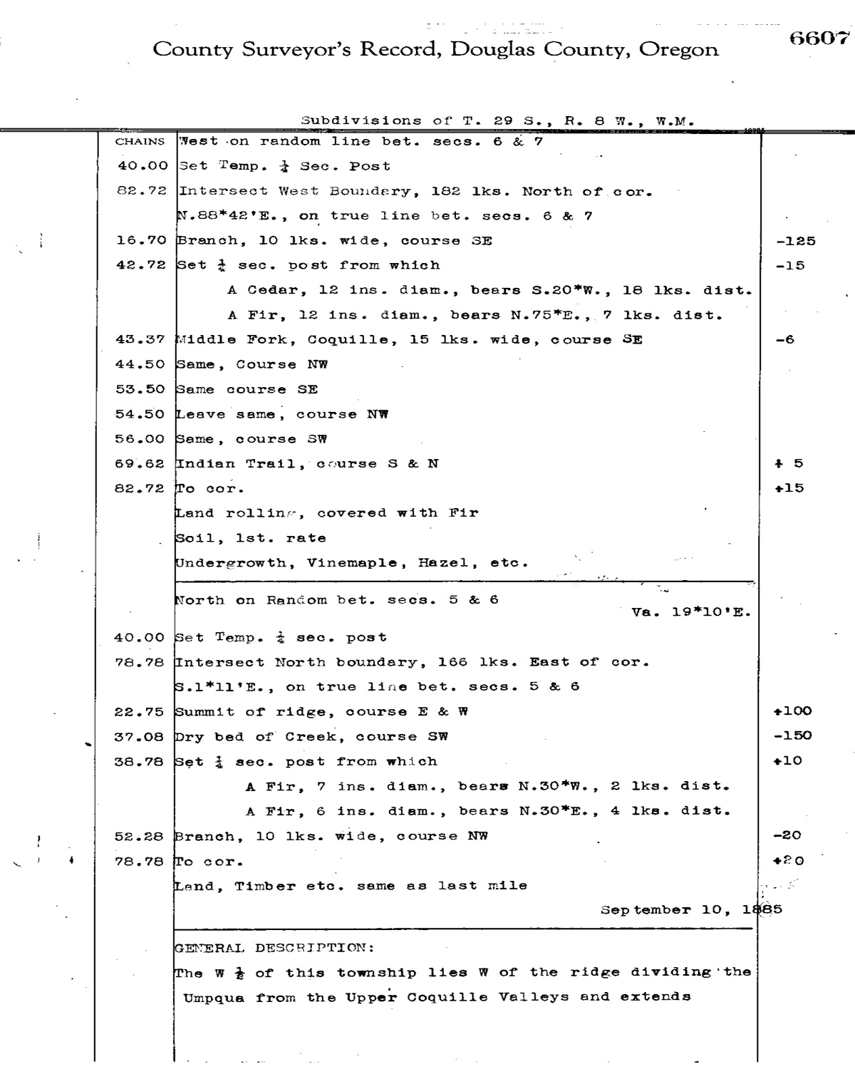
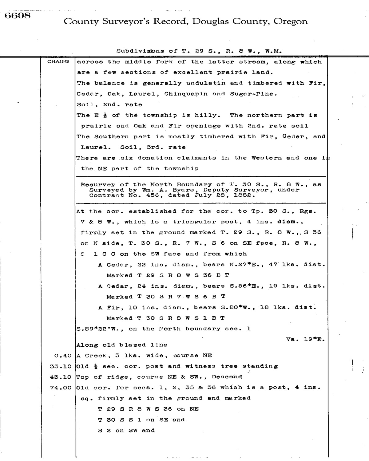
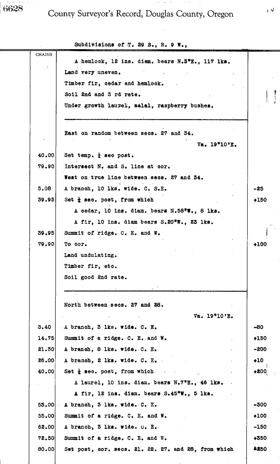
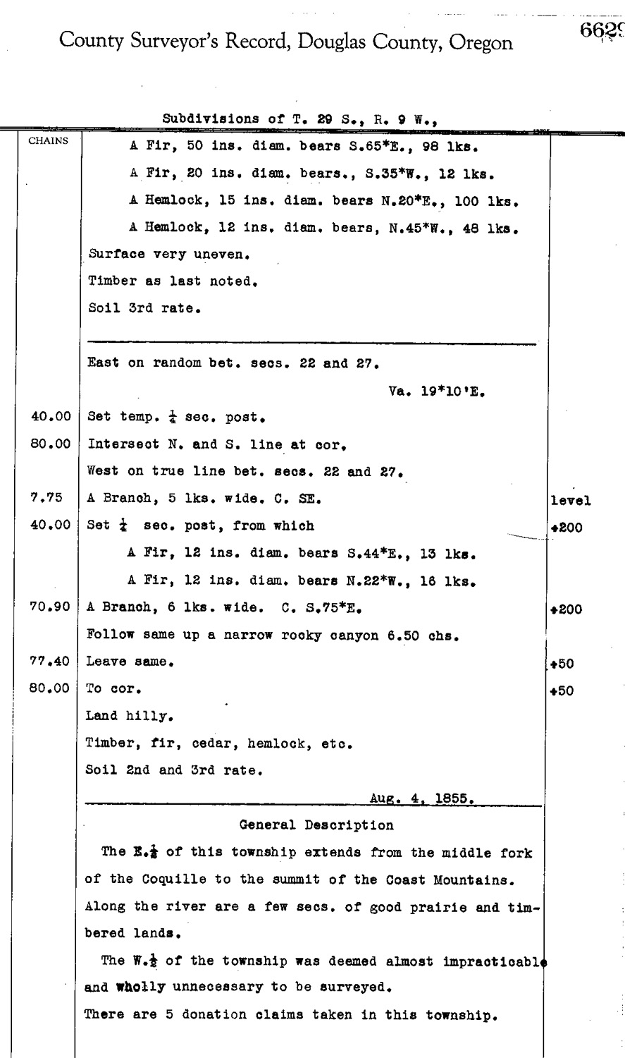
This township is entirely within the boundaries of the 2011-2012 Coquelle Trails Project. It includes Camas Mountain, Jim Belieu Creek and Coquille River in the Bridge-Remote Historical District. This survey was completed in 1856, 1863 and 1924 and mapped in 1856, 1863, and 1924 (Hathorn 1855; Burnett 1857; Mensch 1924). Donation Land Claims were made by George W. Day, William P. Day, A. Dreyer, F. J. Higginson, Alston Martindale, Abraham Patterson, Cyrus D. Rawson, Alexander Reed, and H. O. Waters.
![]()