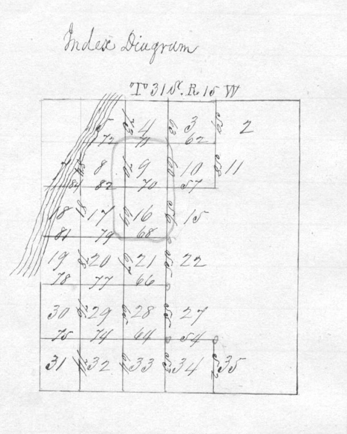
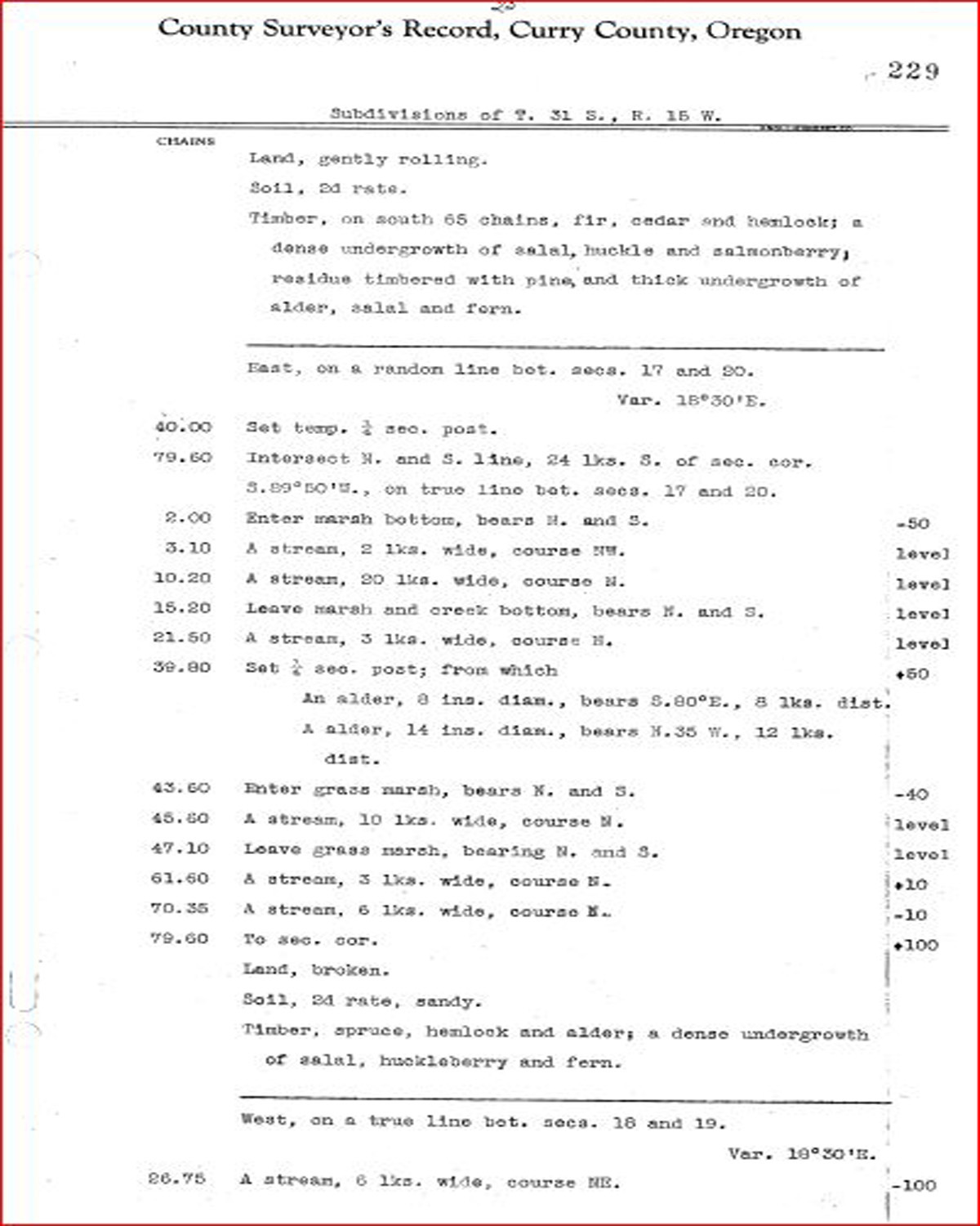
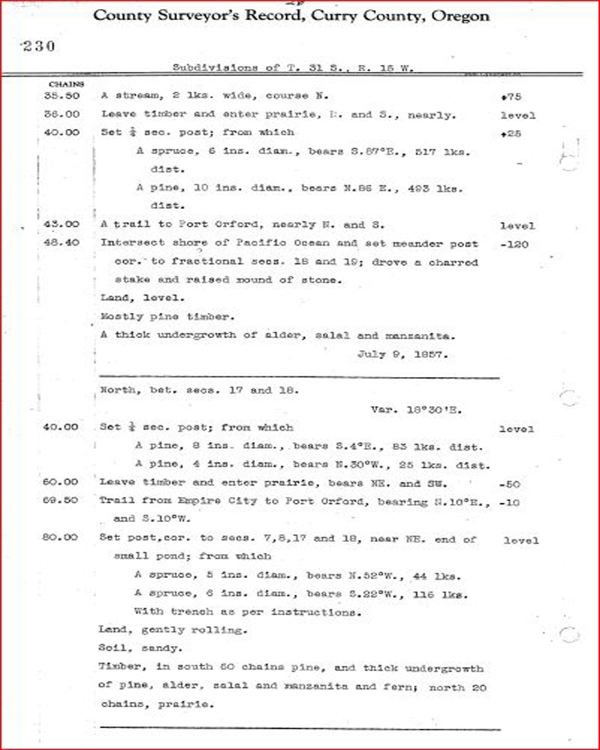
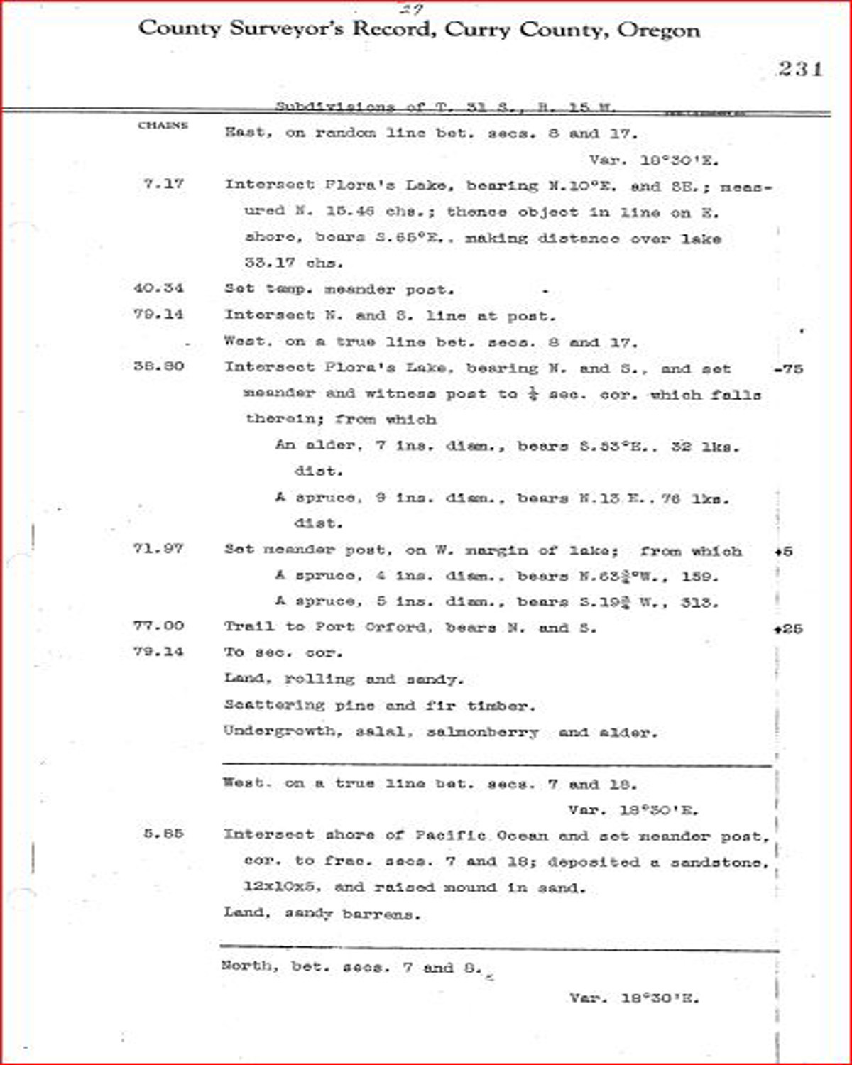
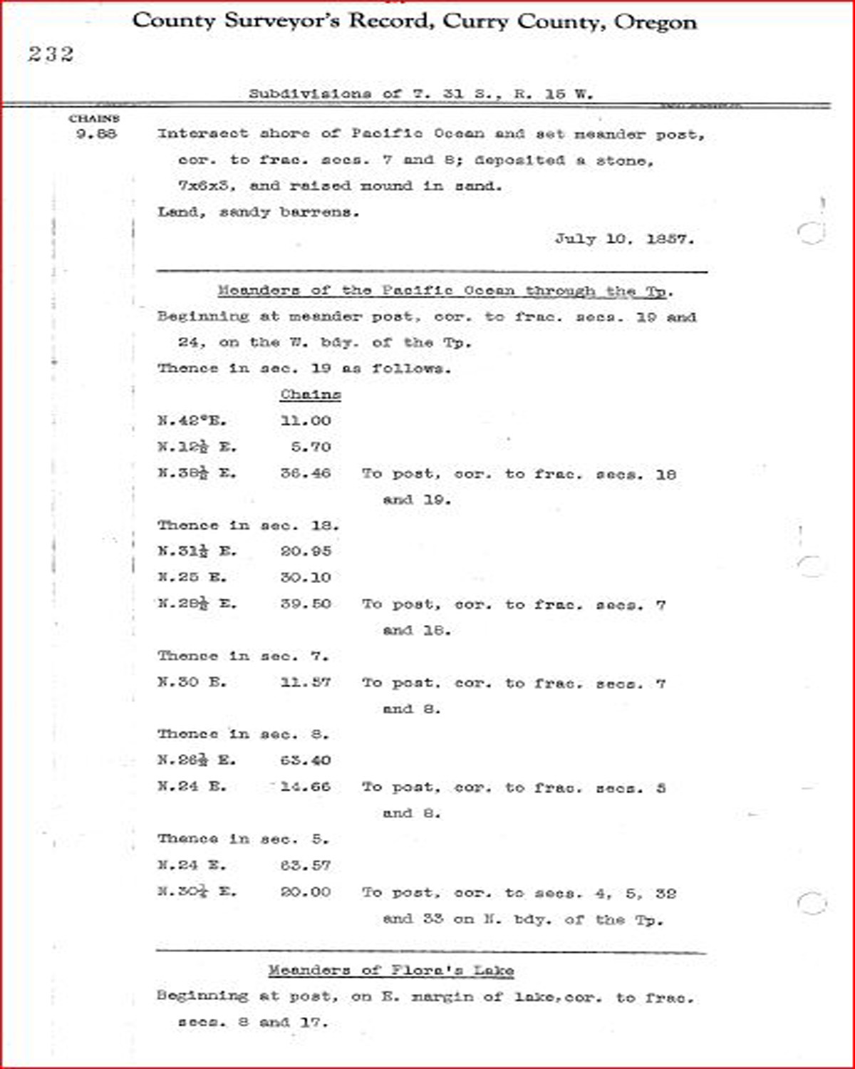
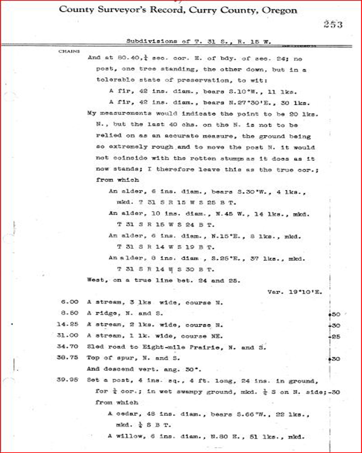
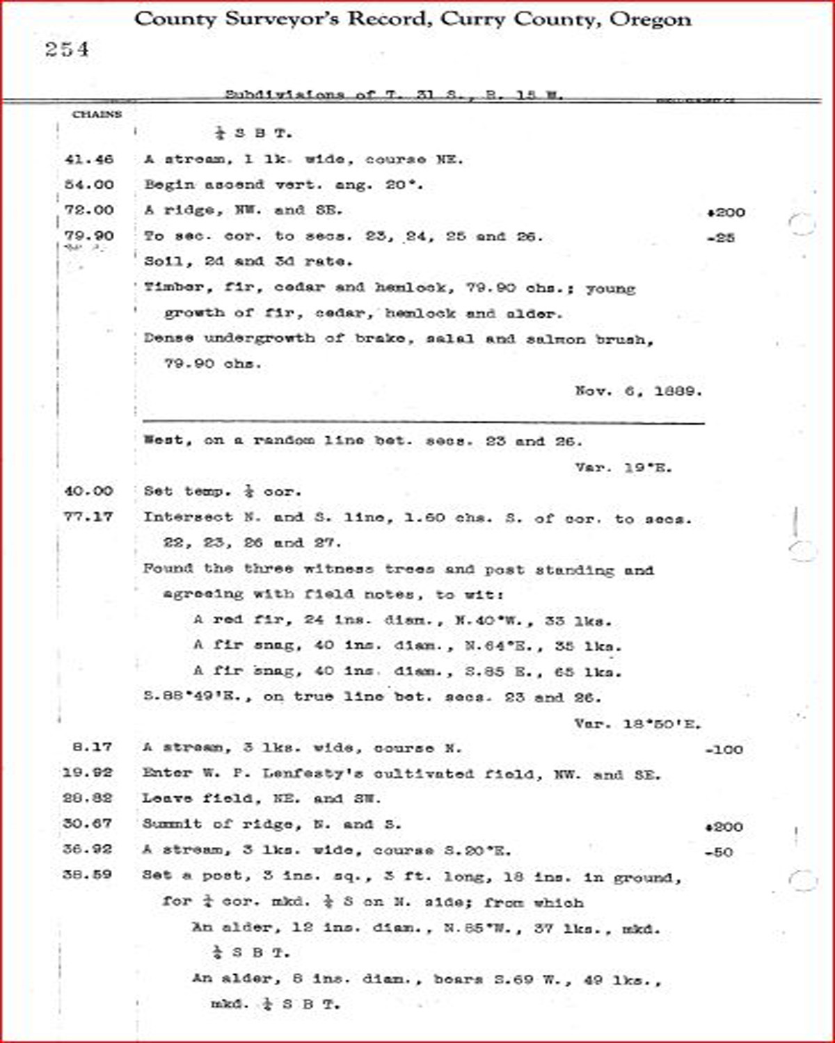
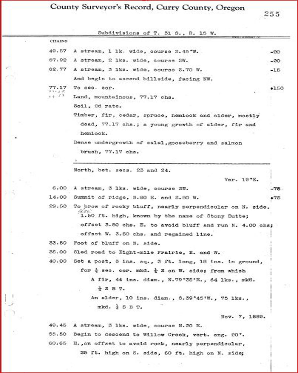
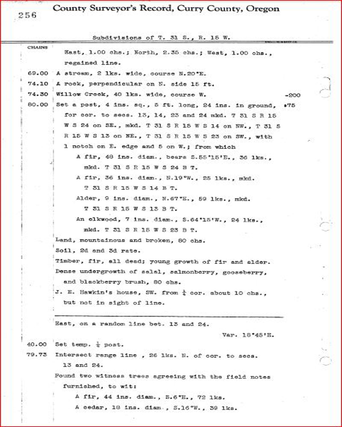
Tsp. 31 S., Rng. 15 W.
General Land Office Survey Index
NOTE: THIS INDEX MAP DOES NOT CONFORM TO THE PAGE NUMBERS IN THE TABLE.
 |
 |
 |
 |
 |
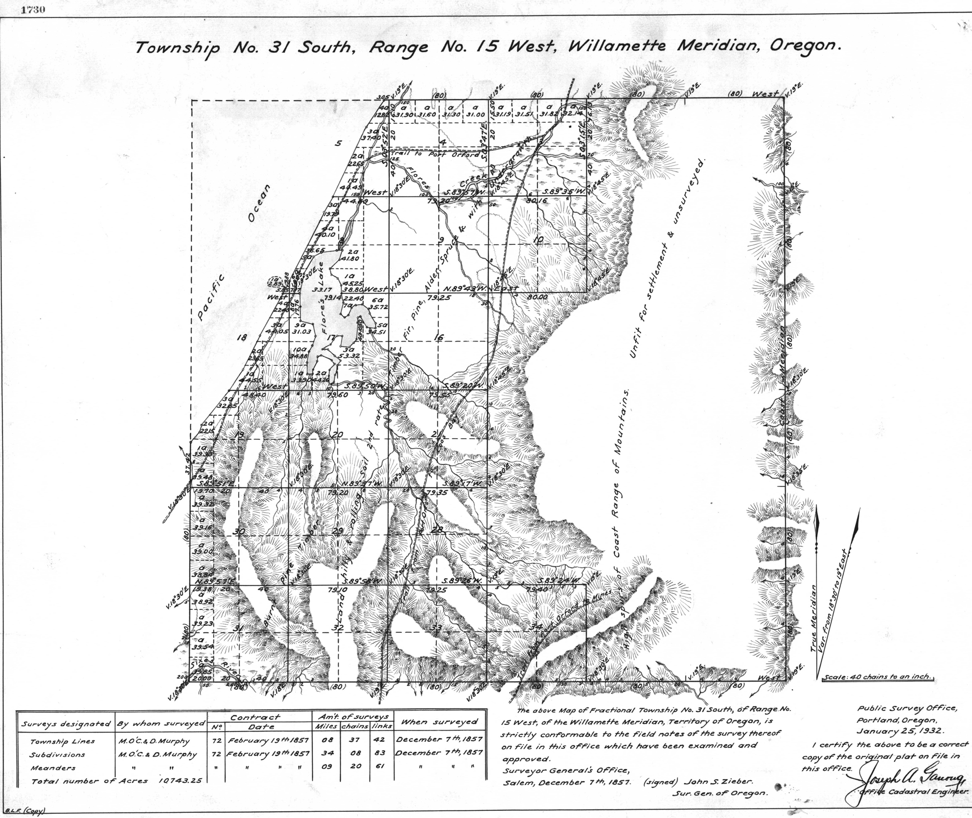
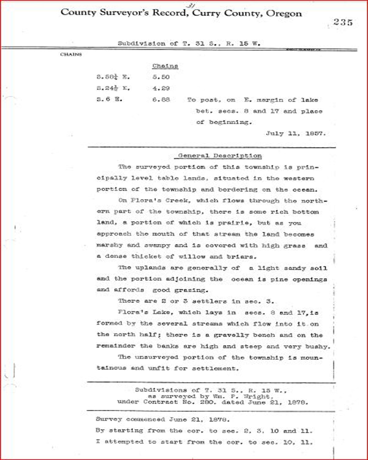
1857 GLO |
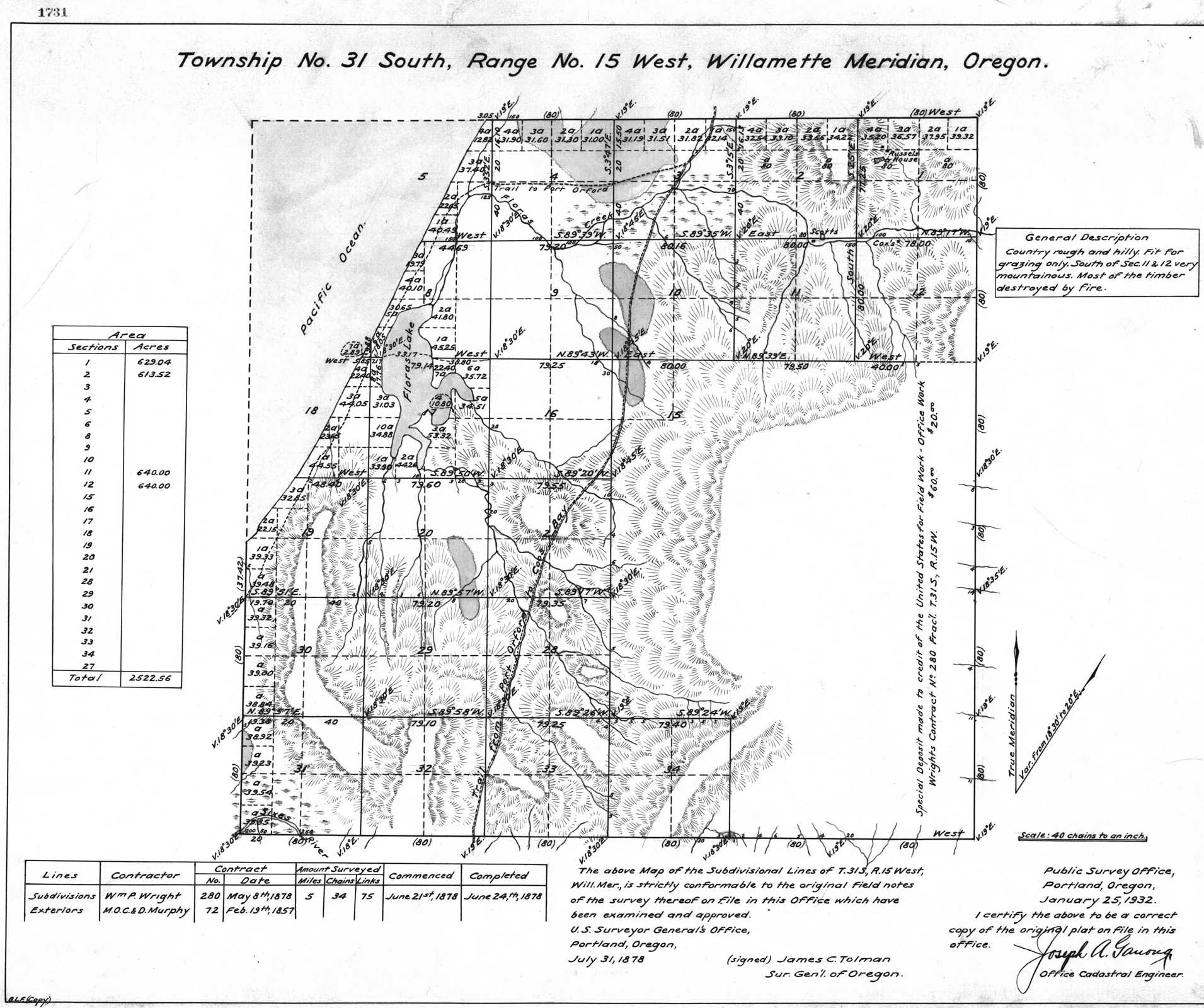
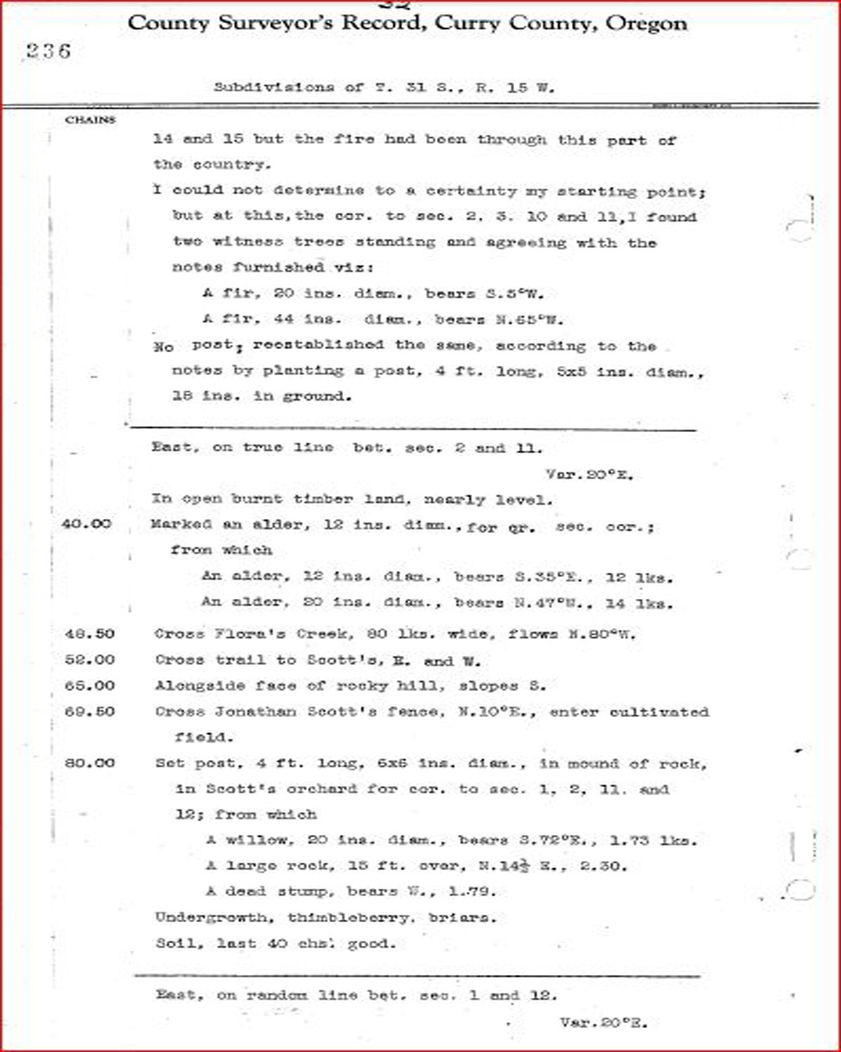
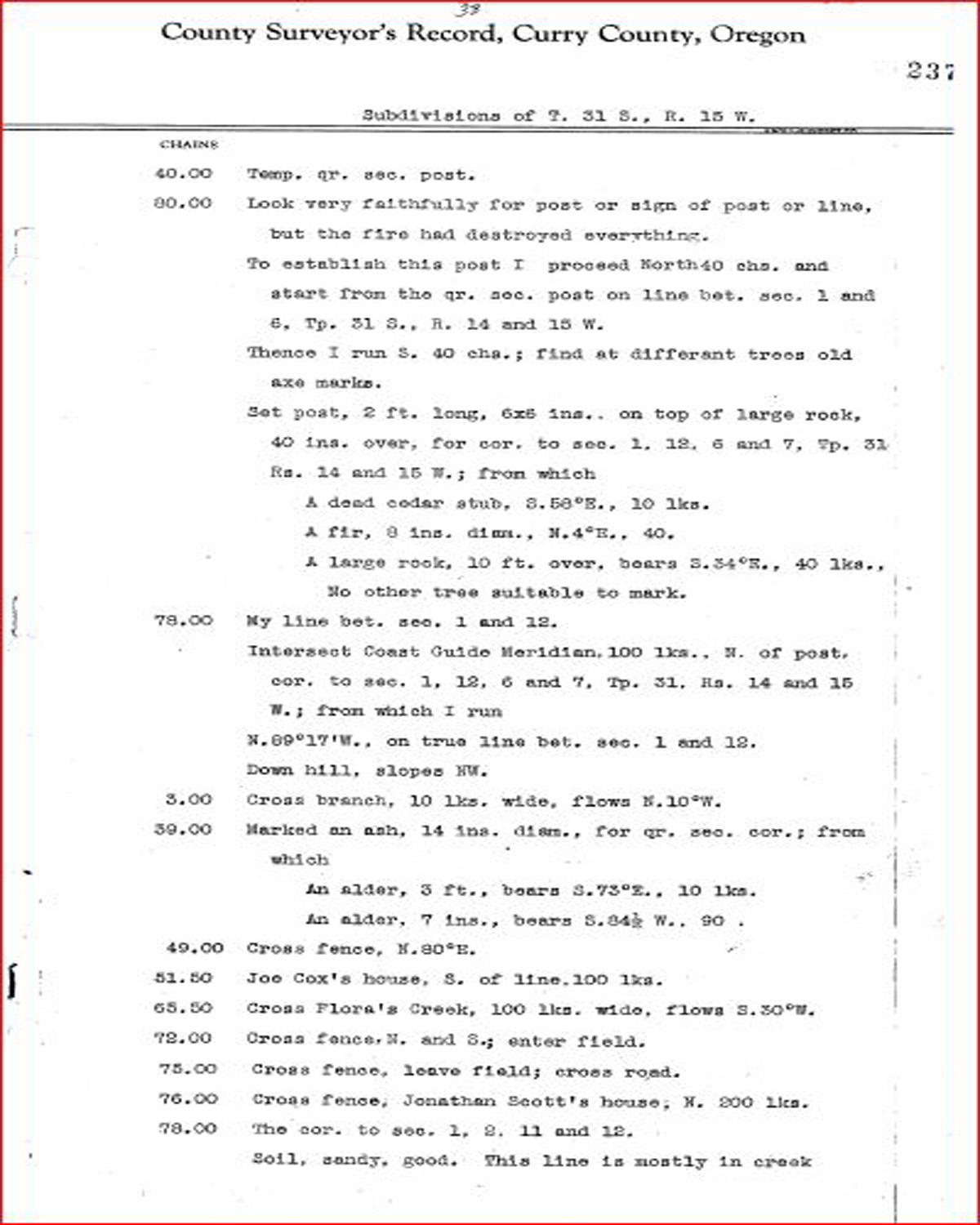
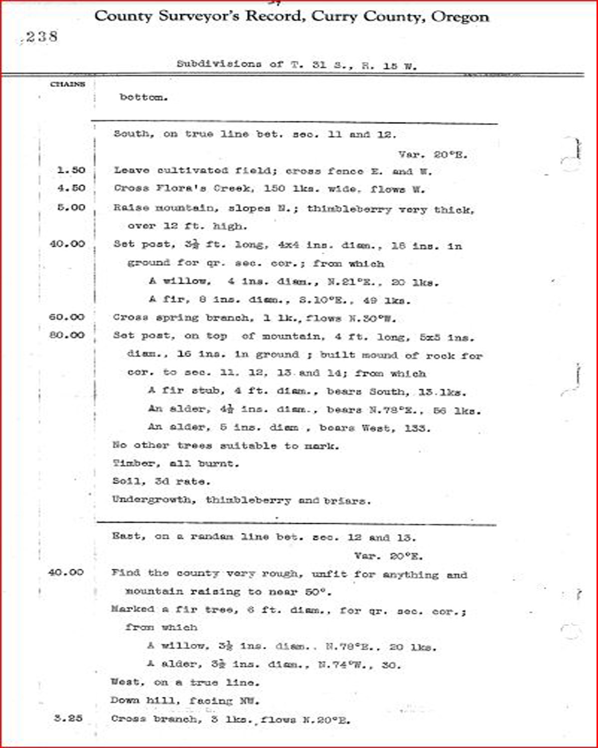
1878 GLO |
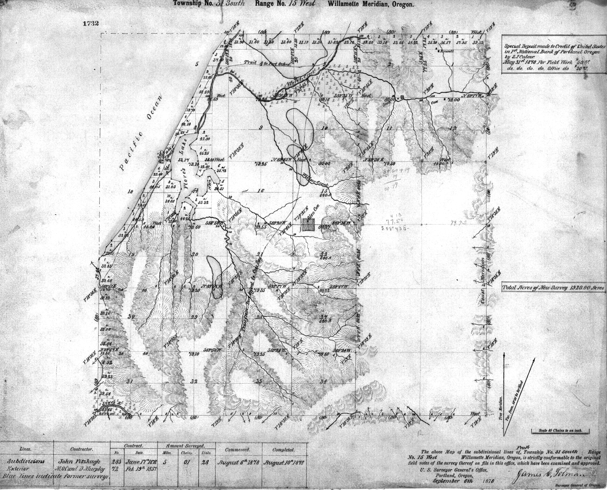
1878 GLO |
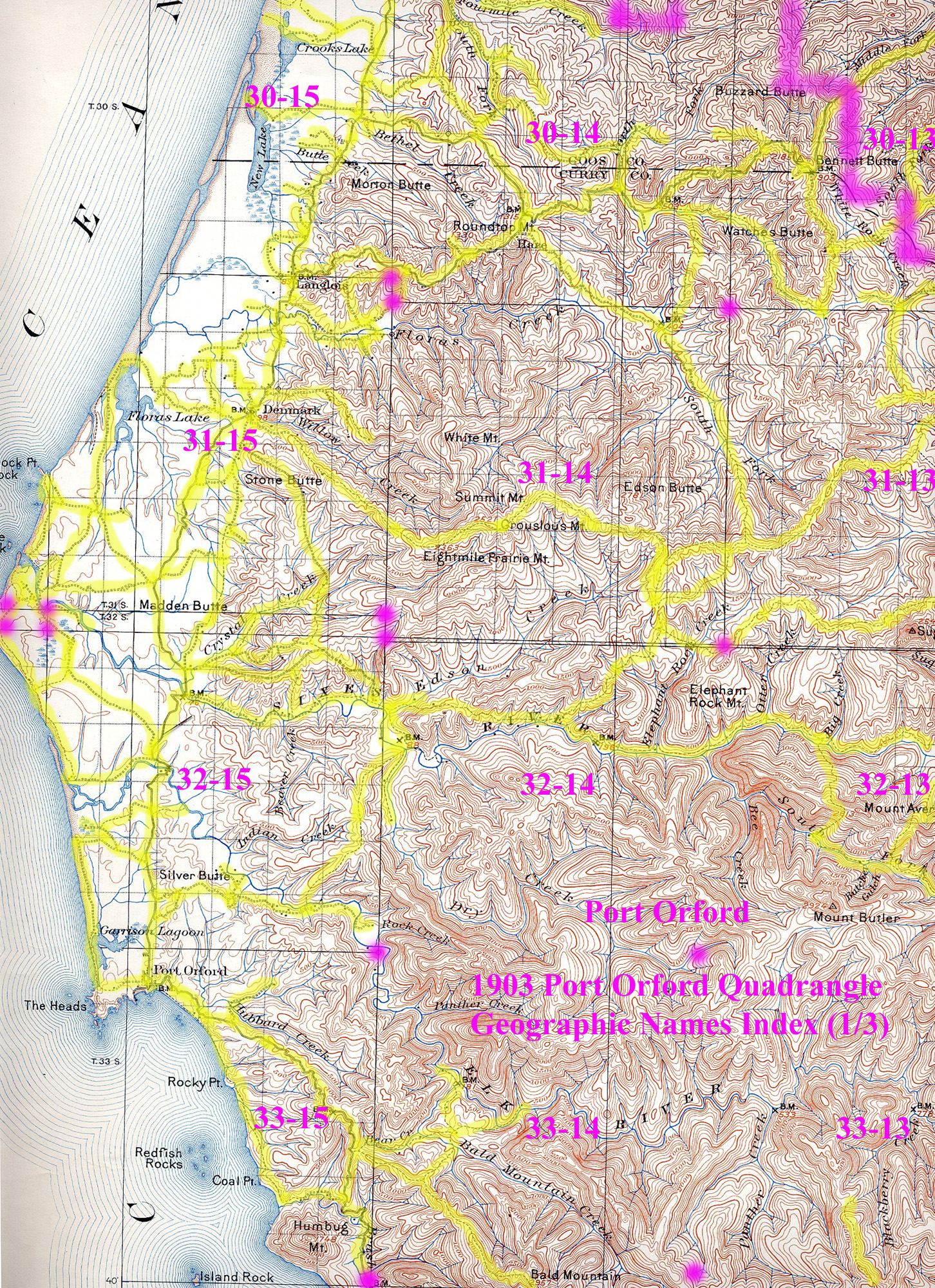
1903 Annotated USGS Port Orford |
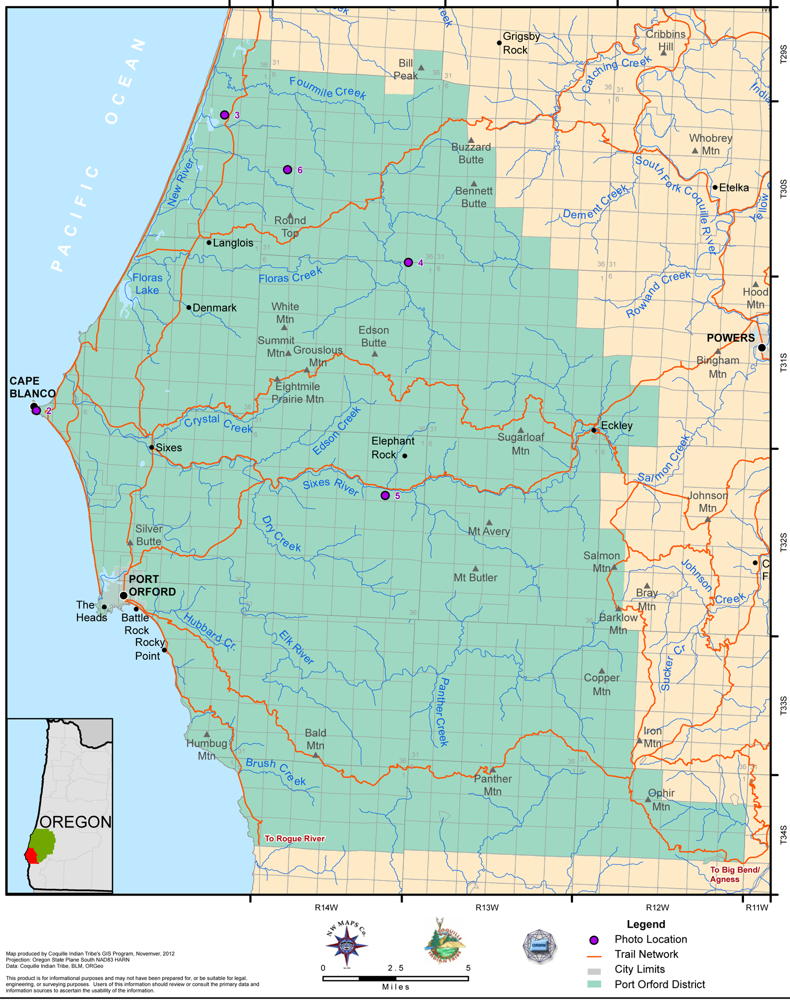
2012 Port Orford District |
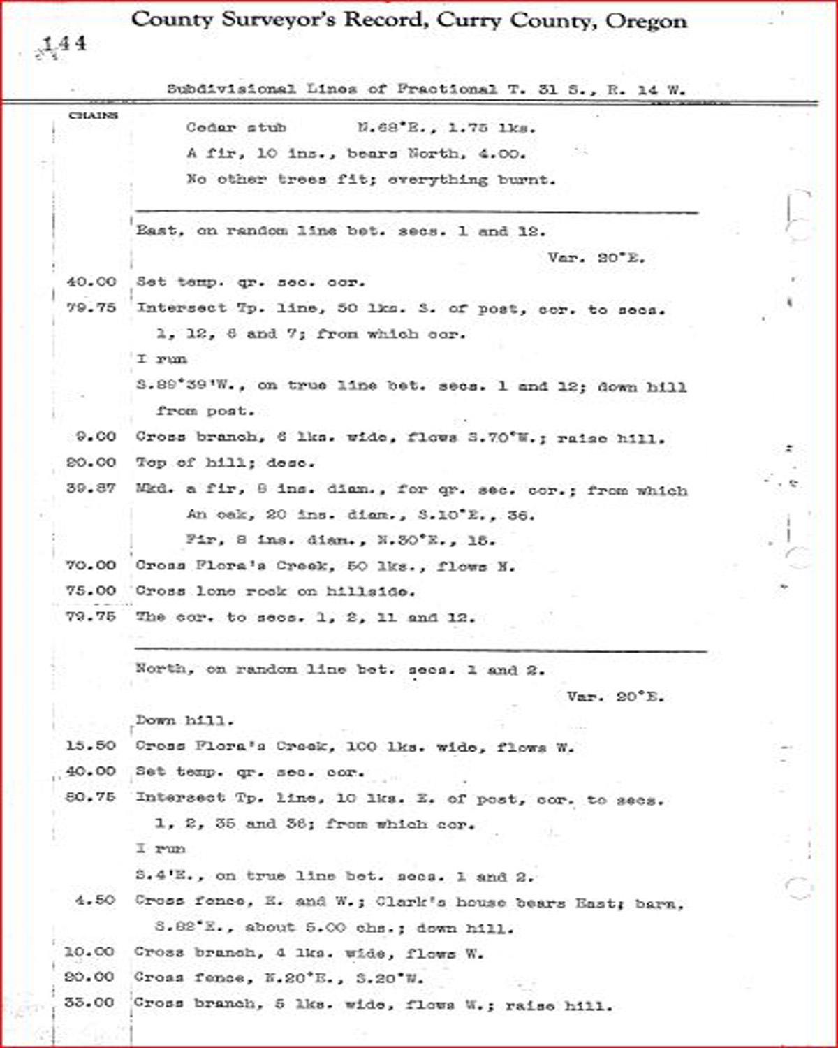
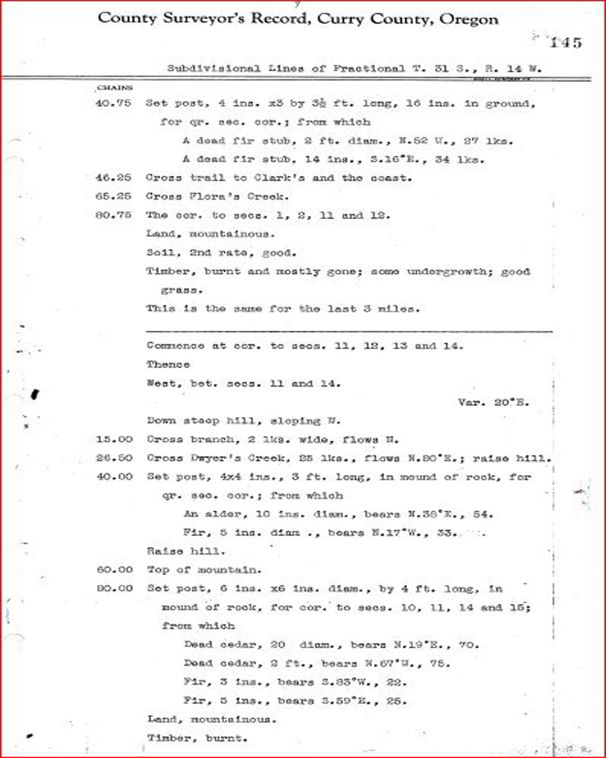
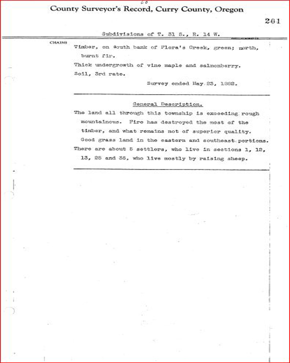
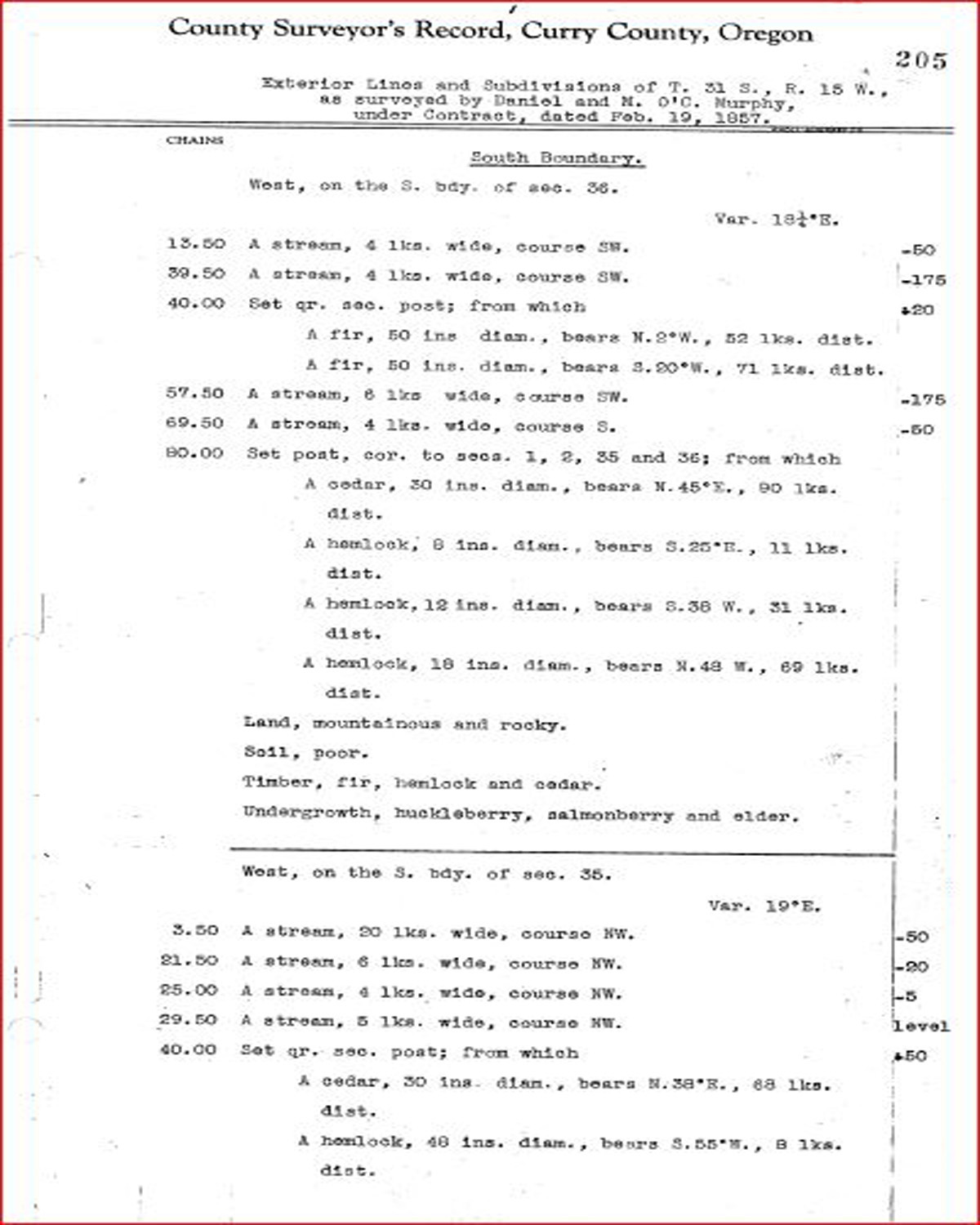
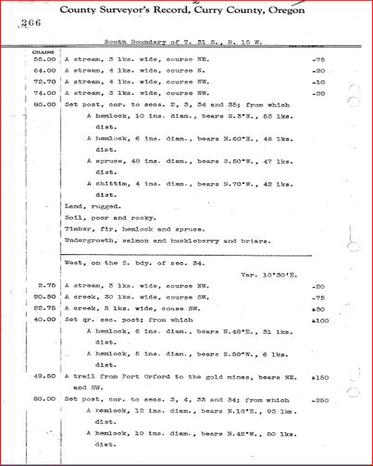
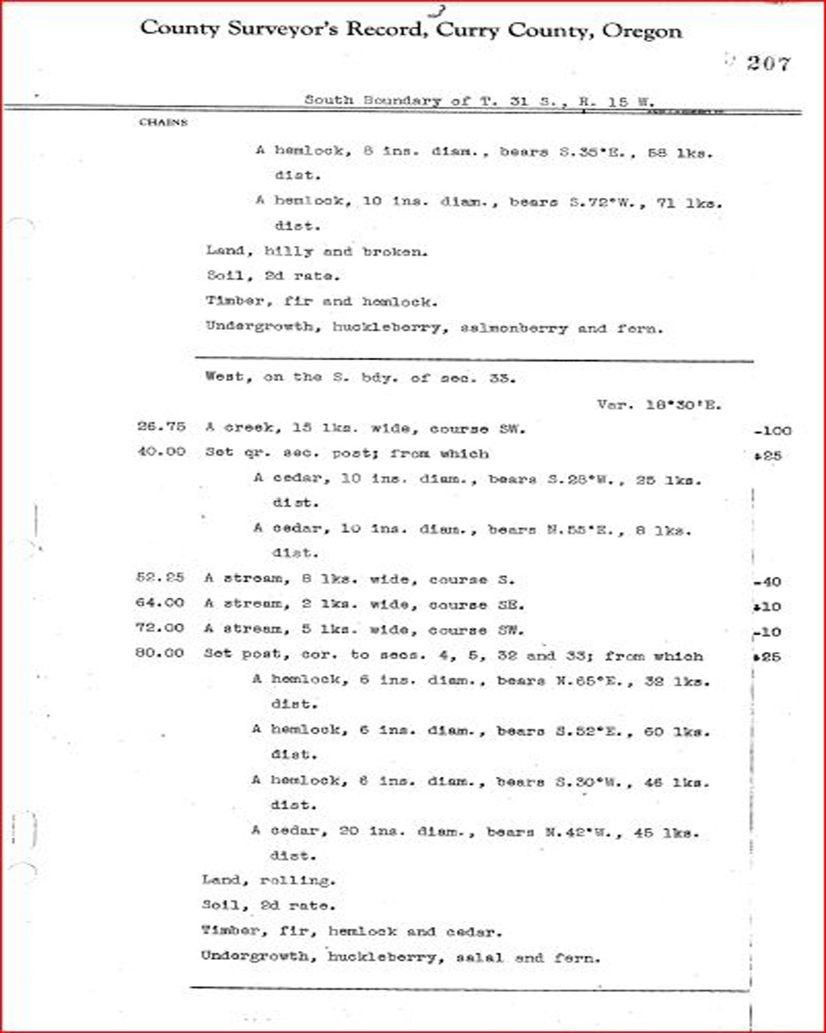
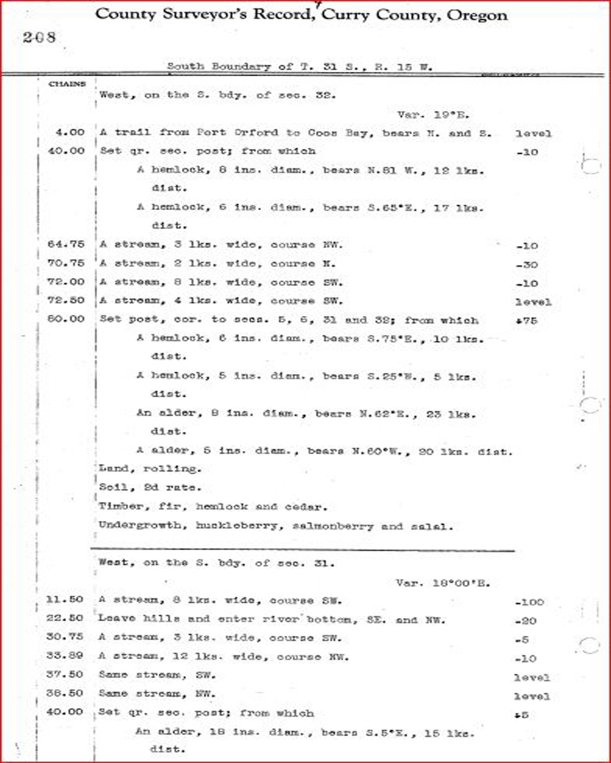
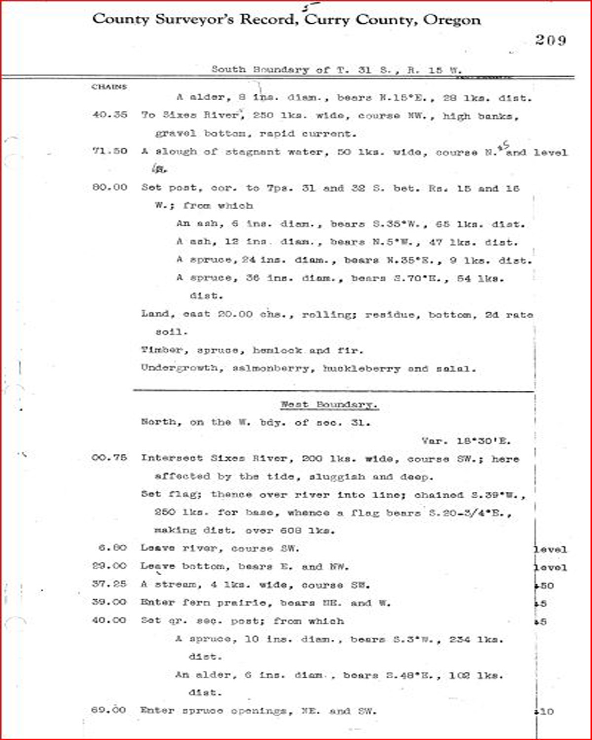
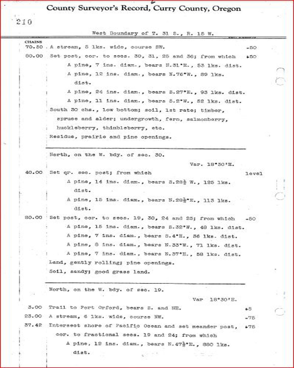
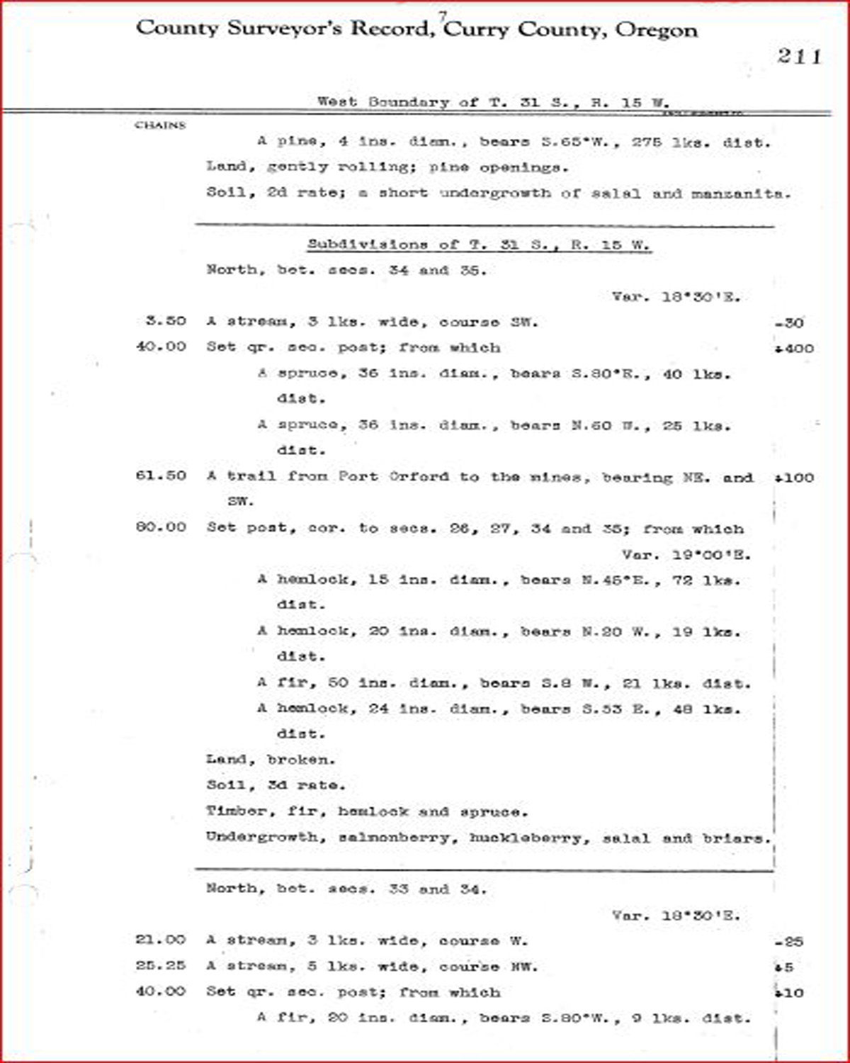
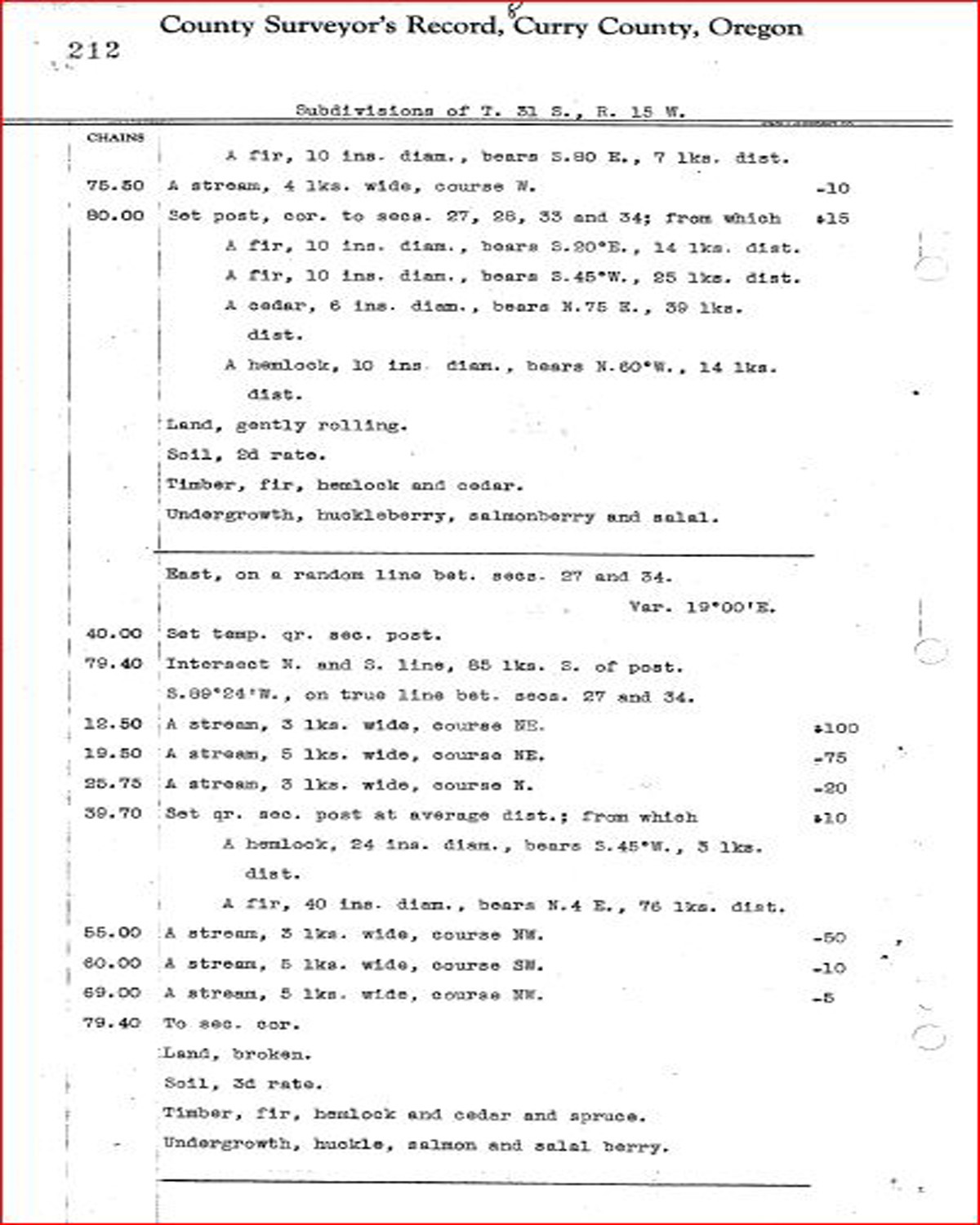
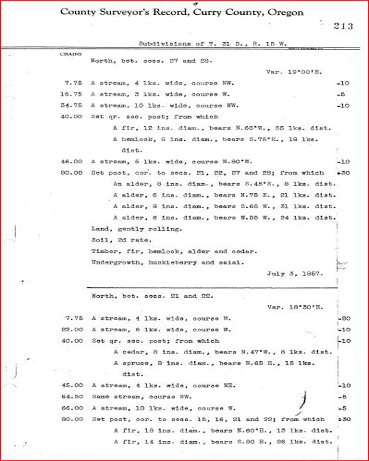
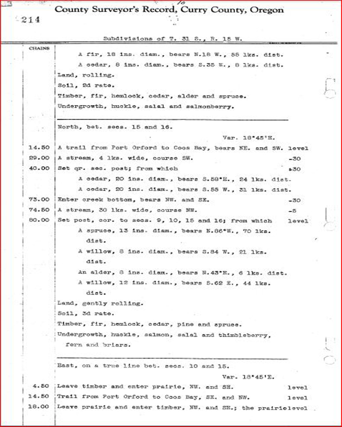
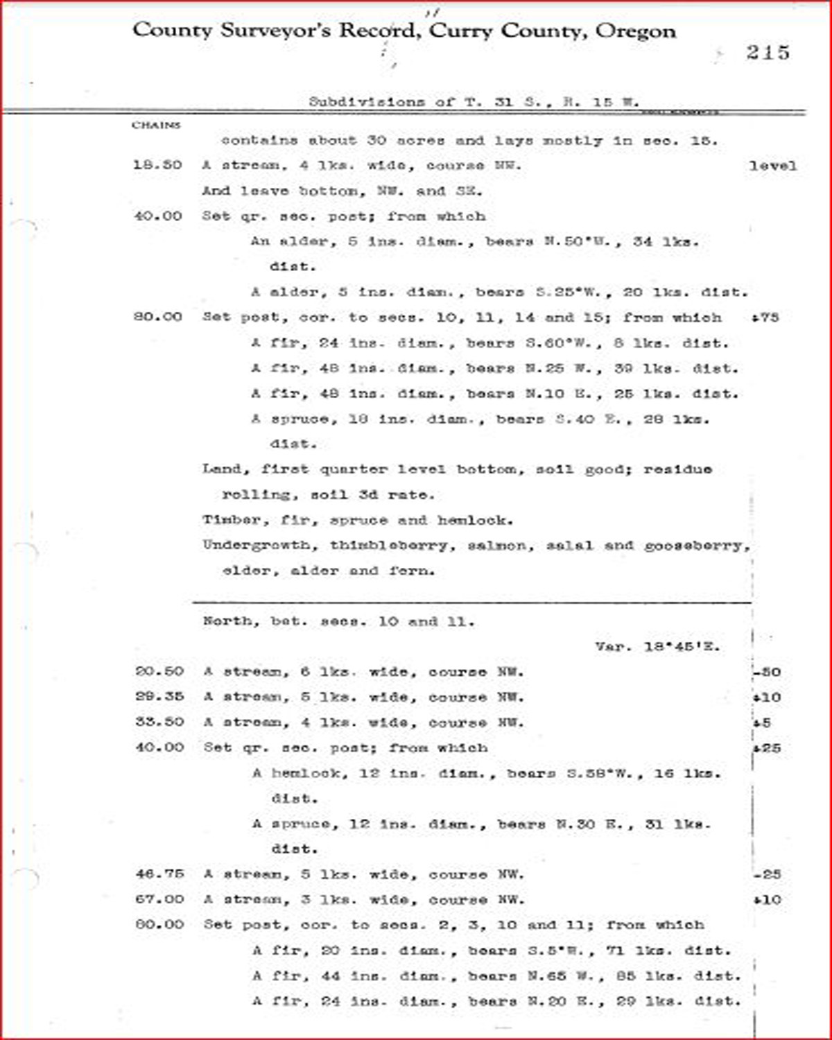
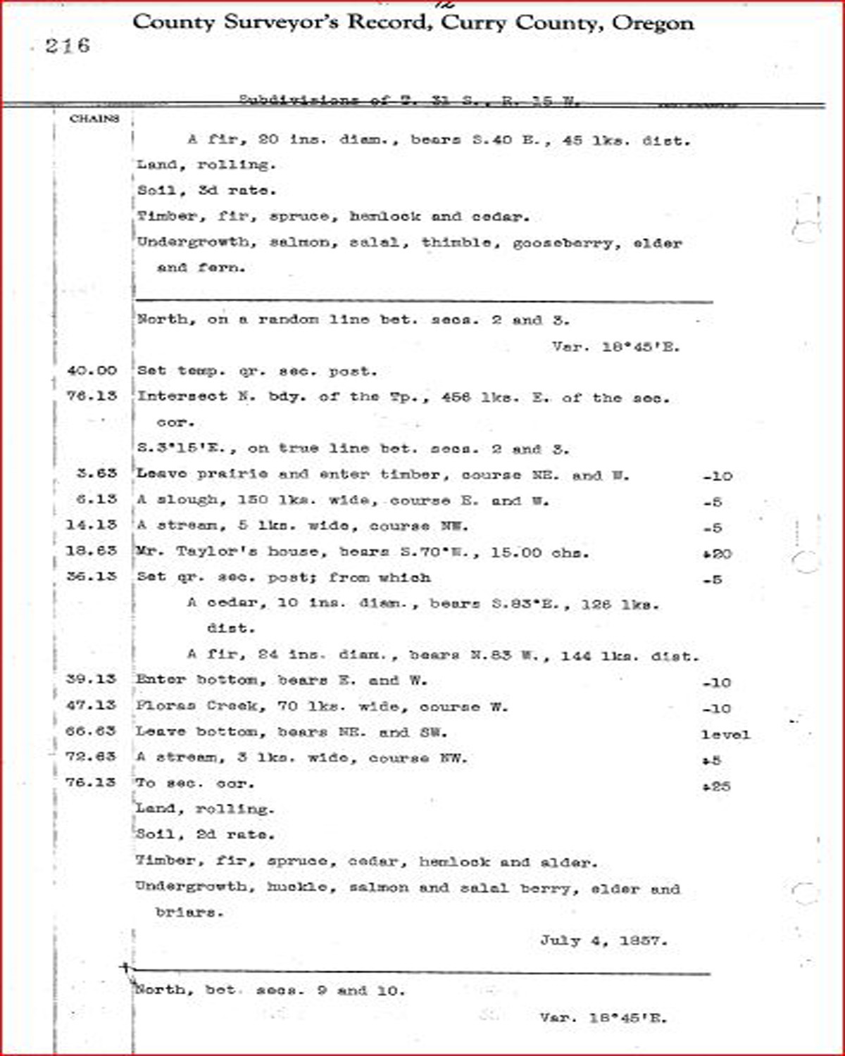
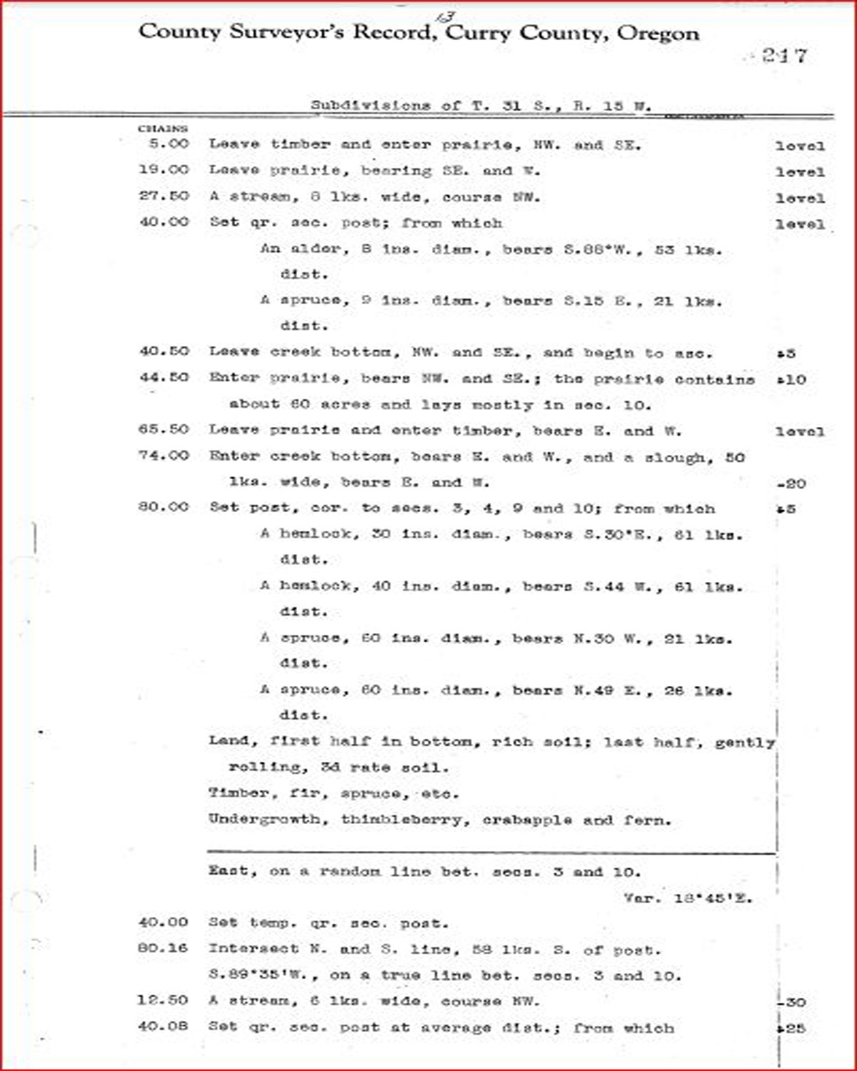
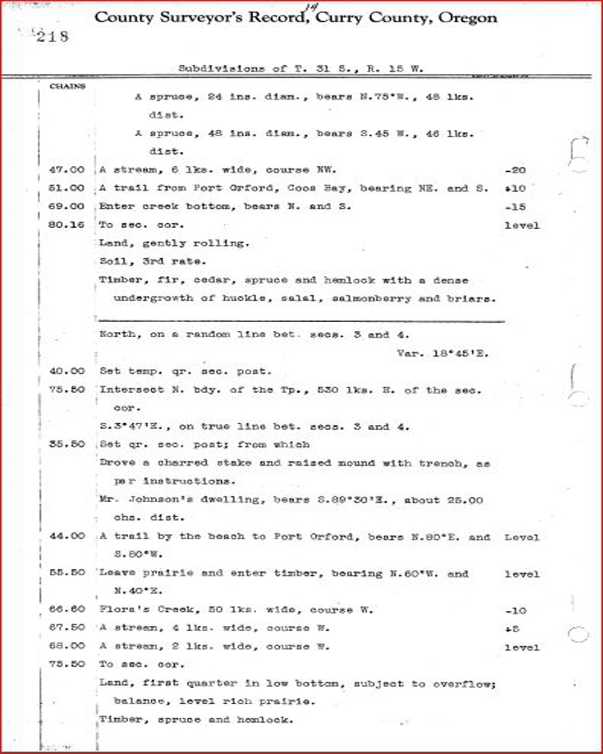
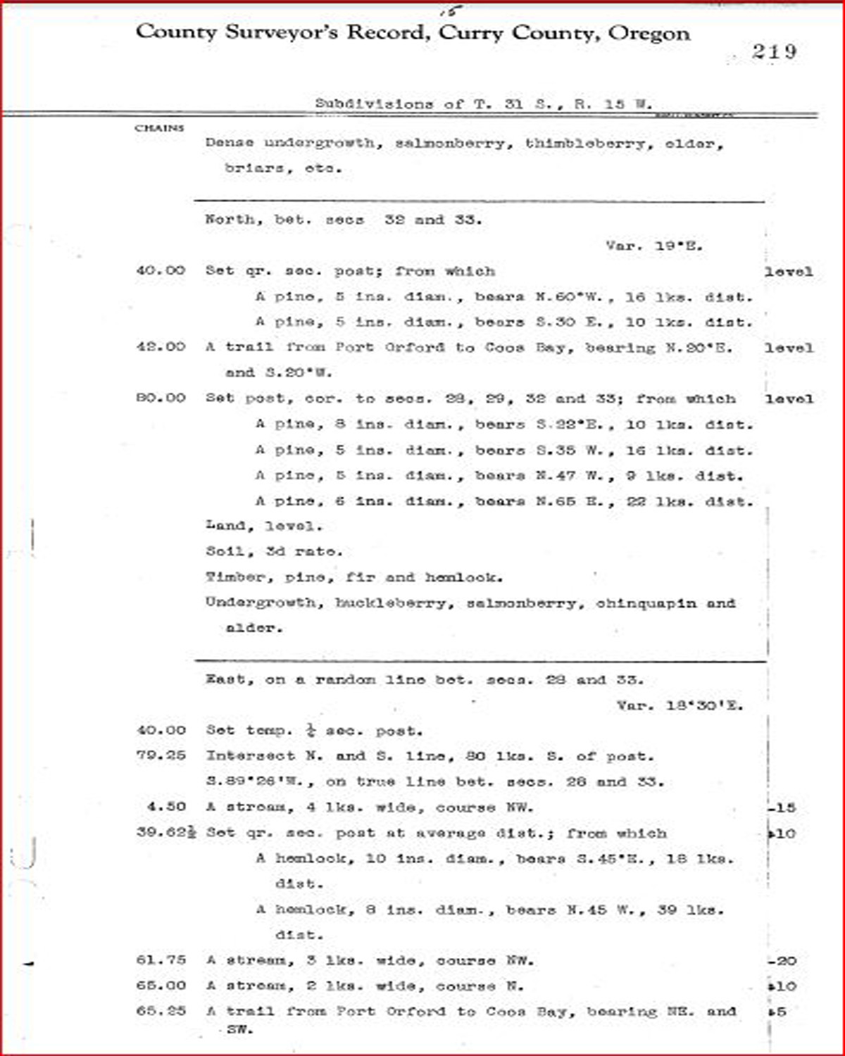
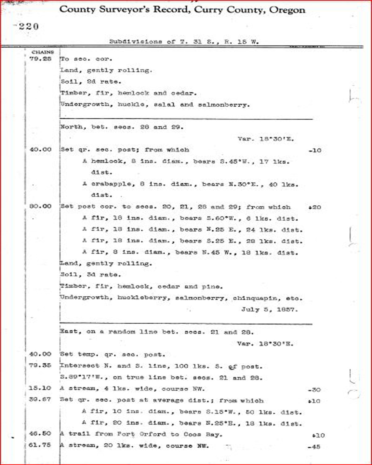
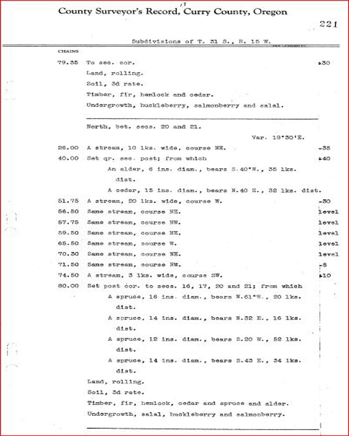
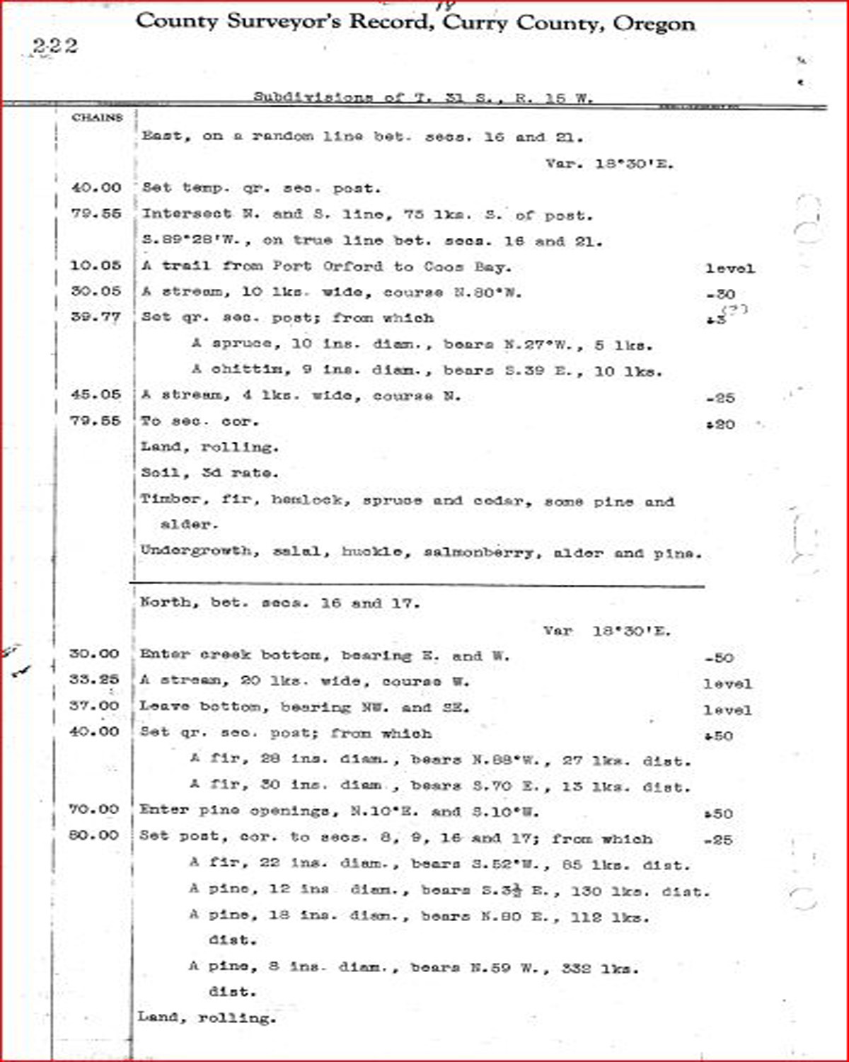
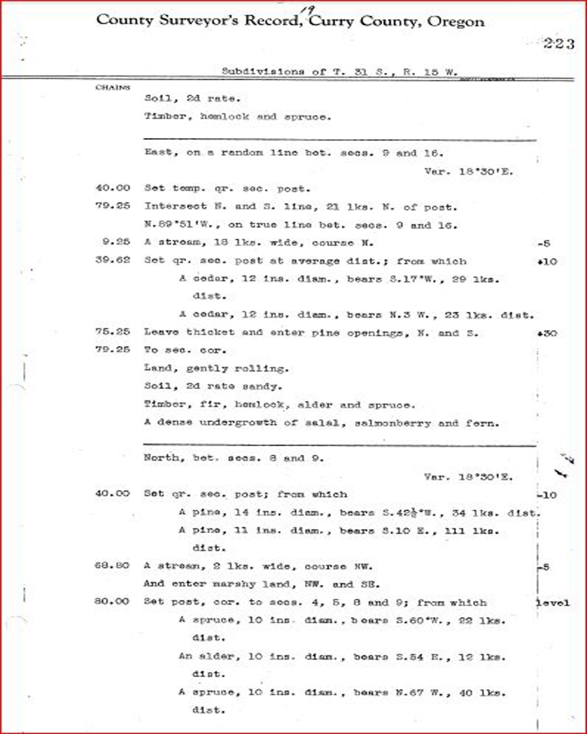
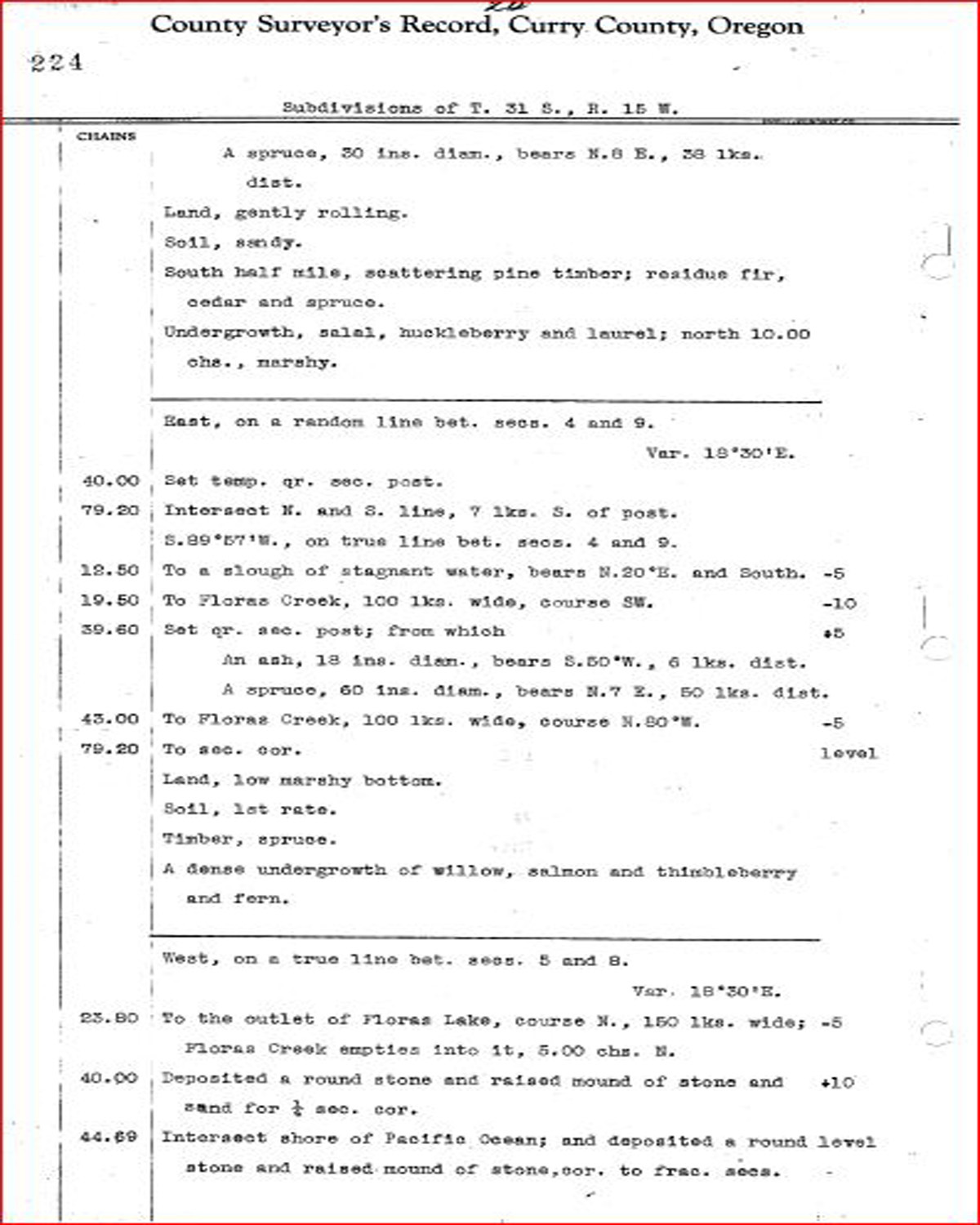
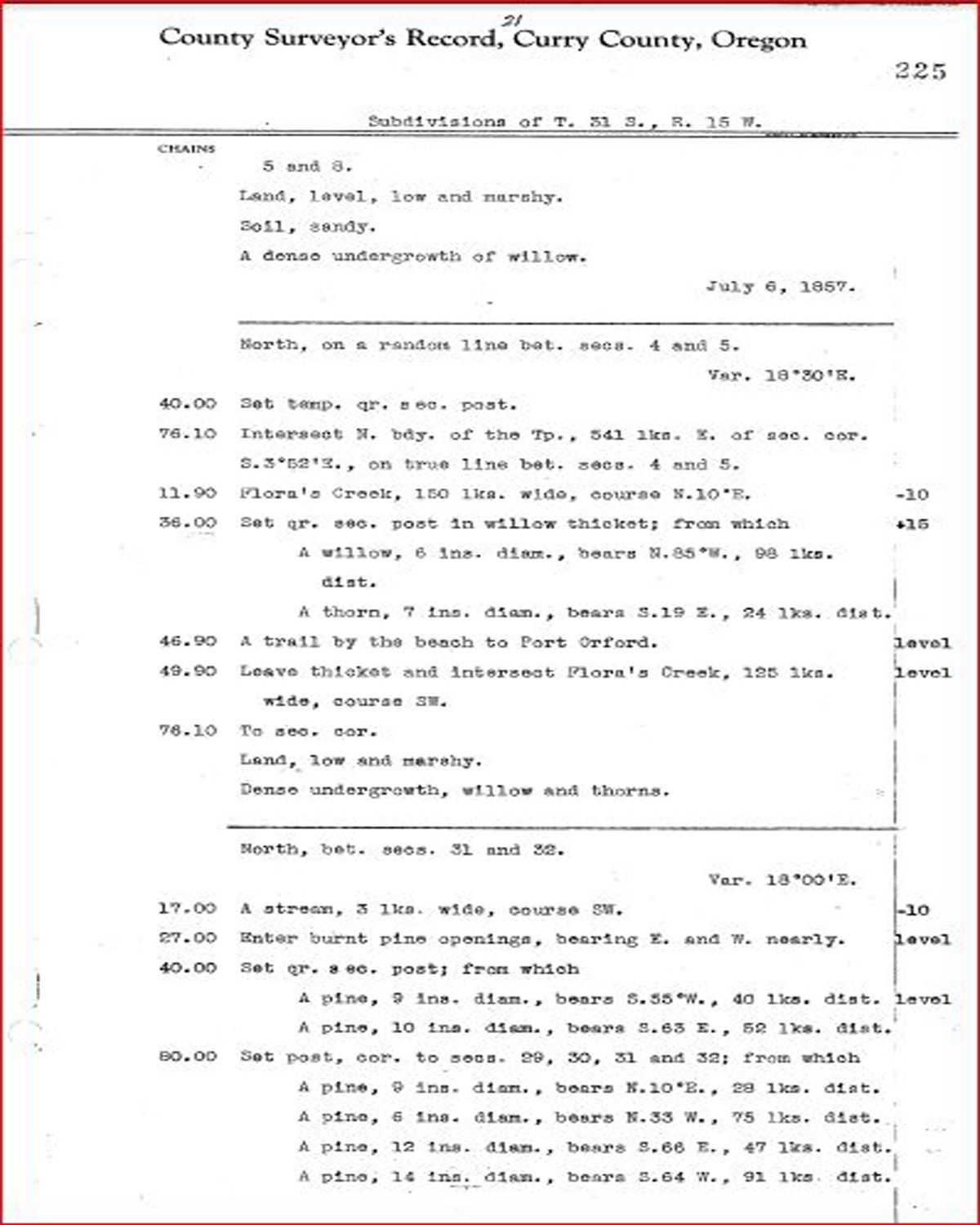
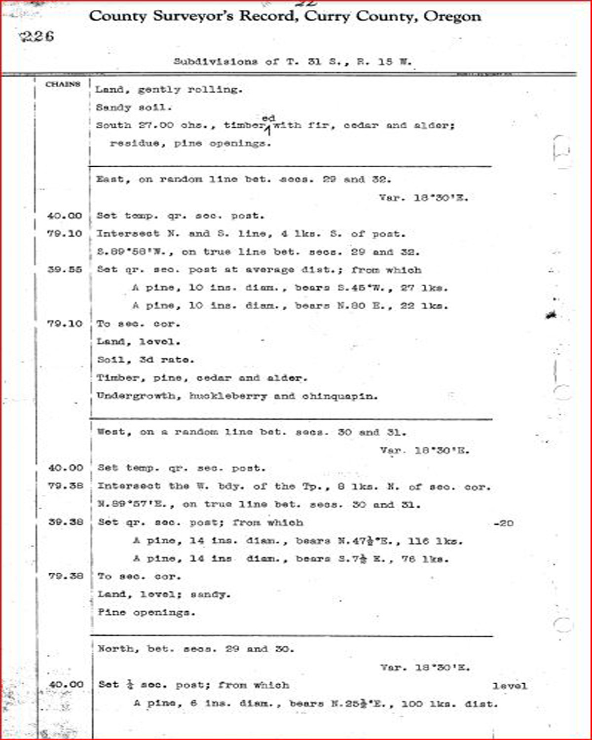
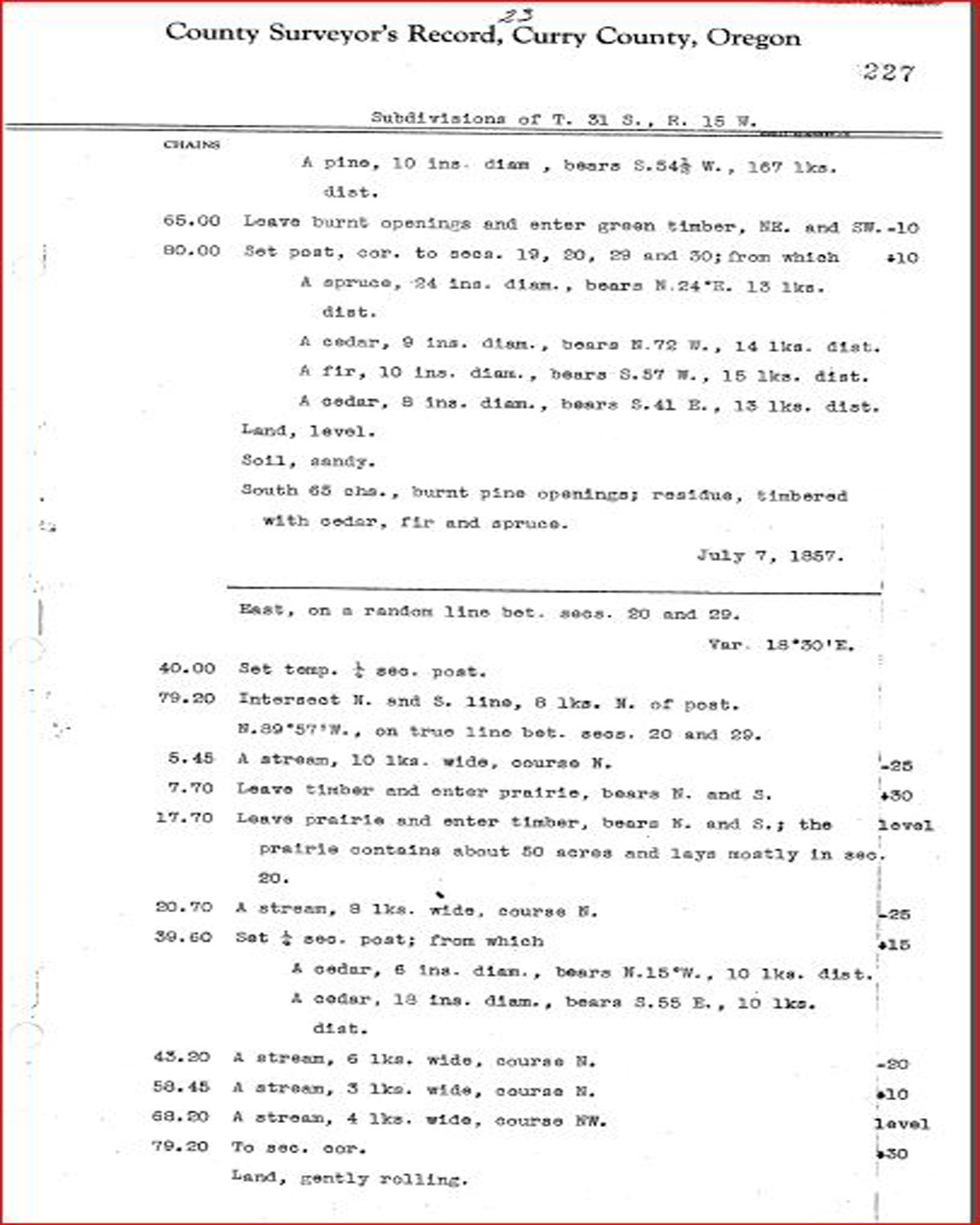
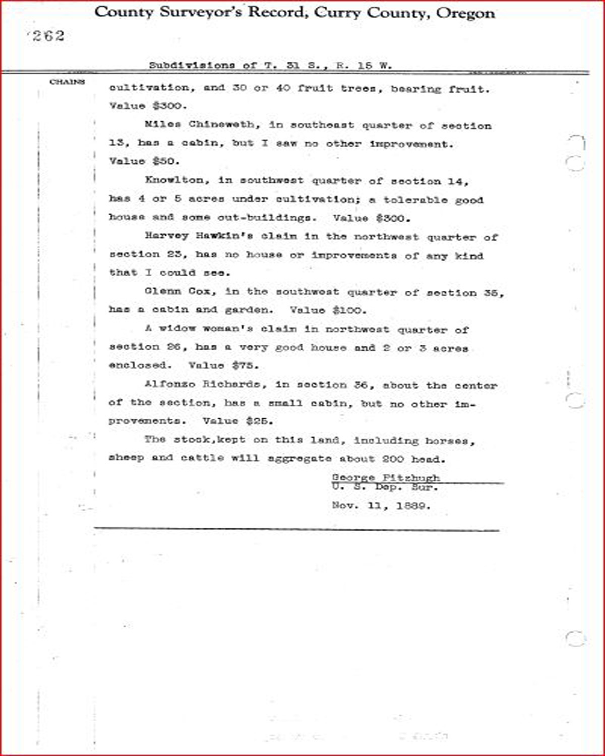
This township is entirely within the boundaries of the 2011-2012 Coquelle Trails Project. It includes Madden Butte and Crystal Creek and Sixes River in the Port Orford Historical District. This survey was completed in 1857 and 1878 and mapped in 1857 and 1878 (Murphy & Murphy 1857; Fitzhugh 1878a; Wright 1878).
![]()