2019 SWOCC Elliott State Forest Draft Recreation Plan
PART 3. Elliott State Forest History, Cultural Resources, and Ethnobotany
By Kelsey Morrison, Kainoa Altier, and Sebastian Bartlett
![]()
Fig. 3.1. Gould family at Elkhorn Ranch, 1886. Photographer unknown.
This chapter is based on chapter 4, “Elliott Forest History,” by Cole Smith, Carter Carr, and Maxwell Richcreek (Kronsberg, et al. 2018: 12-14); chapter 6, “Cultural Resources,” by Carr, Richcreek, and Smith (ibid: 21-23); and chapter 11, “Ethnobotany,” by Cody Harkins, Matthew Hofenbredl, and Abigail Richards (ibid: 41-43) in the 2018 Draft Elliott State Forest Recreation Plan.
Elliott State Forest History
In 1930 Oregon established the Elliott State Forest. It was named after Oregon’s first state forester Francis Elliott. There is a total of 93,000 acres, 90% of the Elliott belongs to the Oregon Common School Fund. It is managed by the Oregon Department of Forestry (J. Phillips: 1998).
The most comprehensive history of the Elliott is written by Jerry Phillips (ibid: 1998) This history was summarized by Cole Smith et al. (Kronsberg, et al. 2018: 12-14). The following timeline summarizes that history.
1850 Precontact- The forest was used by Native Americans before early settlers arrived. The land was used for the survival of several Pacific Northwest tribes such as the Coos, Lower Umpqua, and Siuslaw. All of these groups utilized the Elliott’s natural resources (P. Phillips 2016: 1-126).
1850-1930- The 1st settlement in 1850 was at Mill Creek. Nine years after becoming a state, Oregon experienced a severe fire that that burned 300,000 acres in 1868. Most of the Elliott was burned. In 1914 a fire watch tower was built on Deans Mountain (J. Phillips 1998: 1-15).
1930-1940- CCC began to build a county road in 1933. A second fire lookout was established in 1935. The Bureau of Land Management deeded land, previously part of the Siuslaw forest, to the common school fund for the purpose of generating revenue (J. Phillips 1998: 16-36).
1940-1962- Old growth timber sold for the purpose of building roads throughout the Elliott. Timber was inventoried by Jerry Philips (J. Phillips 1998: 138-190).
1962-1992- The Columbus Day storm hit, leading to a need for more road construction in order to harvest windblown trees. The forest was heavily managed for timber harvest, and a period of high revenue (J. Phillips 1998: 138-190).
1992-2018- Legal issue regarding the listing of Spotted owl led to fiscal issues in the forest. Changes in logging operations and accessibility occurred in order to satisfy environmental standards (J. Phillips 1998: 145).
May 2019- A section of the Elliott, previously called the Silver Creek Heritage Grove, is renamed Jerry Philips Reserve, after the man who set that grove aside and worked in the Elliott throughout his life.
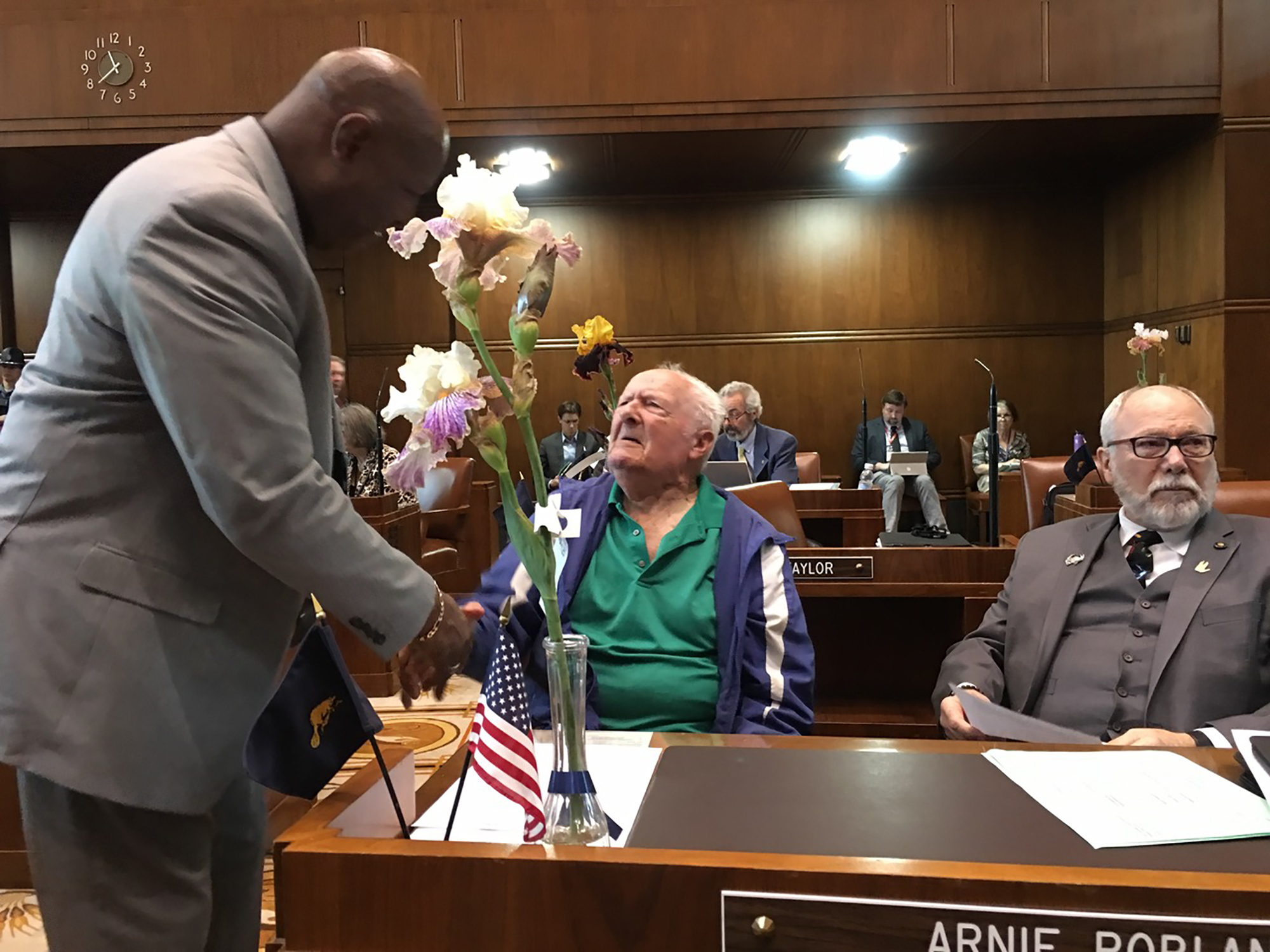
3.2 Third Senate Reading, “Jerry Phillips Reserve,” Salem, May 27, 2019. Jerry Phillips and Bill’s sponsor Arnie Roblan. Photo by Stephen Fitzgerald, OSU Research Forests.
Cultural Resources
Cultural Resources are the locations and artifacts associated with the human activity of the past. Historical resources are typically those of fifty years or older and associated with an important person, event, or historic time period, so far as buildings, structures, cultural landscapes or other identifying characteristics that might exist.

Fig. 3.3. David Gould at Elkhorn Ranch orchard, November 8, 2017. Photo by Bob Zybach.
Within the Elliott State Forest there are such places as: Cougar Pass Lookout; springs where Native Americans camped; CCC roads and trails along with the Elk Horn Ranch; the apple patch planted by the Gould family; and Himalayan Blackberry patches planted by the Native Americans (J. Phillips 1998: 372-395).
Current use on Elliott
The fish hatchery is currently being used for educational purposes and to aide in the S.T.E.P program. There is a hiking trail to the Cougar Pass lookout tower. Hiking and hunting do take place in the Elliott, and berry picking, and mushroom hunting are anticipated in use as well.
The first Cougar Pass lookout tower built was in 1935 and can be accessed by a hiking trail. Today the sixty-foot tower still stands. It is not clear how many users currently frequent the pass (Kronsberg, et al. 2018: 21-23).
Potential for School Trust advantage
By charging for an Access Permit to enter the Elliot State Forest Recreation area we could generate revenue to support the forest. A part of Oregon’s history could be visited in the Elliott State Forest and see the locations as stated above. A lot of people like to experience visiting an area where previous generations have lived. (Based on the chapters done by Carter Carr) (Kronsberg, et at. 2018:21-23).
Ethnobotany
Ethnobotany is the documentation of the use of plants by those closely related native tribes, whose culture are distinct from those of other areas with a focus on native plants and their traditional cultural uses (Summary from readings by P. Phillips 2016).
 |
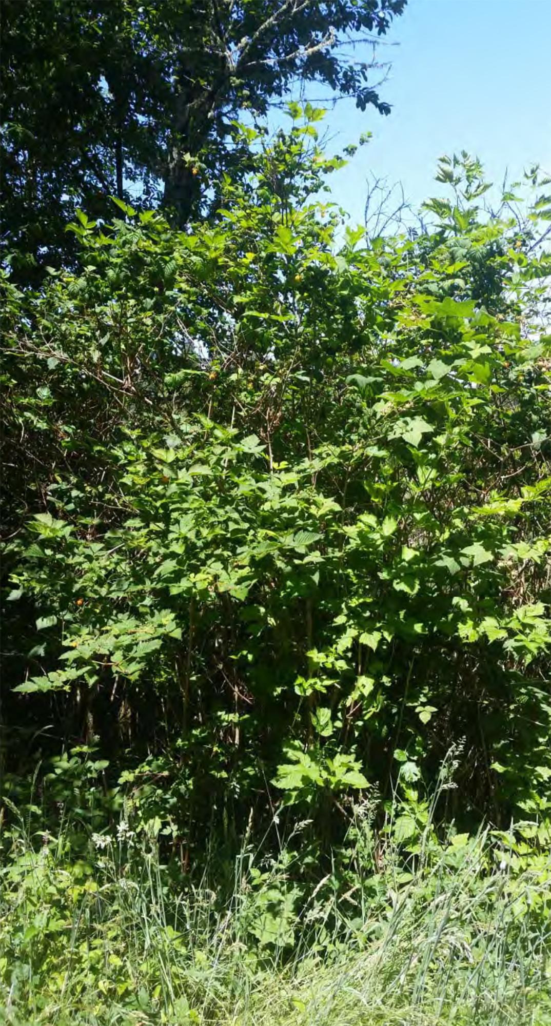 |
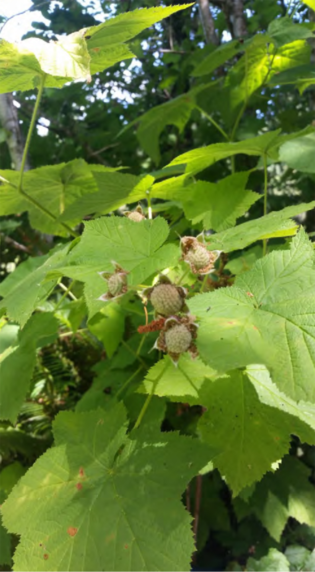
| Fig. 3.4. Thimbleberry, Coos River, June 20, 2019. Photo by Jolene Bartlett. | Fig. 3.5. Salmonberry, Coos River, June 20, 2019. Photo by Jolene Bartlett. |
The following list is generated from the book written by Patty Phillips 2016, “Ethnobotany of the Coos, Lower Umpqua and Siuslaw Indians.”
Fuel/Fiber
Myrtle Wood (Umbellularia californica): Nuts, teas, wood working (Phillips 2016: ibid:42)
Redcedar (Thuja Plicata): Fuel, building, carving, basket weaving (Phillips 2016:31)
Douglas-fir (Pseudotsuga menziesii): Fuel, building carving, tea (Phillips 2016:37)
Hazel (Corylus cornuta var. californica): Basket weaving, nuts (Phillips 2016:55)
Iris (Iris douglasiana): “Flag”/Oregon Iris (Phillips 2016:88)
Food/Medicine
Miners lettuce (Claytonia perfoliate): Food and medicine (Phillips 2016:90)
Gooseberry (Ribes divaricatum, R. menziesii) (Phillips 2016:54)
Salmonberry (Rubus spectabilis) (Phillips 2016:65)
Blueberry (Vaccinium uliginosum) (Phillips 2016:51)
Trailing Blackberry (Rubus Ursinus) (Phillips 2016:51)
Mushrooms/Shelf Fungi (Basidiomycota) (Phillips 2016:113)
Elderberry (Sambucus racemose var. arborescens) (Phillips 2016:52)
Huckleberry (Vaccinium ovatum) (Phillips 2016:56)
The price for a pound of berries varies on the variety. The Gooseberry sells for an average of $15 dollars a pound. Huckleberries can be sold of an average of $12.50 per pound. Himalayan Blackberries can be sold for $4 to $8 a pound. Blueberries average $2 a pound. Mushroom varieties can be sold for $4 to $15 dollars a pound. These prices are based on Northwest Wild Foods, WA and the USDA site of Economic Research. 2018.
Coast Range Forest Watch holds an annual Mushroom Hike during the month of November. Last year was their 6th year.
Potential for School Trust advantage
According to Harkins a substantial amount of profit could be generated by issuing permits, for commercial berry and mushroom harvesting. This could be feasible if the landowner of the Elliott contacted The Forest Watch, local tribes and the Department of State Lands to issue the permits and enforce harvesting practices. Currently the ownership of the land and funding to the common school fund is in influx (Kronsberg, et al. 2018: ibid 3-6).
Barriers to development
The main factors in considering development is that the roads are unmarked, and one can get lost very easily. There are areas where the roads are a bit dangerous due to being located on a steep hill with the drop off very unforgiving. Most roads are primitive and would not be easily navigated by car. To learn more about barriers, see chapter one by Tara Boyd from last year’s report (Kronsberg, et al. 2018: ibid 3-6).
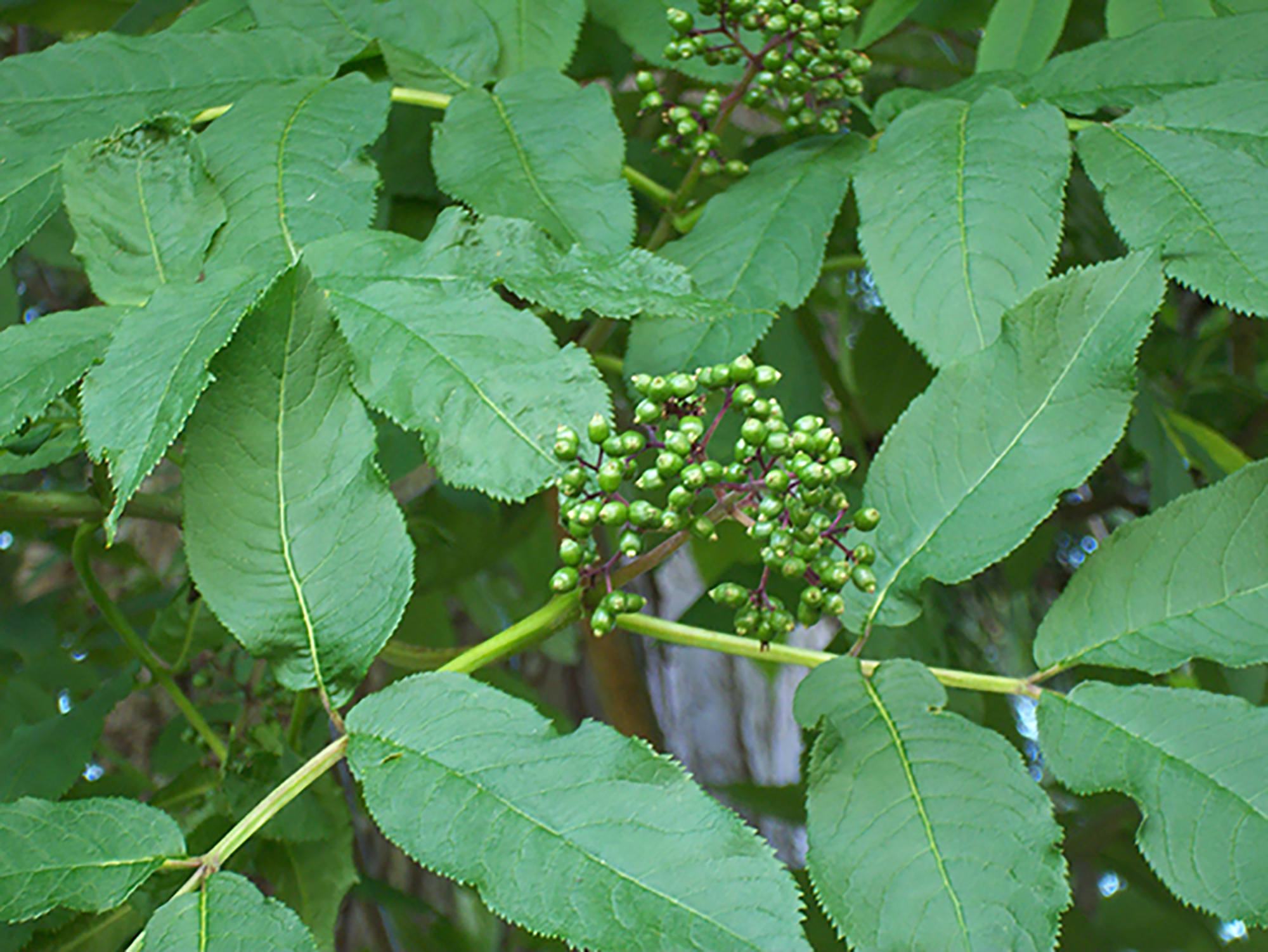
Fig. 3.6. Elderberry, Elliott State Forest, ca. 2017. Photo by Sebastian Bartlett.
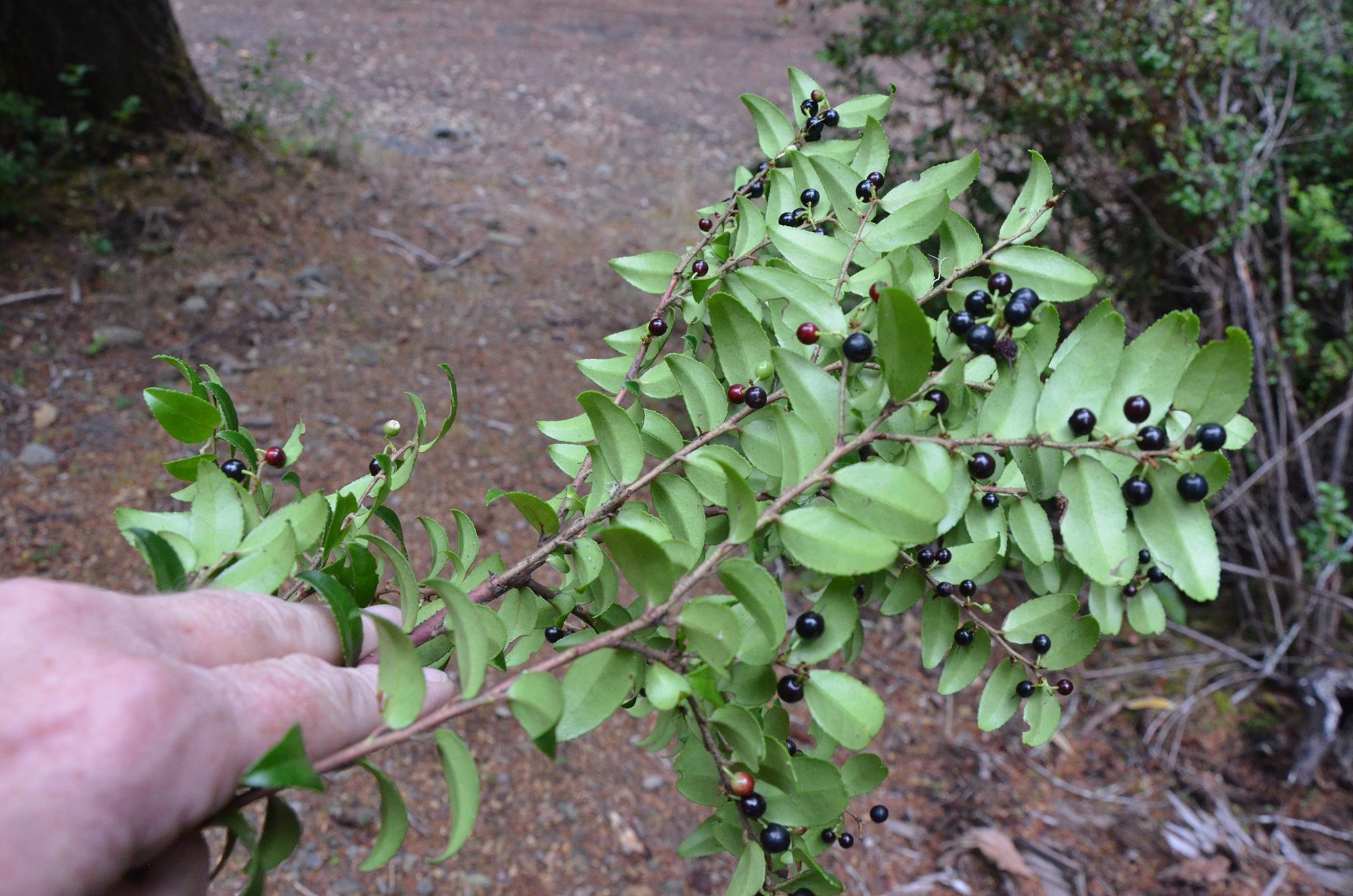
Fig. 3.7. Ripe Huckleberries, Huckleberry Point, October 10, 2017. Photo by Bob Zybach.
It is my recommendation that directional signs be placed within the forest for better navigation in the Elliott. I recommend having interpretive signs that state which berries are available for harvest. I also would create a brochure to be placed at nearby restaurants and hotels to encourage interest. I feel some brush clearing along some of the roads would be helpful as well due to the roads can be accessed by car, however people may not want brushes scratching their paint.
![]()
© 2017, 2019 Oregon Websites & Watersheds Project, Inc. & NW Maps Co.