Josephine County
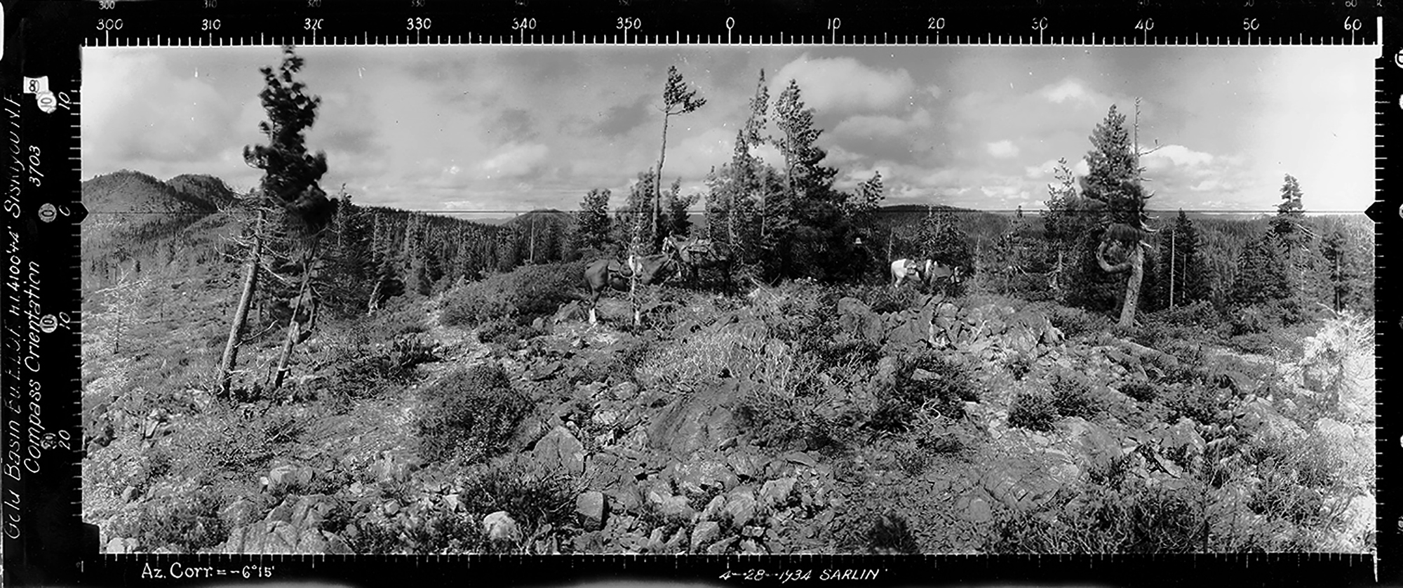
North View, Gold Basin Butte, Joesphine County (Sarlin, April 28, 1934).
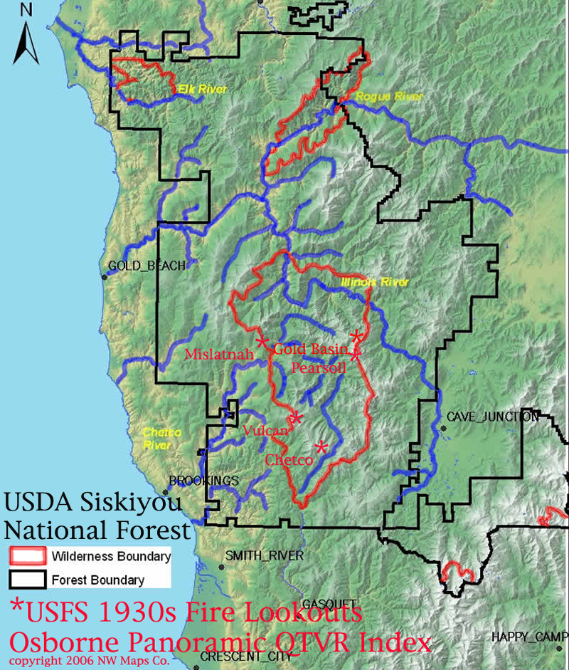
There are currently only two sets of Osbornes available for Josephine County. These were first put online in 2006 on the NW Maps Co. website, along with three sets of Curry County Osbornes. These five lookouts comprised a significant viewpoint, from 1933 to 1937, of the subsequent Kalmiopsis Wilderness, 1987 Silver Complex, 2002 Biscuit, and 2017 Chetco Br Fire landscapes. A primary objective of this project, completed in collaboration with ORWW, was to develop each set of Osbornes into a QTVR file in order to visit the 1930s Chetco River basin terrain in controlled video, with the ability to zoom in on individual features: a virtual and highly accurate time machine controlled by the operator. QTVR was soon replaced with rapidly improving digital video, computer memories, and Internet speed; the technology was abandoned in a few years and the software is no longer functional. The original 2006 Kalmiopsis Wilderness Osbornes website still retains links to the outdated QTVR files, and the quality of the 2020 ORWW Osborne JPEG images is much improved.
| |
|
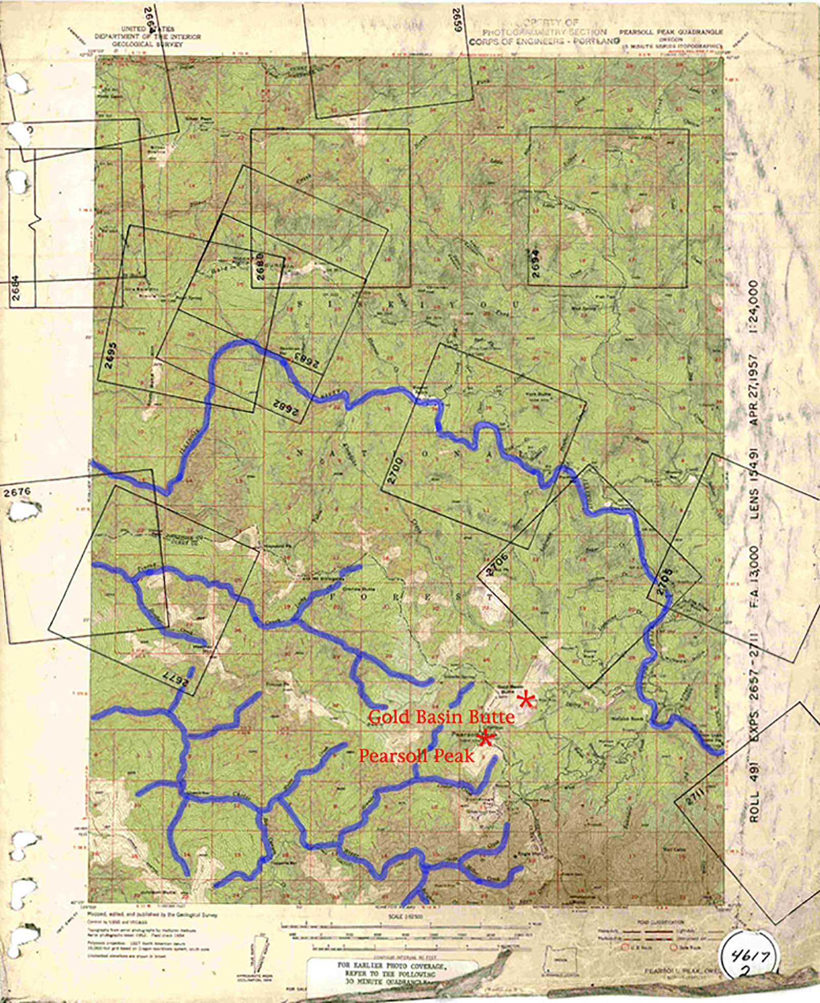
| 1957 USGS Map | 2006 Index Map |
Annotated 1957 USGS Pearsoll Peak Quadrangle Map; NW Maps Co. Fire Lookout Index Map for 2006 Kalmiopsis Wilderness Osbornes QTVR Project. The Wilderness boundary spans Curry and Josephine Counties.
| ICON | LOOKOUT | START | STOP | TSP | RNG | SEC | ELEV. |
|---|---|---|---|---|---|---|---|
 |
Gold Basin Butte | 37 S. | 10 W. | 35 | 4,870 | ||
 |
Pearsoll Peak | 1914 | 38 S. | 10 W. | 2 | 5,091 |
© 2006-2020, Oregon Websites and Watersheds Project, Inc. & NW Maps Co.