Osbornes Panoramic Photographs Index
South Santiam River & Blue River
Headwaters
Santiam Molalla Cultural Landscapes, 1933-1937
Changing Cultural Landscapes, Aerial Photos 1944-1981
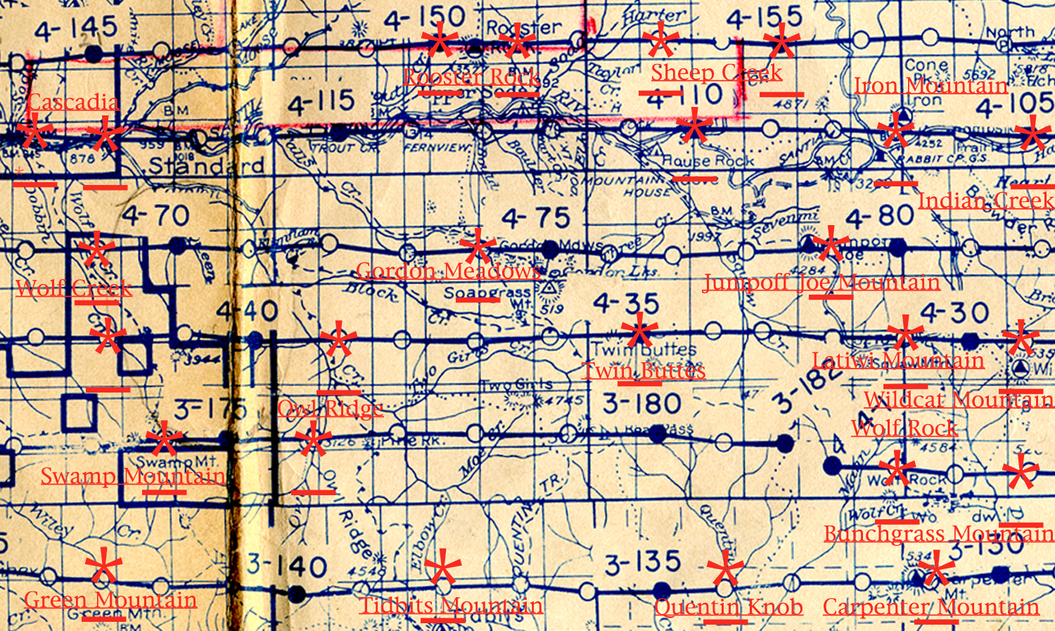
1933-1937 Fire Lookout Index Map
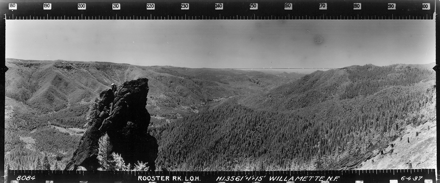
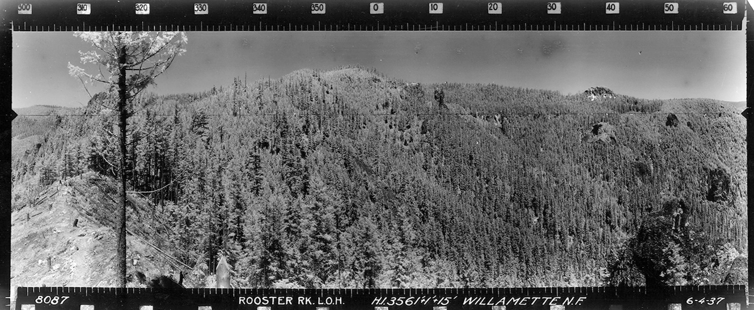
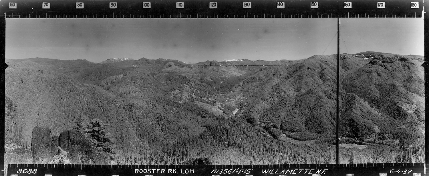
Rooster Rock Unknown Photographer June 4, 1937 |
NW - N - NE 300° - 60° Moose Mountain |
 |
E - SE - S 60° - 180° South Santiam River |
 |
|
SW - W - NW 180° - 300° Bloody Point |
|
![]()
© 2006-2007, 2020 Oregon Websites and Watersheds Project, Inc. & NW Maps Co.