South Umpqua Headwaters Precontact Reference Conditions Study
Historical Aerial Photographs, 1939-1946
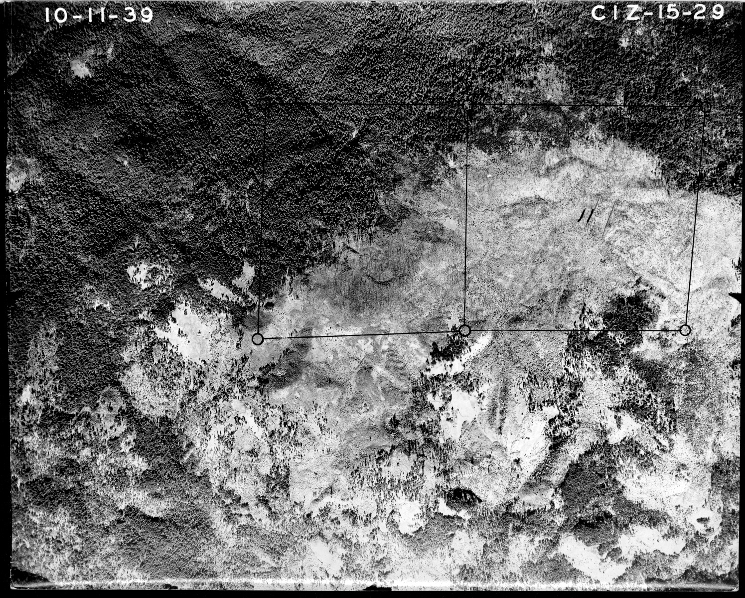
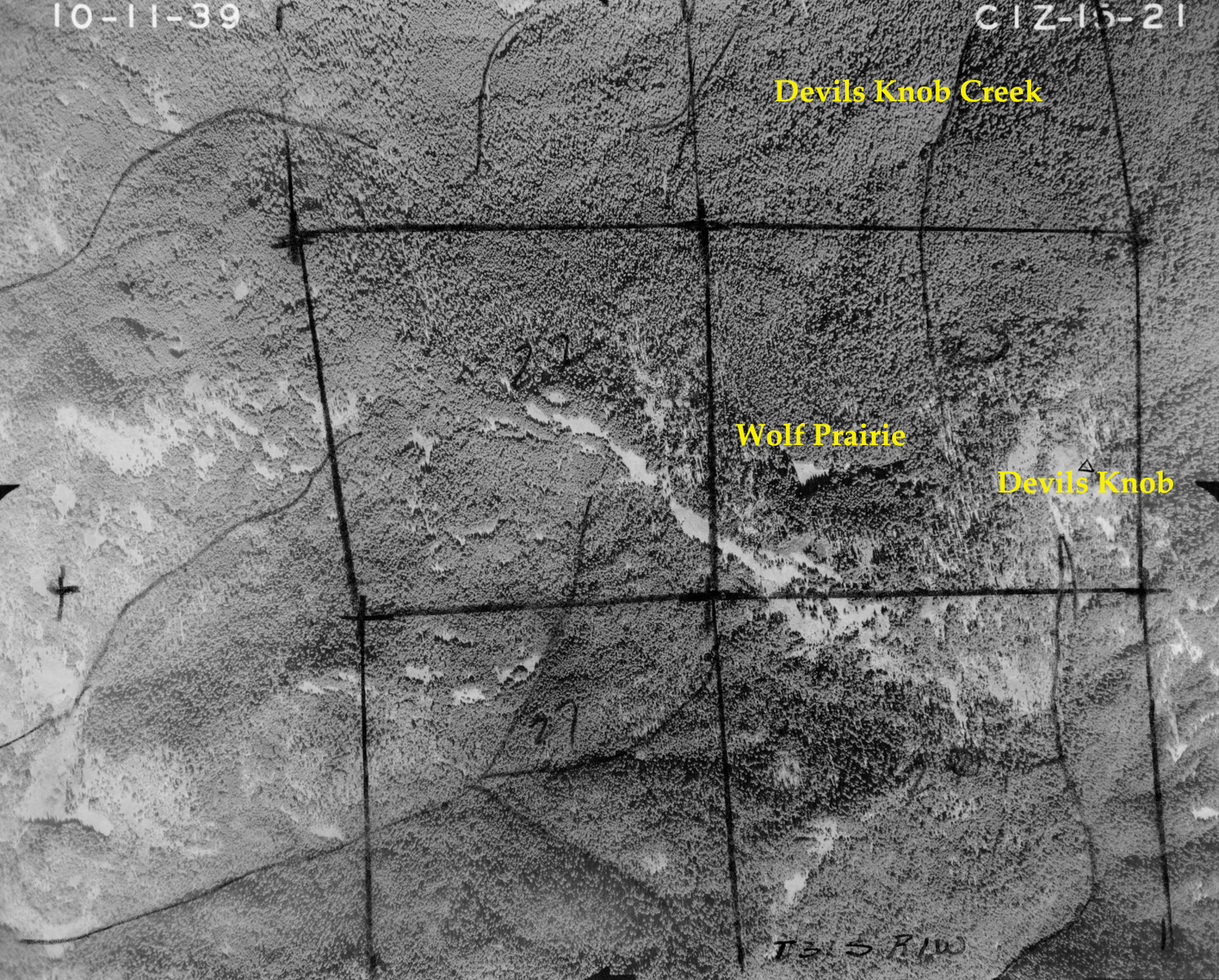
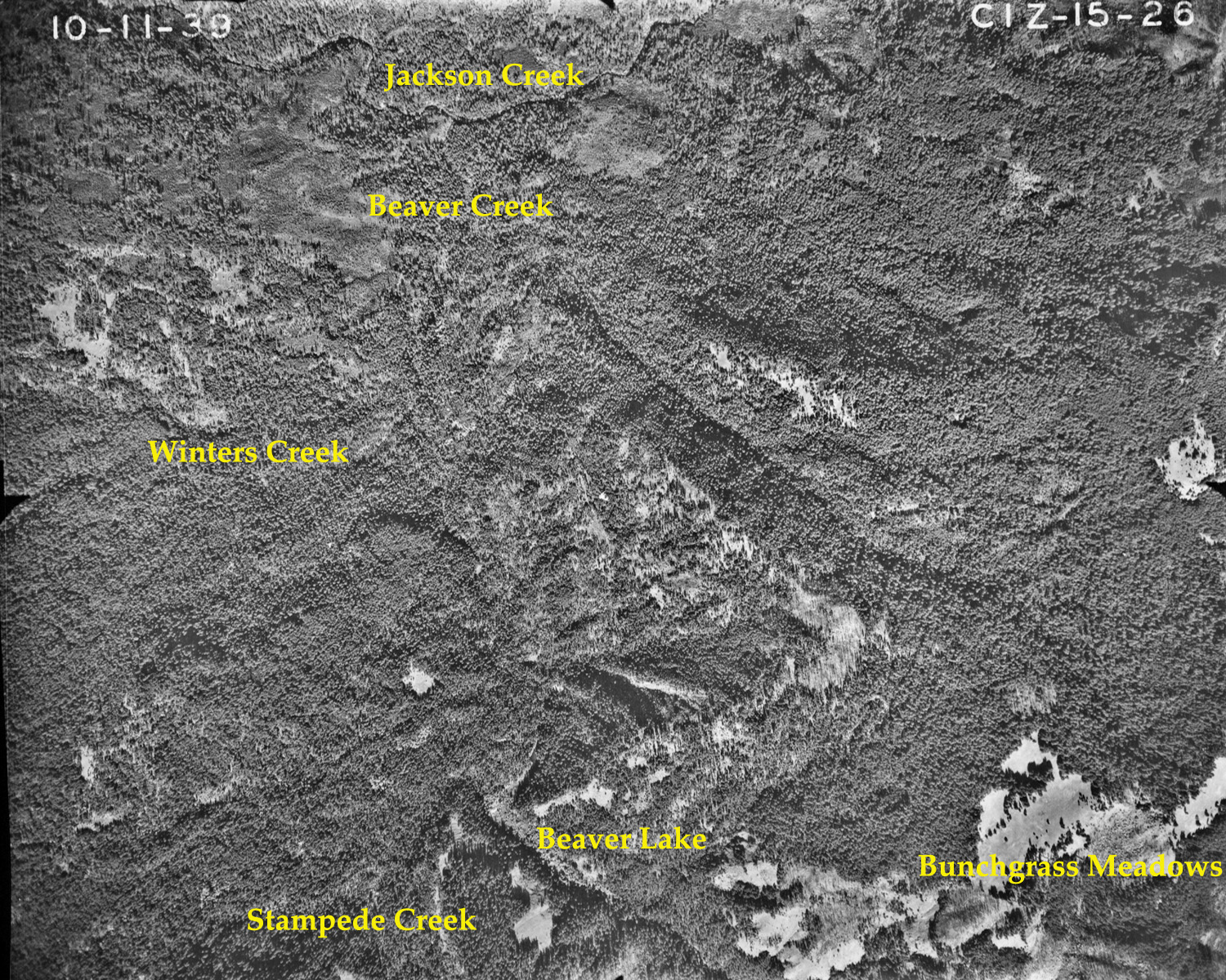
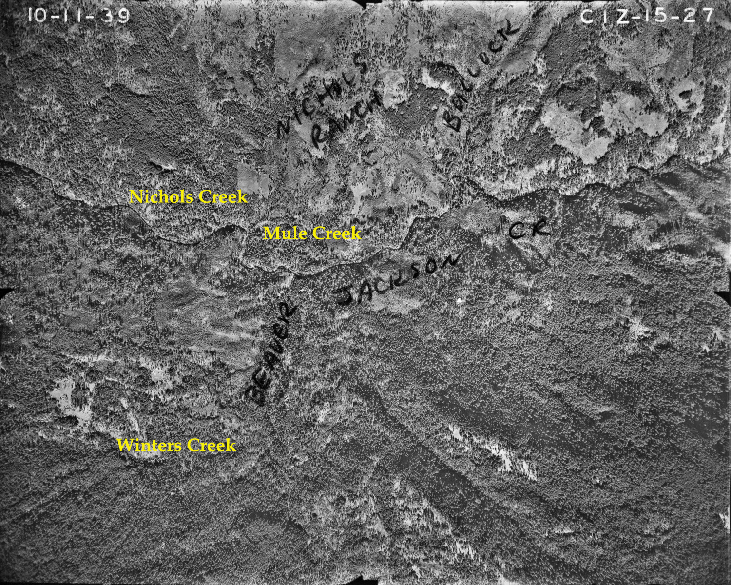
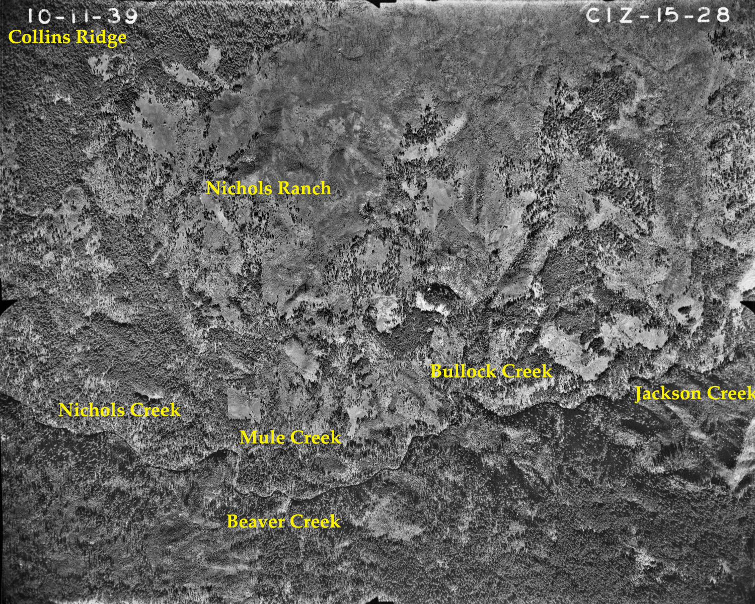
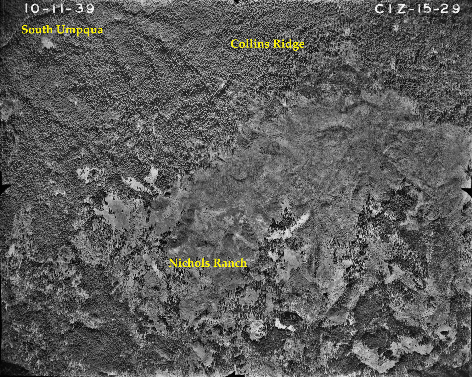
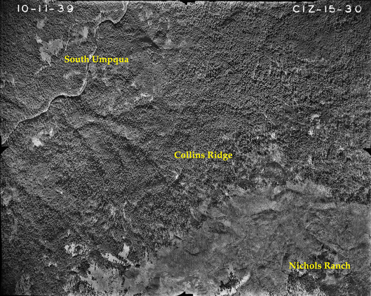
Southern slope of Collins Ridge, Jackson Creek, South Umpqua River, Douglas County, Oregon, October 11, 1939 (courtesy USDA Umpqua National Forest).
The following index of aerial photographs was selected from a collection of more than 240 photographs taken during the course of six flights from September 9, October 10, October 11, and November 16, 1939; July 31 and August 2, 1940; and August 11, 1946. Note that no photographic flights were recorded for the 1941-1945 WW II war years (see Hartley 1993).
These photos are taken from a collection maintained by the USDA Umpqua National Forest and were made possible by permission of the Forest, and particularly through the assistance of Gregory Orton, the Forest's Soil Scientist. The combined 240 photos cover the entire 230,000+ acre study area at a time when logging and road building were just beginning to take place, and shortly after the completion of the General Land Office (GLO) surveys and the compilation of Osborne panoramic photographs from the Forest's fire lookout towers.
The selection of photographs is based on the location of historic fire lookouts for which Osborne panoramas have been located, and of the 25 Areas of Special Interest that were chosen and defined in conjunction with the Upper South Umpqua Headwaters Precontact Reference Conditions study. They have been scanned and annotated with geographical names based on current USGS 7.5 minute topographical maps for locational purposes, and with occasional notes from the GLO surveys to aid in analysis and interpretation.
Note (October 31, 2010): There has been some difficulty with QTVR panoramic files made for this project, in that some browsers or platforms are importing grainy, undersized files that cannot be expanded to fit the screen. This has not been a problem in the past, and we are working to fix the problem at this time.
October 11, 1939 |
||
Annotated |
South to north flight from Devil's Knob to mouth
of Dumont Creek, Douglas County, Oregon. |
 |
 |
||||
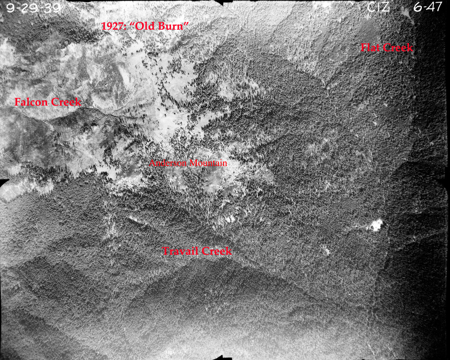
06-47_Anderson_Mountain |
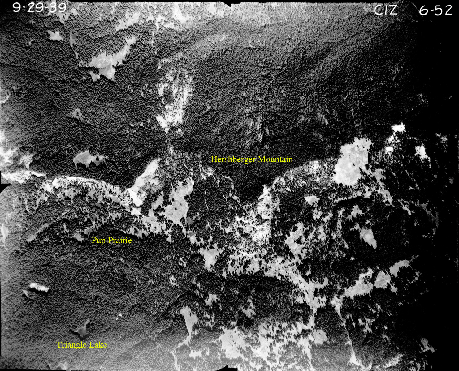
06-52_Hershberger_Mountain |
||||
 |
 |
||||
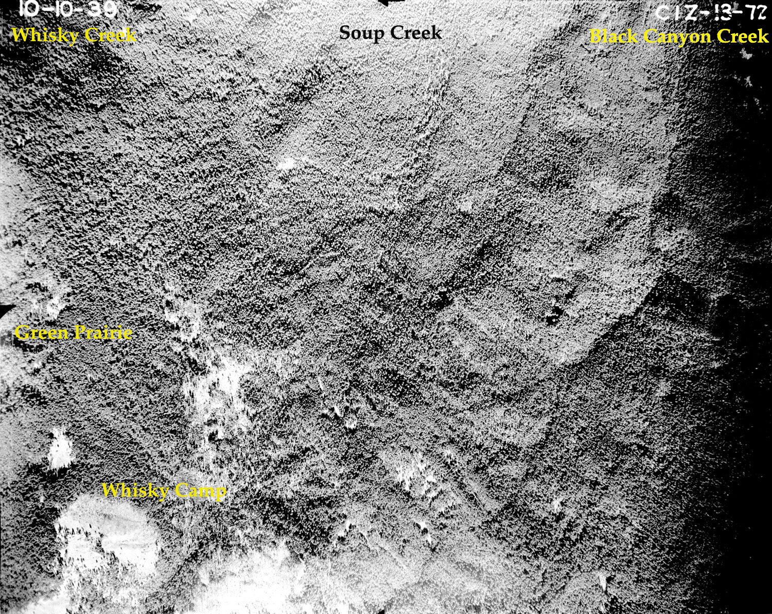
13-72_Whisky_Camp |
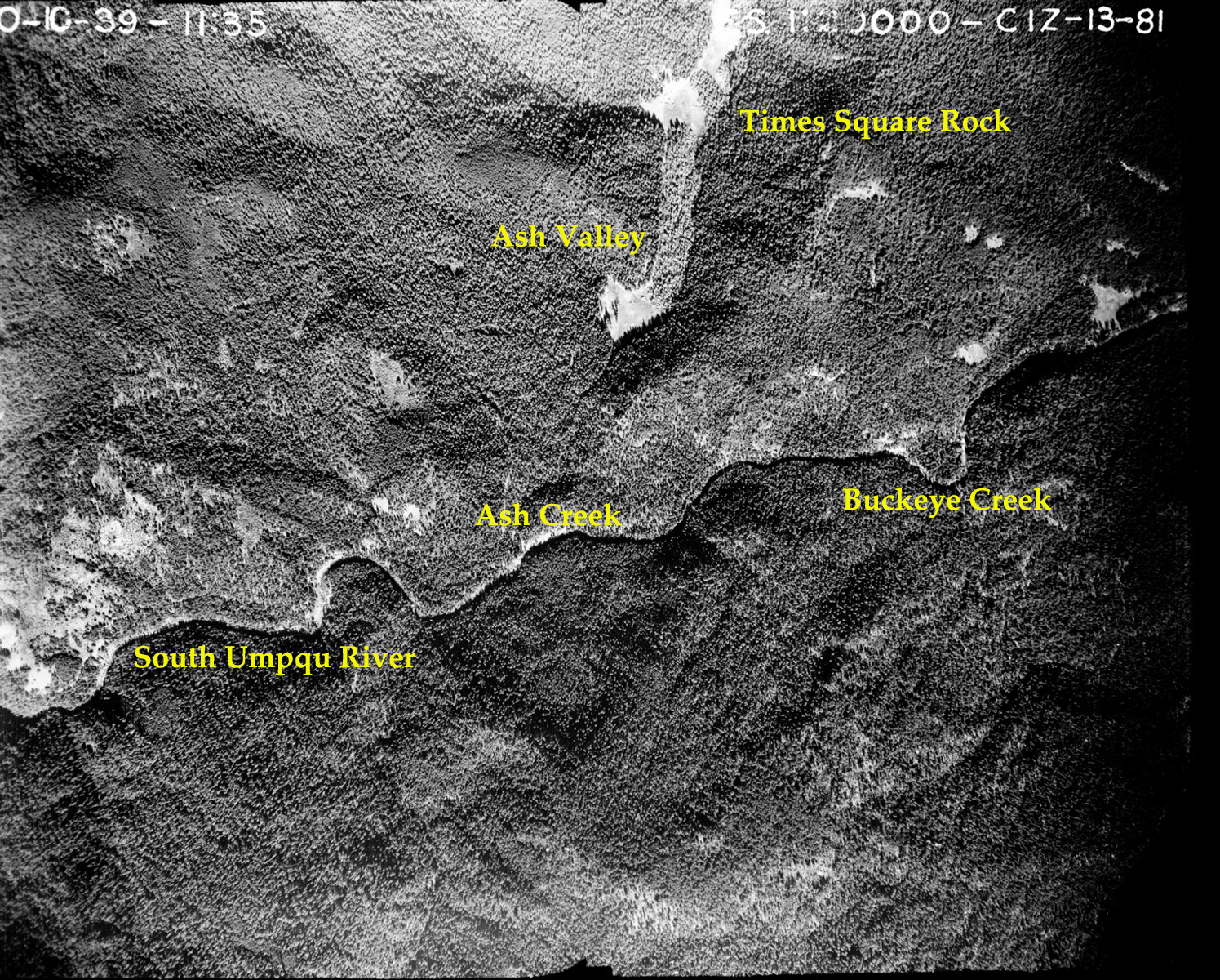
13-81_Ash_Valley |
||||
 |
 |
 |
 |
 |
|
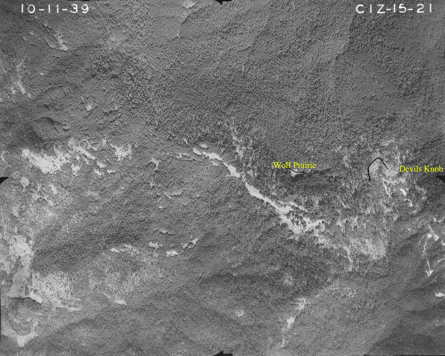
15-21_Devils_Knob |
15-21-1_Devils_Knob |
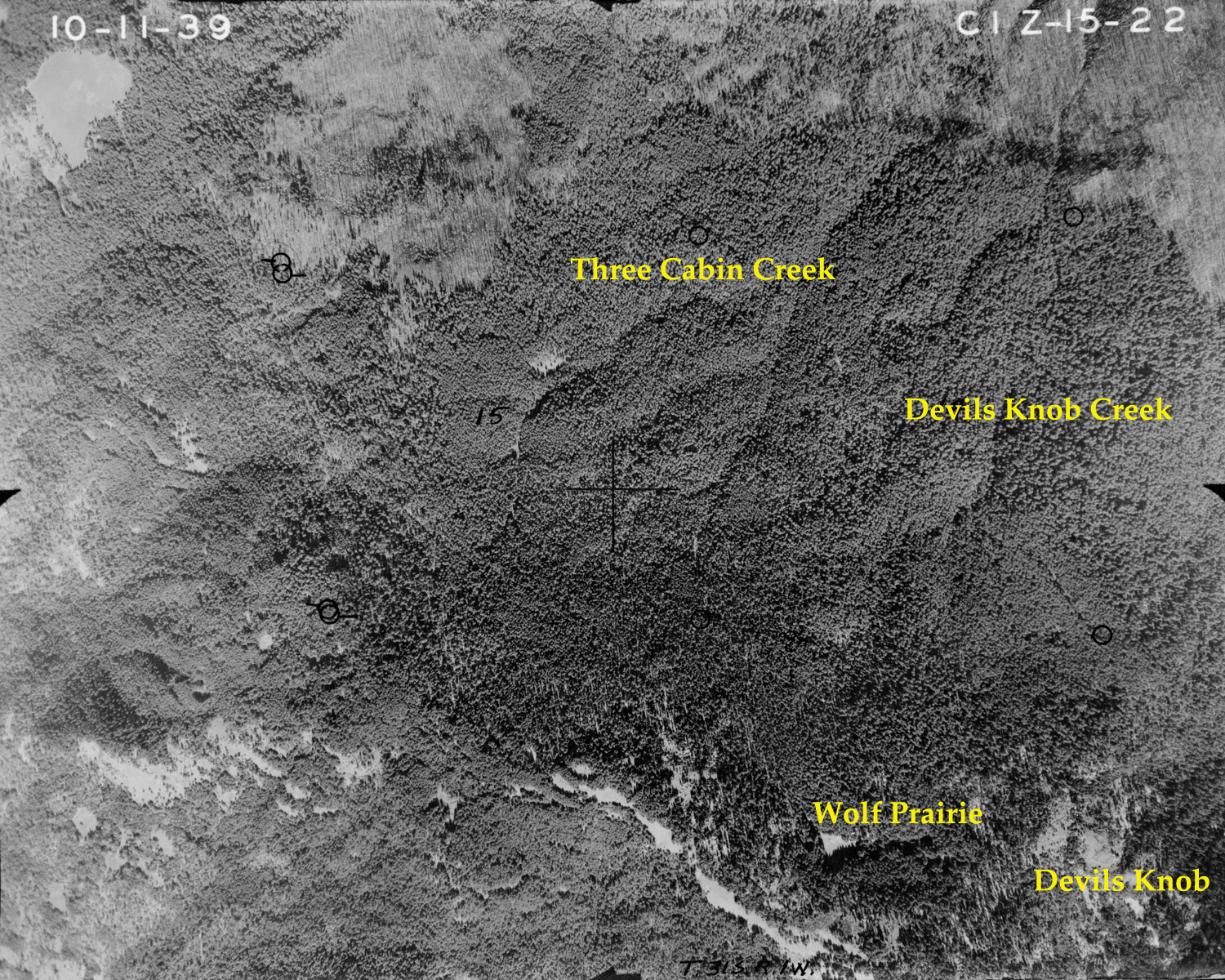
15-22_Devils_Knob |
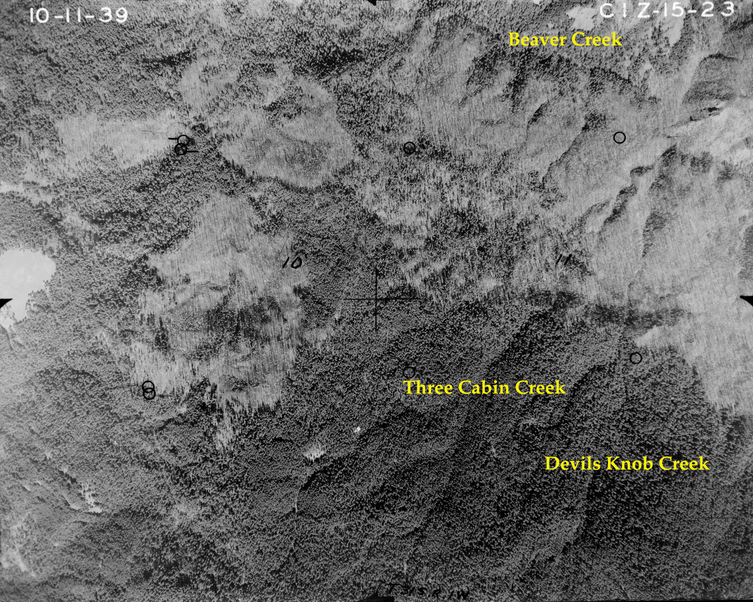
15-23_Three_Cabin_Creek |
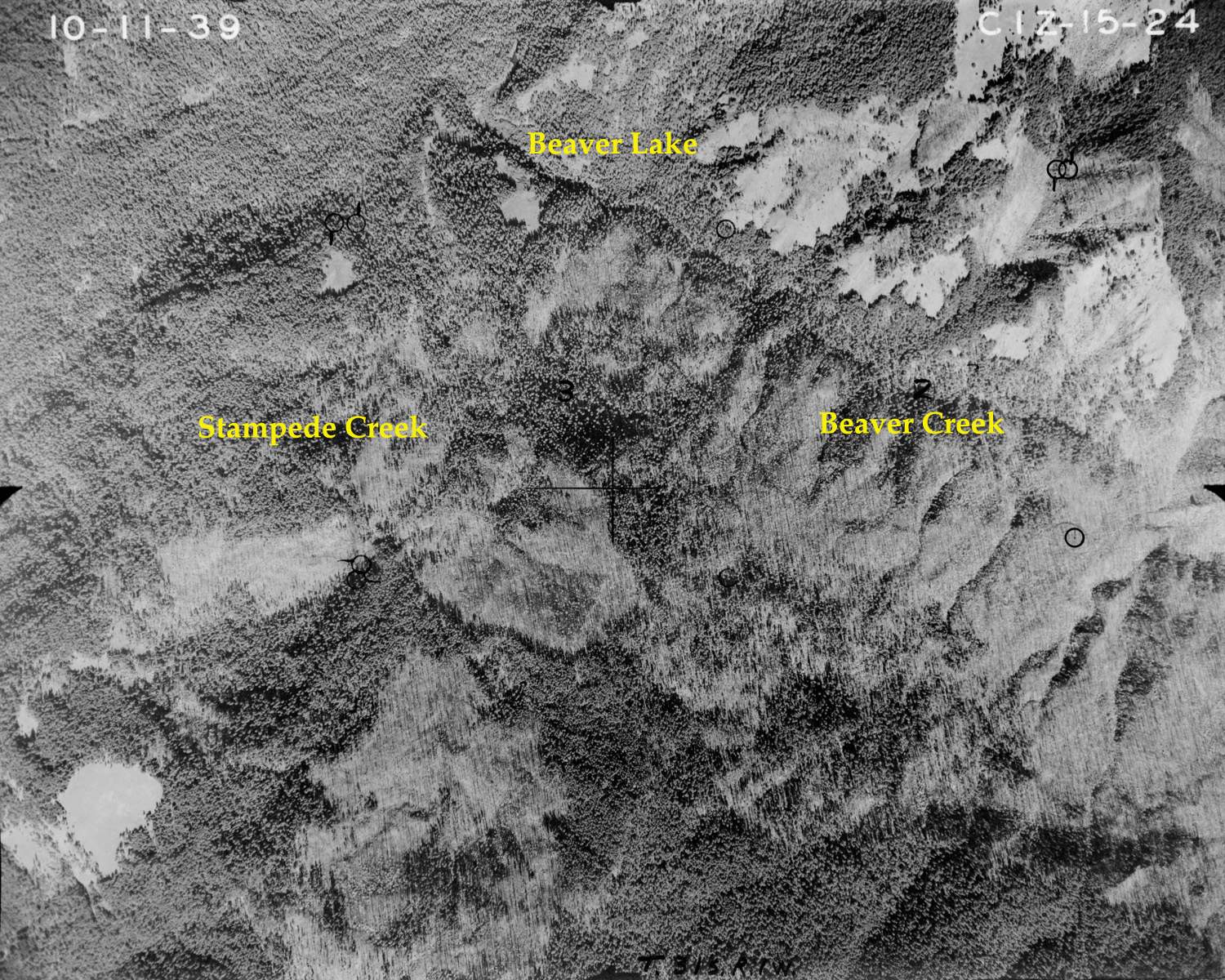
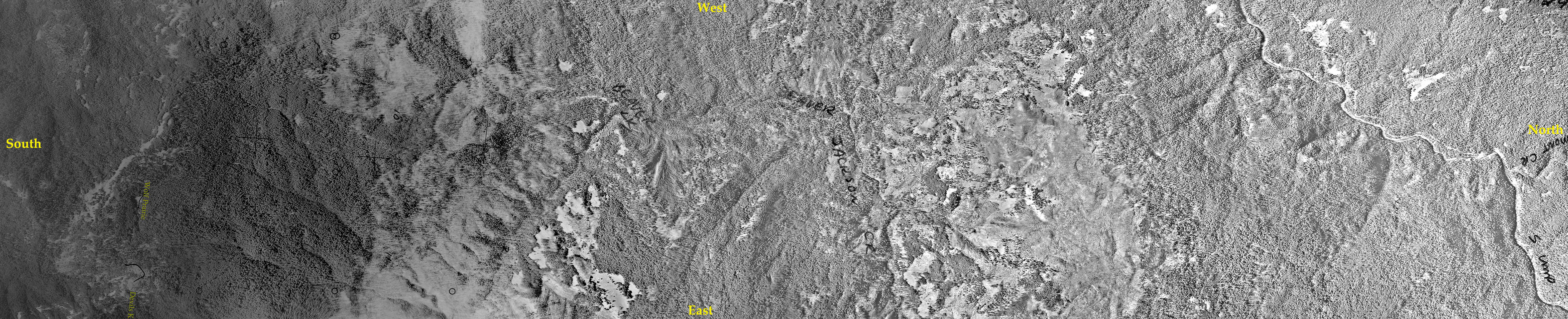
15-24_Beaver_Creek |
|
 |
 |
 |
 |
 |
|
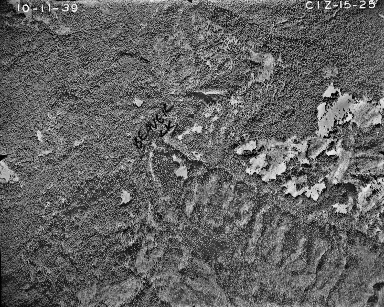
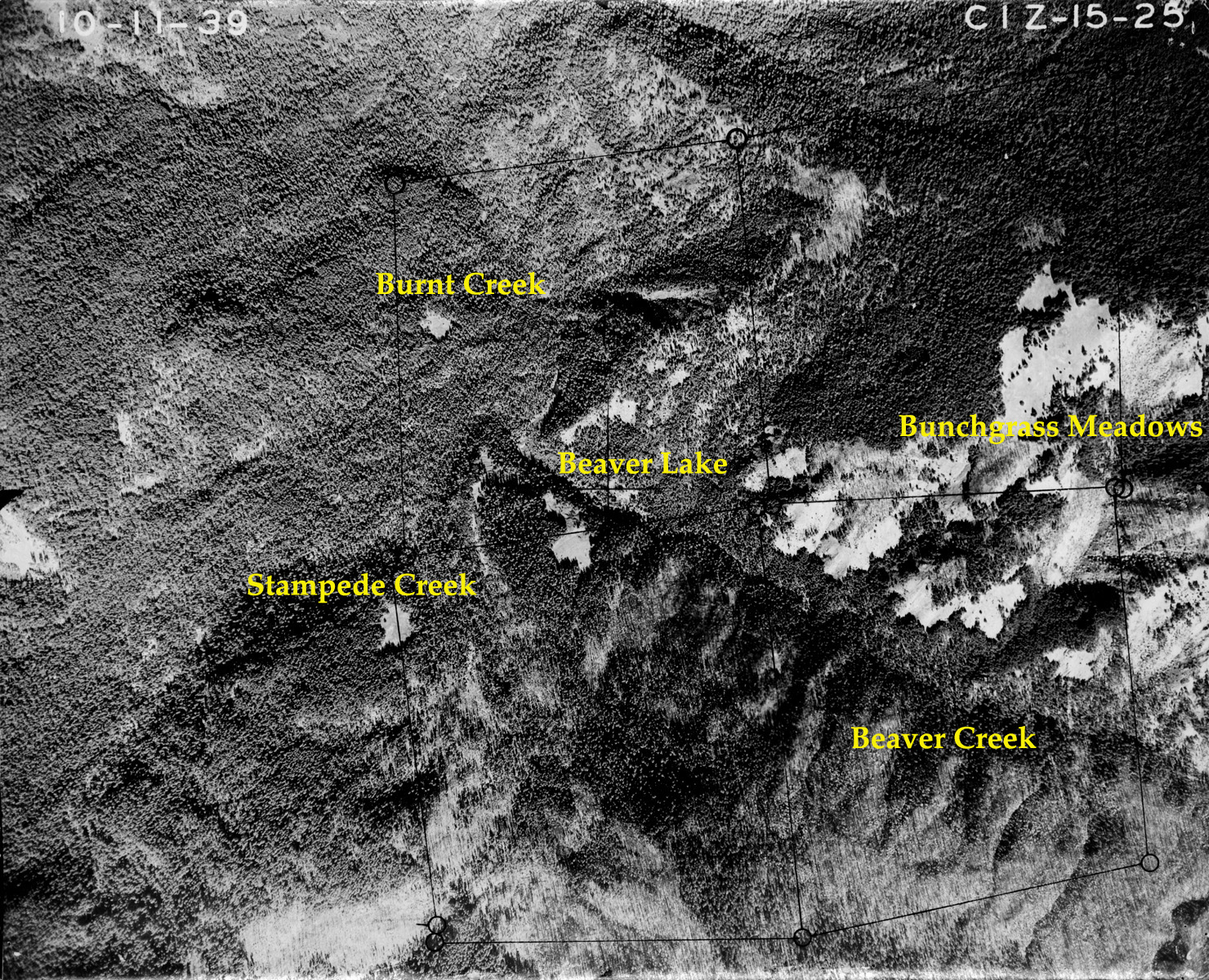
15-25_Beaver_Lake |
15-25-1_Beaver_Lake |
15-26_Beaver_Lake |
15-27_Beaver_Creek |
15-28_Nichols_Ranch |
|
 |
|
 |
 |
 |
|
15-29_Collins_Ridge |
15-29-2 |
15-30_Collins_Ridge |
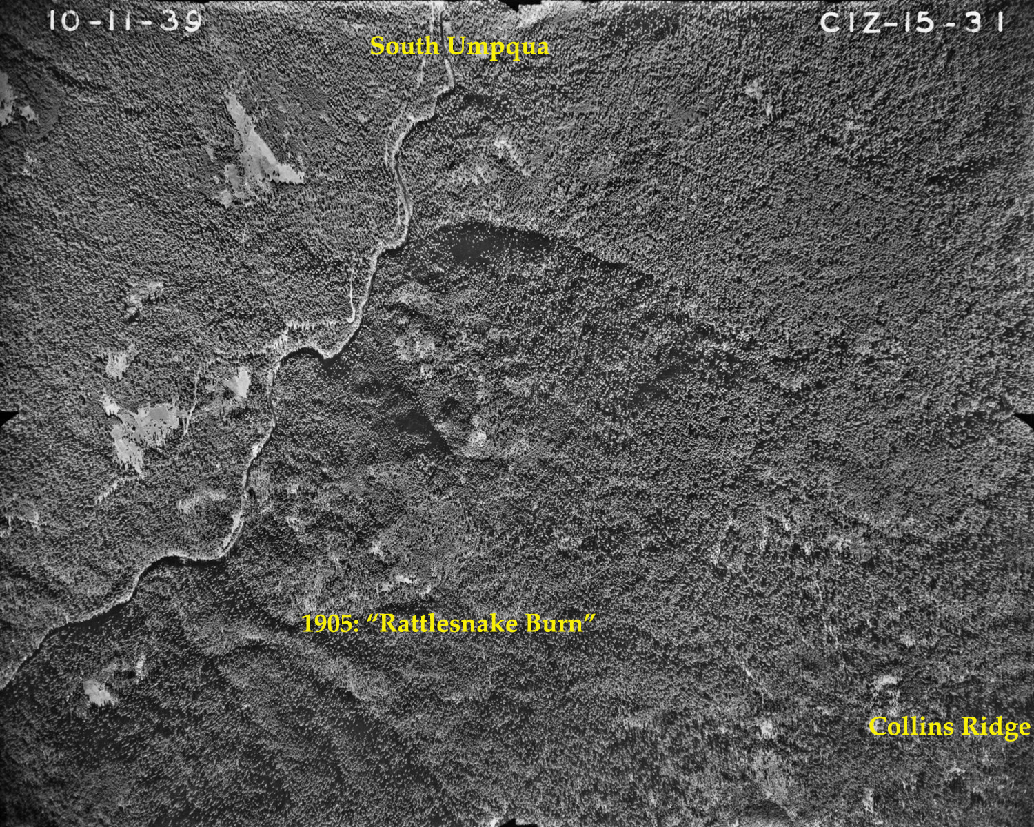
15-31_Rattlesnake_Burn |
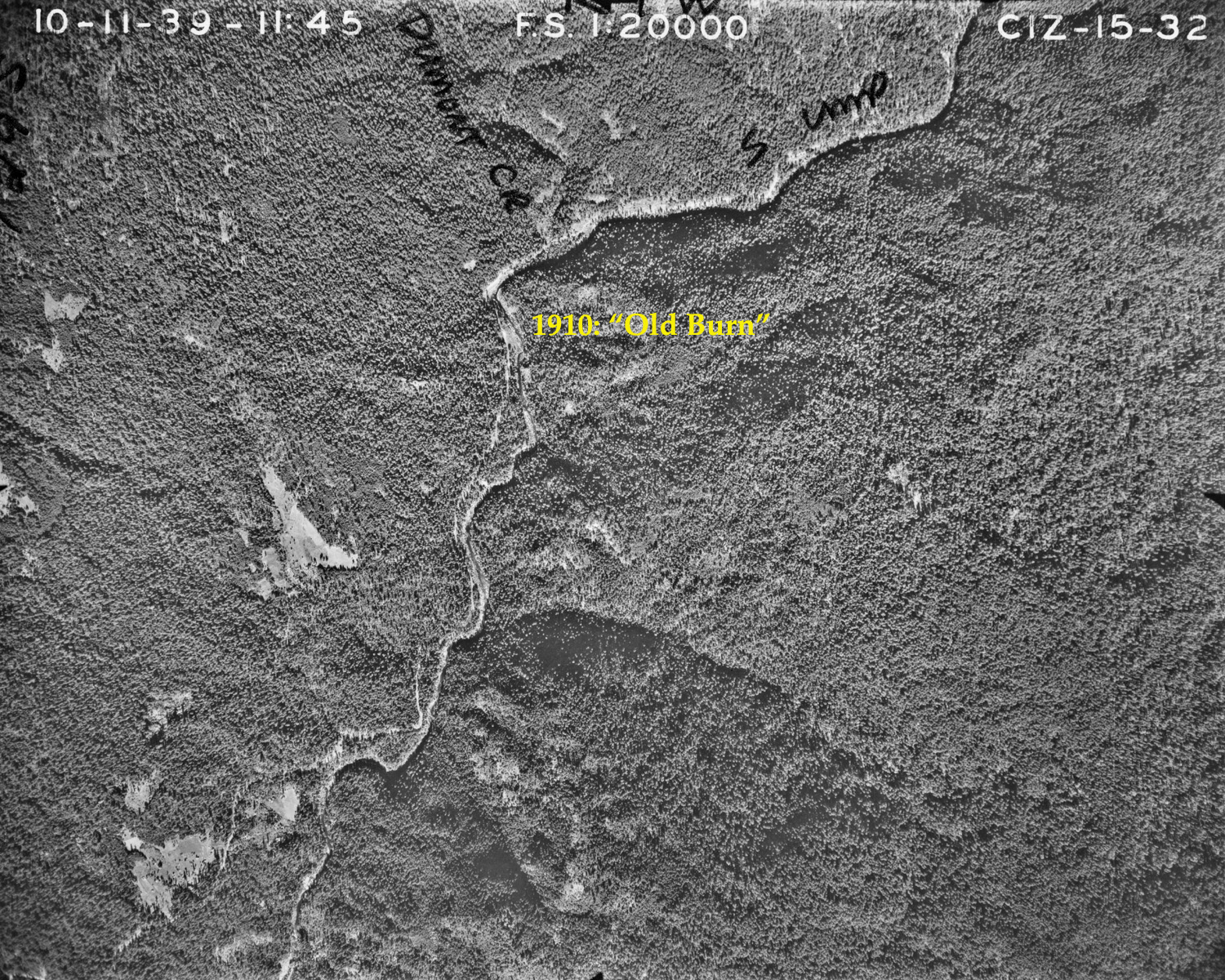
15-32_Old_Burn |
|
 |
 |
 |
|||
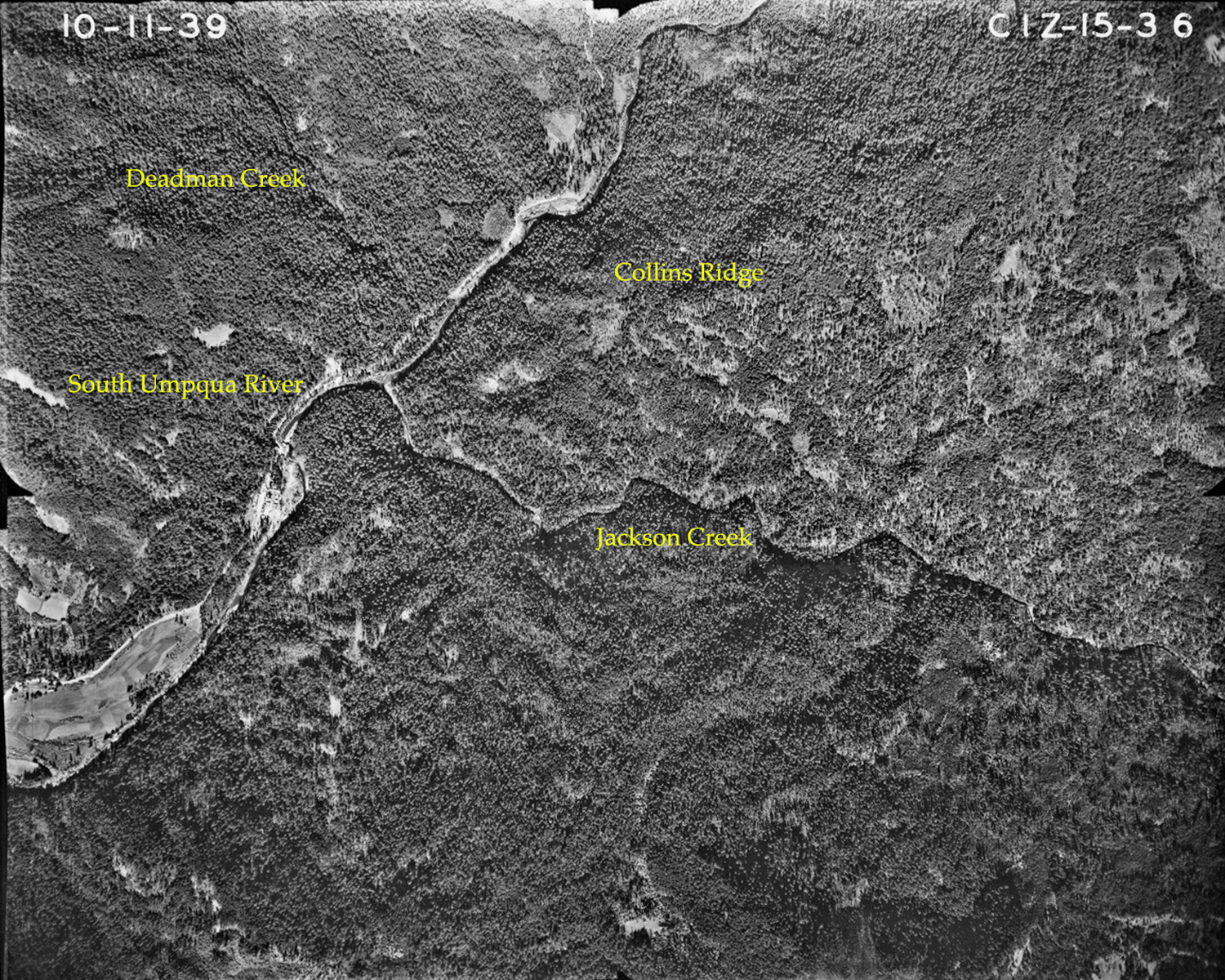
15-36_The_Forks
|
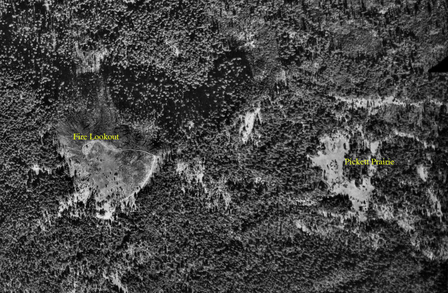
15-37_Pickett_Butte |
15-37_Pickett_Butte-a |
|||
 |
 |
 |
 |
 |
|
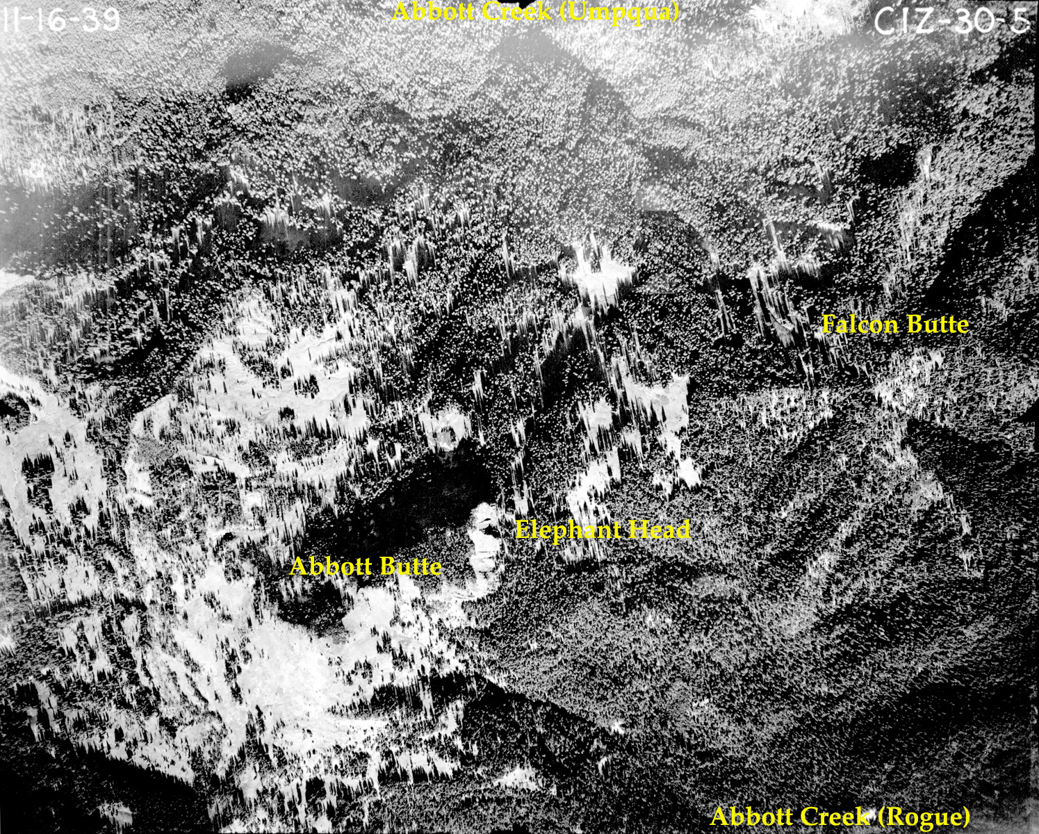
30-05_Abbott_Butte |
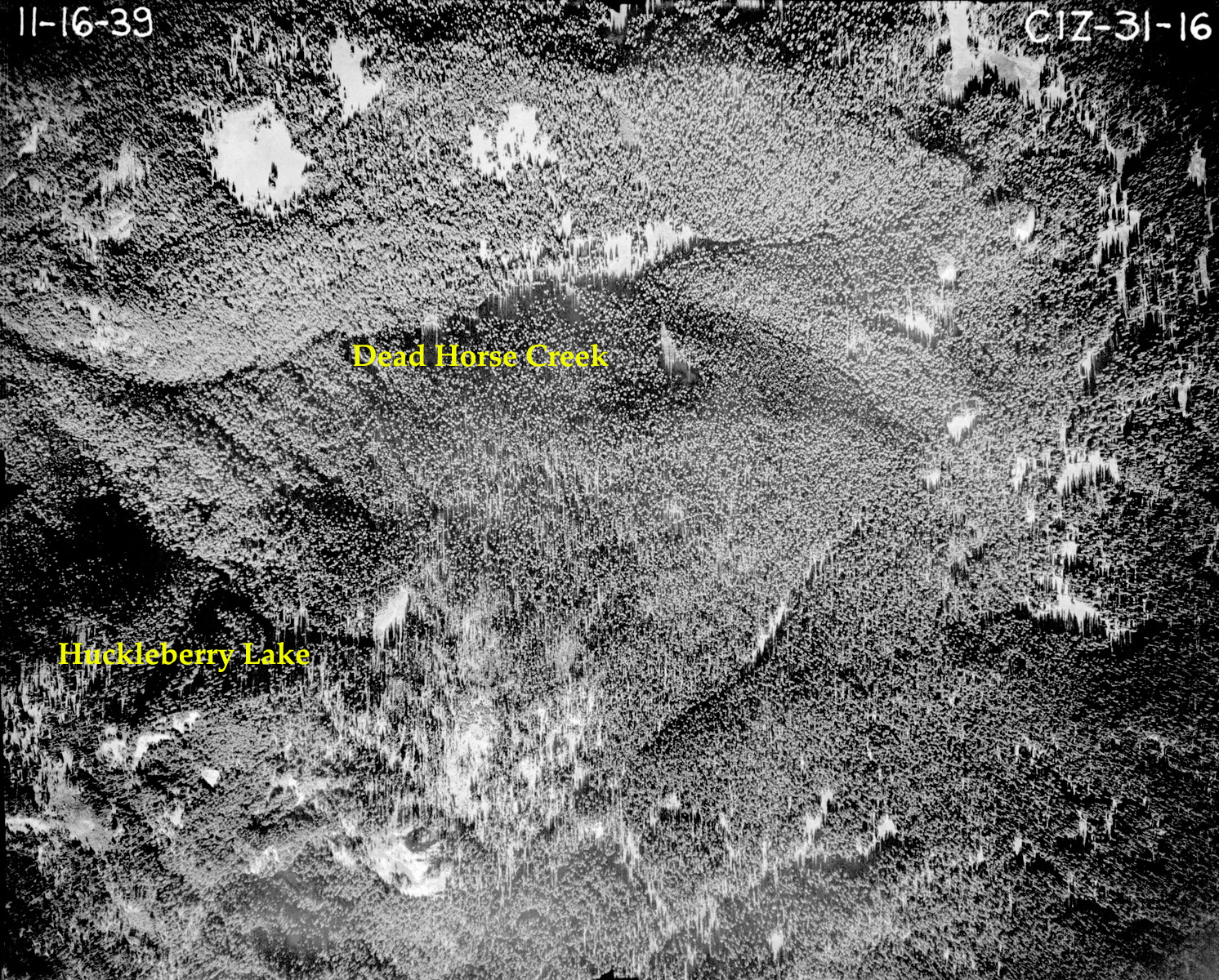
31-16_Huckleberry_Lake
|
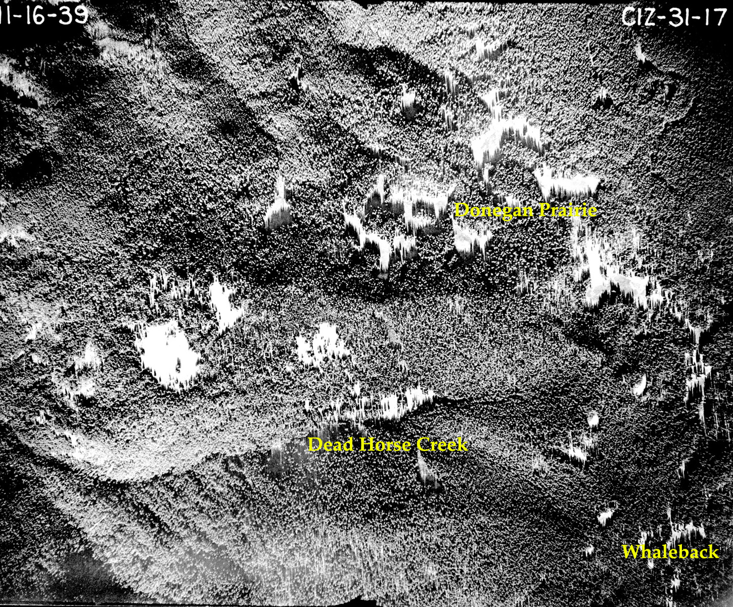
31-17_Donegan_Prairie
|
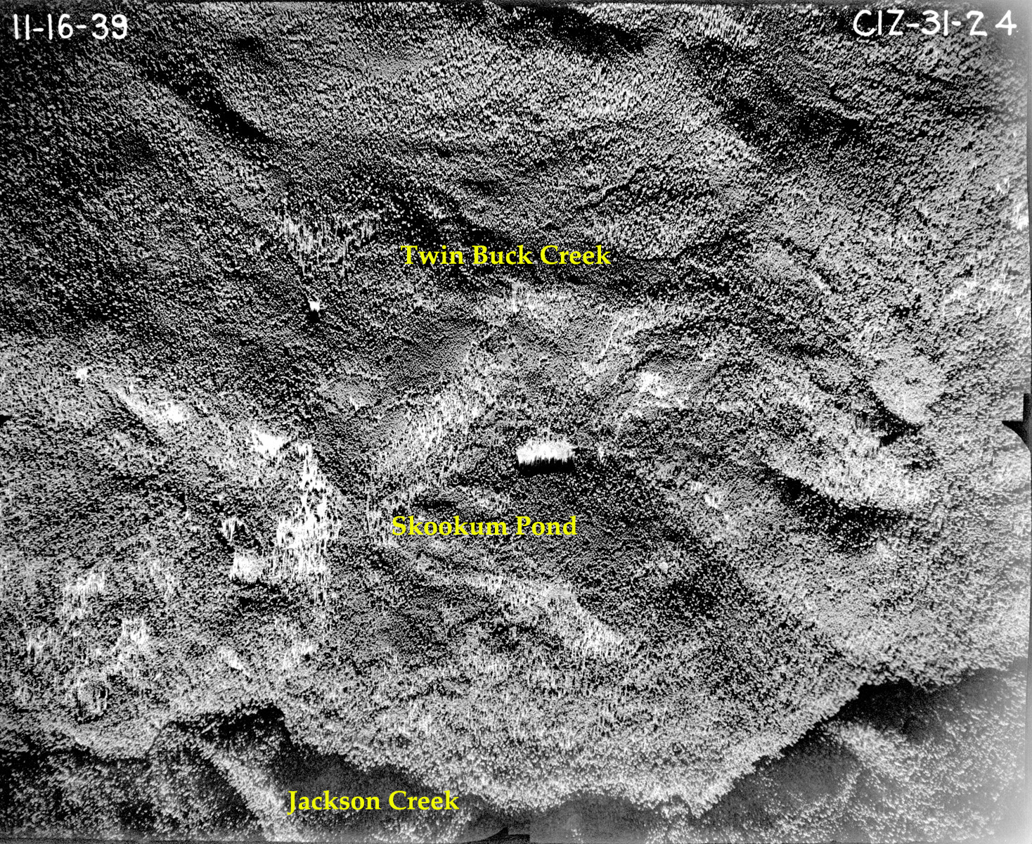
31-24_Skookum_Pond
|
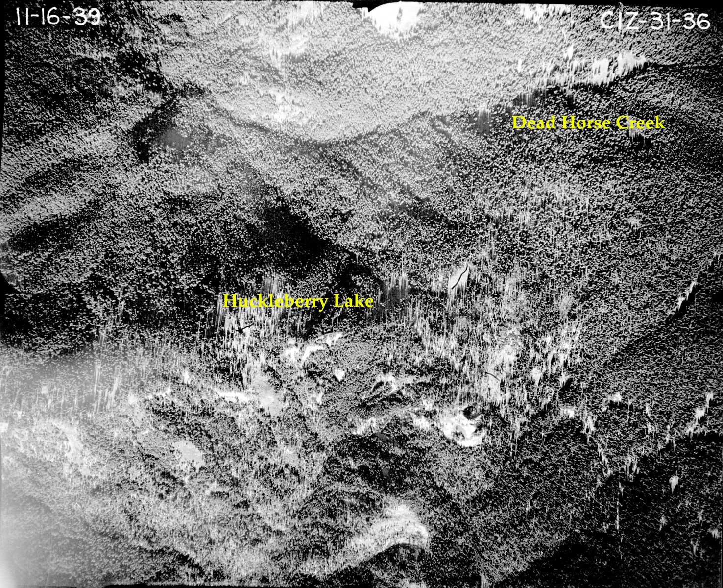
31-36_Huckleberry_Lake
|
|
 |
 |
 |
|||
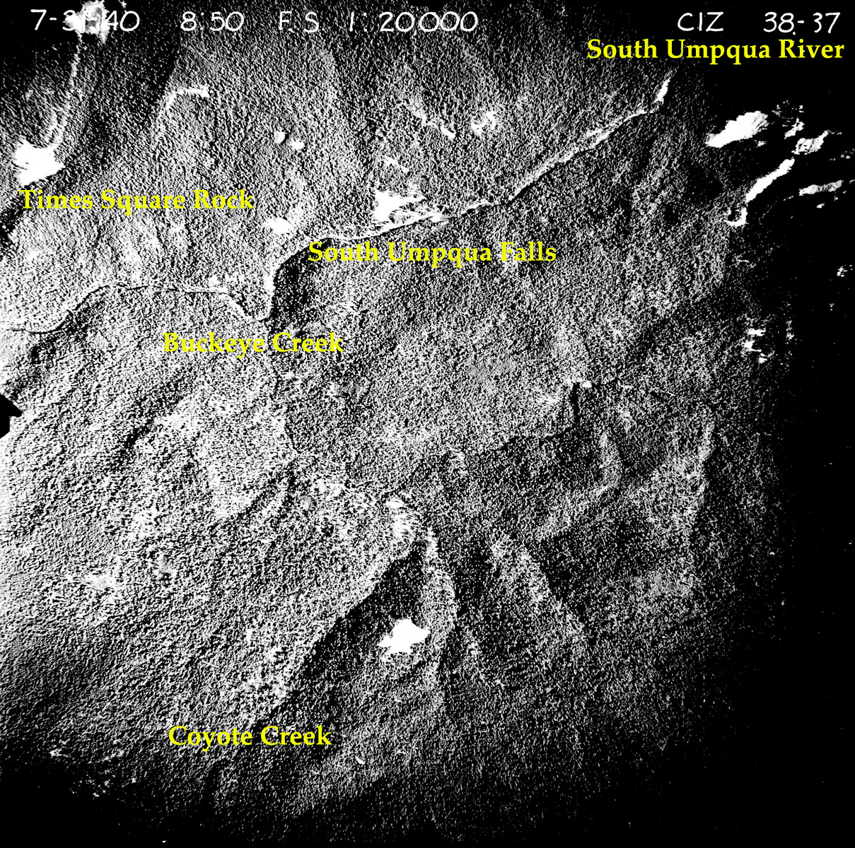
38-37_South_Umpqua_Falls |
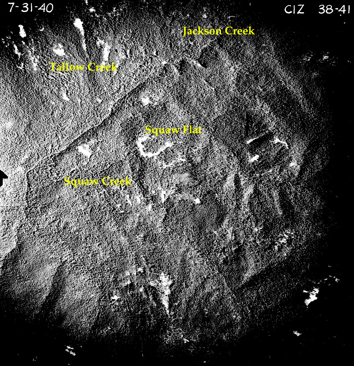
38-41_Squaw_Flat |
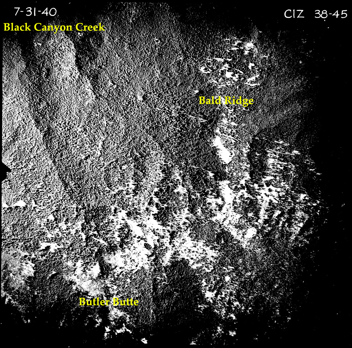
38-45_Bald_Ridges |
|||
 |
|||||
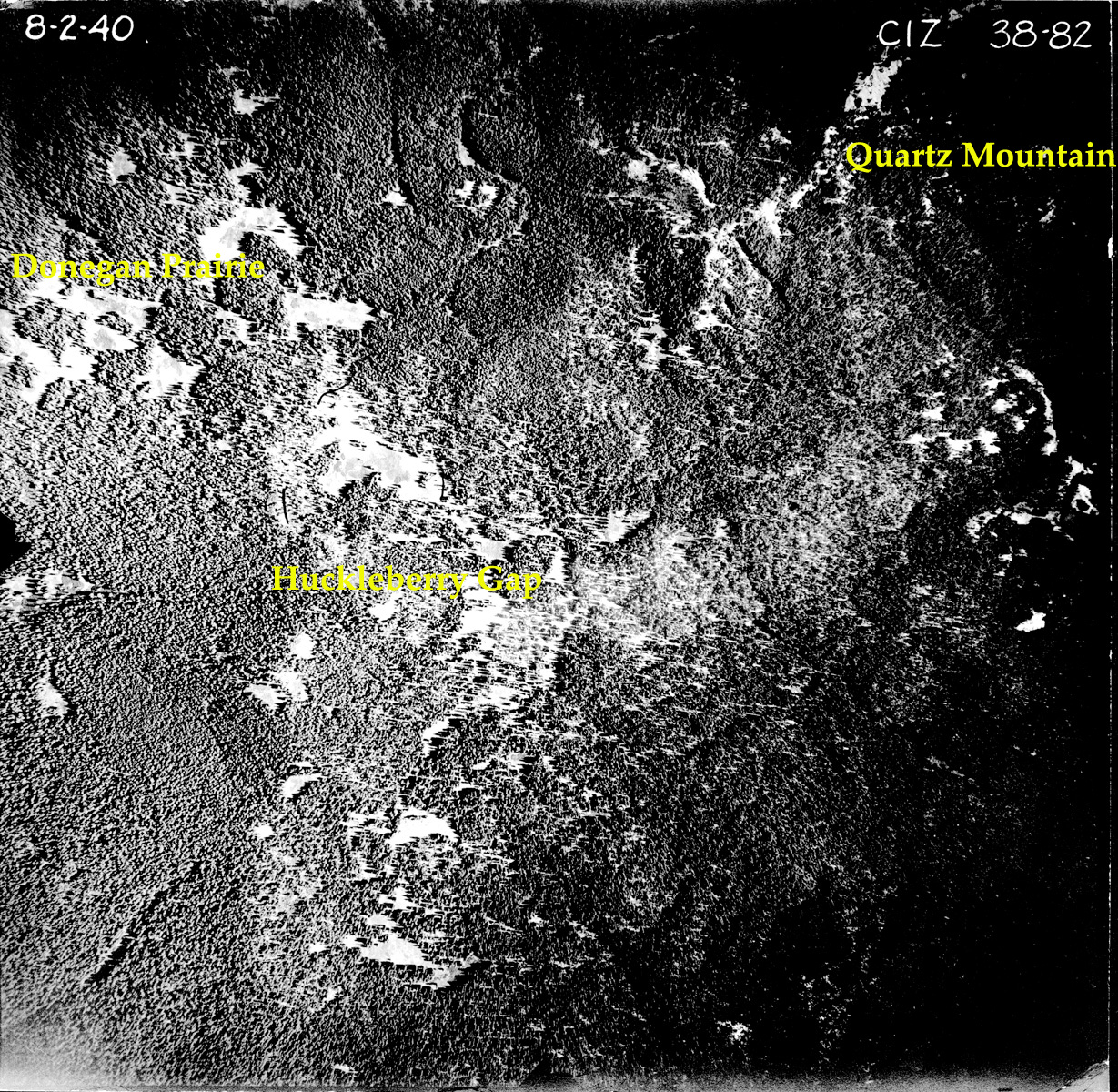
38-82_Donegan_Prairie |
|||||
 |
 |
 |
 |
 |
|
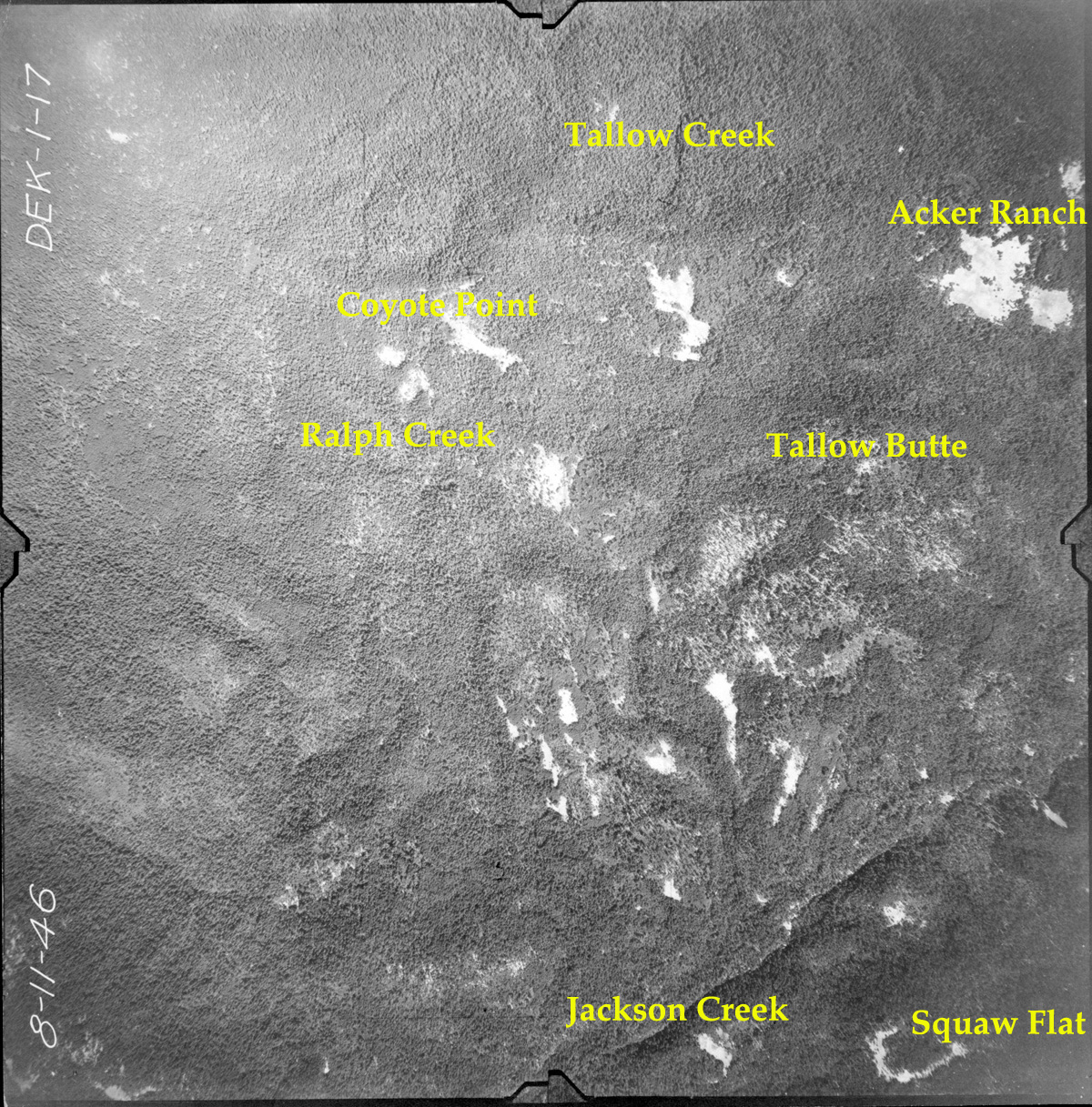
1-017_Coyote_Point |
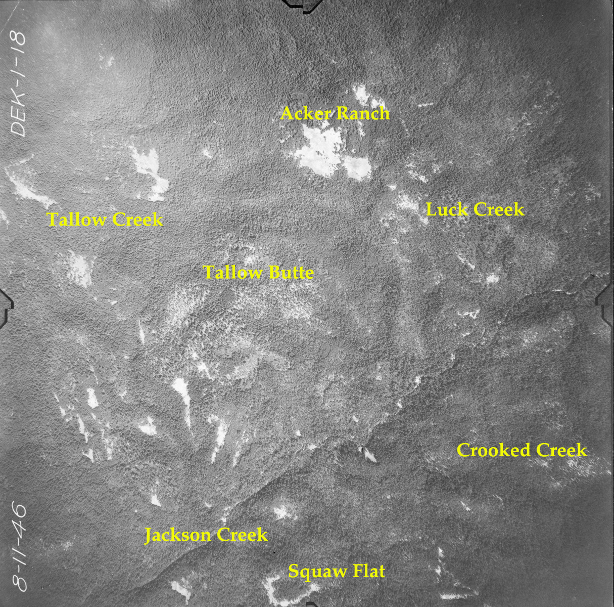
1-018_Acker_Ranch |
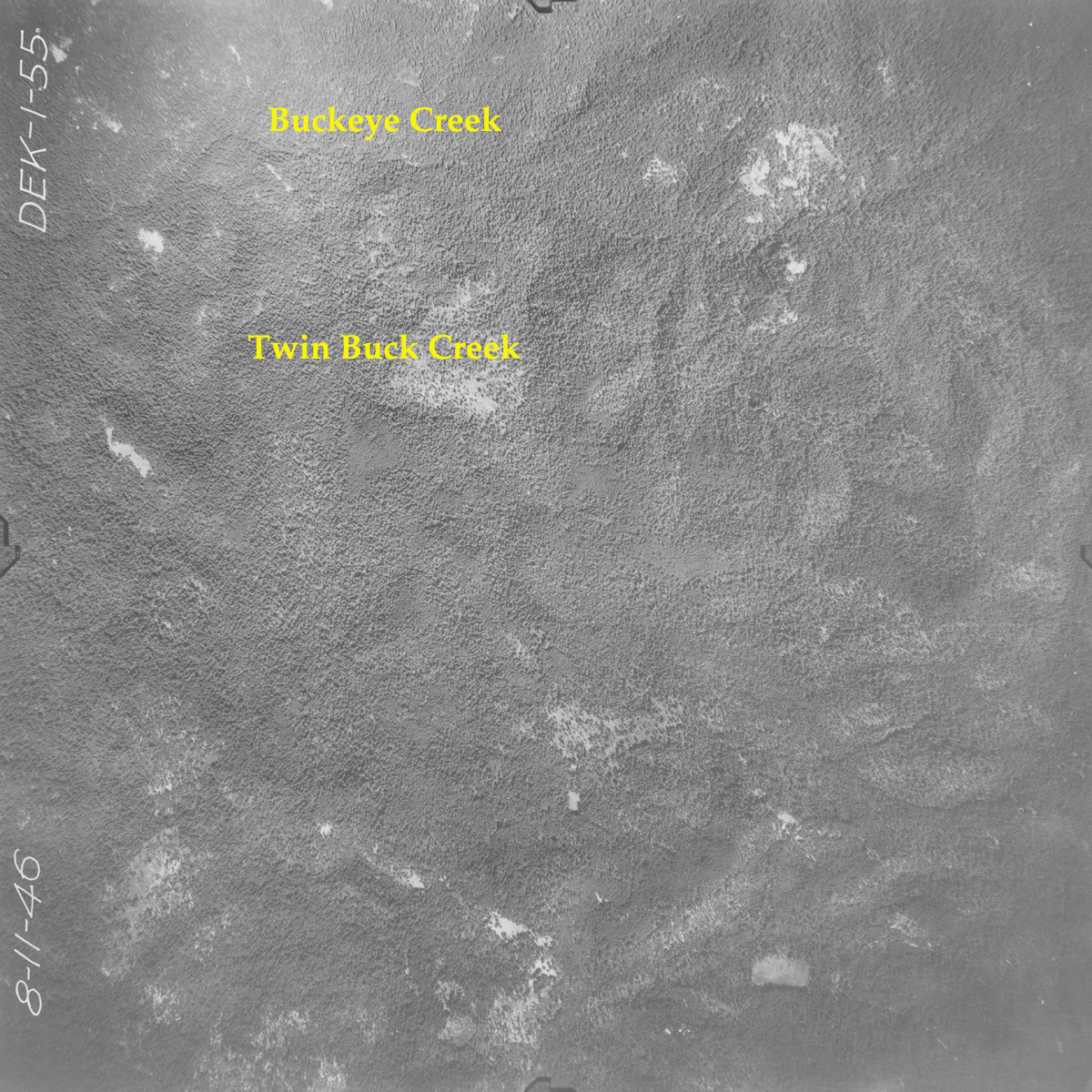
1-055_Buckeye_Creek |
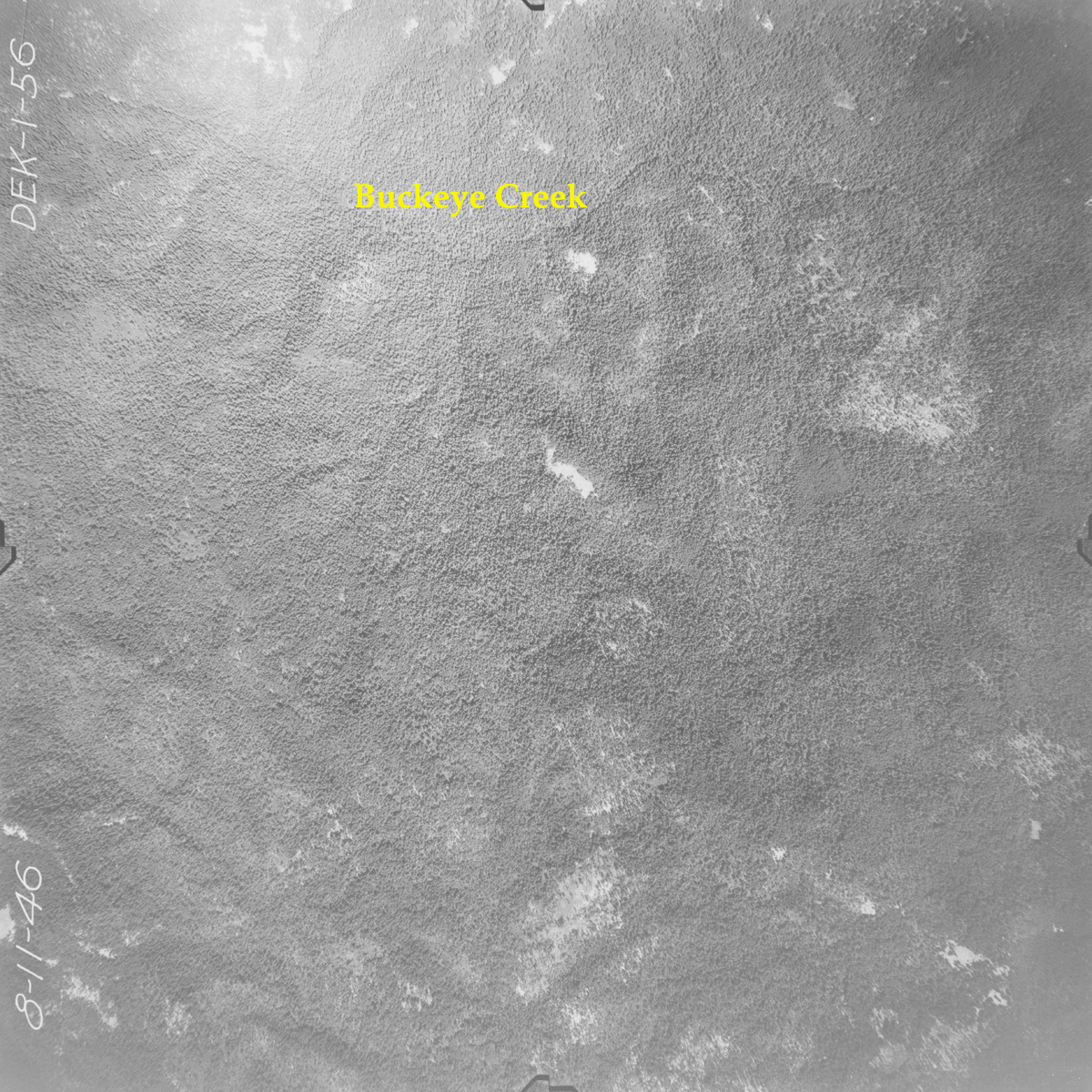
1-056_Buckeye_Creek |
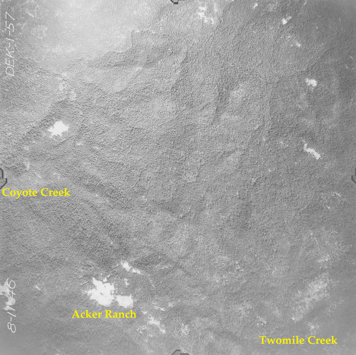
1-057_Acker_Ranch |
|
 |
 |
 |
 |
 |
|
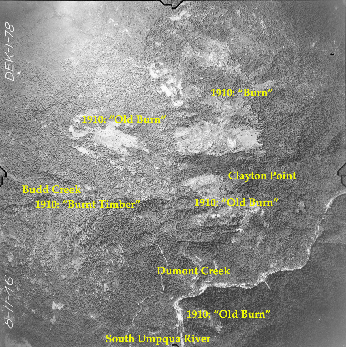
1-078_Clayton_Point
|
1-083_Buckeye_Creek |
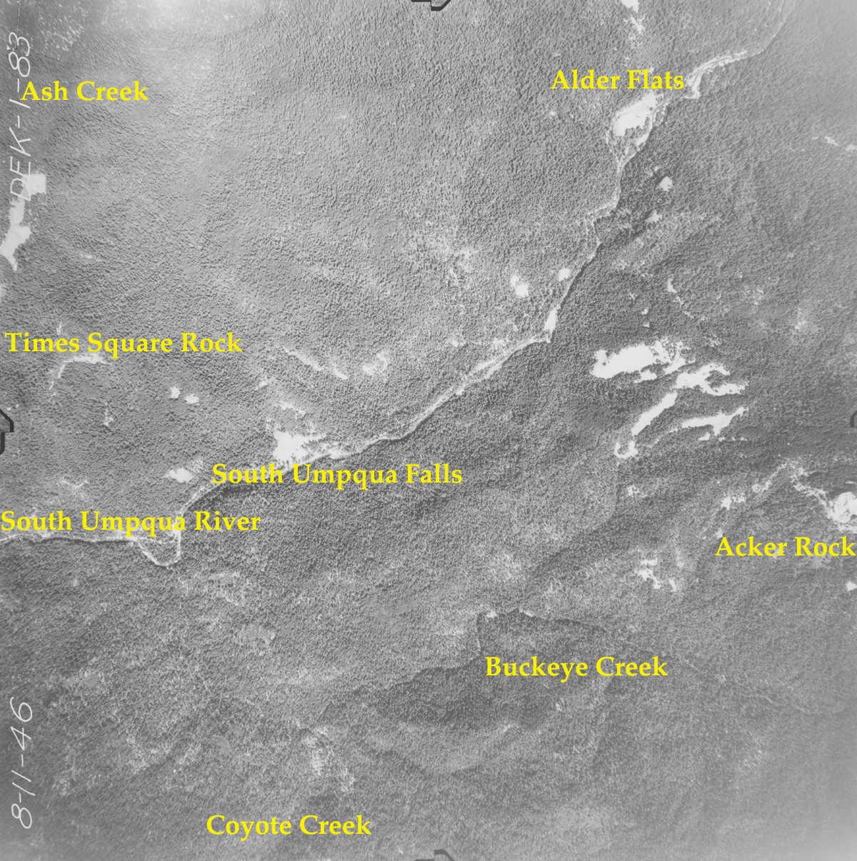
1-084_Acker_Rock |
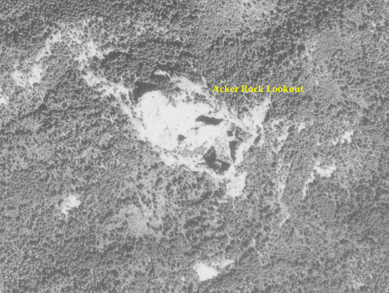
1-084a_Acker_Lookout |
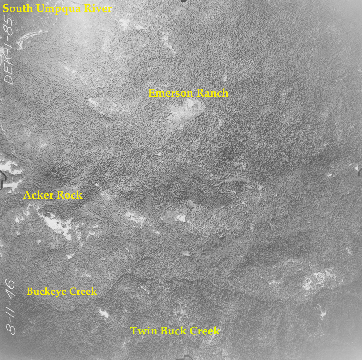
1-085_Buckeye_Creek |
|
 |
 |
 |
 |
 |
|
1-090_Grasshopper_Complex
|
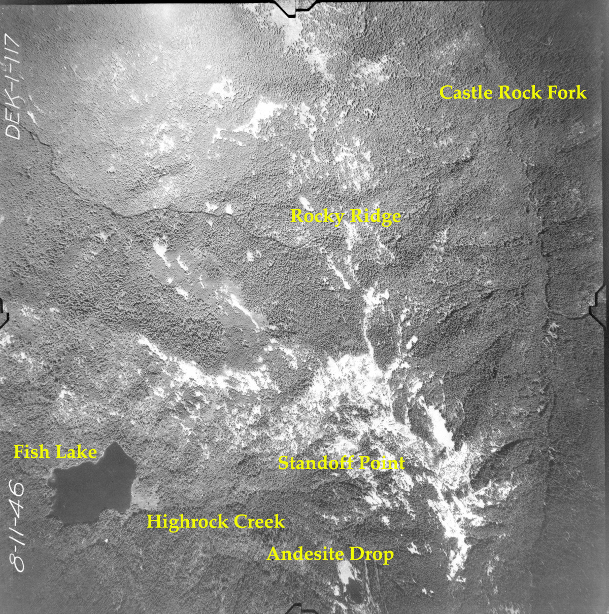
1-117_Fish_Lake
|
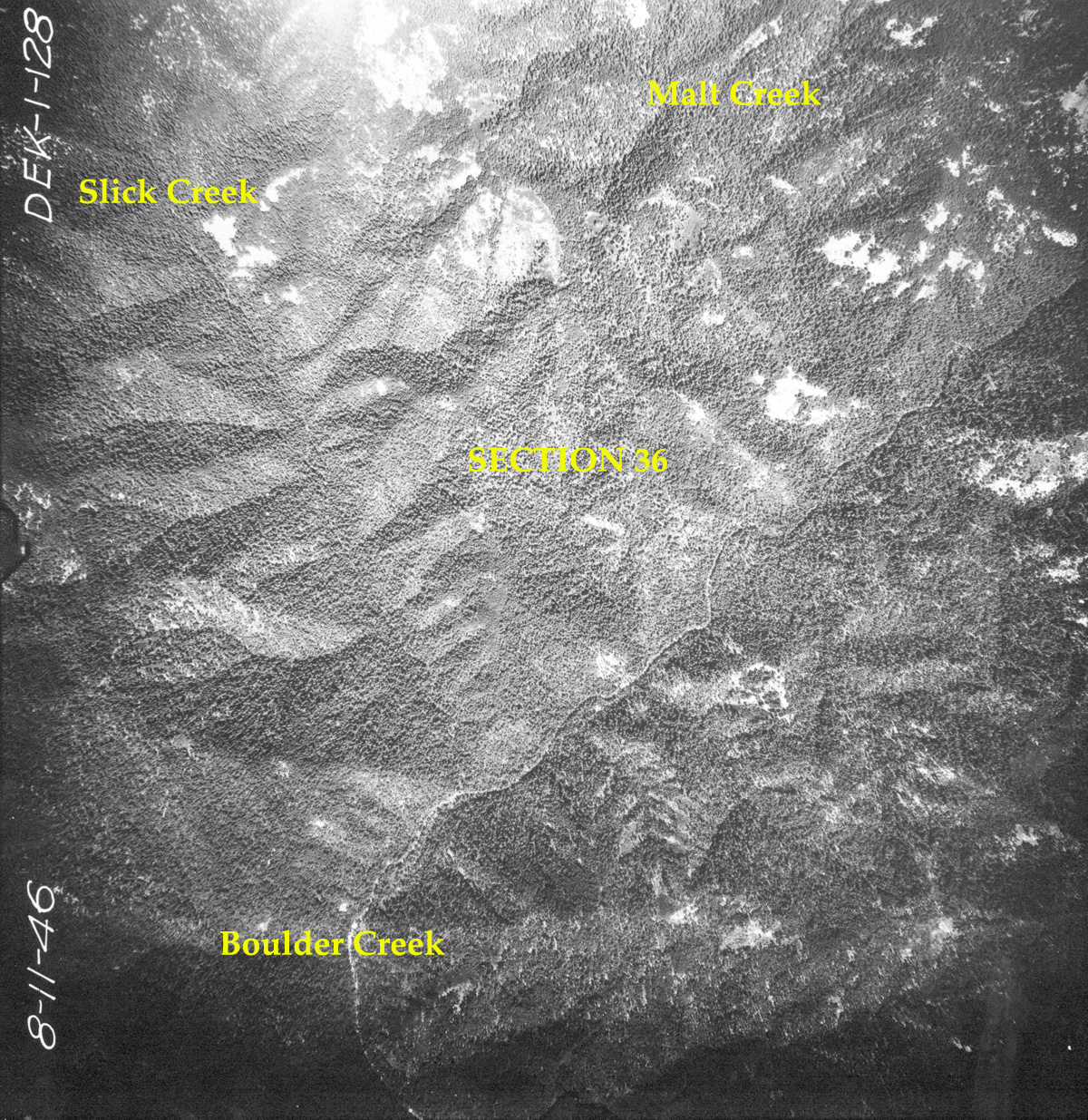
1-128_Section_36
|
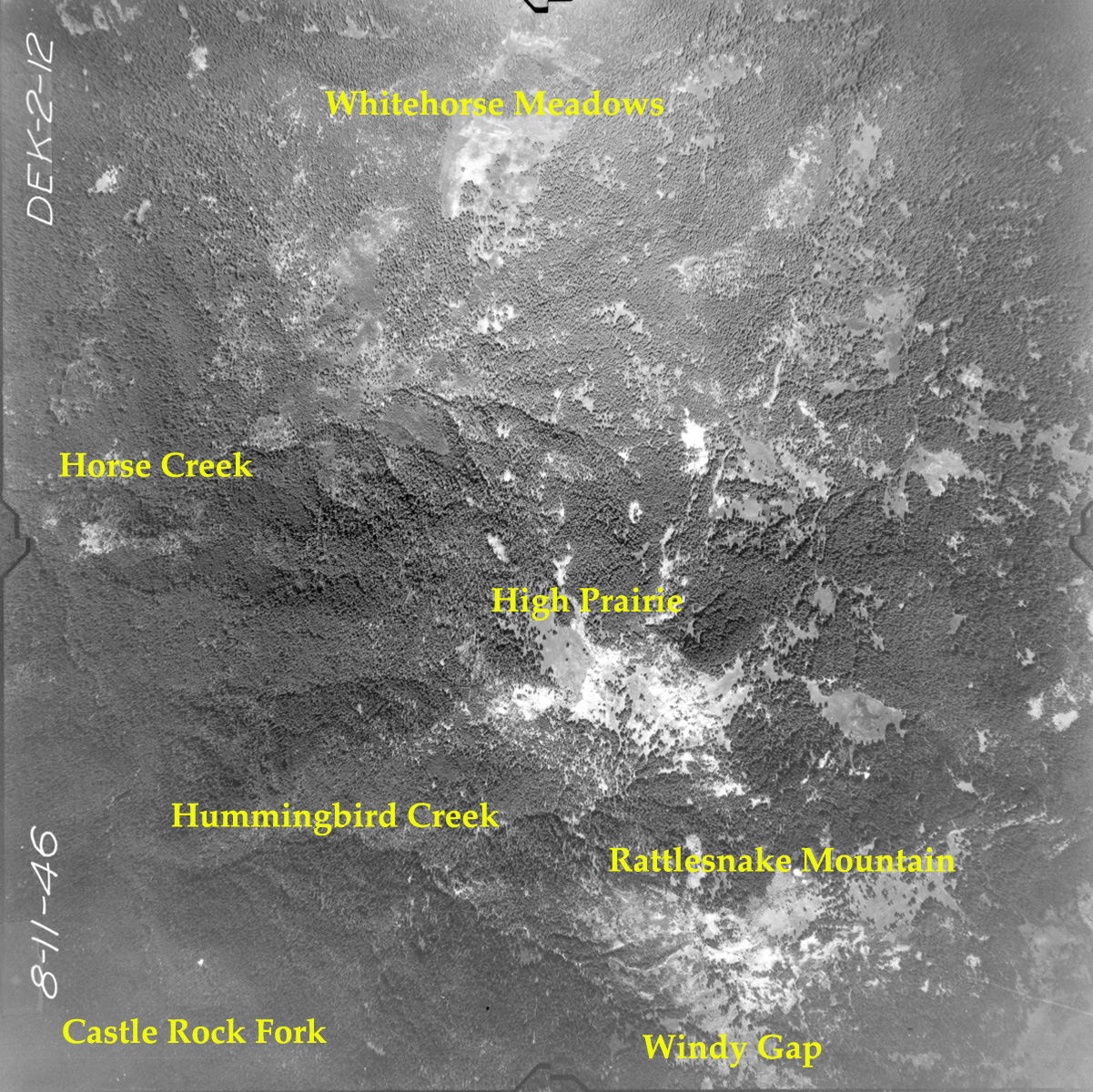
2-012_High_Prairie
|
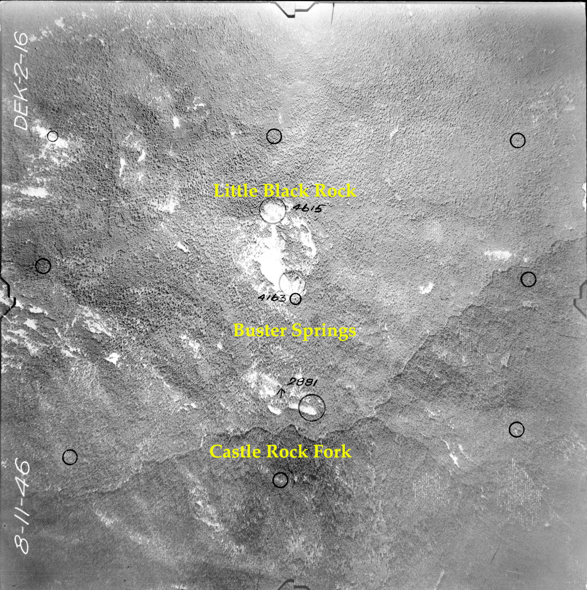
2-016_Little_Black_Rock
|
|
 |
 |
 |
 |
 |
|
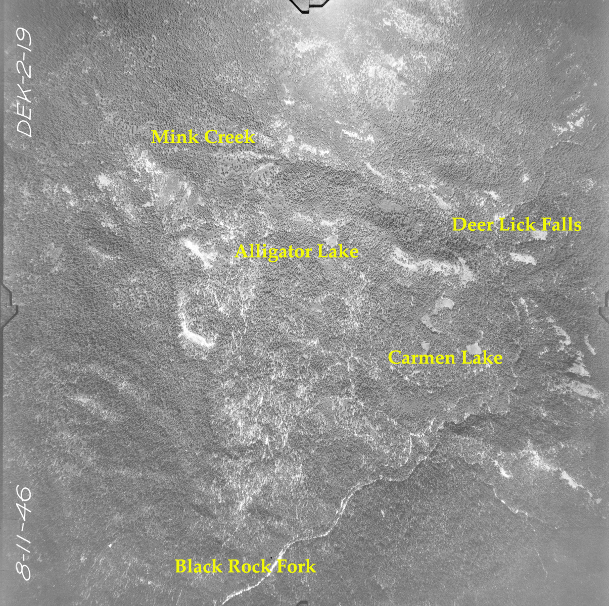
2-019_Five_Lakes
|
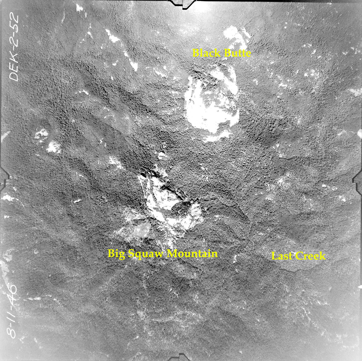
2-052_Big_Squaw_Mountain
|
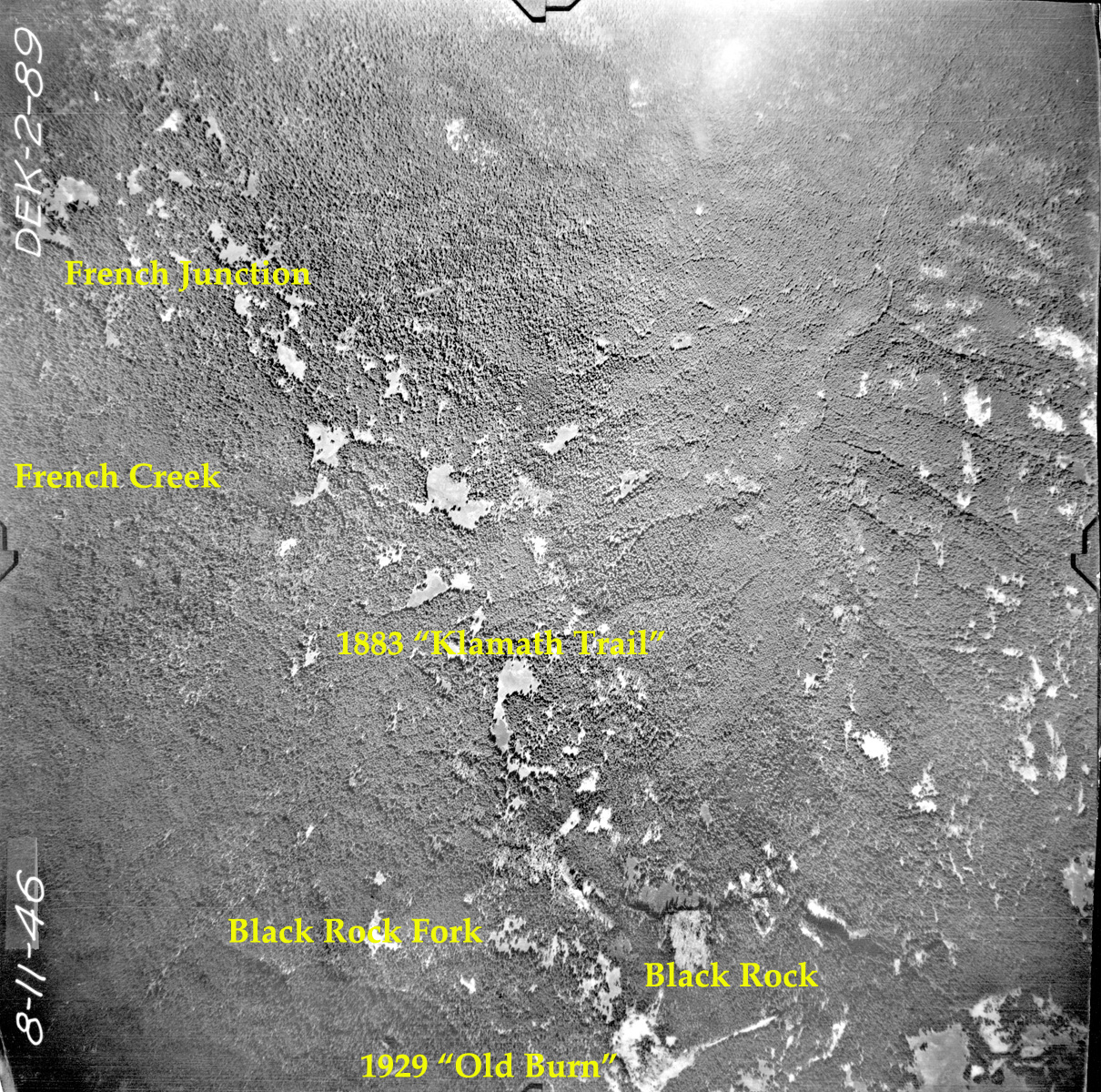
2-089_Black_Rock
|
2-098_Quartz_Mountain
|
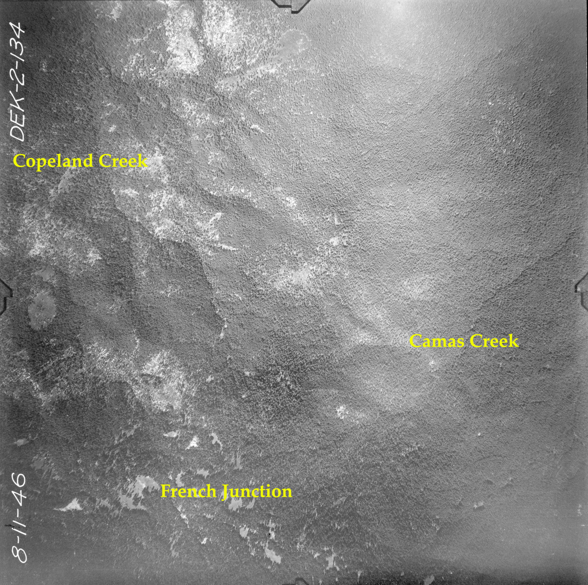
2-134_French_Junction
|