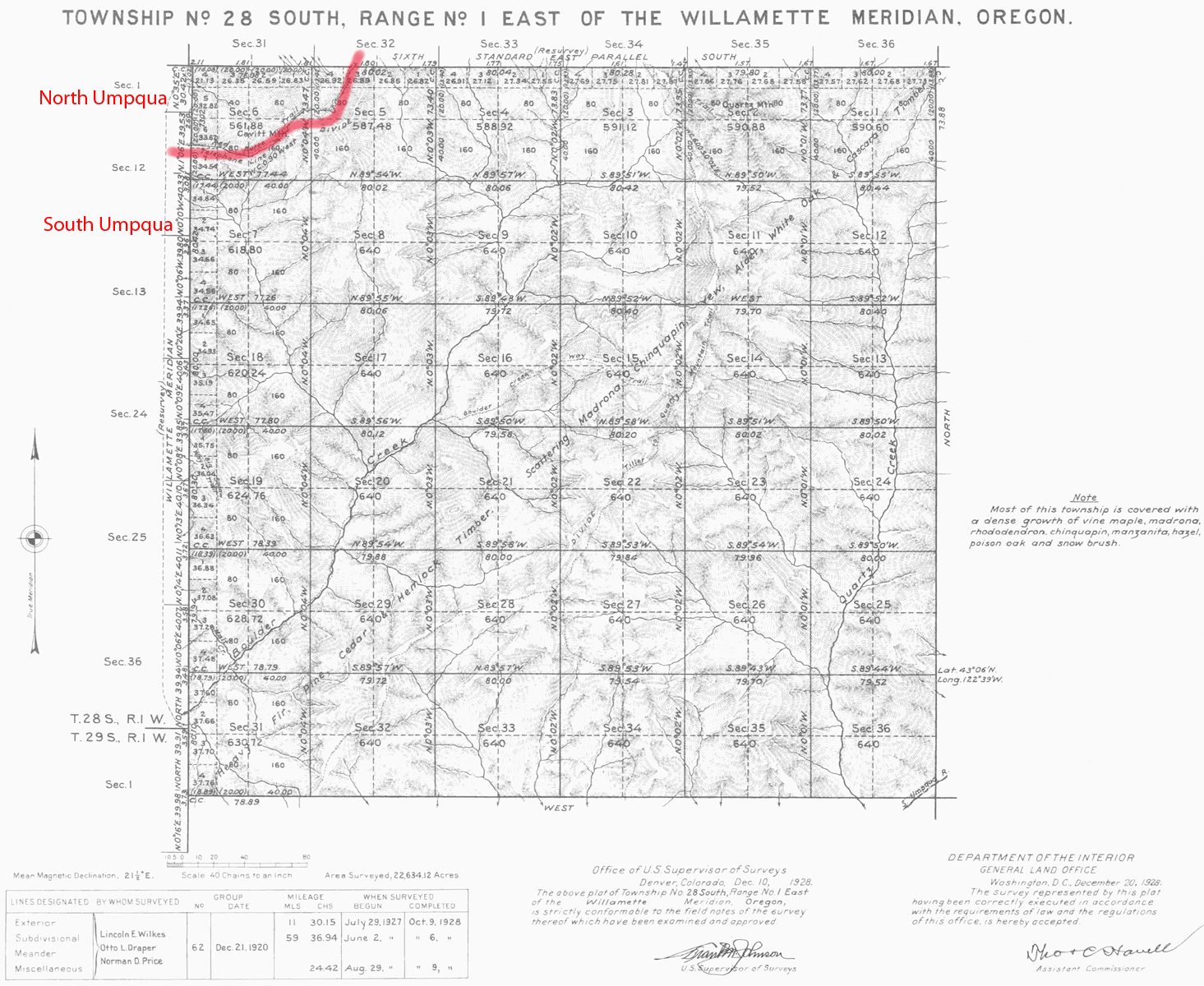
South Umpqua River
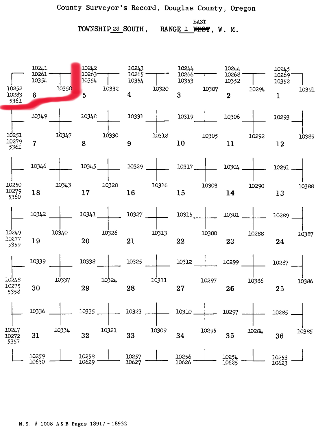
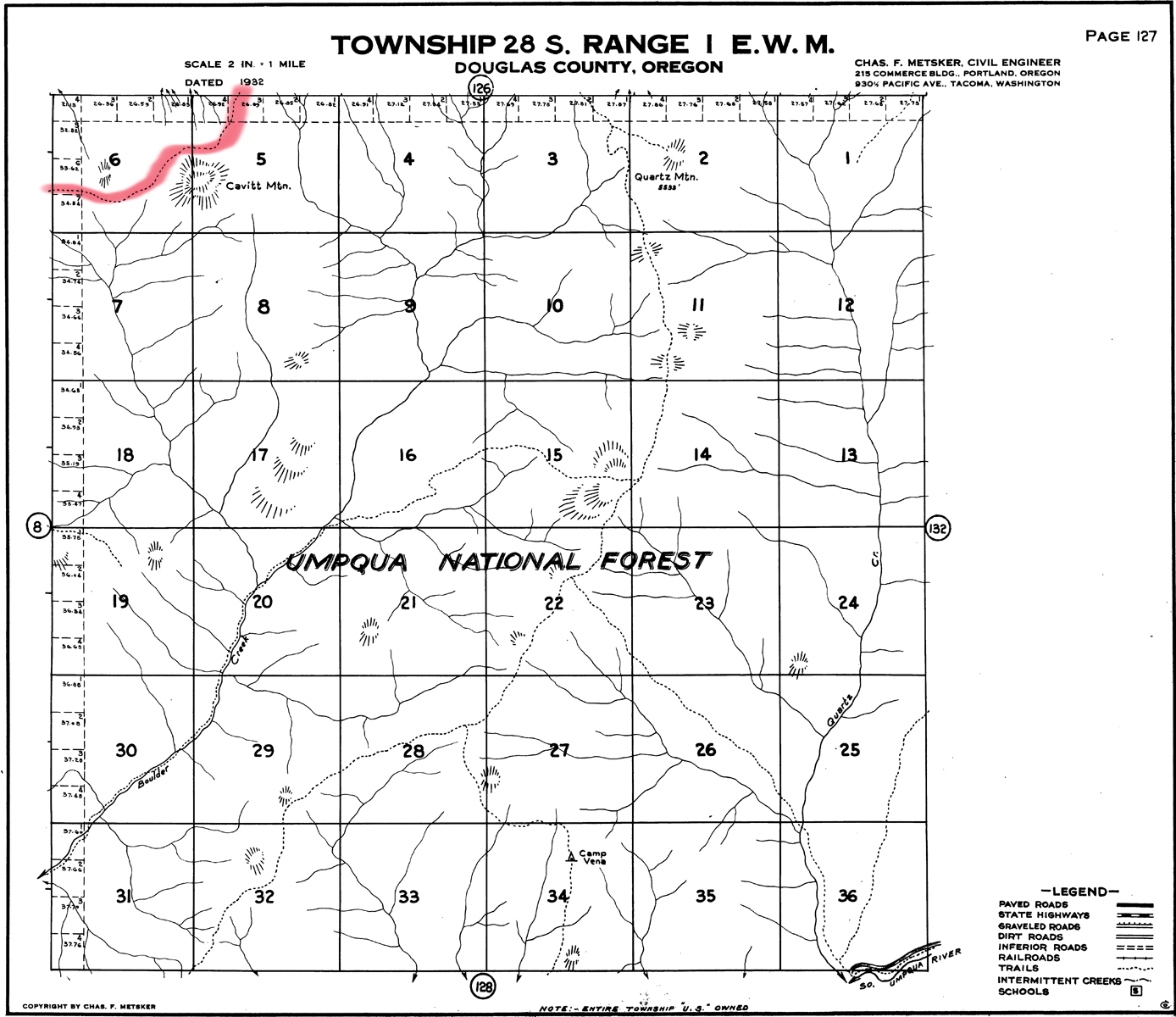
Tsp. 28 S., Rng. 1 E.
1928 General Land Office Survey Index
 |
 |
1928 GLO |
1932 Metsker |
The red line of this index indicates part of the northern-western boundary of the 2010 South Umpqua Headwaters Precontact Reference Conditions Study. This township includes portions of the study's Quartz Mountain and Alder Flats Area of Special Interest. This survey was completed in 1927 and mapped in 1928 (Wilkes, Draper, and Price 1928).
![]()