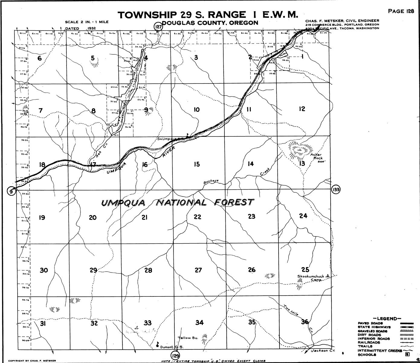
South Umpqua River
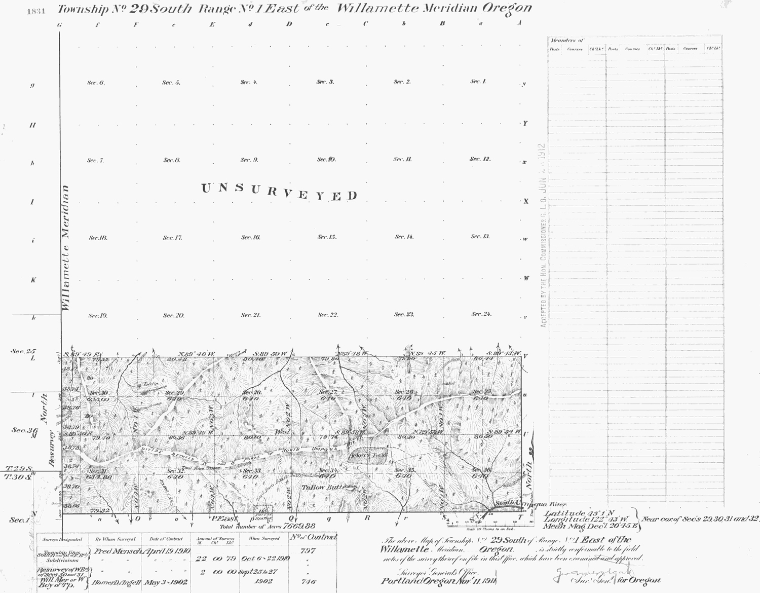
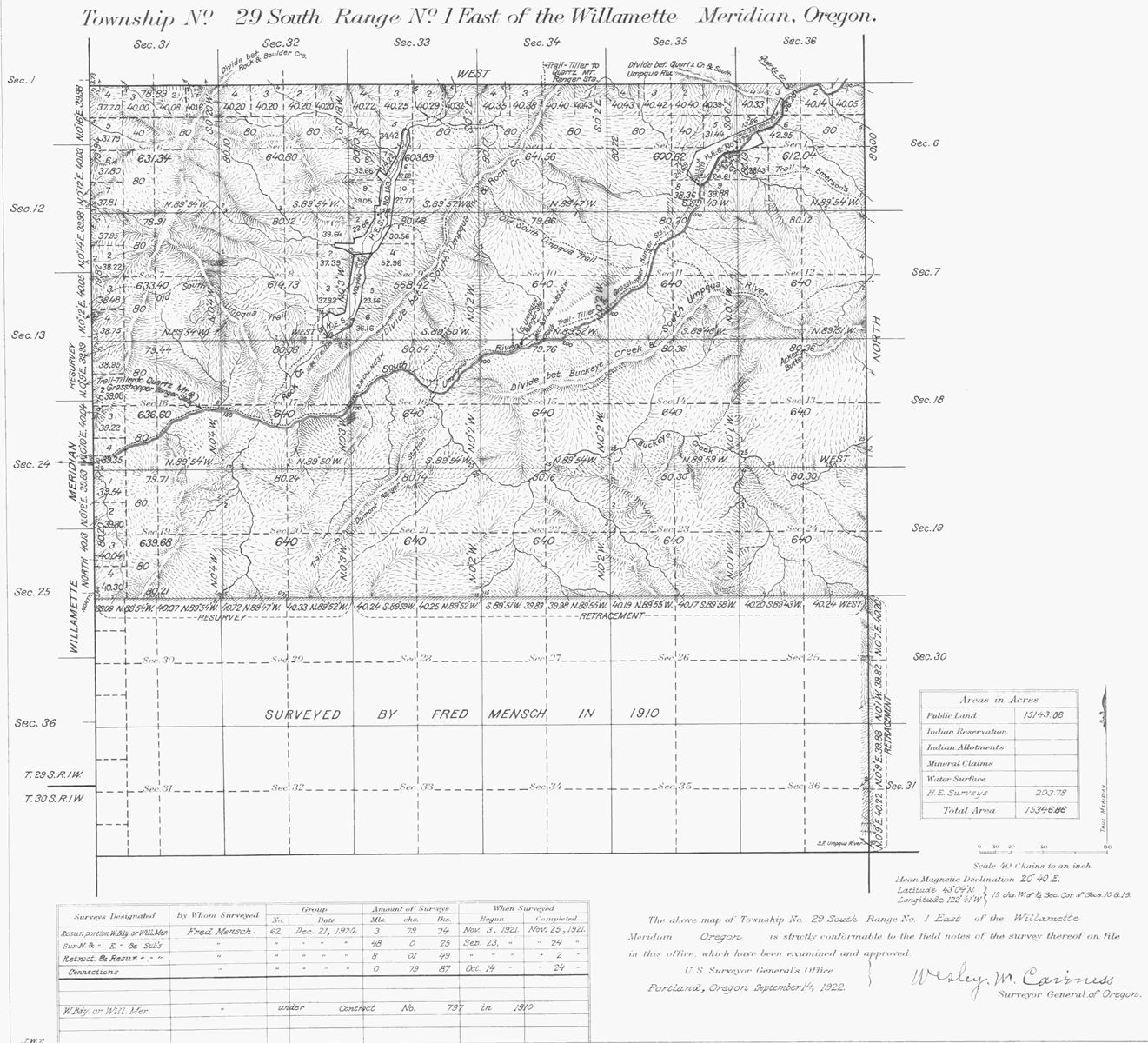
Tsp. 29 S., Rng. 1 E.
1922 General Land Office Survey Index
 |
 |
 |
 |
 |
 |
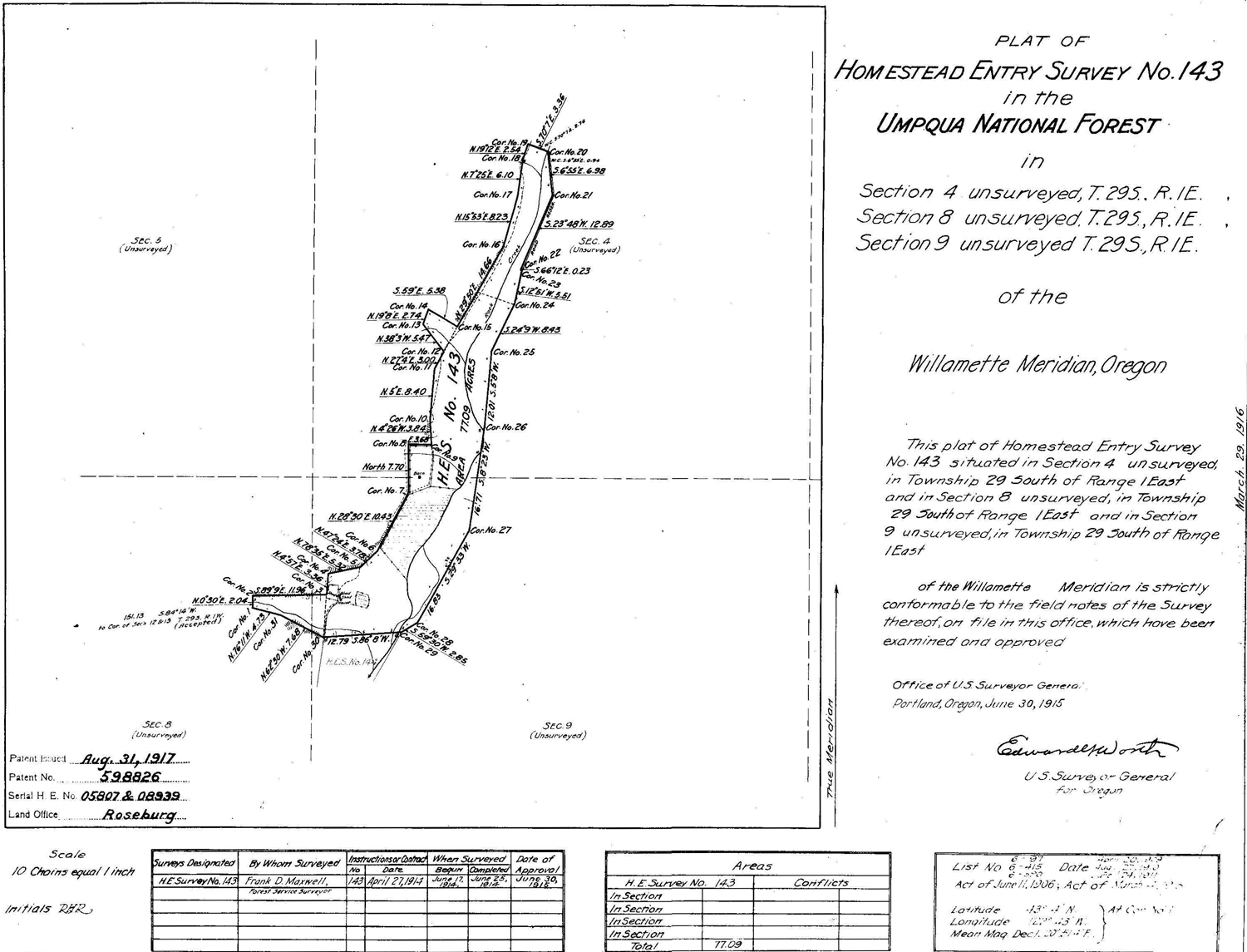
1915 HES 143 |
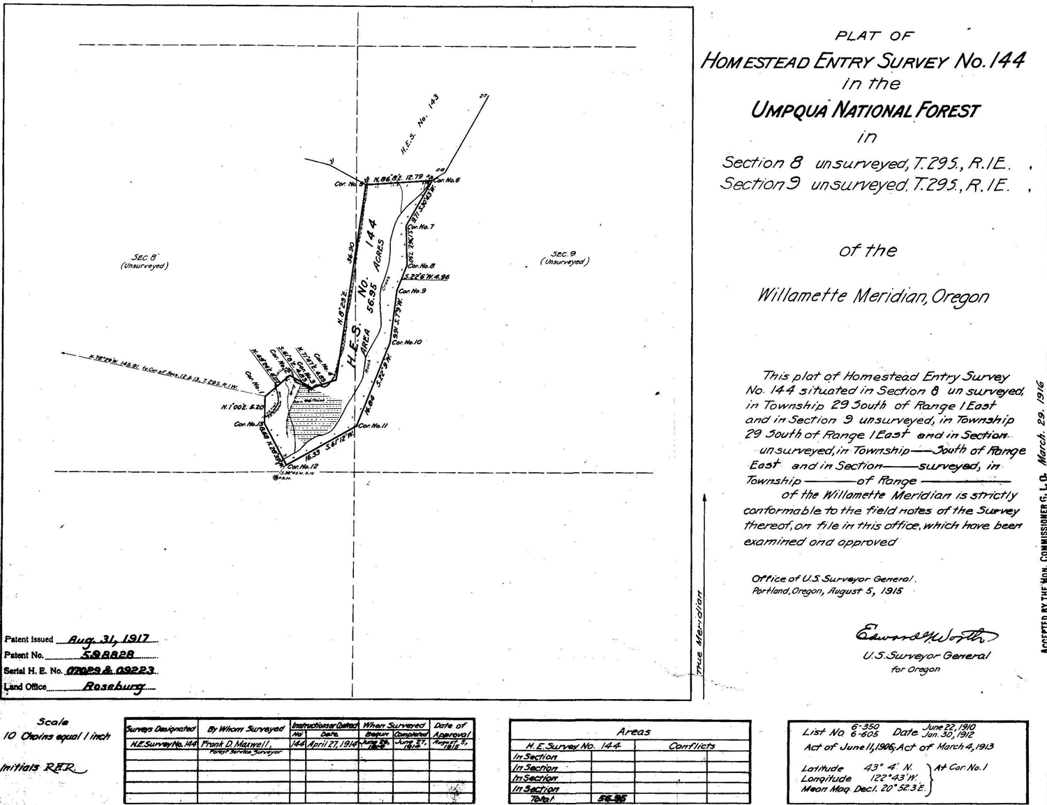
1915 HES 144 |
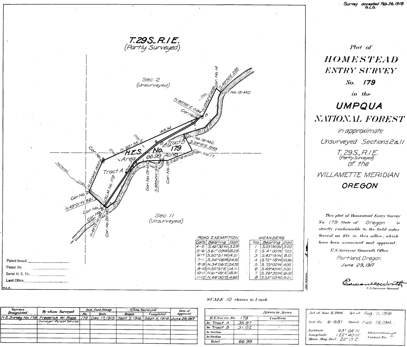
1917 HES 179 |
1911 GLO |
1922 GLO |
1932 Metsker |
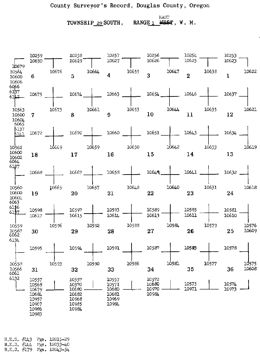
This township is entirely within the boundaries of the 2010 South Umpqua Headwaters Precontact Reference Conditions Study. It includes the Acker Rock and Coyote Point Fire Lookouts and the Ash Valley, South Umpqua Falls, Alder Flats and Acker Ranch Areas of Special Interest. This survey was completed in 1902, 1910, and 1921 and mapped in 1911 and 1922 (Angell 1902; Mensch 1910; Mensch 1921b). The Ash Valley and Alder Flats areas were also settled by at least three homesteaders, who had their claims surveyed and mapped just before WW I; from 1914 through 1917 (Maxwell 1914a; Maxwell 1914b; Rose 1916a).
![]()