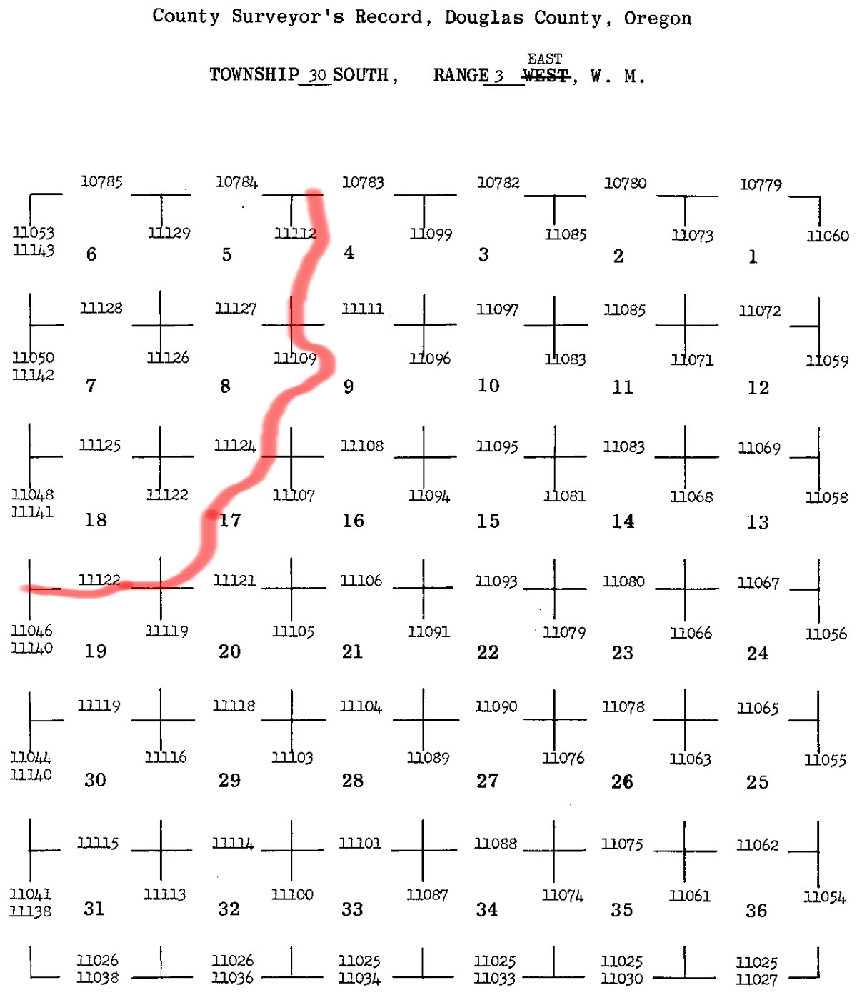
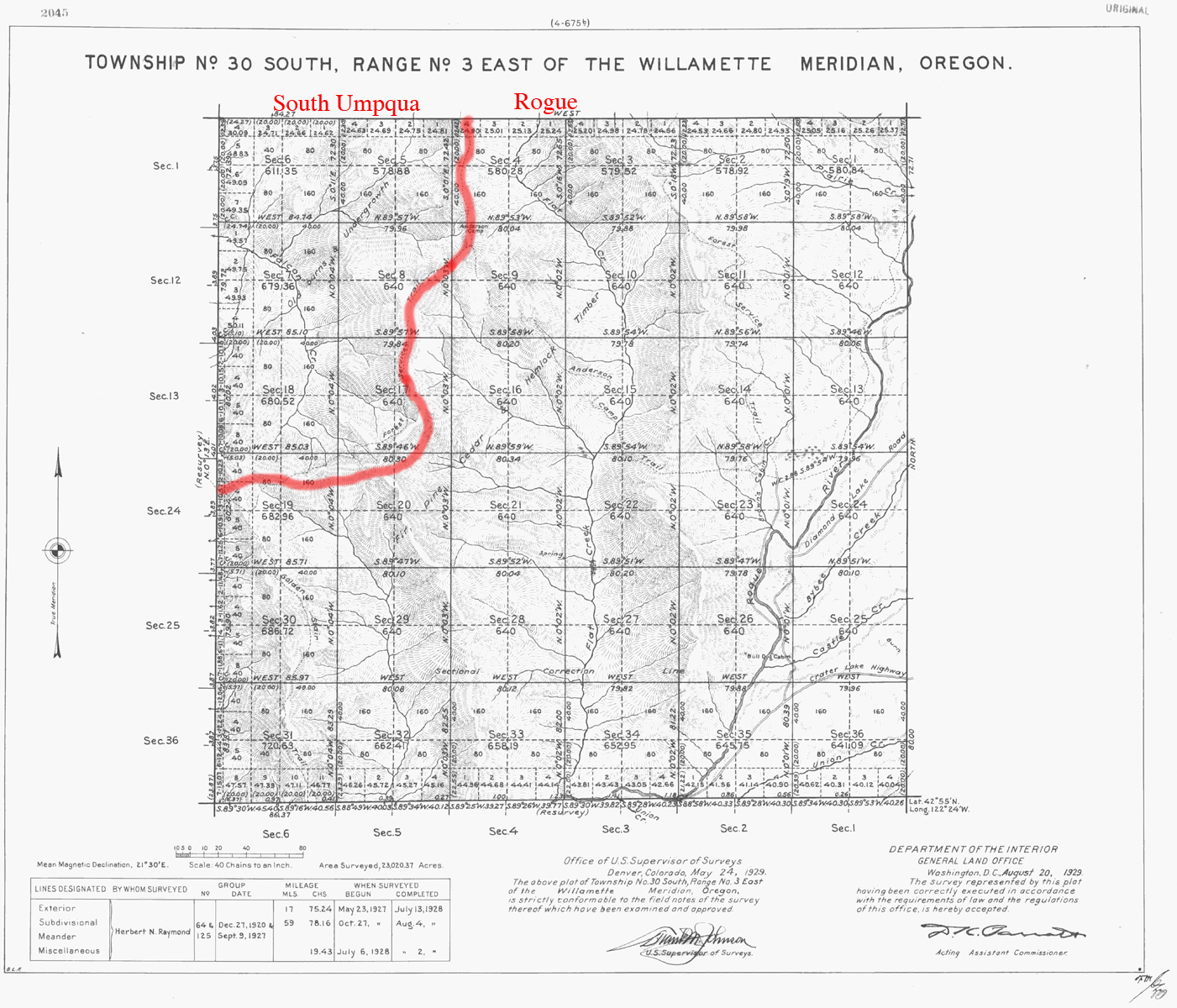
South Umpqua River
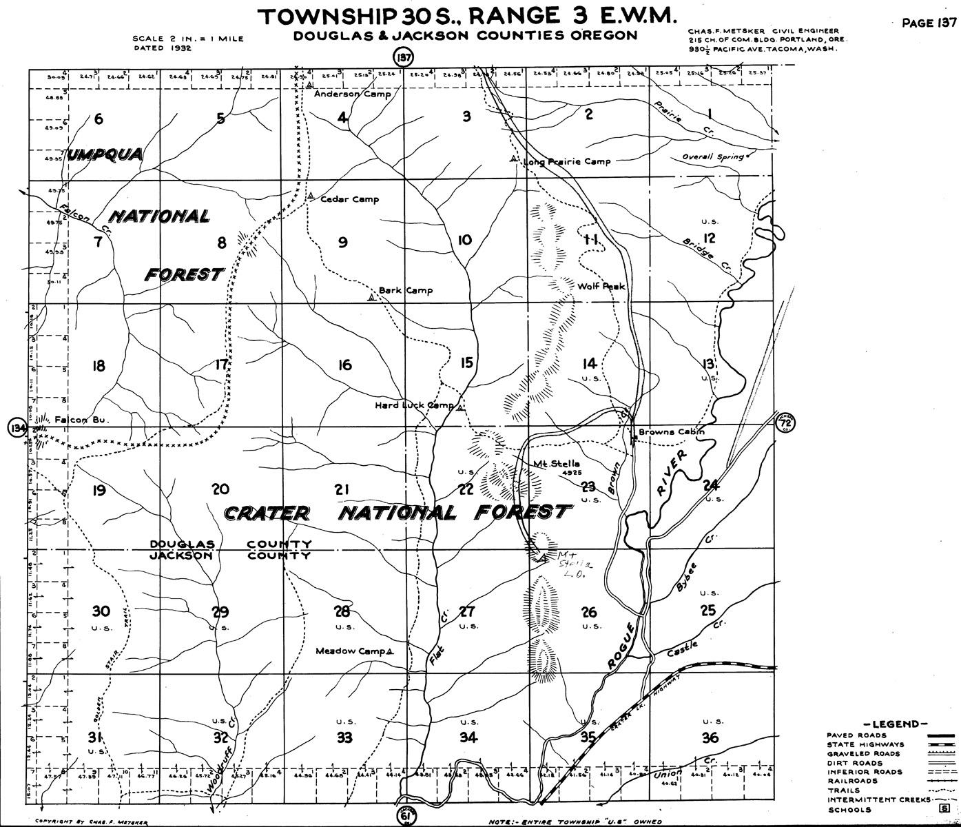
Tsp. 30 S., Rng. 3 E.
1929 General Land Office Survey Index
 |
 |
1929 GLO |
1932 Metsker |
The red line in this index indicates the south-eastern boundary of the 2010 South Umpqua Headwaters Precontact Reference Conditions Study, including the Anderson Camp Fire Lookout. This survey was completed in 1928 and mapped in 1929 (Raymond 1928).
![]()