South Umpqua River
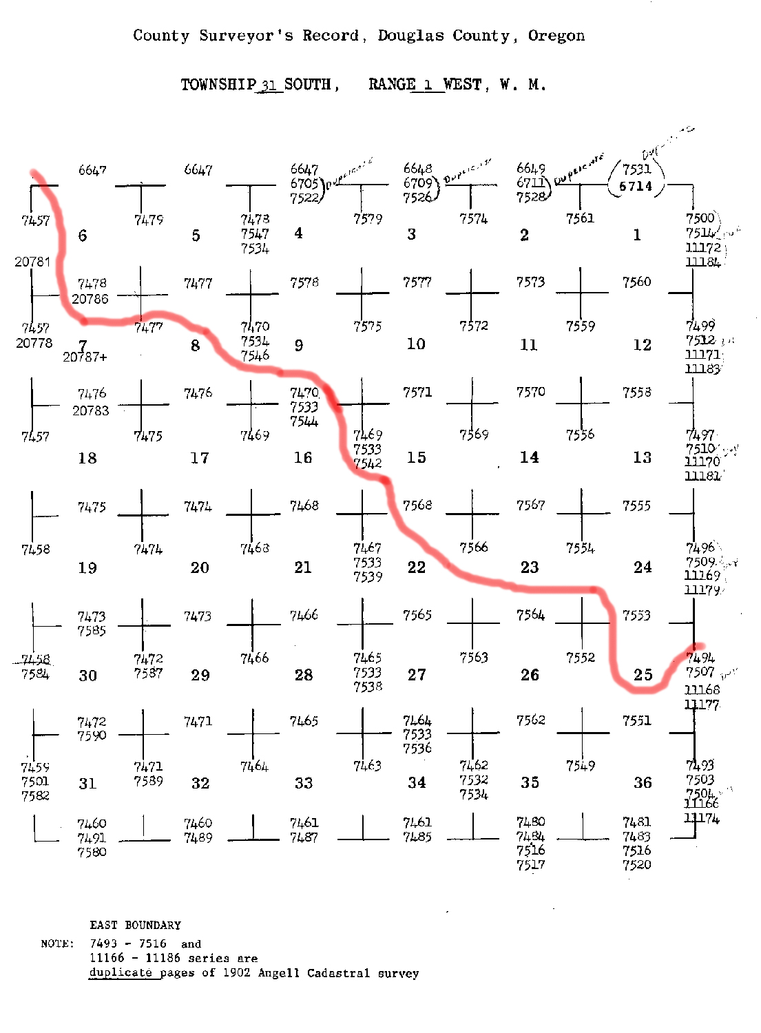
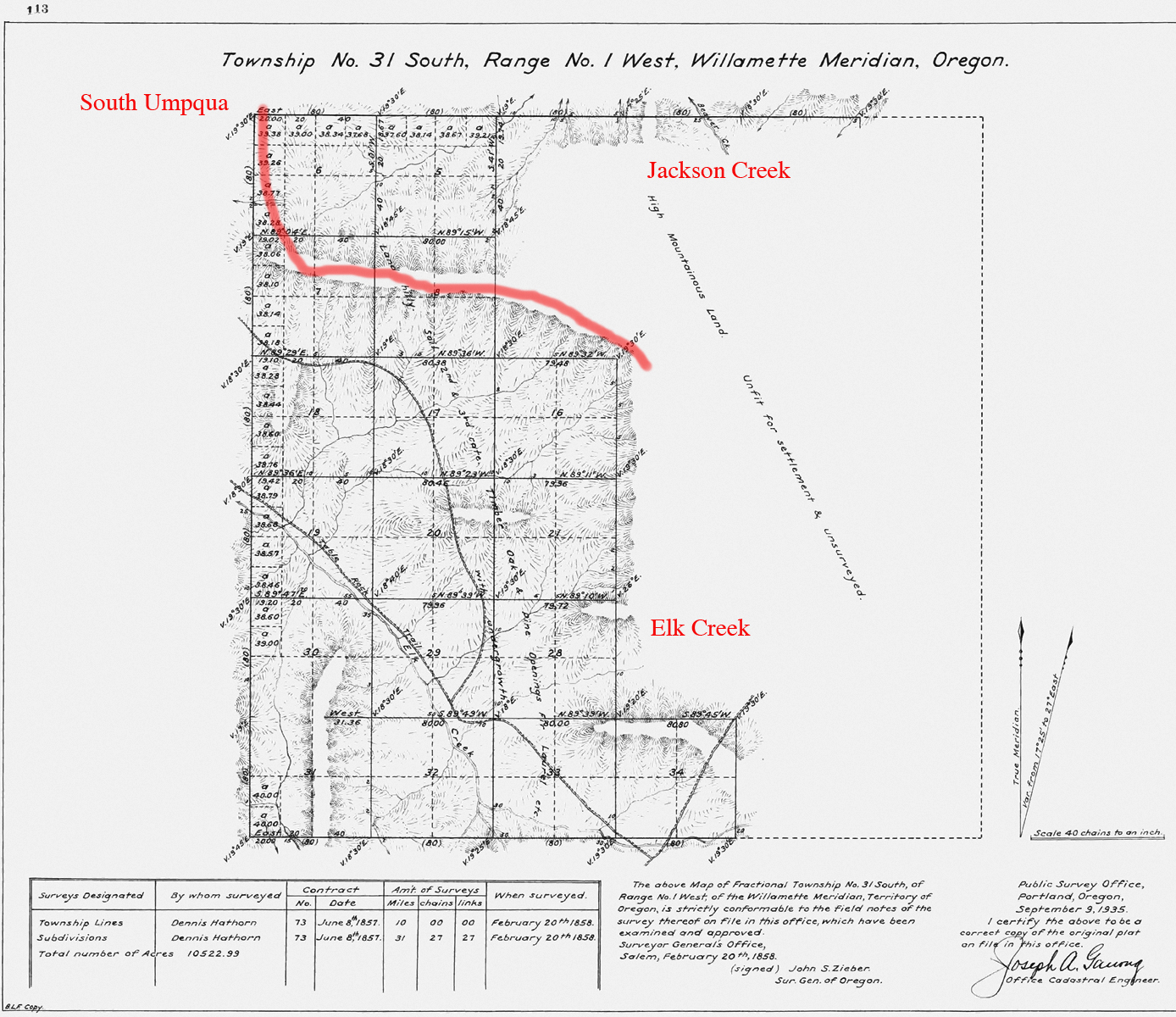
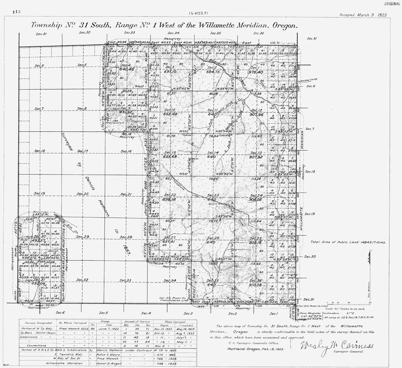
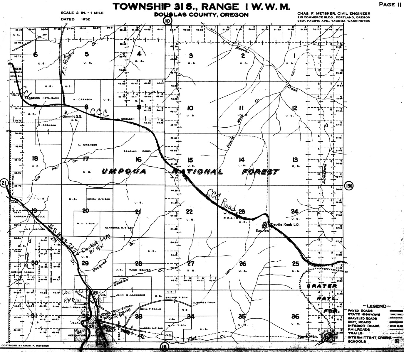
Tsp. 31 S., Rng. 1 W.
1925 General Land Office Survey Index
 |
 |
 |
1858 GLO |
1925 GLO |
1932 Metsker |
The red line in the index indicates the south-western boundary of the 2010 South Umpqua Headwaters Precontact Reference Conditions Study. This area includes the Devils Knob Lookout and Devils Knob and 505 Road Areas of Special Interest. This survey was completed in 1858 and 1923, and mapped in 1858 and 1925 (Hathorn 1858b; Mensch 1923c).
![]()