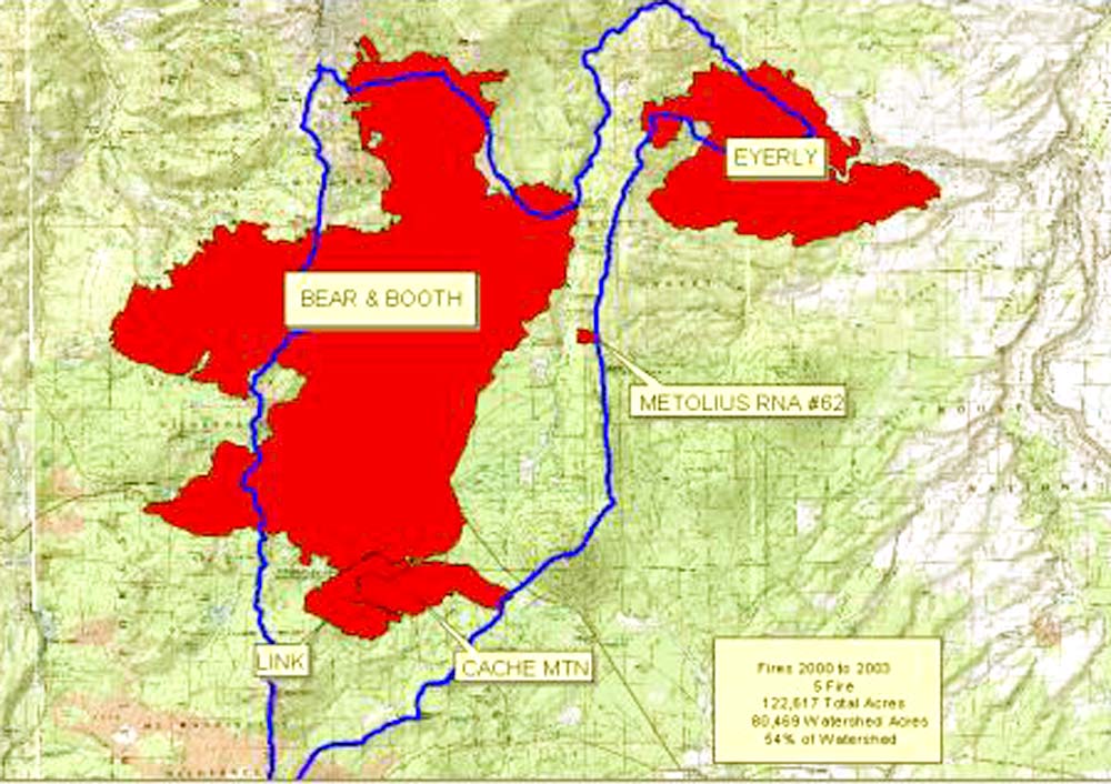
B&B Complex
Historical Forest Maps and GIS Layers
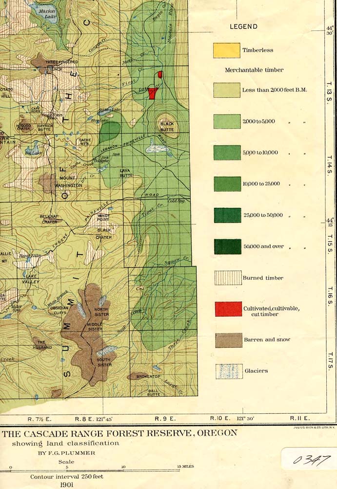
Fragment of Plummer's 1901 land classification map of the central Cascade Mountain Range of Oregon, including the current boundanries B&B Complex Study Area
|
Hyperlink
|
Title
|
Reference
|
Description
|
|
|
Cascade Range Forest Reserve, Oregon: Showing Land Classifications | Plummer 1901 | Map fragment and legend, showing ca. 1900 vegetation patterns for the B&B Complex study area, including extensive areas of "burned timber." |
 |
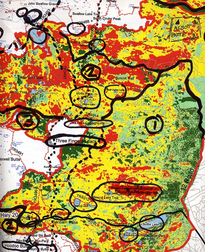
B&B Complex Burn Severity: From Field Observations, September 13, 2003 | USDA BAER 2003 | Annotated BAER map fragment showing Abbot Butte and Round Lake in relation to: 1. Red (High); 2. Yellow (Moderate); 3. Light Green (Low); and 4. Dark Green (Unburned) fire severity. |
 |
B and B Burn Intensity (Barc) | Mills 2003 | Annotated BARC map fragment showing Abbot Butte and Round Lake in relation to: 1. Red (High); 2. Yellow (Moderate); 3. Light Green (Low); and 4. Dark Green (Unburned) fire intensity. |
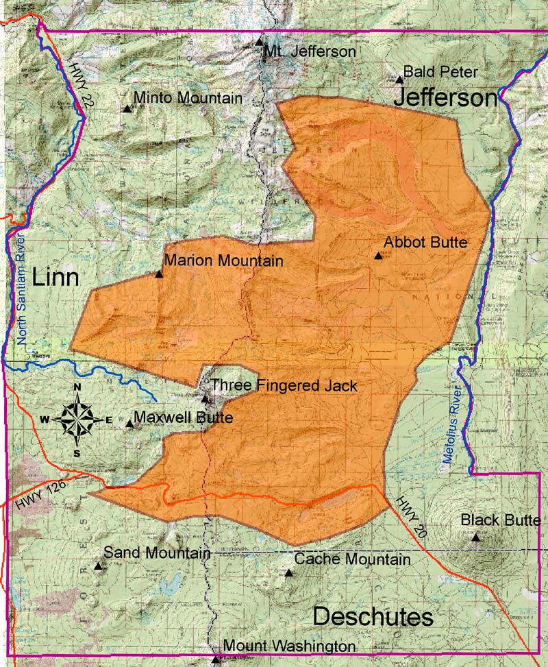 |
B&B Complex Study Area: Boundaries and Named Landmarks | Zybach and Lapham 2004 | Boundaries and named landmarks of B&B Complex study area. Landmarks are used to identify geographic locations of photo-grid panoramas. |
 |
Metolius Basin Maps | Pajutee_2004 | |
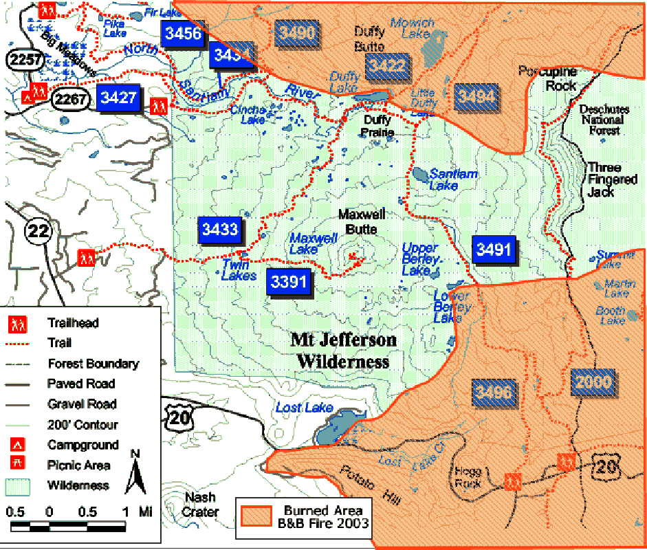 |
Roads and Trails. | ||
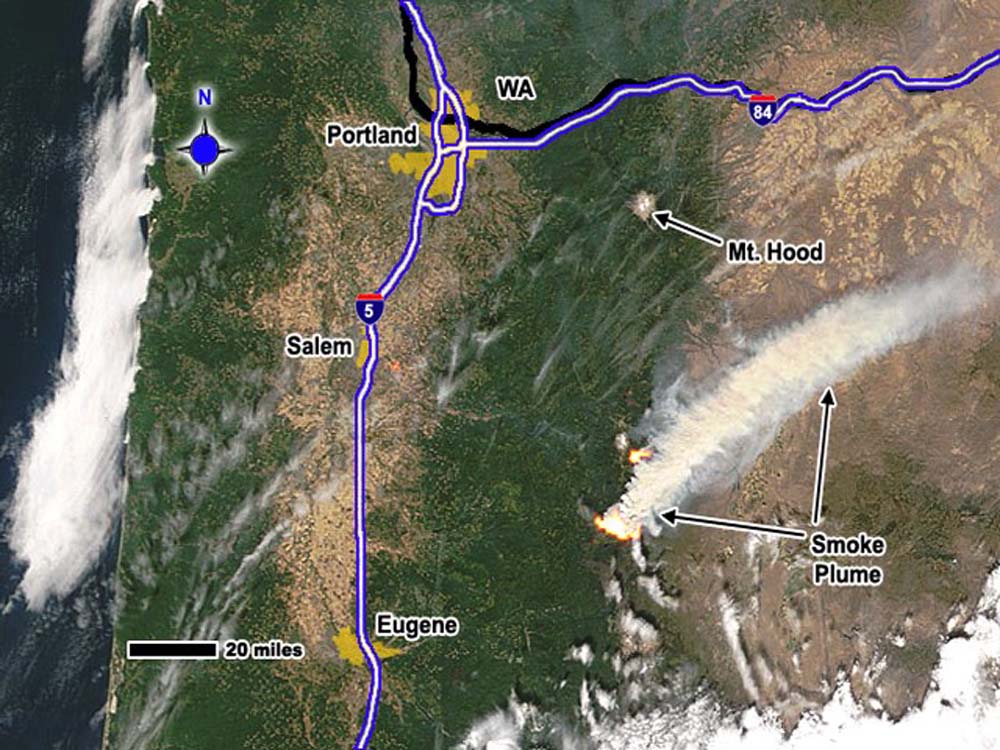 |
B&B Complex Smoke Plume, August, 2003 | Pajutee_2004 |
![]()
©2004 Oregon Websites and Watersheds Project, Inc. and NW Maps Co.