Maps, 1855 - 2012
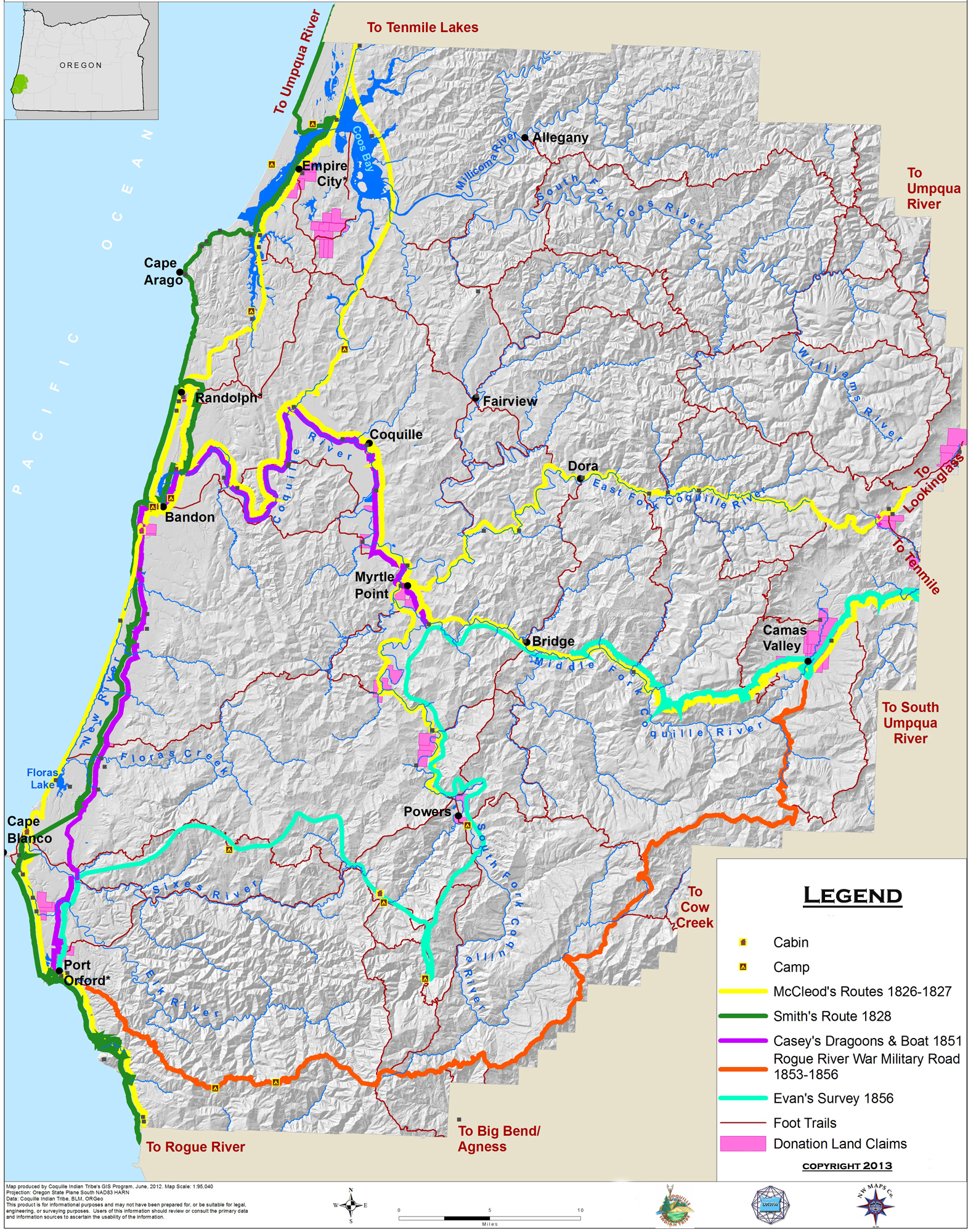
This is Map 1 of the 11 new maps created by this project to depict early historical transportation networks, land marks, and place names in the study area. This map shows five important early historical trail routes through the study area, from 1826 to 1856; the locations of Donation Land Claims from 1851 to 1856; and the background network of the foot trails and canoe routes from which they were derived.
This portion of the Coquelle Trails project is comprised of the principal historical maps used in the research phase of this study, and the 11 new maps that were created as a result of the research. These were not the only maps used (or created) during this process by any mean: US Forest Service, BLM, Weyerhaeuser, USGS 7.5 minute quadrangles, Oregon Department of Forestry, Metskers, and numerous other types of maps and map drafts were used as well -- and dozens of field and test maps were constructed and used from these sources. However, these were the principal historical maps that we used, and the finished maps that were created as a result.
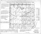 |
Historical GLO Maps, 1855 - 1935. More than 180 General Land Office (GLO) original land survey and Donation Land Claim (DLC) survey maps, covering the entire 1,400,000+ acre study area, were used during this project. Areas were surveyed and platted between 1854 and 1934. |
| Historical USGS Maps, 1896 - 1955. All field work for this project was done on 50 current 7 1/2 minute USGS Quadrangle maps, but most verification of historical place names and trail and road locations was obtained from these early 15-minute and 30-minute Quadrangles. | |
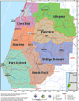 |
Study Area Maps, 2012. Eleven maps were made for this project: four representing the entire study area, and seven representing each of the seven Historical Districts. |
![]()