2020 SWOCC F251 Elliott State Forest "Virtual" Roads & Trails Report
Part 2. Pre-Elliott County Roads and Logging Roads, 1900-1930
By Kevin Ballard, Ethan Howard and Regan Lavoie
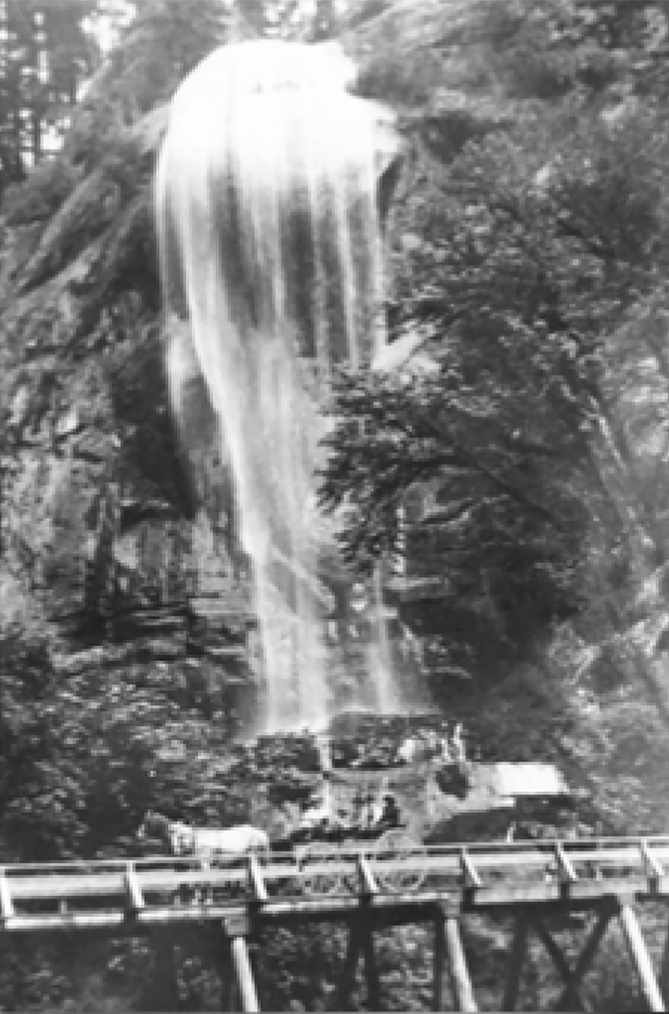
Fig. 5. Larson photo of Silver Falls and bridge, ca. 1911 (Youst 2003: 86).
The Elliott State Forest was established in 1930 to benefit the Common School Fund of Oregon; however, the forest and its resources were being used long before 1930. The forest was used for a variety of reasons prior to being established as the Elliott, ranging from use by the Native Americans of Oregon, homesteading by the early white settlers, recreation such as hunting and fishing, and, of course, logging.
The history of the forest prior to being established as the Elliott has been orally passed down from generation to generation, and some of the history of the forest can still be found today from the remnants of roads. Though with pre-Elliott logging the timber was primarily transported by water, some of the county roads that run through the forest have historical significance from the type of construction that was used to create the roads. Not only are some of the roads around 100 years old, they are important to help the people today understand not only how the early settlers of Oregon travelled prior to paved highways, but how they built the roads on which they travelled. This report will discuss the significance, use, location, and creations of roads of the Elliott State Forest from 1900 to 1930.
Many of the current road systems in the Elliott State Forest were built by the Civilian Conservation Corp (1930’s) or built for the timber salvage from the Columbus Day storm (1960’s). However, there are still road systems in the Elliott that were used prior to 1930.
On September 5, 1900, a petition and affidavit was established to build a county road through the forest land. The road was to start at the bridge at Glenn Creek Junction and terminate on the summit of the dividing ridge between the waters of Glenn Creek and the waters of Loon Lake. The petition obtained 55 signatures.
Upon approval of the affidavit from the county commissioner the state surveyor, Simon Bolivar Cathcart, conducted a survey of the possible new road and reported his findings back to the commissioner. The commissioner declared, “the viewers report, survey and plat be recorded and that said road as viewed out, surveyed and platted be declared a public highway and the road supervisor open said road for public travel” (Youst 2003: 83).
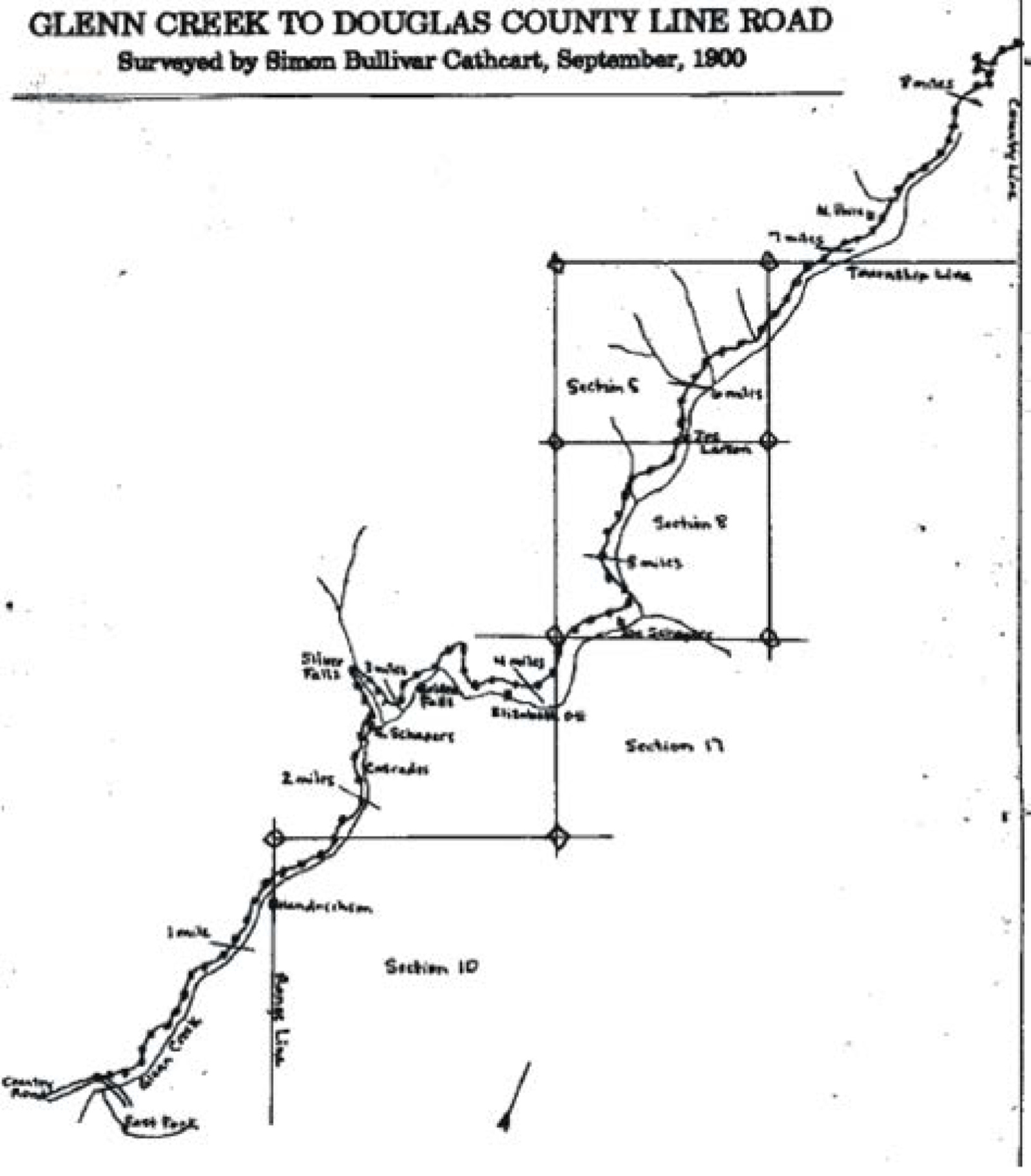
Map 3. Cathcart's Coos County Survey of Glenn Creek Road, 1900 (Youst 2003: 82).
While Cathcart was conducting his survey, he came across an impassable rock bluff. Since Coos County was not willing to fund the construction to build a road through the rock bluff, the public took matters into their own hands. Men spent up to 50 days blasting through the bluff; they did not have the technology we have today. The men would each carry 50 pounds of dynamite up to the bluff each day. The men would then lower themselves down the bluff and create six-foot deep holes in the bluff with a hammer drill to load with dynamite and set the charges. By the end of the summer the men had created their road through the bluff. The style of construction of this road makes this road historically significant.
A few years later, in 1906, the county allotted $1,000 to obtain a contract to complete and grade the road. In 1909 the width of the right of way of the road was established at 40 feet, and in 1911 a team of contractors set out to widen the road (Youst 1934: 84). The improvement of the road allowed new opportunities like the creation of a sawmill at Loon Lake. By 1912 the road had made so many improvements that an auto stage line was put in. The stage line ran until 1916 when the railroad was finally completed from Eugene to Coos Bay.
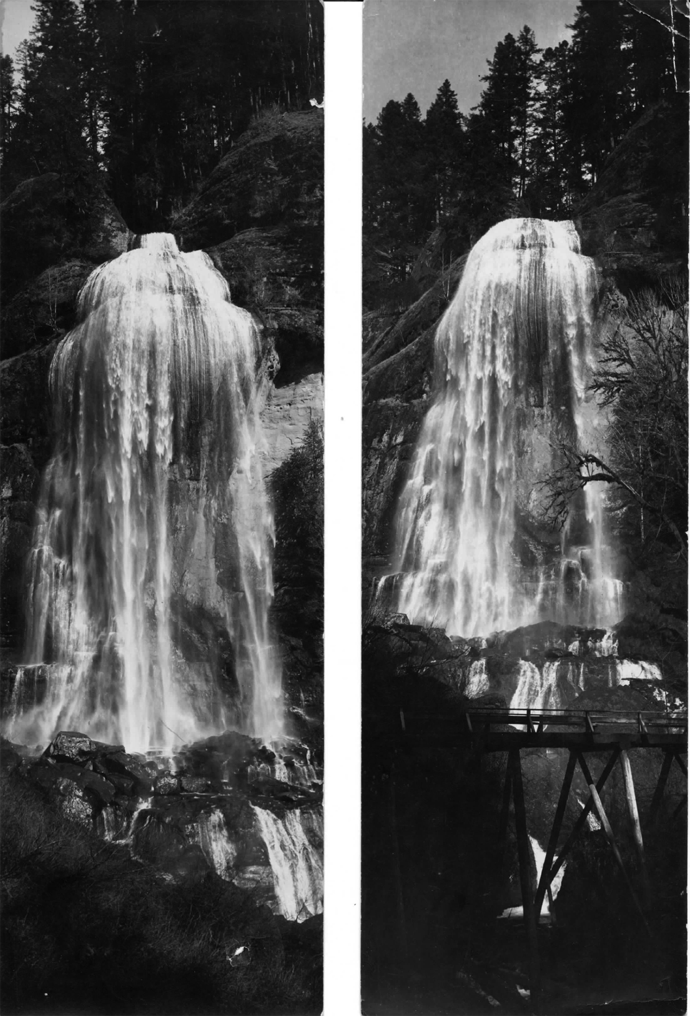
Fig. 6. Gould Postcards of Silver Falls and Bridge ca. 1930
After the railroad was finished in 1916, the county lost interest in maintaining the road. The only maintenance that was done on the road was done by the public that continuously used the road; most likely the same people that risked their life's blasting their way through the bluff (Youst 2003: 84).
Douglas County Road No. 3: Loon Lake Road
Another important county road is County Road No. 3. In 1900 a community that lived in what is now known as the Elliott State Forest, created a road petition and sent it to the commissioners of Douglas County (Fig. 7). The petition stated the desire to create a county road from Allegany to Loon Lake (14.5 miles). This road would allow the residents living in this area to travel to and from. The construction of the road was delayed due to multiple complaints from landowners whose land would be damaged if the road was created. It wasn't until 1920 that the petition for the road was finally approved. This road can still be traveled today and is now known as Loon Lake Road (Information provided by Heidi Wood, Information Technician, Public Works Engineering Division, Douglas County, Oregon).

Fig. 7. Local Resident Signatures in favor of Douglas County Market Road #3, August 4, 1900.

Map 3. Douglas County Survey of "Market Road #3," November 1920.
Douglas County Road No. 2: Umpqua River Highway 38
Equally important as the two county roads listed above is County Road No.2, now known as Highway 38. Unfortunately, after speaking with the Douglas County Surveyor’s Office I was not able to obtain the same level of information that I obtained regarding Glenn Creek Road and County Road No. 3. However, I was able to establish that Highway 38 was in fact a County Road prior to 1930.
When looking at the Glenn Creek Road there are a few factors that make this a historically significant road. The first and most obvious factor would be the age of this road. The construction of this road took place not just 50 years ago, but over 100 years ago. The other factor is the style of construction of this road. This road was built long before there was fancy equipment that is used in the construction of roads today. A few dedicated men worked many long days constructing this road through the bluff with hand tools and risking their lives by propelling down the bluff to set the dynamite charges that blasted the path through the bluff.
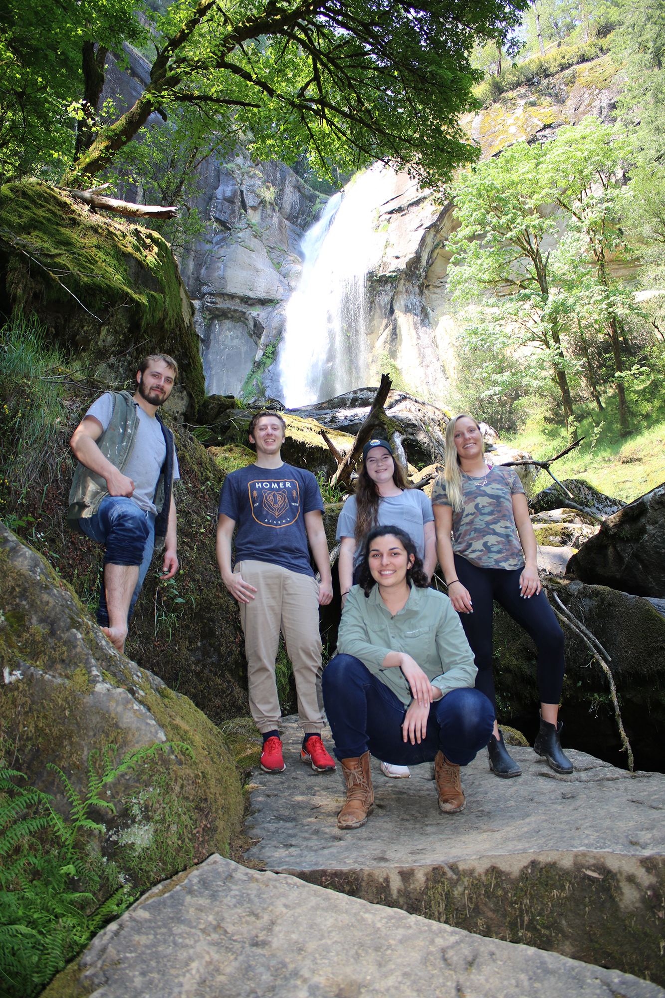
Fig. 8. Southwestern Oregon Community College Natural Resources Instructor, Tasha Livingstone, with 2019 F251 Forest Recreation Students (L-R) Sebastian Bartlett, Koby Etzwiler, Hunter Black-Priest and Amelia Harvey, Golden Falls, May 28, 2019 (Photo by Anne Farrell-Mathews).
Recommendations
I do not have any recommendations for County Road No. 2 since it is now a highway that is maintained by the Oregon Department of Transportation.
I do not have any recommendations for County Road No. 3 except to continue maintenance on what is now known as Loon Lake Road.
My recommendations for Glenn Creek Road would be to continue maintenance, as well as add a sign near the bluff that was blasted out for the road to pass through describing the construction that took place in order for the road to be created, as well as establish the road as a historically significant road (Oregon State Historic Protection Office 2013).
© 2021 Oregon Websites & Watersheds Project, Inc. & NW Maps Co.