Methodology
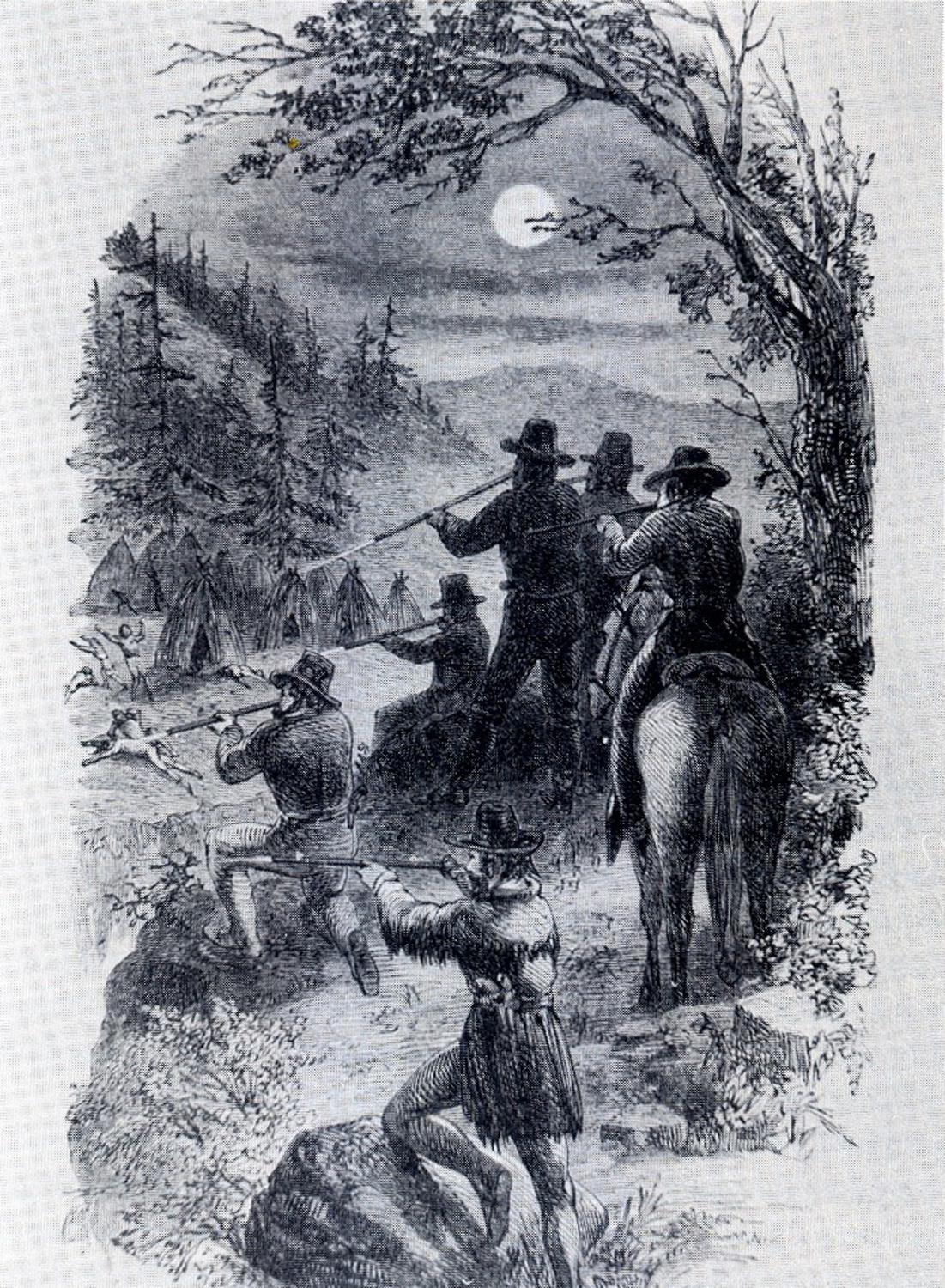
"Fighting The Indians" (Glisan 1874: 283).
Making the Trail Maps
Grandmother Ned was born many moons ago in a little village on the Coquille River, a few miles from her home. This was her people’s home, and how long they had been here nobody knows. They used the river for a highway, and their trails laced through the hills and valleys. Beverly H. Ward (1986: 7) |
The primary purpose of the Coquelle Trails research project was to locate and document, so near as possible, the exact locations of the earliest historical trails, named landmarks, private landowners, and important events of the ancestral lands and trade routes of Tribal Coquille Indian families and communities -- and then be able to locate those routes and events on Tribal GIS layers and proprietary field maps; and on a series of digital and print maps intended specifically for the use of students, teachers, and interested public.
This information also has important value to wildlife ecologists, landscape historians, and resource managers
The products developed during the course of this project include: the proprietary field maps; physical and digital historical document files; Tribal GIS layers; annotated reference maps; Excel database project indexes; GPS-referenced photographs; an educational website; this report; and a complementary wall map, Coquelle Trails Study Area: Historic Routes and Trails, 1826 to 1856 -- which has been reduced in size as the facing frontispiece ("Map 1"), and is fully intended to be a principal outcome, illustration and cross-reference to the project and to this report.
The intended audiences for these combined materials are the students, teachers and scientific researchers of local history, geography, and culture -- particularly those with an interest in the lives of ancestral Coquille Tribal families and communities. Each of these products is intended to be organic by design: that is, as new information becomes available they can be easily updated, corrected, amended, and/or expanded as needed. The design is also intended to be functional insofar as the ready location and use of cross-referenced project maps, historical documents, academic references and digital datasets are concerned.
This report is arranged in two volumes. Volume I includes this introduction: a description of project boundaries -- spatial and temporal -- and definitions; a brief, mostly illustrated, an illustration and brief description of primary research methods; description of how the finished trail maps were constructed for this project; a complete series of the seven “Historical District” trail maps of the study area, each illustrated with a table of six GPS-referenced field photos representative of the general travel conditions within the district; an overview of the earliest documented accounts of travel within the study area, from 1826 to 1875; and an annotated bibliography, with references, of the principal historians and academicians whose earlier work contributed to this research.
Volume II contains a series of the earliest historical records in the study area, including transcribed excerpts from the Alexander R. McLeod journals of 1826 – 1827, the journals kept by Harrison Rogers and Jedediah Smith in 1828, and the correspondence of Lt. Col. Silas Casey in 1851; a series of cross-referenced tabular indices derived from project Excel databases, including project legal descriptions, historical map locations, transcribed land survey records, early landmark and trail names, and referenced land surveyors; tabular indices and timelines of historical events and locations; and listed historical references.
The combined data represented by these two volumes provides the documentary basis and supporting methodology for the construction of Map 1 and of the remaining ten maps that together constitute a principal intended outcome of this project: the Coquelle Trails Map Series, 1826 – 1875.
Project Setting, Description, Boundaries & Definitions
Before 1826, or possibly 1827, there were no pack trails or wheeled vehicles in the Coos or Coquille river basins. Virtually all travel was accomplished by foot or in canoes, and had been for more than 10,000 years. The line of demarcation between these modes of transport was often the head of tidewater in the bay, at the far reaches of sloughs, and along the tidal rivers and major creeks. It was quicker and easier to move goods and people in and out with the tides in canoes than it was to carry loads or move long distances by foot; but canoes were not an option in upland areas or along shallow rocky streams. Once outside a canoe, virtually all other travel was by foot -- and these had been the only two documented methods of transportation since people first entered the area, whether by boat or by foot. For as long as people had canoes, then, and wherever they used them in the study area, it seems likely that the head of tidewater soon became a principal juncture of foot trails and canoe routes: in fact, many of these junctures had developed into known campgrounds, communities, and trade centers well before the beginning of historical time.
The current northern-most extent of tidewater in Coos Bay, near present-day Hauser, was selected as the northern boundary of this study; the eastern extent of the Middle Fork Coquille River headwaters is the study’s eastern boundary; the southern extent of the South Fork Coquille headwaters is the southern boundary of the study; and the Pacific Coast, from Humbug Mountain on the south to North Spit on the north, forms the western boundary of the study. In all, the study area is a little more than 1,425,000 acres in size and includes the entire Coquille, Elk, Sixes, and New River drainages, as well as a large portion of the Coos River basin (Map 2).
In late 1826 or early 1827, Alexander McLeod apparently introduced the first packhorses into the study area, by way of connecting the South Umpqua River Valley with the Coquille River and Coos Bay basins. On June 30, 1828, Jedediah Smith entered the study area from the south with a crew of 28 men and a team of 300 horses and mules. In a ten-day period he traveled the entire south-north distance of the area: along the coast from Humbug Mountain to North Spit.
The next historical record in the study area, following the departure of Smith and his troupe on July 11, 1828, was not until 1851 and the landing made by William Tichenor and his crew at Battle Rock (Fig. 1). From 1851 until the completion and development of the Coos Bay Wagon Road in 1875, a massive transformation took place in regards to the types and locations of trails within the study area; a time which, for the most part, good records still exist.
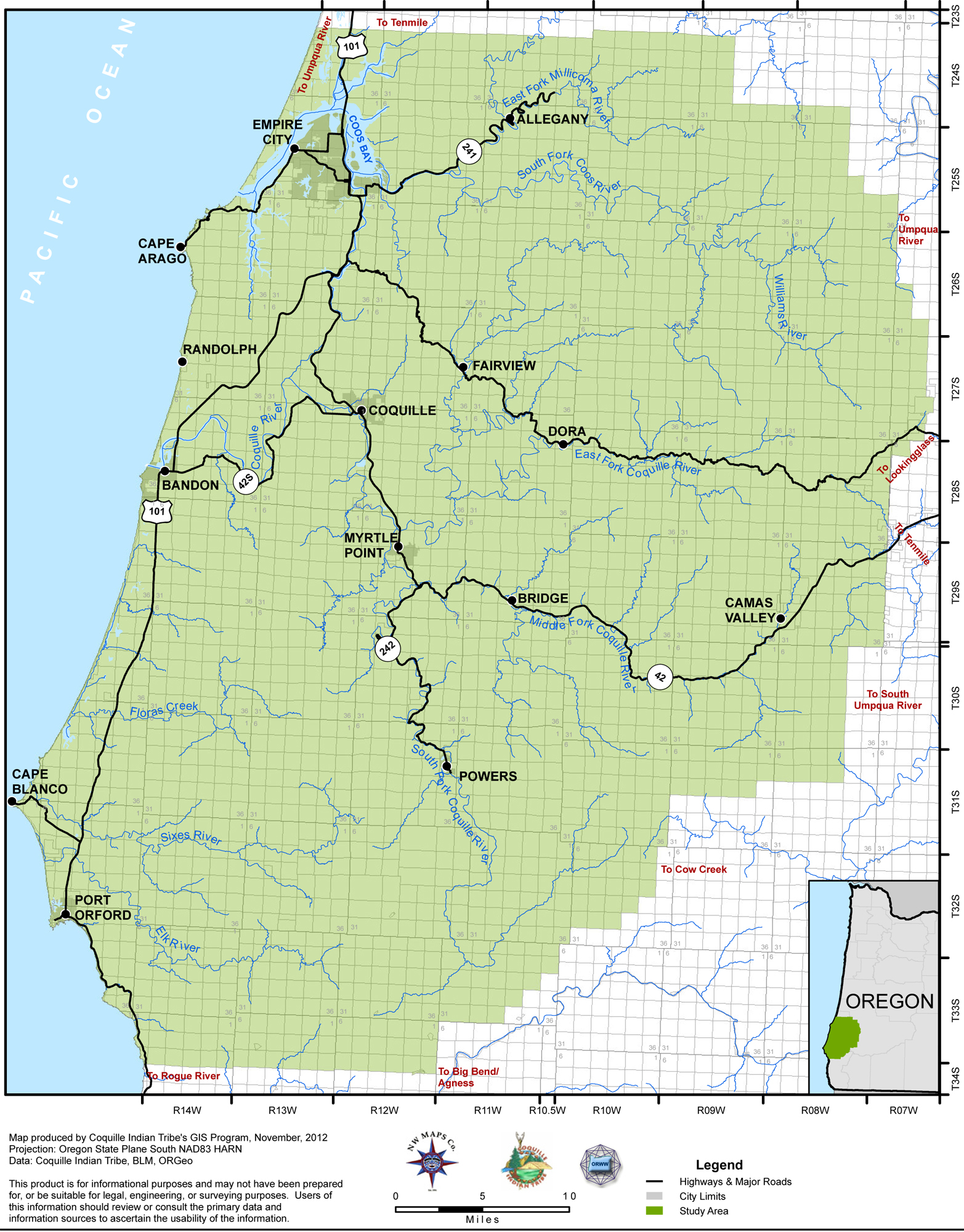
Map 2. Coquelle Trails Study Area: Modern Towns, Boundaries & Highways, 2012 (Zybach, Ivy & Harkins 2012).
Within weeks of the first arrivals of immigrant gold miners and settlers in early 1853, foot trails began being replaced or supplemented by pack trails, “cow trails,” “sled trails,” and “skid trails” -- and these new developments immediately began heading directly toward gold deposits, coal veins, local timber stands, farm lands, pasturages, and sea ports (Fig. 2).
By 1854 some of these routes had become bridged and graded so as to allow for wagon use. In 1855 the US General Land office (GLO) began surveying and mapping lands within the study area that had been claimed by American settlers (Fig. 3). These surveys included a number of references to Indian Trails, “Old” Indian Trails and even Klickitat Indian Trails (Fig. 4). In July 1856, nearly all of the Indian families and people still remaining in southwest Oregon were forcibly collected together and sent to government reservations at Grand Ronde, Siletz, and Yachats (Zybach 2012). Following 1856, the next GLO Survey reference to an “Indian Trail” in the study area wasn’t until 1911 (Vol. II, Part 2.4).
During the course of this research it became necessary to define and refine terms used to describe the differing types of foot trails and canoe routes that existed during early historical time -- also the types of roads and trails that first developed from this framework following the abrupt and nearly complete replacement of local, long-established traditional cultures with successive invasions of immigrant foreign cultures from 1851 to 1856.
We found the following definitions useful, if not always definitive, in our several formal and informal discussions of routes, maps, and historical journal accounts:
Major trail networks are those combination of primary ephemeral trails, canoe routes, and foot-trails that most directly connected the families and communities of the Sixes, Elk, Coquille, and Coos rivers in late precontact and early historical time, and remained in full use when first observed and described by McLeod in 1826.
Canoe Routes. Canoe routes extended to the navigable tidewater limits of the bay, rivers, large tidal creeks, and sloughs of the study area. These locations were typically important beginning or terminus points to primary foot trail and pack trail locations.
Riparian Trails. Riparian trails followed creeks and rivers to reach fishing and camping spots, or to travel to the next community, particularly in areas above tidewater. These trails (and stream crossing spots) often varied significantly from season to season or day to day, depending on tides, stream flow levels, and time of year.
Ridgeline Trails. Ridgeline trails, as their name implies, typically follow the watershed divisions between rivers and major creeks. These trails often parallel riparian trails at lower elevations. They were seemingly used most often on a seasonal basis, or for longer distance travel trips from one major community to another. Travel could be limited by snow or heavy winds, and was probably greatest during early spring to late fall, for hunting, gathering, and trade purposes. Important ridgeline trails in the study area include Bald Mountain, Panther Ridge, Johnson Mountain, Iron Mountain, and Callahan Trail.
Ephemeral Trails. Ephemeral trails are those routes that change locations from time to time: whether every day, every season, or every few years. Trail locations typically shift in a back and forth pattern, depending on tides, landslides, fallen trees, seasonal stream flows, and other factors that affect well-traveled routes along ocean sands, bay mudflats, or river banks. The most important ephemeral trail route in the study area is the north-south beach trail that extends almost the entire length of the coast, with minor variations at headland, river, and bay crossings.
Primary Trails. This is the principal group of canoe routes, ridgeline trails, riparian trails, and ephemeral trails that provided a direct linkage to ancestral Coquille coastal, tidewater, and mountain communities prior to the advent of wheeled vehicles, horses, and oxen. One such foot trail appears to have connected Big Bend on the Rogue River, to Myrtle Point on the Coquille River, and the eastern tidewaters of Coos Bay – with major canoe branches to Bandon and foot trails to Camas Valley, Cow Creek Valley, and Fairview.
Secondary ("Connective") Trail Networks
Secondary trails form the “short cuts” between primary trails at convenient locations, and can also be used on a more seasonal basis for local hunting, fishing, gathering, and trading purposes.
Diffused Trails. These trails are most often associated with primary destination points in large, open, flat or gently sloping areas, such as towns, villages, and seasonal campgrounds located in large meadows, prairies, wide saddles, or alongside marshes and mudflats. Once an individual arrived in such a location, it was much like being in a canoe on the bay at slack tide -- you can go in any and all direction with similar ease and speed and there is no need to follow a particular path. These types of trails are most evident in areas of relatively high population, where a person can go almost anywhere, anytime, without major impediments -- and with a wide number of potential destinations, such as homes, freshwater sources, fishing spots, cultural food plant fields, and trading or gaming locations.
Pack Trails. Pack trails are, for the most part, considered “secondary” in this project because they represent the novelty of travel by horseback that characterized the entire historical period considered by this study. It is important to note that there is no history of horses or other pack animals in the study area between July 1828 – when Jedediah Smith passed through – and May 1851, when Silas Casey sent Lt. Stanton by horseback from Port Orford to the Coquille River. However, it is also likely that Hudson Bay trappers and Klickitat hunters – and perhaps others – may well have also used these new trails from time to time in the 1830s and 1840s.
Roads. Roads, for purposes of this project, are considered graded surfaces prepared for wheeled traffic, such as wagons or carriages. Stream crossings often involved the construction of bridges to accommodate the vehicles. The first roads constructed in the study area were probably in 1851 or 1852, in the neighborhood of Fort Orford; or 1853 or 1854, in the area of Empire City.
Railroads. Railroads were constructed in the study area before 1875, but their history has not been considered for the most part because their use was almost entirely related to coal mining and not general transportation or most other trade during those years. They were also widely used in the study area for logging purposes, but not until later years.
 |
|
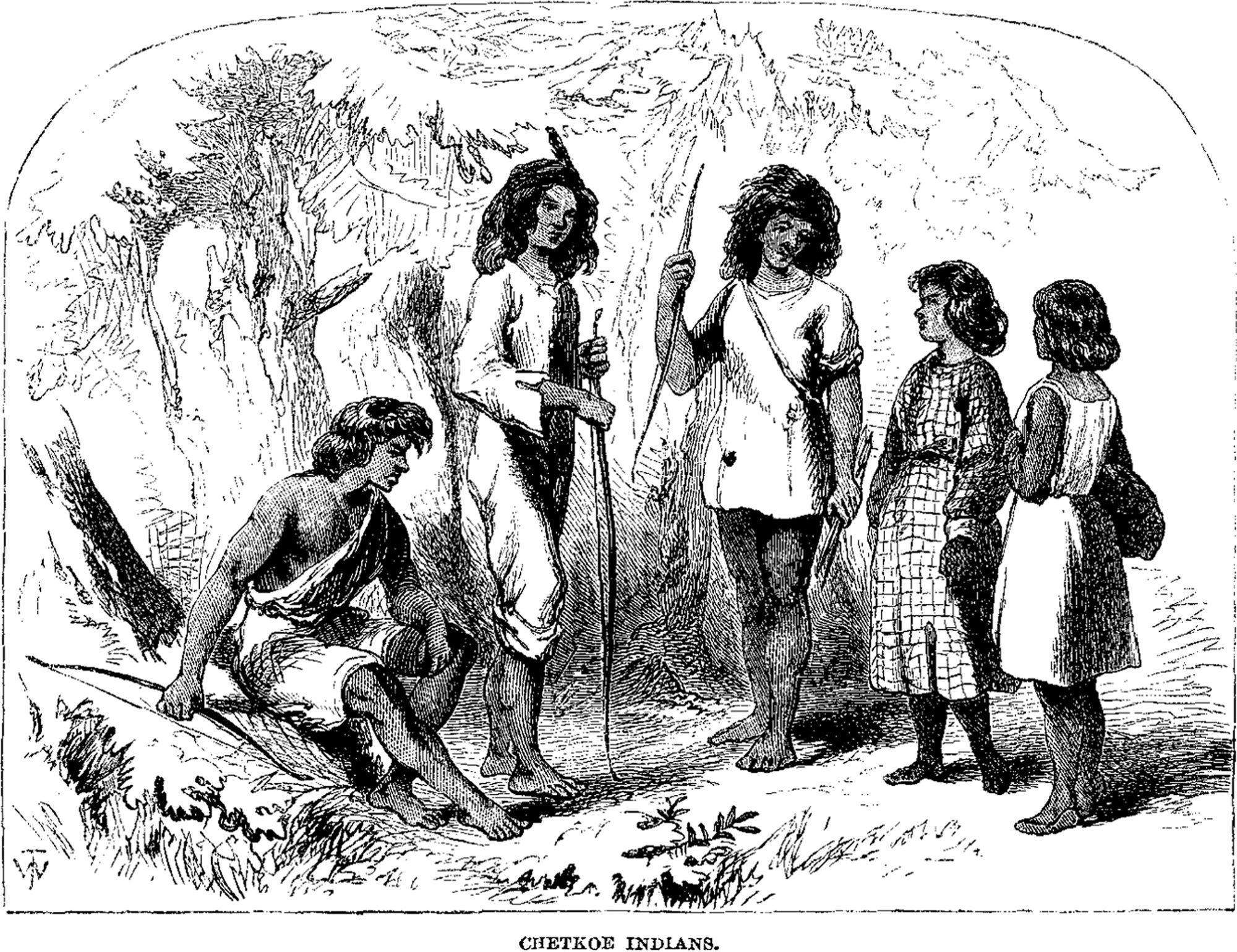
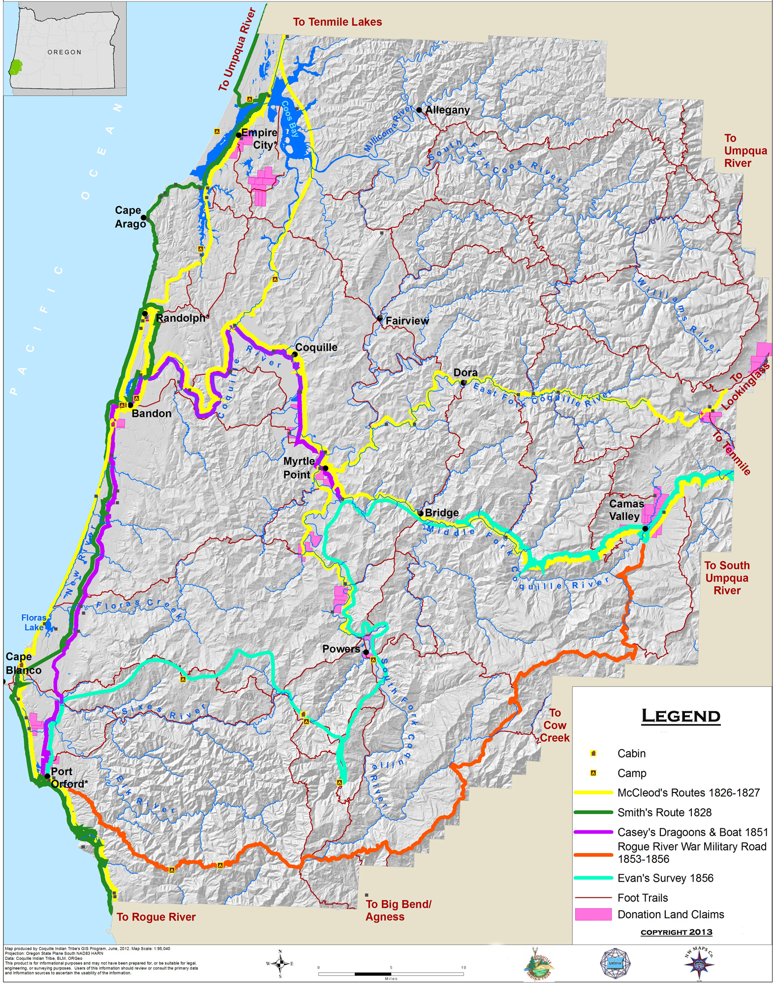
Chetkoe Indians (Wells 1856: 588) |
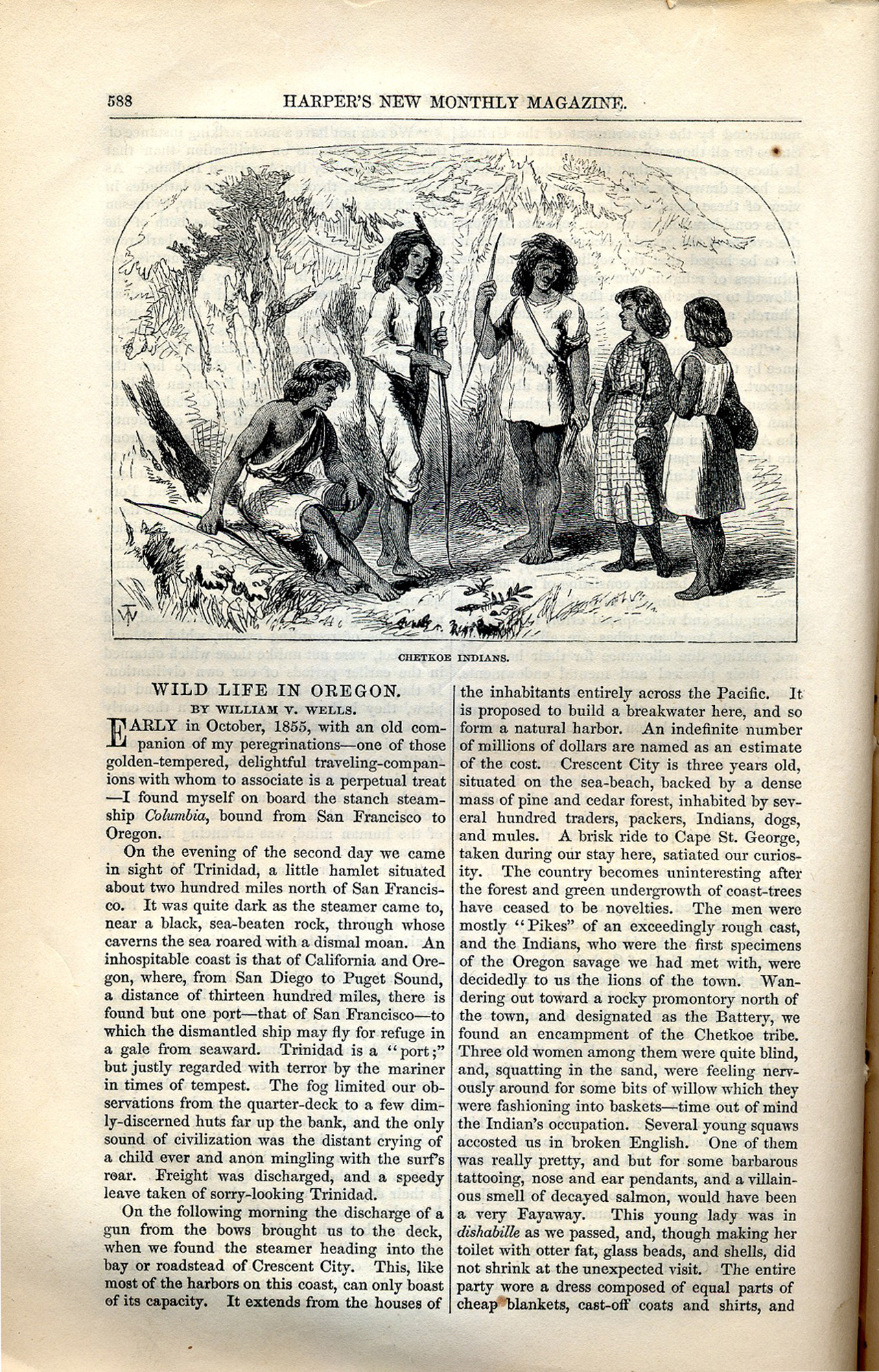
Beach Gold Digging (Wells 1856: 595) |
|
|
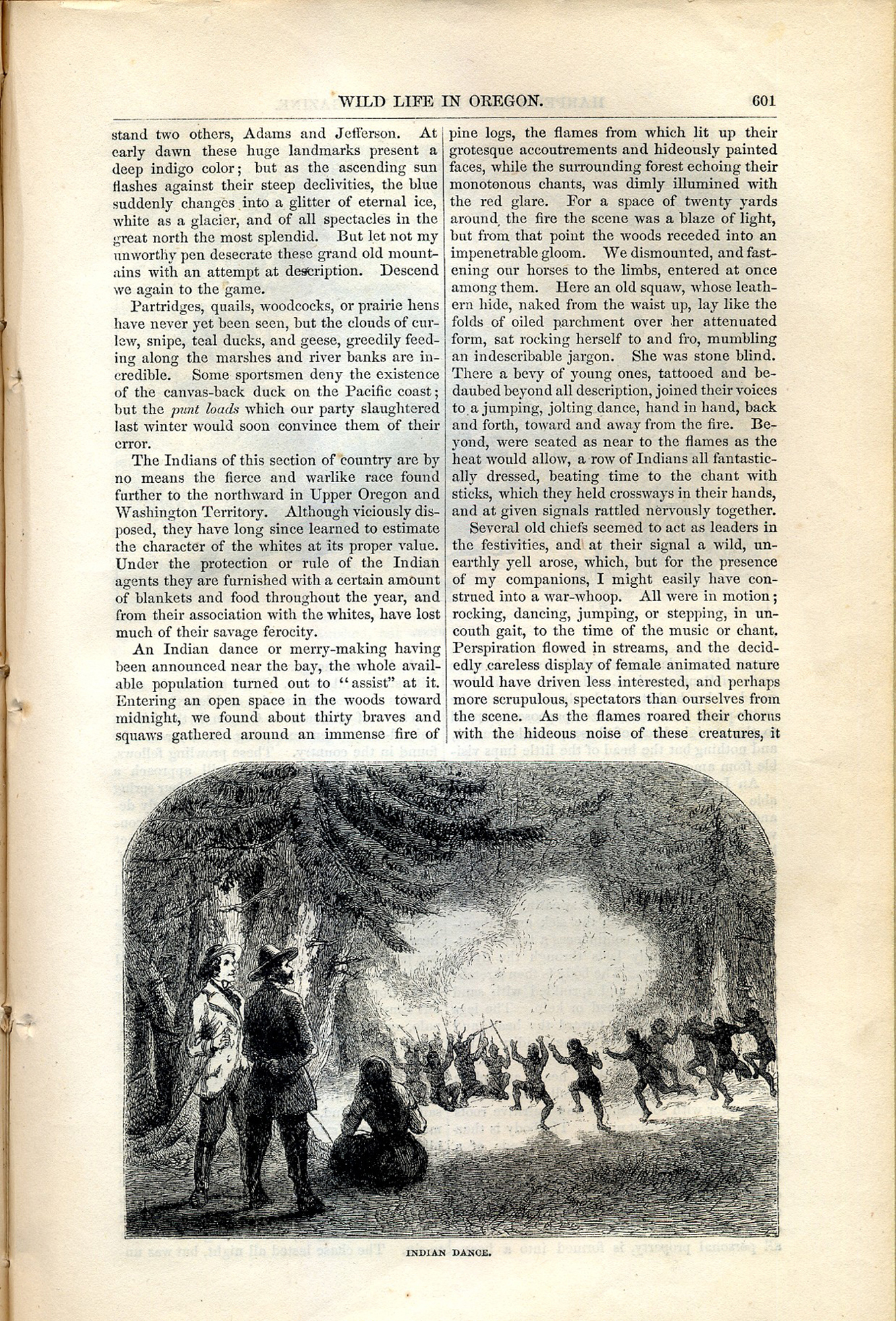
Indian Dance (Wells 1856: 601) |
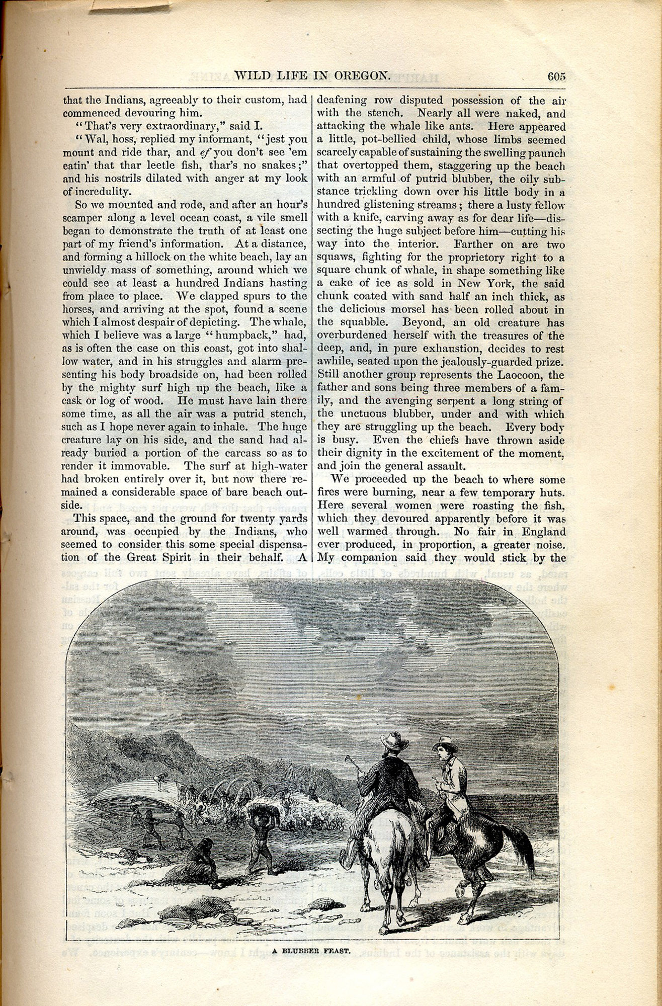
A Blubber Feast (Wells 1856: 605) |
|
|
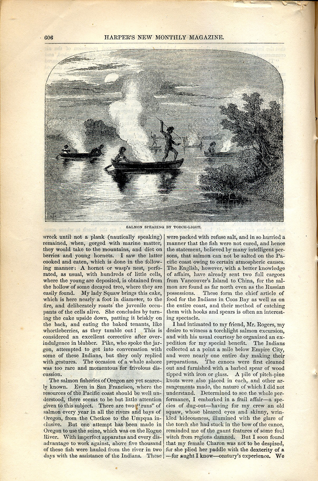
Salmon Spearing By Torch-Light (Wells 1856: 606) |
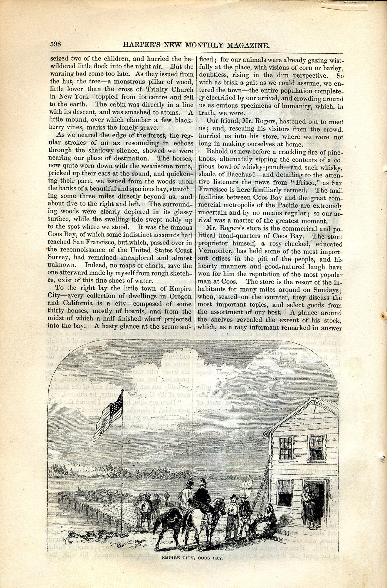
Empire City, Coos Bay (Wells 1856: 598) |
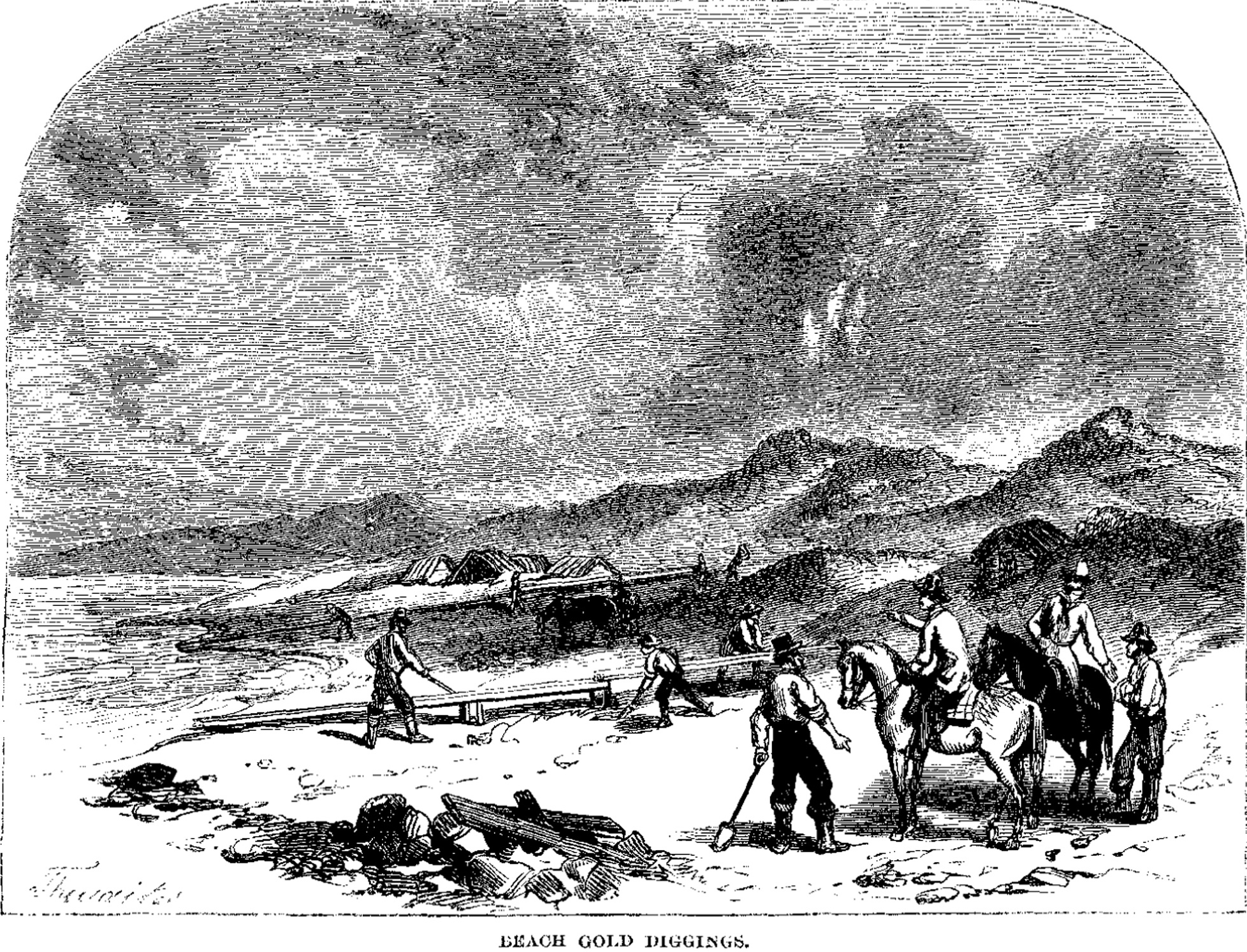
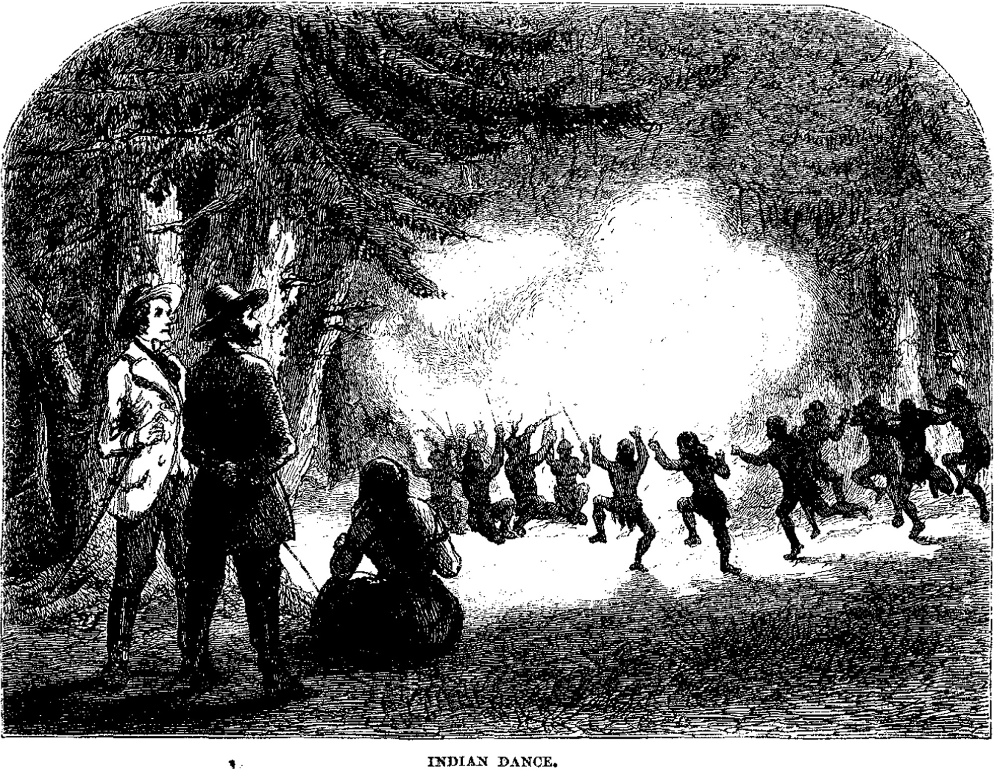
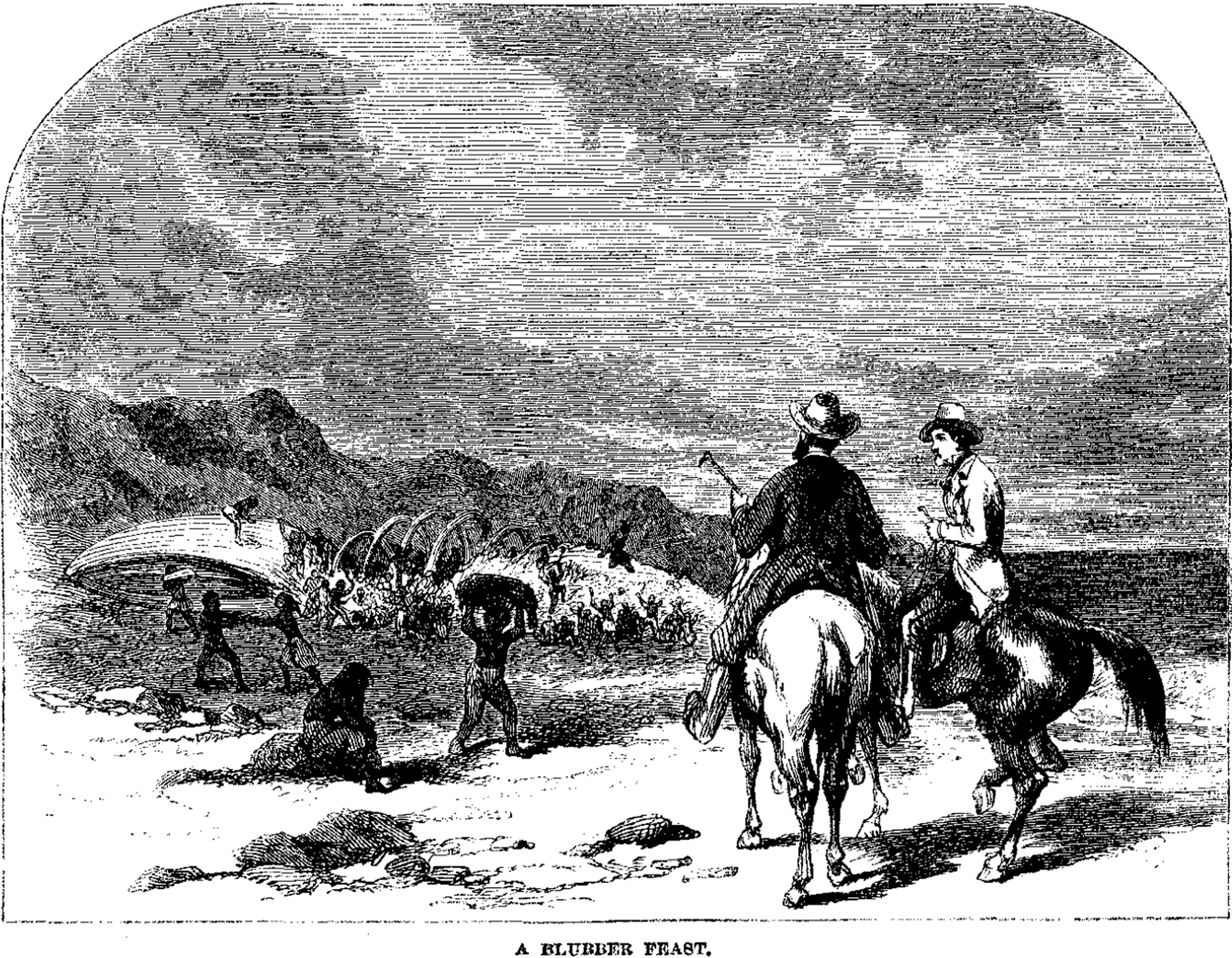
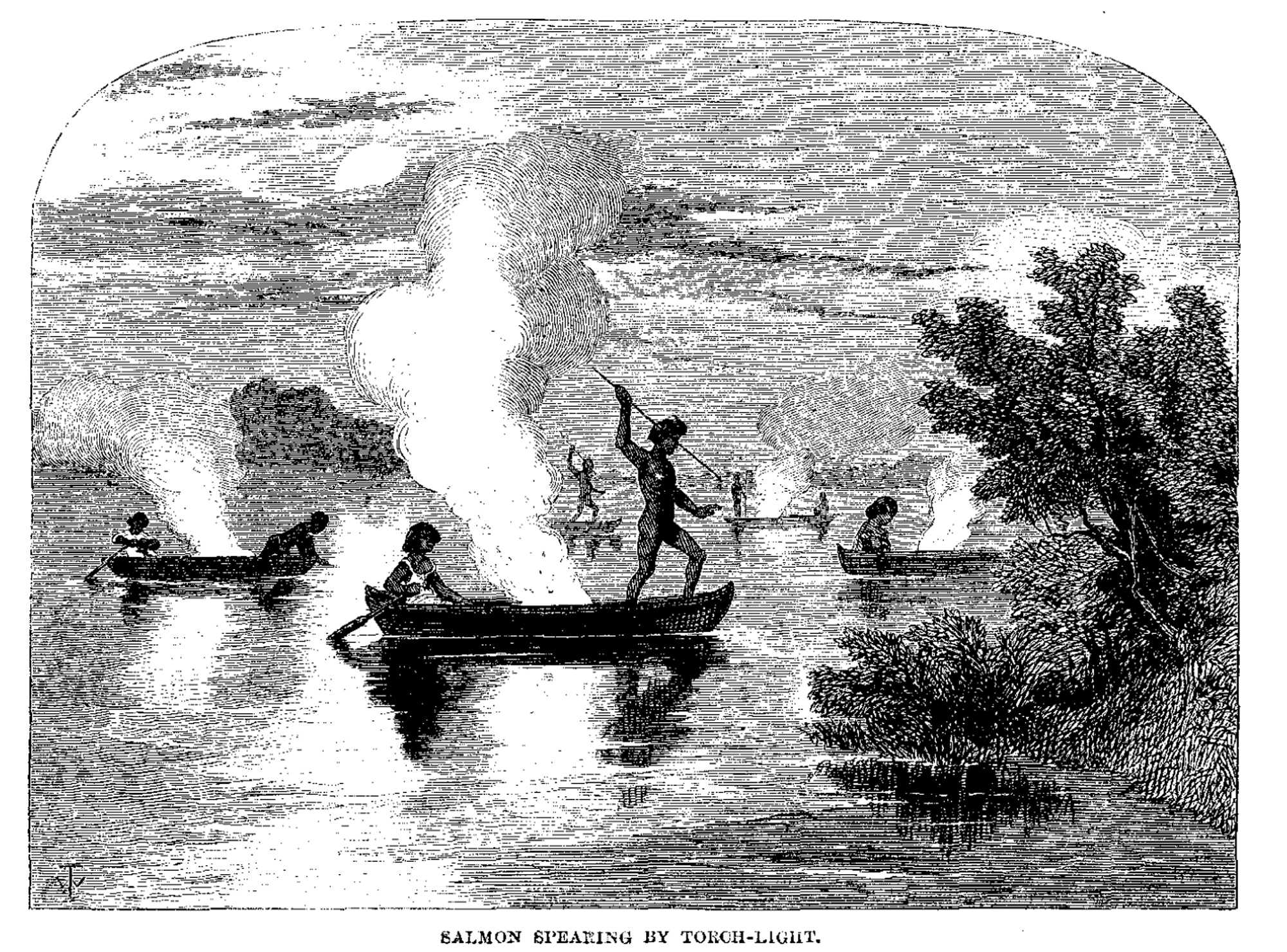
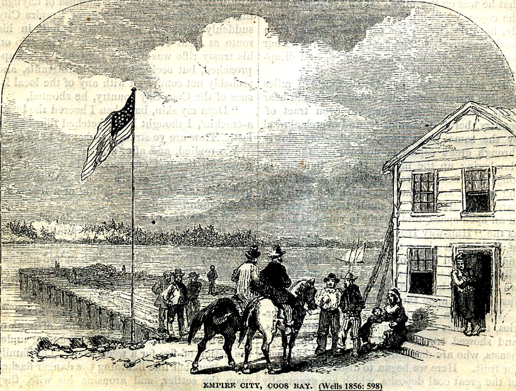
Fig. 2. Select 1855 – 1856 study area illustrations from Harper’s New Monthly Magazine (William H. Thwaites, illustrator).
Research Design: Traditional Methods & Modern Technology
The principal research methods used during this project are relatively standard and have been reliably used for many years: the principal difference is that nearly every year during the past few decades has witnessed new and valuable digital products being developed and refined that offer unprecedented aids in the gathering of field data, and in its subsequent analysis and display.
This project is based on traditional archival research methods, followed by physical transcription of data to maps, and then location and documentation in the field. This approach was exemplified in the study area by Alice B. Maloney in her attempts during the 1930s to locate and document Jedediah Smith’s 1828 camping spots in Oregon (Maloney 1940), and by Ed Henderson and Hollis Dole, in their efforts in the 1960s to track down Dr. Evans’ 1856 travel route and camping spots (Henderson & Dole 1964). The difference today is the added values of using Internet searches, GPS-referencing, digital scanning and photography, GIS mapping, and computerized databases during the course of this type of research.
The methods used to conduct this research include the technical use of GLO data layers and computerized spreadsheets, recorded field interviews, literature reviews, archival texts and maps, field surveys, and ground-truthing and documentation via the uses of digital photography, field notes, and GPS receivers. These methods have been successfully tested and used in a series of similar projects in the past by the senior author of this report, including peer reviewed studies and academic research. Comprehensive descriptions of these types of methods can be found in Zybach (1999); Zybach (2002); Zybach (2003); and Zybach and Wasson (2009).
The purpose of this project was not to test known methods of archival research, or to provide a technical basis for the development and use of digitized data, but rather to present the basic products and findings of the Coquelle Trails project in a manner that can be readily and easily understood by the average reader with an interest in these topics. The following few pages will be used to briefly illustrate the types of research materials that were used during this study, describe how they were used, and then present a finished product of that process as an example.
US Government land survey mapping of the study area began in 1855, in order to locate and protect the Oregon Donation Land Claims made by American citizens from 1851 until 1855. In July 1856, the remaining Indian families and individuals in southwest Oregon were gathered up by the US Army and Volunteers and sent to reservations in the north. Virtually all of the original land surveys completed by General Land Office (GLO) Surveyors in the study area were conducted after the original Indian residents had died, been murdered, or exiled to a reservation at that time: however, GLO surveys remain among our most valuable sources of information for documenting and considering early historical conditions (Zybach 2002).
Fig. 3 shows an annotated portion of an 1875 GLO subdivision map of Tsp. 33 S., 15 W., including a map of Port Orford at that time, made about 20 years after the drawing on the report cover (Fig. 1). The yellow high-lighter follows a road surveyed in 1874 -- and that generally folows the pack trail route established by Smith in 1828. Circled “Sec.” numbers reveal the location of survey notes used to locate and draw the maps lines (and roads). Smaller circles identify areas of special research interest, and other influential features, such as sawmills and city blocks. These circles represented important locations to try and document during subsequent field research. Note the “survey rejected” notice in Sec. 14: fortunately, it had nothing to do with the annotated features just described.
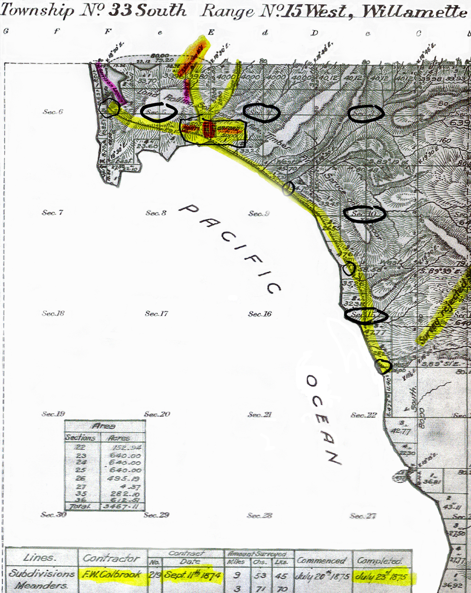
Fig. 3. Annotated GLO Map Detail: T. 33 S., R. 15 W. (Port Orford), 1875.
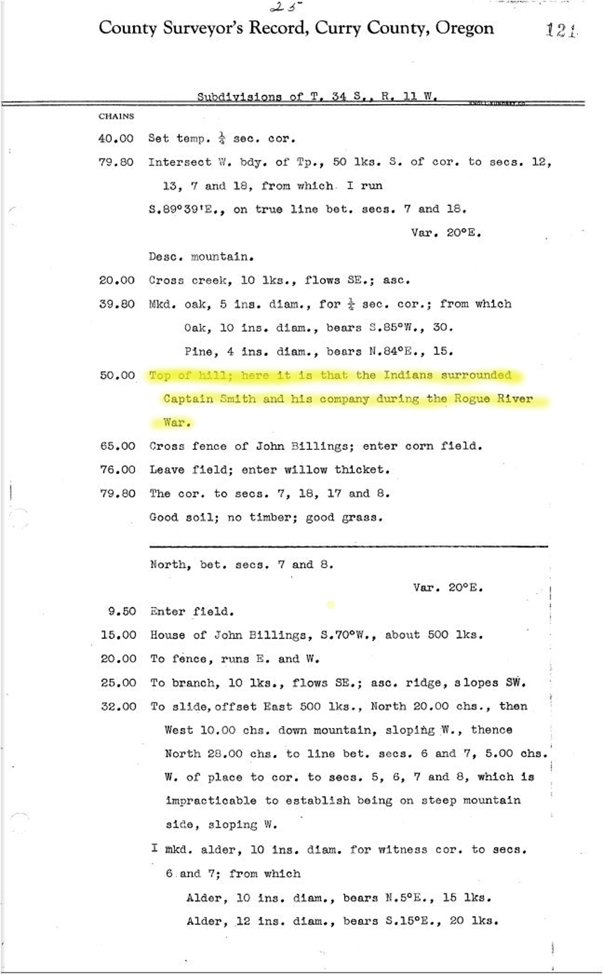
Fig. 4 shows an example of GLO survey notes made in 1855. Note the annotated references to an “Old” Indian Trail and the differentiation between that and the “Clickatat” Trail. The Klickitats were a horseback riding tribe from north of the Columbia River that began coming down into western Oregon in the 1820s and 1830s. It is possible that the local people and the newly arrived Klickitats used separate trails for political or social reasons, but it seems more likely that the “Old” Indian Trail was a foot trail, and the Klickitat Trail was a pack trail. Other survey notes used during this research identified an 1855 Indian Burial Ground, a major battle site of the Rogue River Indian War, and detailed descriptions of gold mining developments at Johnson Creek and Sixes River.
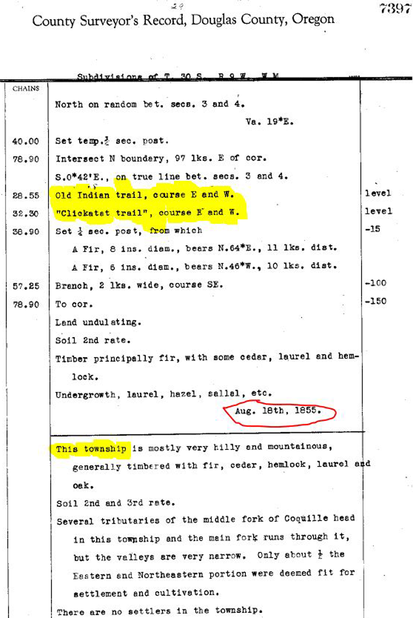
Fig. 4. Annotated GLO Surveyor’s Notes: T. 30 S., R. 9 W., S. 3 (Aug. 18, 1855).
Fig. 5 shows another type of map used in this research: a USGS geological map from the late 1890s, first printed in 1903 and apparently showing pre-automobile roads and trails to a very accurate degree at that time. This map detail is of the same general area as shown in Fig. 3, and also based upon the same survey lines, but made about 20 years later (or, about 40 years later than Fig. 1).
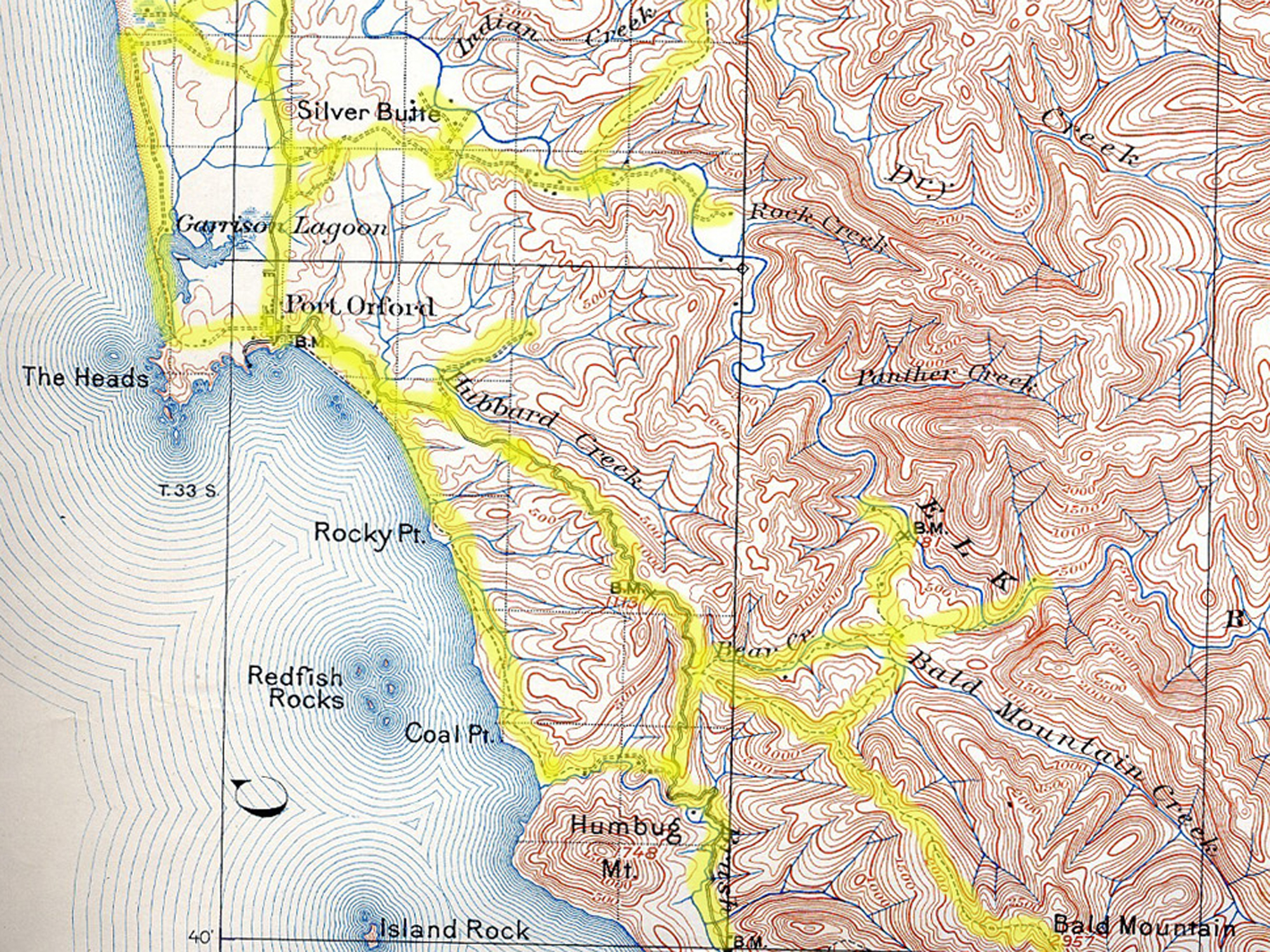
Fig. 5. Annotated USGS Geologic Atlas Detail: Port Orford Quadrangle, 1897-1898.
Finally, Fig. 6 shows a detail from a 1941 Metsker Map of the general area as Fig. 3 and Fig. 5, and shares the same GLO-surveyed township boundaries (Tsp. 33 S., Rng. 14 W.) as Fig. 3 -- and used as the locational basis for the tabular indices in Vol. II. Note the differences in Port Orford between the maps, but also the similarity in road and trail alignments between 1875 and 1941.
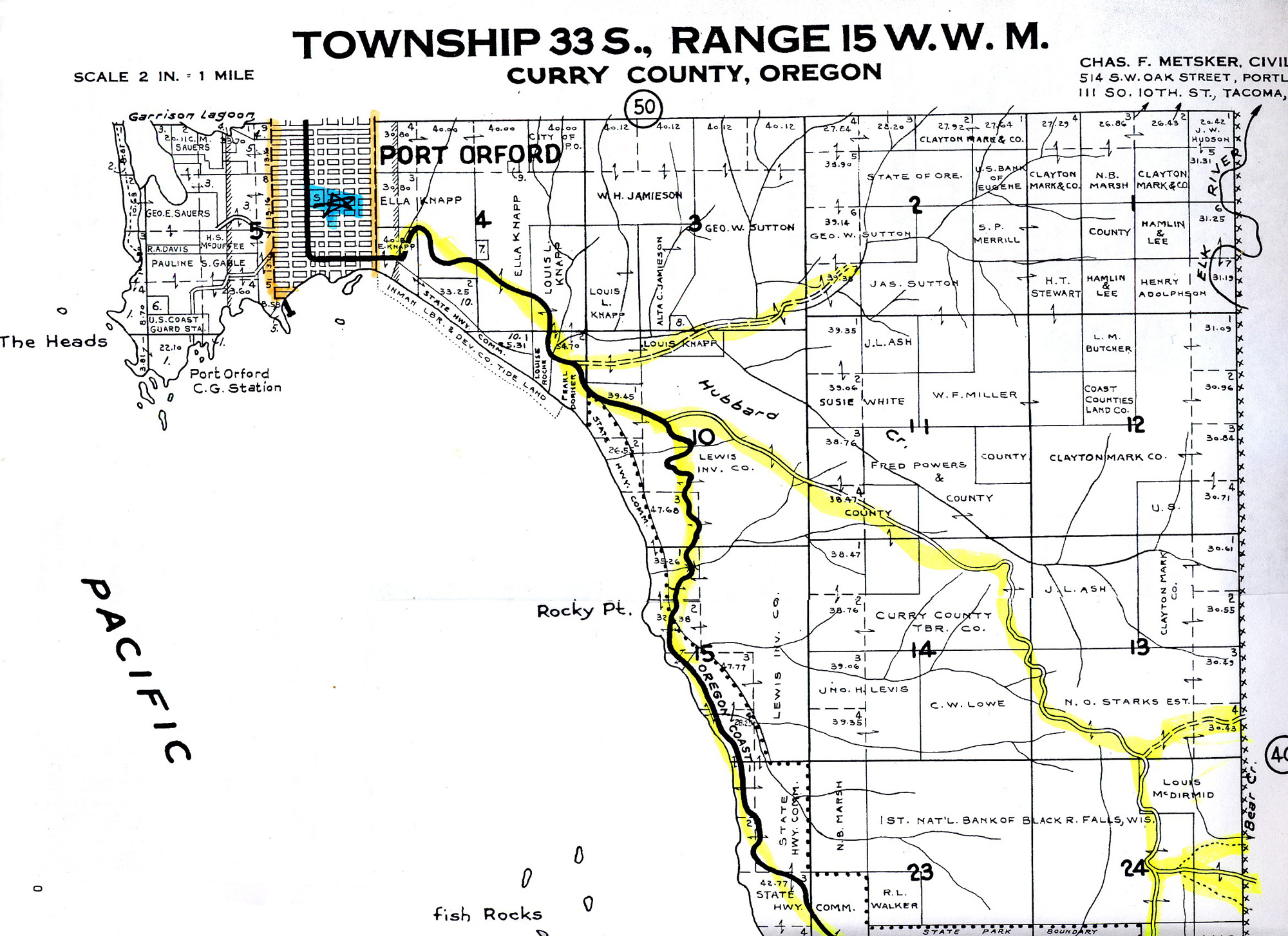
Fig. 6. Annotated Metsker Map Detail: T. 33 S., R. 15 W. (Port Orford), 1941.
Fig. 7 is a reduced version of Field Map #46 (Port Orford quadrangle), one of the 50 proprietary 7.5 minute USGS Quadrangle maps developed during this project (Vol. II, Part 2.2). It shows the routes and locations selected from Fig. 3 and Fig. 5, from survey notes, and from other sources. The thin red lines with yellow high-lighter were transcribed as possible foot-trail routes, with solid lines depicting existing road and trail surfaces, and dotted lines showing predicted (but undocumented) or documented (but no longer depicted) trail locations. Small circles are for desired photo-point locations in order to consider and document more precise trail locations (Map 4). Other annotations show important survey notes, or locations of historical events and travel routes.
All of the initial red solid and dotted lines were made into a GIS layer and from that point were field tested and documented at depicted photo-points and other useful locations that presented themselves while doing “ground-truthing” research. One of the more helpful conditions during field work on this project was the combination of “clear skies and clearcuts” along the ridgeline roads we drove. These allowed for wonderful perspectives of the surrounding landscape, including likely, possible, and improbable trail locations. In addition to first hand observation and photographic documentation, significant effort and success was also made by talking with knowledgeable local individuals in many of the key locations considered in this project. A number of those individuals are noted in the Acknowledgement section of this report.
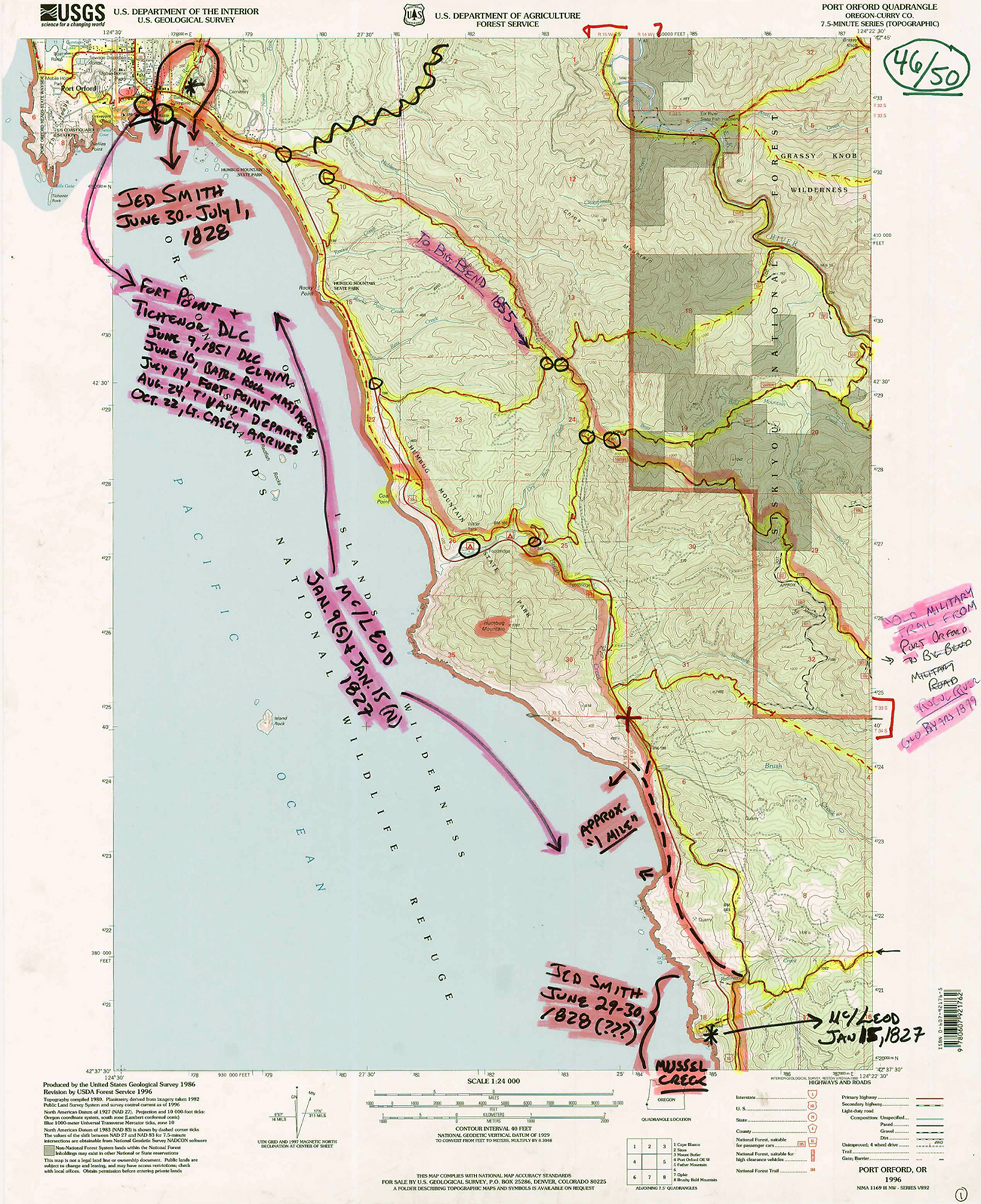
Fig. 7. Annotated USGS Field Map Detail: Port Orford, 2011.
Following field work, the “pinkish” highlighter in Fig. 7 was used to show the final editorial decisions made by the authors following much discussion and consideration of the possible alternative routes and the documentation that supported each alternative. These final selections are the same routes and notes shown on Map 1, and form the basis for what the authors hope will be much additional consideration, discussion, funding and research.
Finally, Map 3 shows the final selection of 1826 to 1875 primary foot trails and canoe routes made by the authors and considered to be the “major trail network” for the 1826 - 1875 time period that was intended to be documented and mapped at the outset of this project. Note the position of the selected trails on Fig. 7 and those shown for the same location on Map 3.
Map 3 also displays the seven “Historical Districts” selected by the authors as being representative of the various travel and settlement patterns within the study area. A principal reason for developing these districts was to allow for greater detail to be displayed at a larger scale. Another reason was to isolate and focus on specific local histories that differed significantly from one district to another.
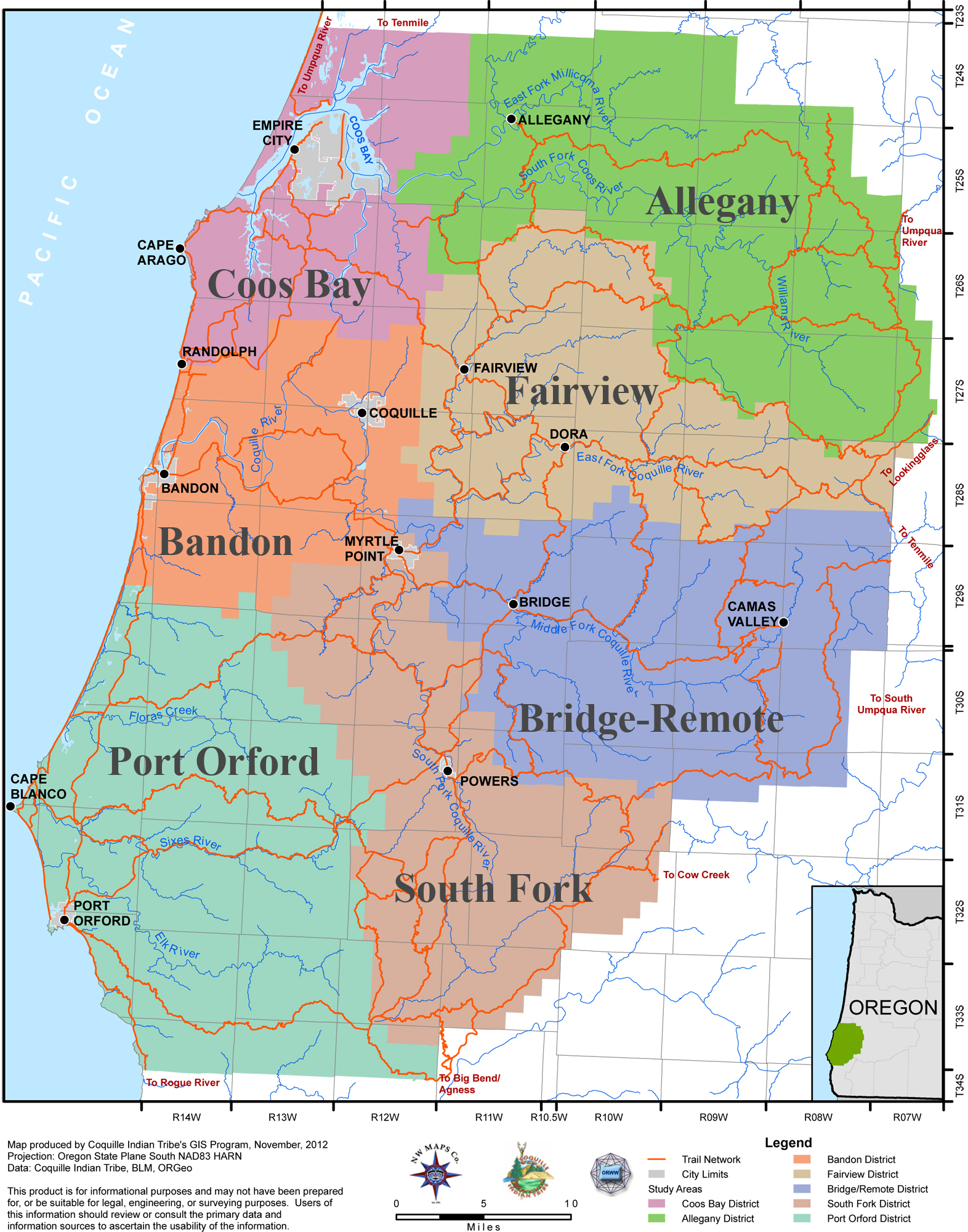
Map 3. Coquelle Trails Study Area: Early Historical Trails Network, 1826-1856 (Zybach, Ivy & Harkins 2012).
Research Products:Maps, Photos, Database Files, GIS & Website
A number of products were developed during this project, including this report and the historical trails wall map it accompanies. Several of these products are intended strictly for discretionary Tribal uses, but the greater majority is specifically intended for public research and educational purposes. A key part of that strategy is the creation and long-term maintenance of an educational website, www.ORWW.org/Coquelle_Trails, where this report and the following maps, photographs, Excel databases, GLO survey notes, and historical reference materials can be obtained by anyone with an interest in these topics.
USGS quadrangle field maps
Discretionary products developed during this project include 50 Annotated USGS 7.5 minute quadrangle maps used for fieldwork (Fig. 7). Some of these maps contain specific information of a sensitive nature and all can be used in the future for additional field and research findings and reconsiderations. These maps cover the entire 1,400,000-acre study and were used to cross-reference archival research data with documented field observations. An index to these maps is provided in Vol. II, Part 2.2 and digital copies at: www.ORWW.org/Coquelle_Trails/Maps_1855-2012.
GLO and Metsker township maps.
More that 200 copies of General Land Office (GLO) and Metsker township maps were annotated during the course of this project for purposes of transcription to the USGS field maps (Fig. 3; Fig. 6). The GLO maps were made from 1856 to 1934 and represent the first detailed land surveys of the study area. The annotated Metsker cadastral maps were from 1929 and 1941, depending on their availability in each county. Both GLO and Metsker series were arranged according to township and cover the entire 1,400,000-acre study area (Vol. II, Part 2.3).
GLO Survey Notes files.
Several thousand pages of GLO survey notes and survey note transcriptions were examined for specific references to the earliest named roads and trails in Coos, Curry, and Douglas counties. Hundreds of these pages were in handwriting that was difficult to read, or had to be downloaded from a balky BLM website if they couldn’t be obtained via the County (“Curry”) Surveyors Office. Each time a specific reference was located, it was scanned or photographed and entered into an Excel file database; then printed, annotated with the name of the surveyor and date the observations were written, and filed in a folder labeled with the individual township in which the notes were made. A significant number of the digital files have been placed online and can be downloaded at: www.ORWW.org/Coquelle_Trails/Land_Surveys. The annotated hard copies are on file with the Coquille Tribe. An index to these files is found at Vol. II, Part 2.4.
Excel Database Indexes
Six Excel file database indexes were developed for this project in order to provide direct access to specific types and forms of information generated by this research. Each file includes columns of Tsp., Rng. and Sec. information in order to be easily combined and cross-referenced with each other and with the maps, survey notes, historical texts, and geographic locations identified, collected and/or created during this project. Tabular indices listing select columns from these databases are provided in Vol. II, Parts 2 & 3. The parent Excel files are found at: www.ORWW.org/Coquelle_Trails/Databases:
Coquelle_USGS_Maps-20111231_194. Index to 50 USGS 7.5' Quadrangle annotated project field maps, 2011 to 2012, with GLO Map cross-references (Vol. II, Part 2.2).
Coquelle_GLO_Maps-19341231_230. Index to 229 General Land Office DLC and subdivision maps, 1855 to 1934 (Vol. II, Part 2.3).
Coquelle_GLO_Notes-19341231_535. Index to 534 dated GLO survey notes regarding historical roads and trails, 1855 to 1934 (Vol. II, Part 2.4).
Coquelle_Place_Names-18991231_408. Index to 407 study area historic place names and locations, pre-1800 to 1900 (Vol. II, Part 2.5).
Coquelle_Trail_Names-19341231_172. Index to 171 documented references to early historical roads and trails, 1855 to 1934 (Vol. II, Part 2.6).
Coquelle_History-18761231_261. Index to 238 historical events specific to the study area, 1826 to 1876, not including land surveyor entries (Vol. II, Part 3.1).
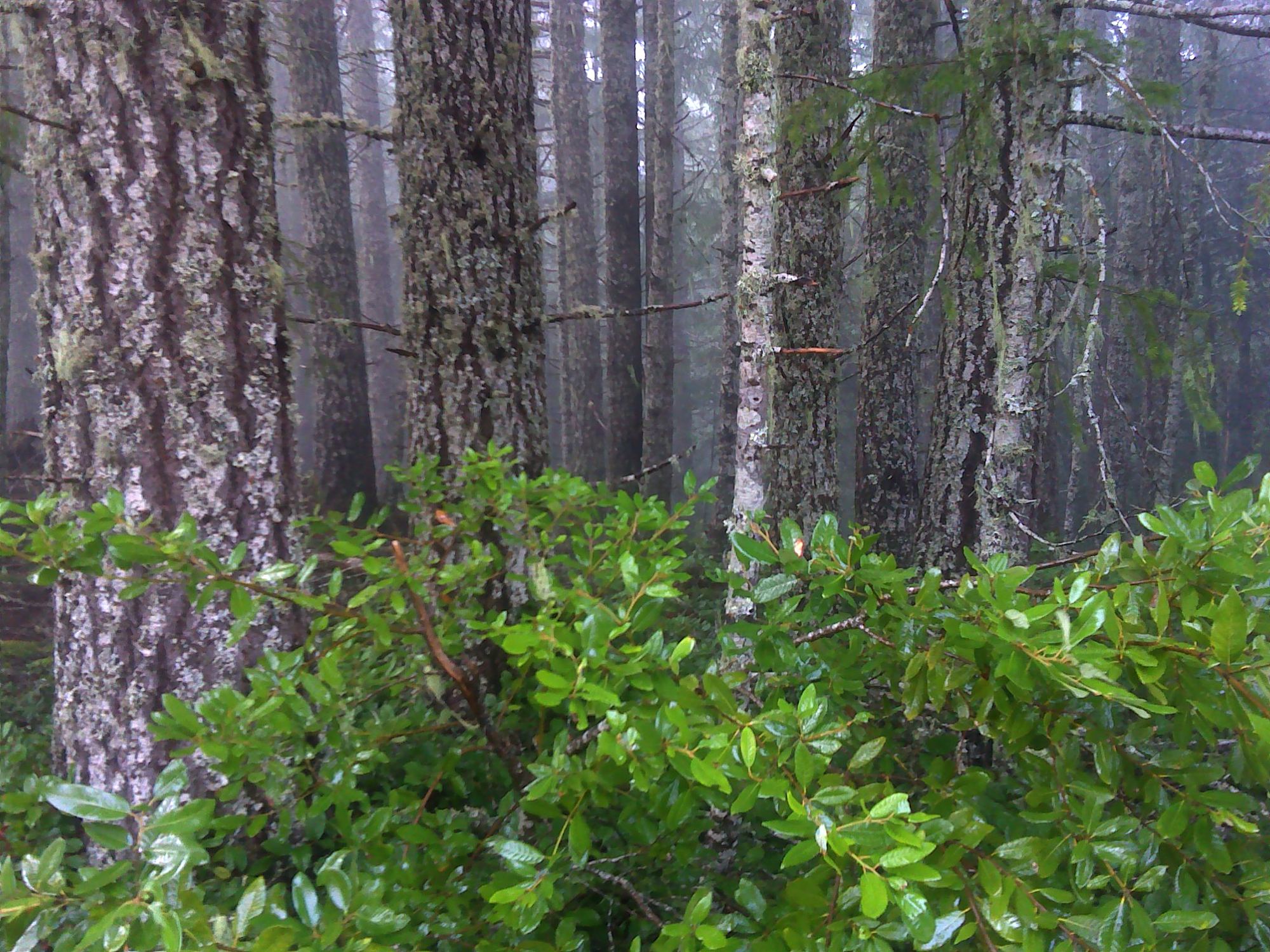
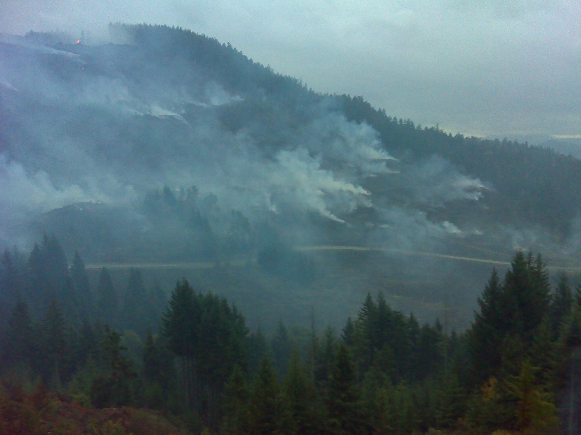
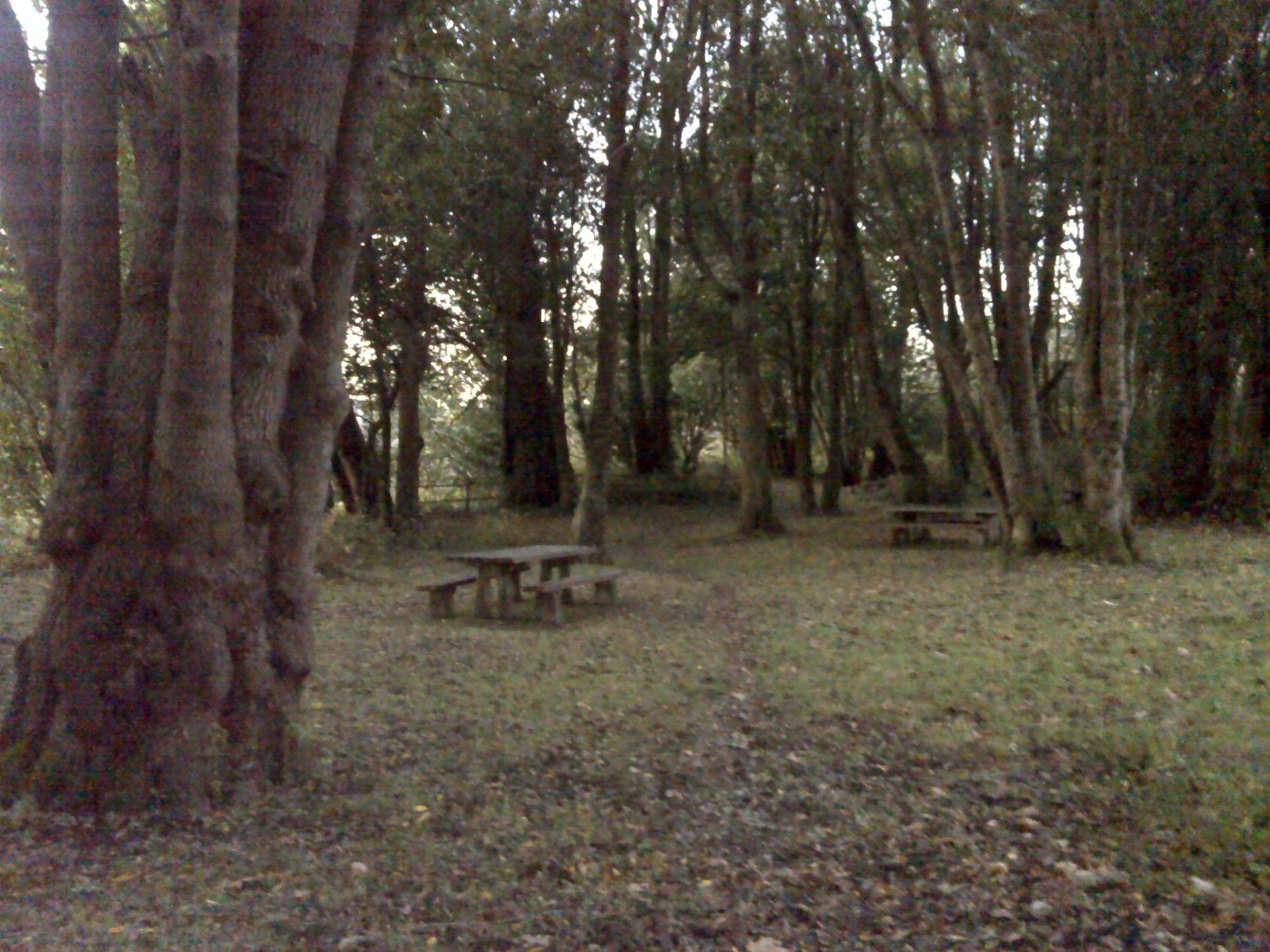
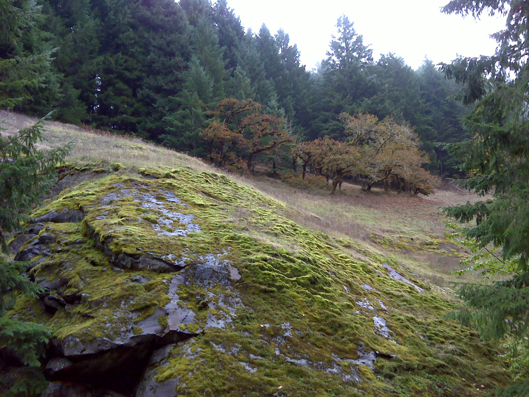
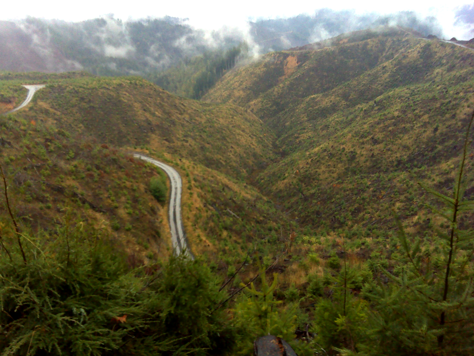
After the USGS field maps had been constructed, it was then necessary to ground truth the hypothetical locations transcribed onto the maps. About 80% of the study area was directly visited and observed and recorded with GPS-referenced photographs during 2011. Some areas could not be visited because of locked gates, snow, or time, but 2300+ documentary photos were taken with a Garmin GPS-receiver/camera product (the “550-t Oregon”) at the locations shown on Map 4. In most instances the device was able to capture a significant amount of detailed “field notes”-type information rapidly and at relatively little cost. A principal result of this method is an inventory of digital photographs that can be used as a basis for repeat photography research projects in the future, for purposes of measuring ecological and cultural changes through time.
Map 4 and Table 1 show the locations of the study area that were visited and documented during the course of this project, along with a representative sampling of the types and quality of the GPS-referenced photos taken -- and the information they contain. In addition to the Garmin photos, approximately 500 much-higher grade digital photos were taken at many of the locations using a Nikon D-7000 camera with a zoom lens. Many of these photos are 360-degree panoramas from key vantage points. This latter inventory is also georeferenced by default (taken in the same locations as the Garmin’s), but are of much higher quality for analytical, reproduction or presentation purposes. All photos were taken between July 2011 and January 2012, and the large majority are in the procss of being archived on the Internet and will be made available via the project website at a later date.
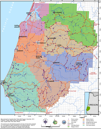
Map 4. Coquelle Trails Study Area: GPS-Referenced Photo Points (Zybach, Ivy & Harkins 2012).
|
|
|
|
|
|
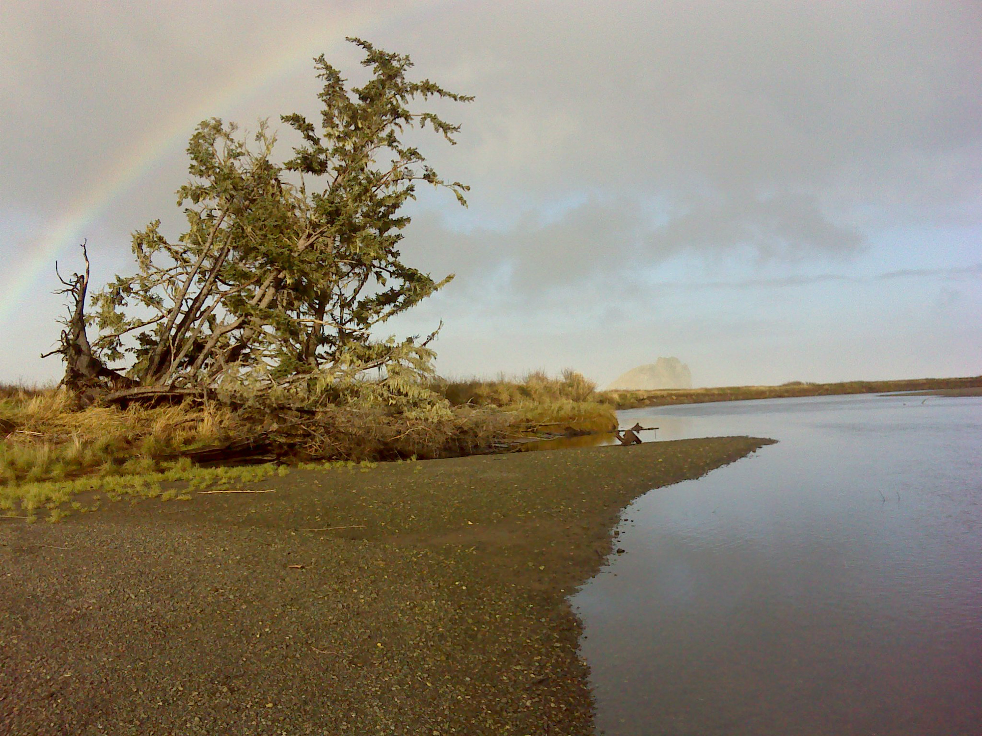
Table 1. Coquelle Trails Study Area: Sample GPS-Referenced Photo Points (B. Zybach 2011).
![]()