Jackson County
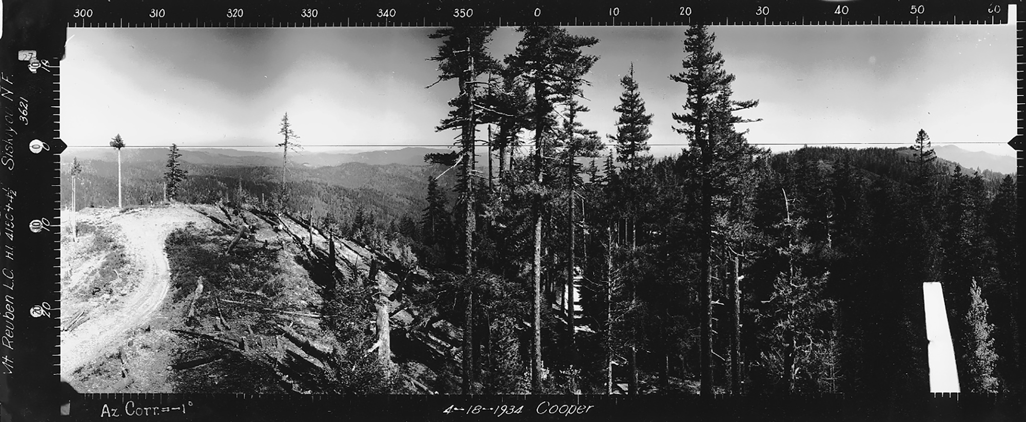
North View, Ragsdale Butte Lookout, Jackson County (Cooper, April 18, 1934).
There are only two sets of Osbornes currently included in Jackson County. These sets are included because they document forest cover conditions from the northwest to the northeast in the Douglas County 2010-2011 ORWW Upper South Umpqua Headwaters precontact forest cover conditions study, although being located within the Rogue River basin.
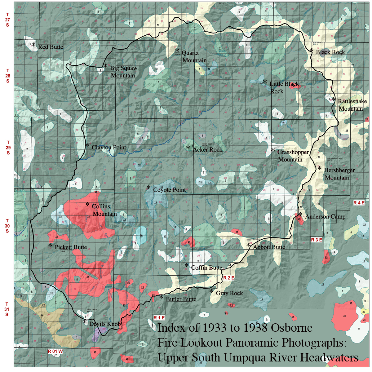
2010 NW Maps Co. Index of 1933 to 1938 Osborne Panoramic Photographs: Upper South Umpqua Headwaters. Grey ("Gray") Rock is to the east and southeast of Butler Butte and Coffin Butte; Ragsdale Butte is 5.5 miles to the southwest of Devils Knob, but is slightly below the map's boundary in Tsp. 32 S., Rng. 1 W., Sec. 14.
| ICON | LOOKOUT | START | STOP | TSP | RNG | SEC | ELEV. |
|---|---|---|---|---|---|---|---|
| Grey Rock | 31 S. | 2 E. | 8 | 5,347 | |||
 |
Ragsdale Butte | 1933 | 1963 | 32 S. | 1 W. | 14 | 4,803 |
© 2006-2020, Oregon Websites and Watersheds Project, Inc. & NW Maps Co.