
Douglas County
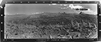
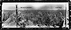
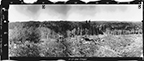
West View, Abbott Butte Lookout, Douglas County (Sarlin & Burchall, July 24, 1933).
The ORWW "Osbornes Project" was started in 2006 as a collaboration by (at that time) Oregon State University College of Forestry undergraduate student, Judd Lehman, and ORWW Program Manager, Bob Zybach. The basic idea was to revisit each of the fire lookout towers in Oregon from which an Osborne panoramic photo sequence had been taken in the 1930s (Arnst 1985), and then take additional panoramic photos in order to begin building a detailed Repeat Photography inventory (Zybach and Lapham 2004). The resulting spatial and temporal sequences are then permanently displayed on an ORWW website in order for others -- particularly students, teachers, researchers, and resource managers with an interest in Oregon history and resources -- to reference.
NOTE (December 15, 2010): There has been some difficulty with QTVR panoramic files made for this project, in that some browsers or platforms are importing grainy, undersized files that cannot be expanded to fit the screen. This has not been a problem in the past, and we are working to fix the problem at this time.
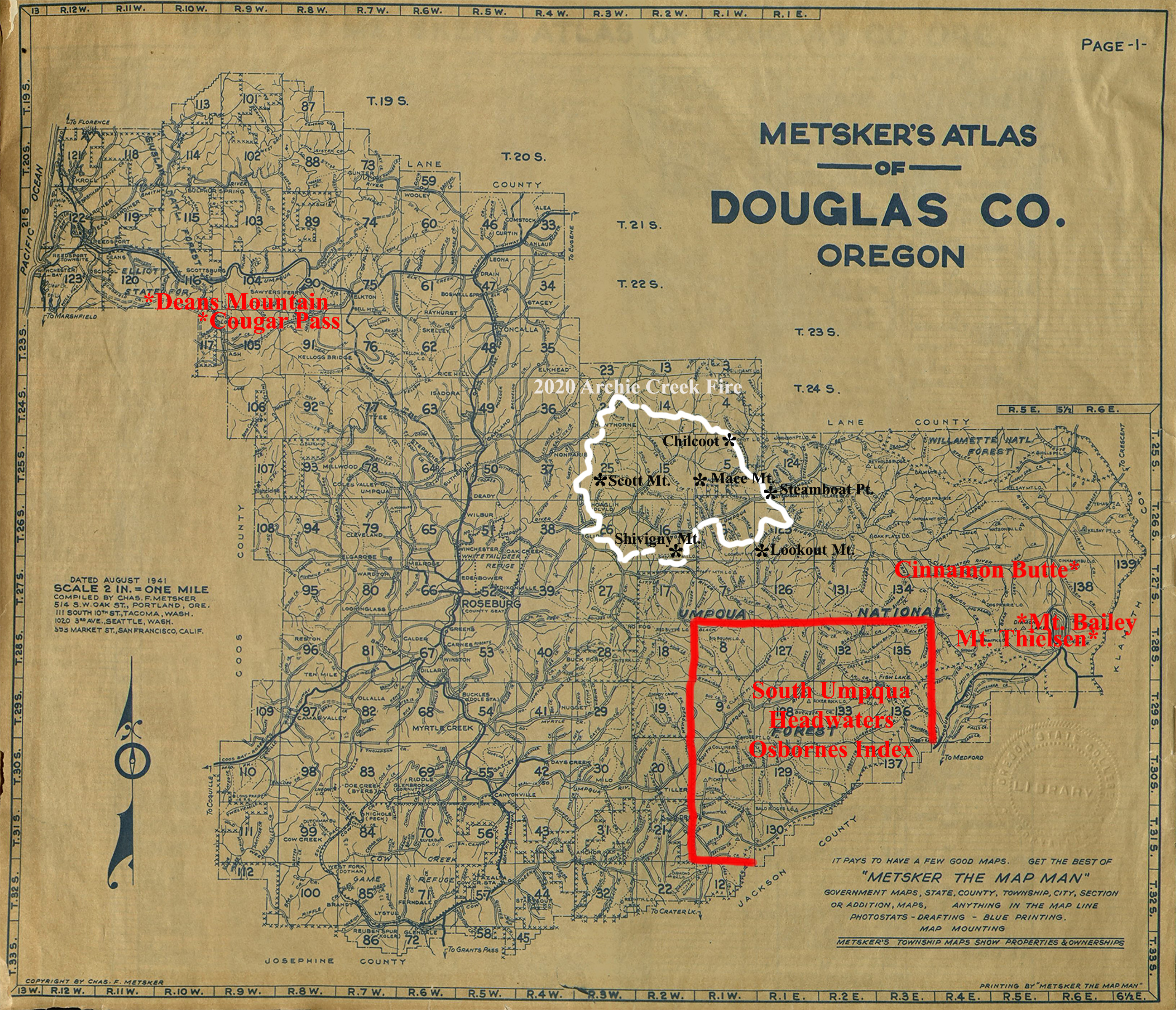
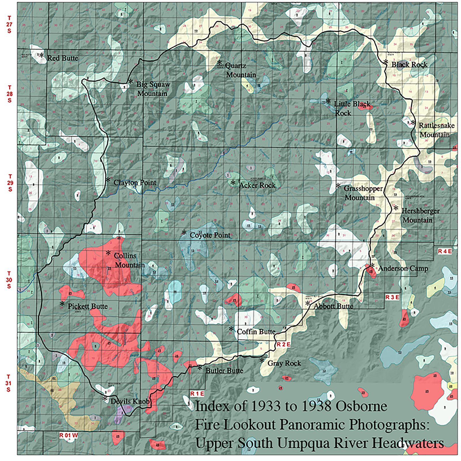
This project has been built from earlier efforts along these same lines, including Peterson and McMurray 1994; IamWho 2001; and Zybach and Meredith 2006. Douglas County Osbornes were intially based on research associated with the 2010 South Umoqua Headwaters Project.
| ICON | LOOKOUT | START | STOP | TSP | RNG | SEC | ELEV. |
|---|---|---|---|---|---|---|---|
| Abbott Butte | 1914 | 1984 | 30 S. | 2 E. | 23 | 6,131 | |
| Acker Rock | 1913 | 29 S. | 1 E. | 13 | 4,112 | ||
| Anderson Camp | 1933 | 1958 | 30 S. | 3 E. | 9 | 5,469 | |
| Big Squaw Mountain | 1932 | 1958 | 28 S. | 1 W. | 13 | 4,878 | |
| Black Rock | 1899 | 1965 | 28 S. | 3 E. | 4 | 6,150 | |
| Butler Butte | 1924 | 1958 | 31 S. | 1 E. | 10 | 5,513 | |
| Chilcoot | 1923 | 1962 | 25 S. | 1 E. | 6 | 4,986 | |
 |
Cinnamon Butte | 1933 | 27 S. | 6 E. | 9 | 6,417 | |
| Clayton Point | 1933 | 1958 | 29 S. | 1 W. | 14 | 3,190 | |
| Coffin Butte | 1934 | 1963 | 30 S. | 1 W. | 36 | 4,208 | |
| Collins Mountain | 1914 | 30 S. | 1 W. | 1 | 3,670 | ||
| IMAGES MISSING | Cougar Pass | 1935 | 1985 | 23 S. | 10 W. | 3 | 1,750 |
 |
Coyote Point | 1935 | 29 S. | 1 E. | 32 | 3,093 | |
 |
Deans Mountain | 1914 | 1966 | 22 S. | 11 W. | 35 | 1,819 |
| Devils Knob | 1912 | 1962 | 31 S. | 1 W. | 23 | 4,900 | |
| Grasshopper Mountain | 1915 | 1977 | 29 S. | 3 E. | 18 | 5,552 | |
| Hershberger Mountain | 1913 | 29 S. | 3 E. | 22 | 6,200 | ||
| Little Black Rock | 1933 | 1966 | 28 S. | 2 E. | 24 | 4,538 | |
| Lookout Mountain | 1924 | 1983 | 26 S. | 1 E. | 31 | 5,015 | |
| Mace Mountain | 1933 | 1960 | 25 S. | 1 W. | 31 | 4,289 | |
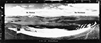 |
Mount Bailey | 1917 | 1952 | 28 S. | 5 E. | 10 | 8,363 |
| Mount Scott | 1914 | 2020 | 25 S. | 3 W. | 28 | 4,250 | |
 |
Mount Thielsen | 1933 | 1933 | 28 S. | 5.5 E. | 13 | 9,182 |
| Pickett Butte | 1933 | 30 S. | 1 W. | 29 | 3,296 | ||
| Quartz Mountain | 1915 | 1972 | 28 S. | 1 E. | 2 | 5,530 | |
| Rattlesnake Mountain | 1932 | 1962 | 28 S. | 3 E. | 26 | 6,656 | |
 |
Red Butte | 1917 | 28 S. | 2 W. | 1 | 5,275 | |
| Shivigny Mountain | 1933 | 1978 | 26 S. | 2 W. | 34 | 3,782 | |
| Steamboat Point | 1933 | 1965 | 25.5 S. | 1 E. | 33 | 2,956 |
© 2006-2011, 2020 Oregon Websites and Watersheds Project, Inc. & NW Maps Co.