Round Lake
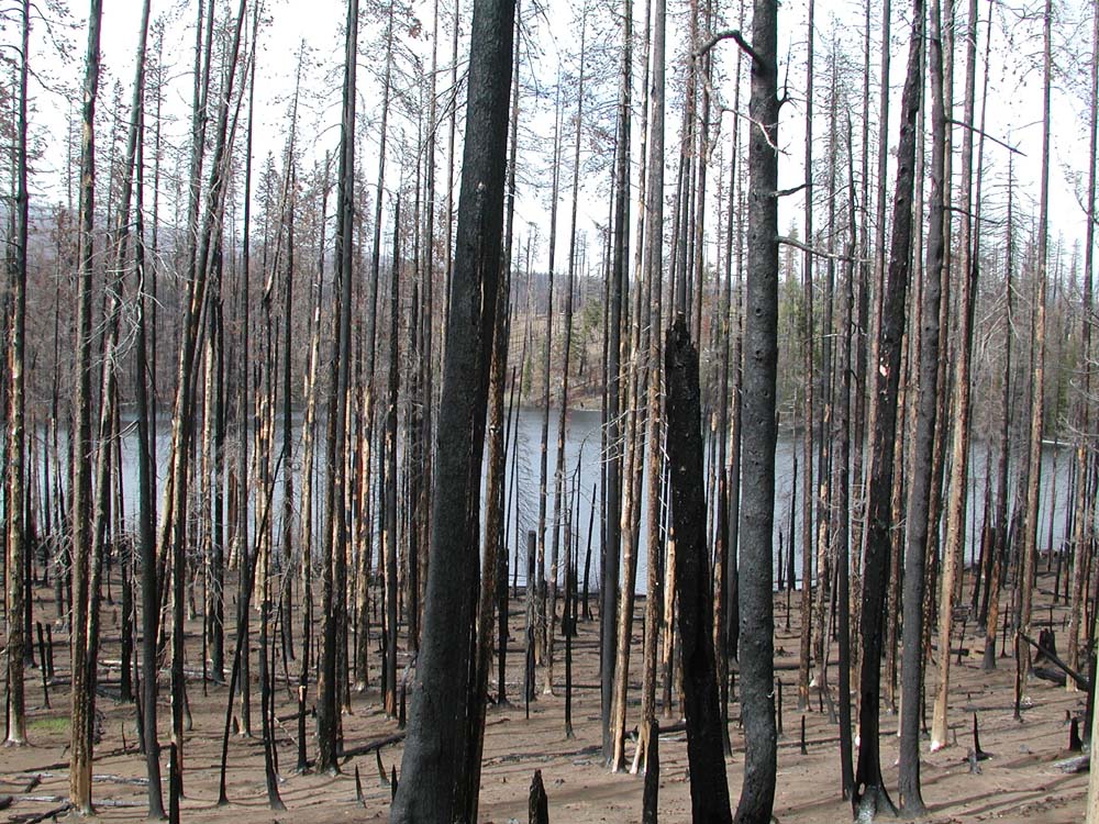
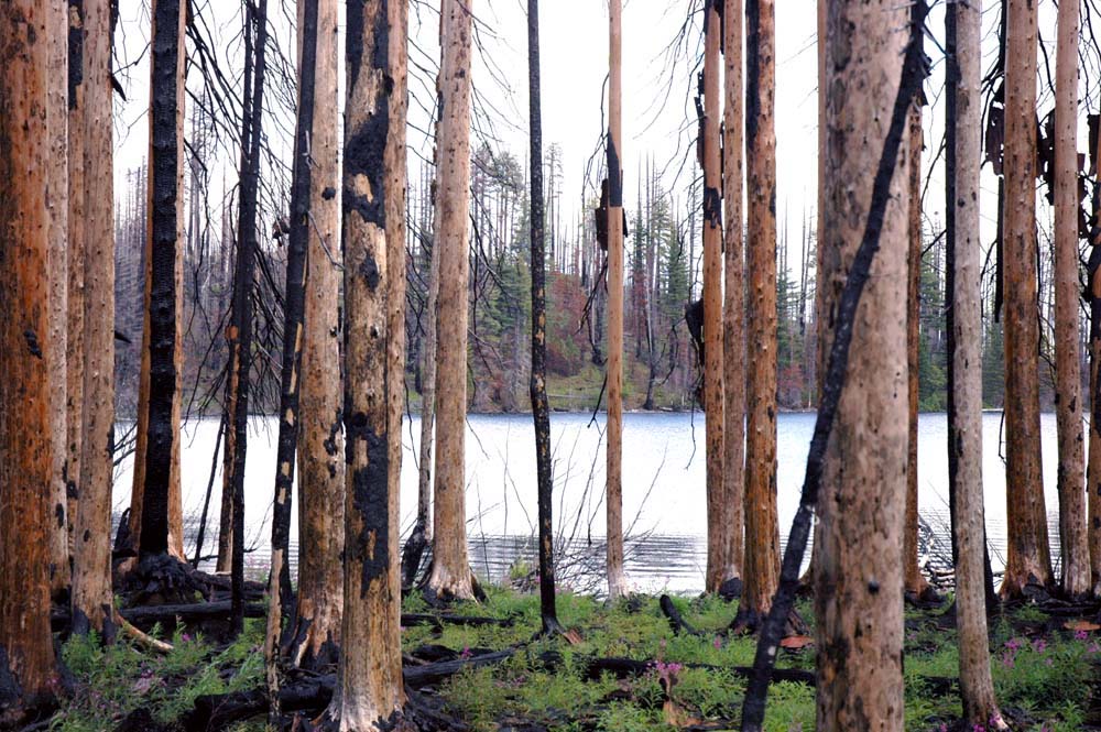
Round Lake, looking North, May 15, 2004.
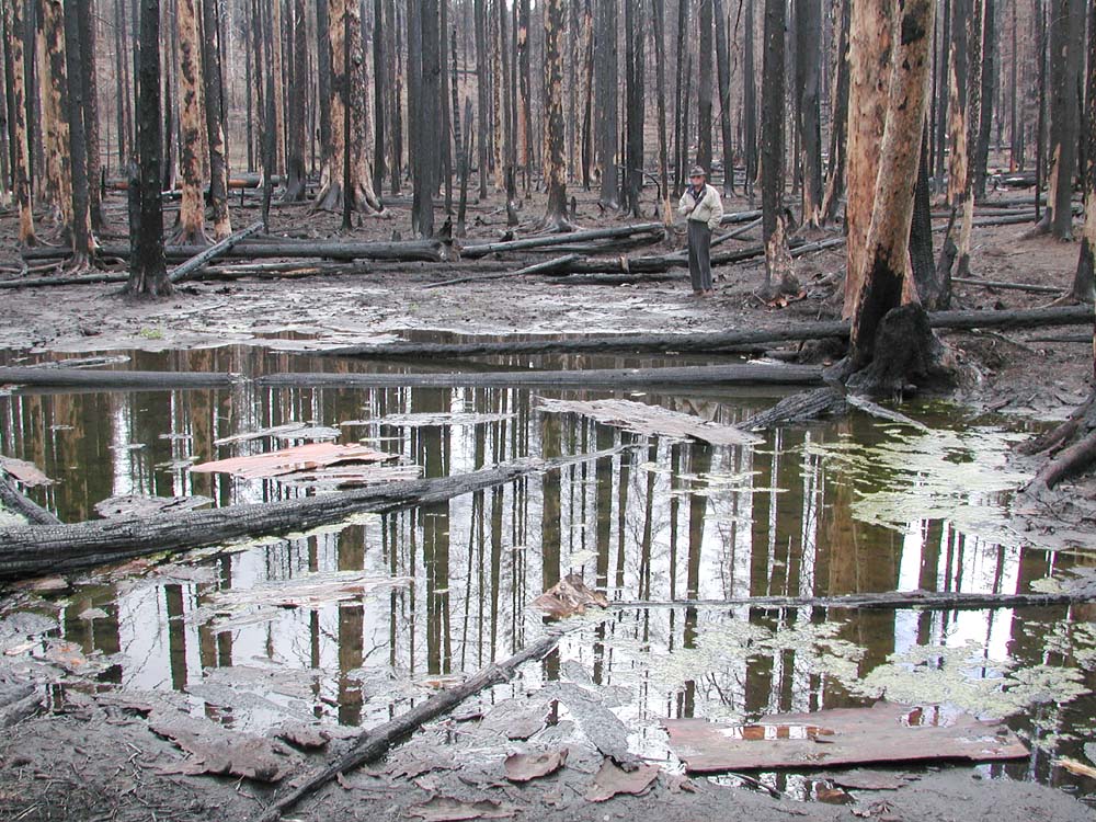
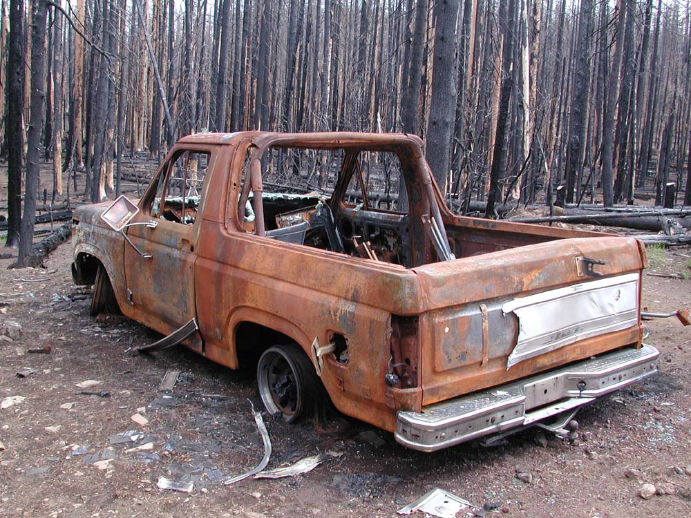
Round Lake is located at the end of the 1210 ("Round Lake") Road in Sec. 16, Tsp. 13 S., Rng. 8 E. Two campgrounds are located on the lake: a "Christian Camp," with structures and vehicles severely damaged during the fire; and a more primitive "horse camp," which seems to have lost some wooden fencing and little else. Round Lake provides a well-used trail head into the Mt. Jefferson Wilderness, but is not listed in the Atlas of Oregon Lakes (Johnson et al 1985) or in the 5th Edition of Oregon Geographic Names (McArthur 1982).
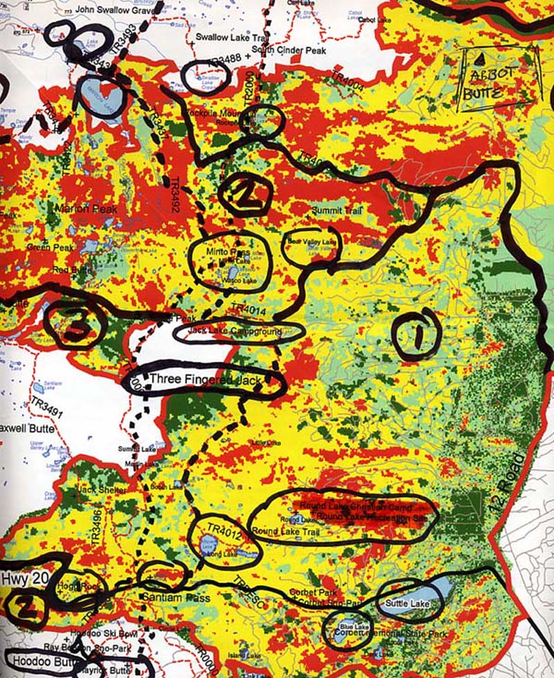
Fire damage to the Round Lake area was first surveyed and documented by Zybach, Lapham, and Stout on May 15, 2004. Landscape conditions were compared on-site to BAER maps provided by the US Forest Service. On September 15, 2004, ORWW co-sponsored a field trip to the B&B Complex burn, including stops at Round Lake, Hogg Rock, and Link Creek.
The USDA Forest Service "Intensity" (Mills 2003) and "Severity" (USDA BAER 2003) maps for the Round Lake area show dominant patterns of "Low" and "Moderate" intensity (a debated measure of flame length and fire temperature peaks in a location during a wildfire or prescribed fire event) and "Low" and "Moderate" severity (another debated measure of plant mortality and/or soil temperatures caused by wildfire or prescribed fire). These patterns can be compared to on-site photographs to help edit GIS layers, or refine data gathering techniques .
In the table below, you will find sequential and panoramic photographs and interactive QTVR (Quick Time Virtual Reality) files of Round Lake. Click here for free viewing software and more information about viewing QTVR (.mov) files.
| icon | Filename | Description | Date | Northing | Easting |
 |
West_Shore_360 | QTVR
& |
May 15, 2004 | 44.44210 | 121.79014 |
| South_Bank_360 | QTVR
& Slideshow (9) |
May 15, 2004 | 44.44036 | 121.78490 | |
 |
Christian_Camp | Misc. Pictures (11) | May 15, 2004 | N/A
|
N/A
|
 |
ORWW_Field_Trip | Misc. Pictures (8) | September 15, 2004 | N/A |
N/A |
![]()
©2004, 2005 Oregon Websites and Watersheds Project, Inc. and NW Maps Co.