South Umpqua Headwaters Precontact Reference Conditions Study
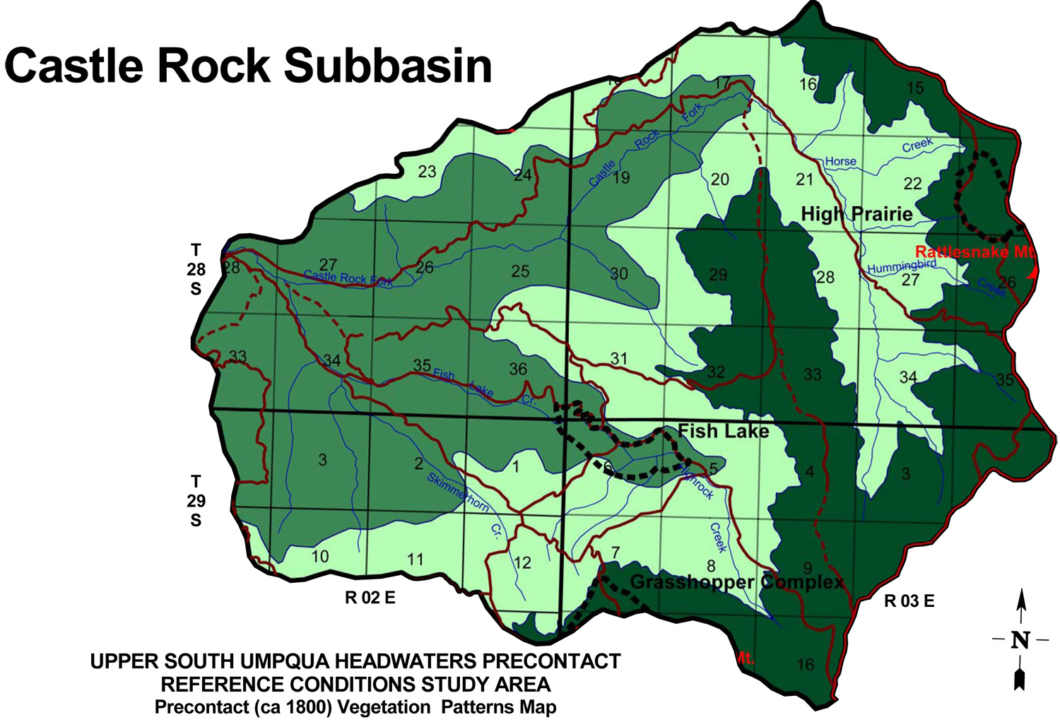
Castle Rock Fork Subbasin
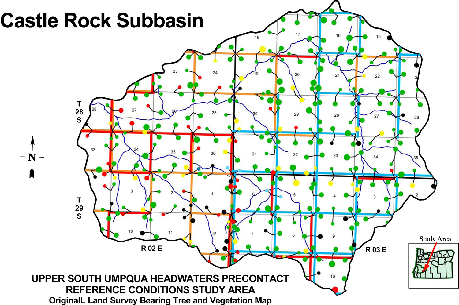
Castle Rock Fork subbasin map, with ca. 1800 Indian Trails and ca. 1800 Forest Vegetation Patterns.
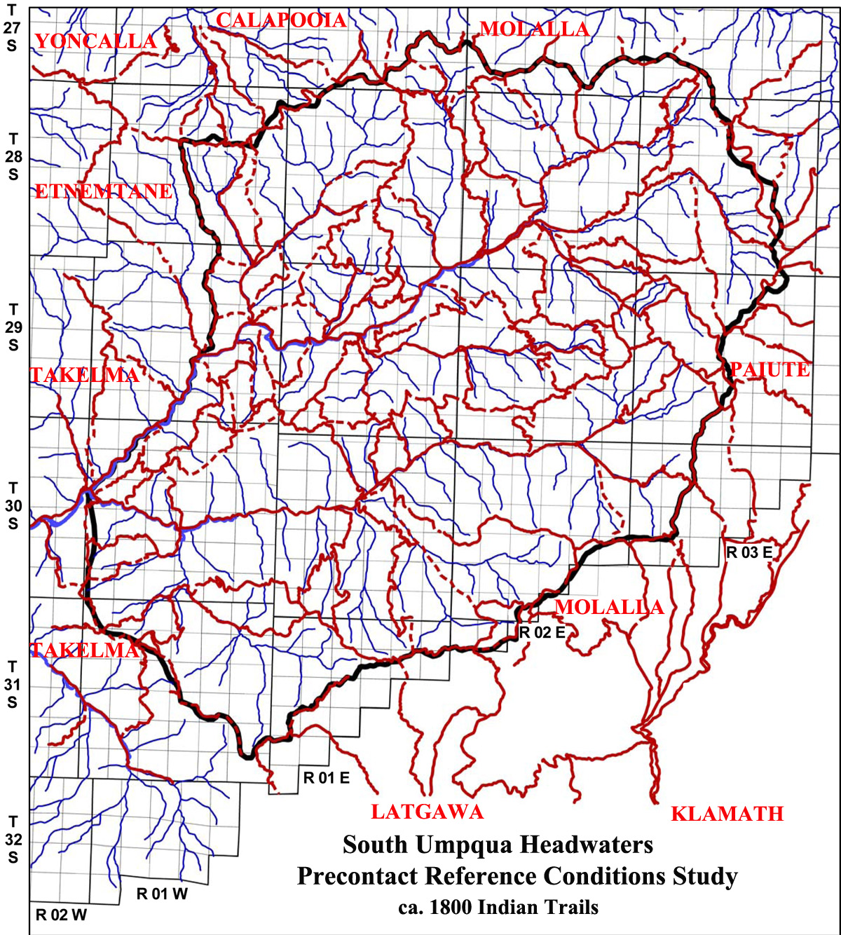
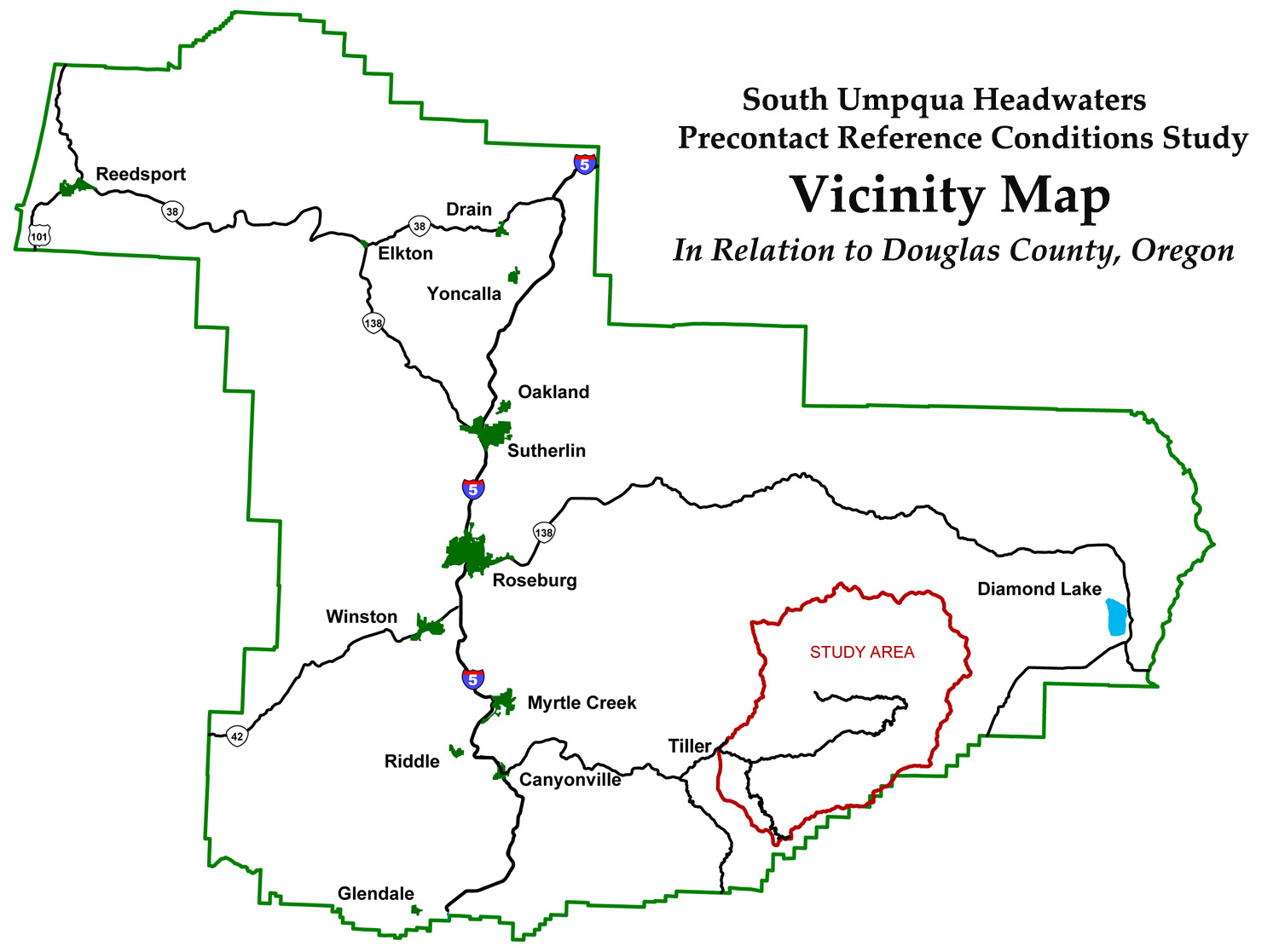
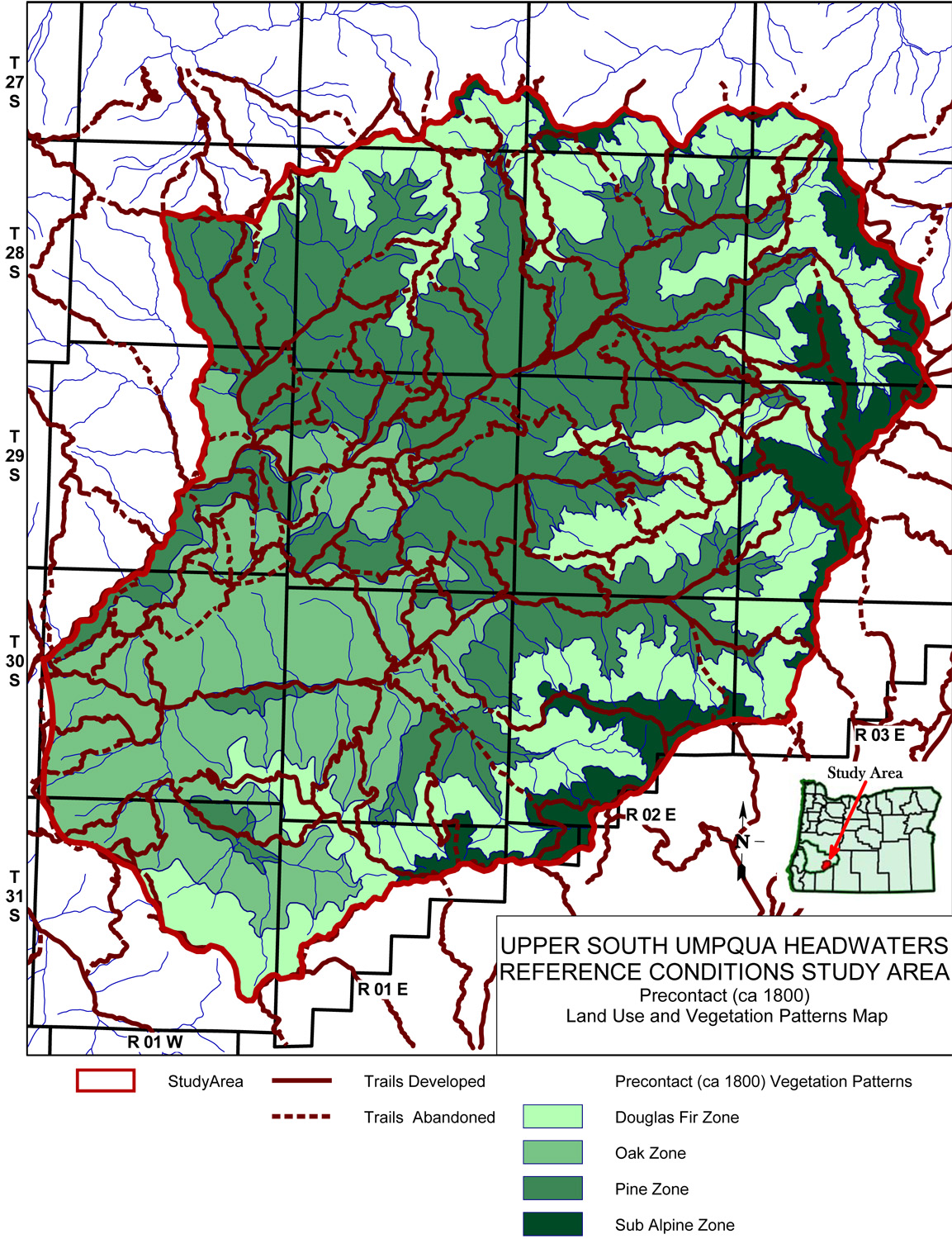
| Study Area Vicinity Map | ca. 1800 Vegetation | 2010 Subbasin Index | GLO Bearing Trees |
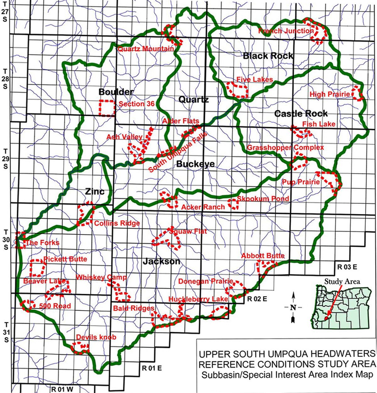
The Castle Rock Fork subbasin is 27,212 acres in size and includes Skimmerhorn Creek, Fish Lake Creek, Highrock Creek, Horse Creek, and Hummingbird Creek as principal tributaries. It is the easternmost subbasin in the South Umpqua Headwaters Reference Conditions Study and contains portions of four Townships; three Fire Lookouts along its perimeter; two of the study's 25 designated "Area of Special Interest" and a portion of a third.
TOWNSHIPS, MAPS, PHOTOGRAPHS & ORIGINAL LAND SURVEYS
| Tsp. 28 S., Rng. 2 E. |
FIRE LOOKOUTS & OSBORNE PHOTOGRAPHS
| ICON | LOOKOUT | START | STOP | TSP | RNG | SEC | ELEV. |
|---|---|---|---|---|---|---|---|
| Grasshopper Mountain | 1915 | 1977 | 29 S. | 3 E. | 18 | 5,552 | |
| Little Black Rock | 1933 | 1966 | 28 S. | 2 E. | 24 | 4,538 | |
| Rattlesnake Mountain | 1932 | 1962 | 28 S. | 3 E. | 26 | 6,656 |
Icon |
Name |
TSP |
RNG |
SEC |
Acres |
 |
Fish Lake | 29 S. |
3 E. |
05-06 |
285 |
 |
Grasshopper Complex | 29 S. |
3 E. |
07, 18 |
458 |
 |
High Prairie | 28 S. |
3 E. |
23 |
251 |
![]()
© 2010, 2020 Oregon Websites & Watersheds Project, Inc. & NW Maps Co.